- Marina District, San Francisco
-
Marina District — Neighborhood of San Francisco — The Palace of Fine Arts, one of the two surviving buildings of the Panama-Pacific International Exposition, is the centerpiece Landmark of the Marina District.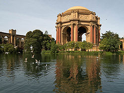
Nickname(s): The Marina Location within Central San Francisco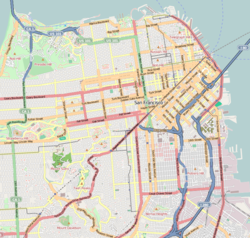
 Marina District
Coordinates: 37°48′11″N 122°26′10″W / 37.803°N 122.436°W Government – Board of Supervisors Mark Farrell – State Assembly Tom Ammiano (D) – State Senate Mark Leno (D) – U.S. House Nancy Pelosi (D) Area[1] – Total 2 km2 (0.778 sq mi) – Land 2 km2 (0.778 sq mi) Population (2008)[1] – Total 12,071 – Density 5,988.8/km2 (15,511/sq mi) ZIP Code 94123 Area code(s) 415 [1] The Marina District is a neighborhood located in San Francisco, California. The neighborhood sits on the site of the 1915 Panama-Pacific International Exposition, staged after the 1906 San Francisco earthquake to celebrate the reemergence of the city. Aside from the Palace of Fine Arts (POFA), all other buildings were demolished to make the current neighborhood.
Contents
Location
The area is bounded to the east by Van Ness Avenue and Fort Mason; on the west by Cow Hollow, Lyon Street and the Presidio National Park; on the south by Lombard St, which bisects the southern edge of the Marina District.[clarification needed] The northern half of the Marina is a shoreline of the San Francisco Bay, and features the Marina Green, a picturesque park adjacent to the municipal boat marina from which the neighborhood takes its name.
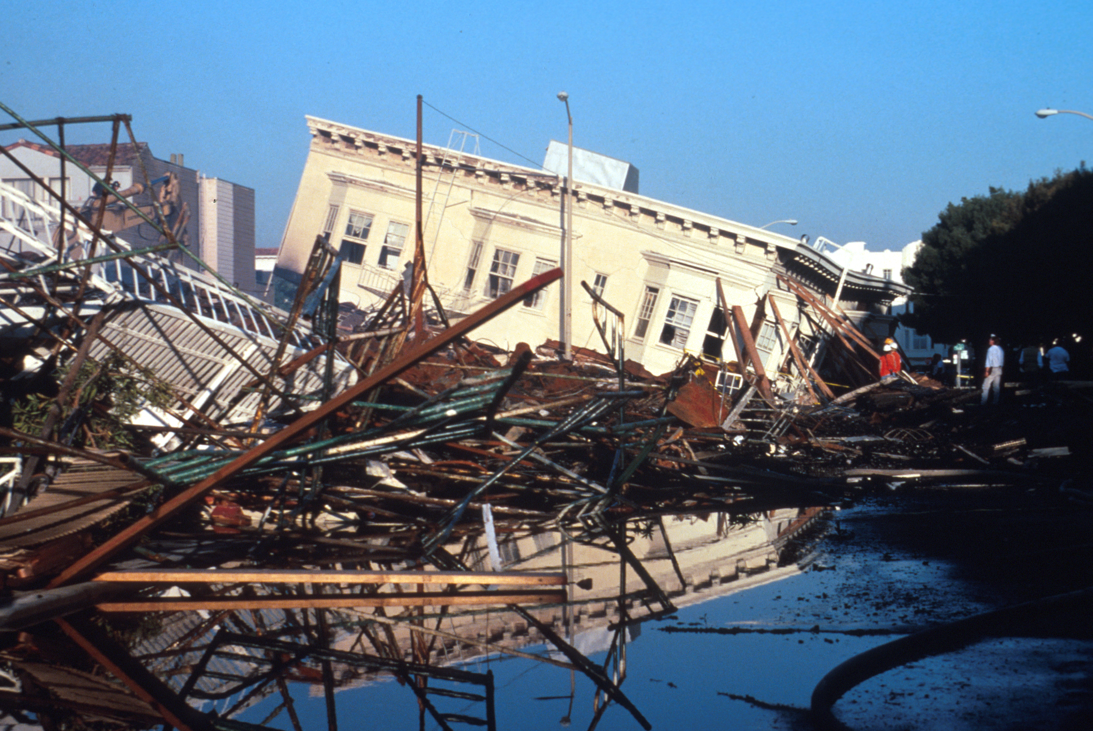
Much of the Marina is built on former landfill,[2] and is susceptible to soil liquefaction during strong earthquakes. This phenomenon caused extensive damage to the entire neighborhood during the 1989 Loma Prieta earthquake.
History
 Damage to the Marina District following the Loma Prieta earthquake.
The area in the 19th century prior to the 1906 Earthquake consisted of bay shallows, tidal pools, sand dunes, and marshland similar to nearby Crissy Field. Human habitation and development came in the mid to late 19th century in the form of a sandwall[further explanation needed] and of a road from the nearby Presidio to Fort Mason. Most of the sand dunes were leveled out, as a hodgepodge of wharves and industrial plants was built extending from what is now Laguna Street to Steiner Street. All of this was destroyed in the 1906 Earthquake that would destroy large swaths of the city.
During reconstruction of the city after the 1906 Earthquake, the area was chosen as the site of the Panama-Pacific International Exposition. Although rubble from the earthquake was used as part of the land reclamation, most of the landfill was from dredging mud and sand from the bottom of the Bay. After the end of the exposition in 1915, the land was sold to private developers, who tore down nearly all of the fair's attractions and developed the area into a residential neighborhood. This major redevelopment was completed in the 1920s. In the 1930s, with the completion of the nearby Golden Gate Bridge, Lombard Street (now Highway 101) was widened, and soon developed into a strip of roadside motels.
The 1989 Loma Prieta earthquake caused severe liquefaction of the fill upon which the neighborhood is built, causing major damage including a small firestorm. Firefighters resorted to pumping water directly from the Bay, to replace water unavailable from broken water mains. The neighborhood was quickly rebuilt. Physically, the neighborhood appears to have changed very little since its construction in the 1920s.
Attractions
The neighborhood is most famous for the Palace of Fine Arts, which shelters the Exploratorium, a renowned hands-on science museum and children's educational center, and which takes up much of the western section of the neighborhood. The Palace is the only building left standing in its original location within the 1915 Exposition fairgrounds. The grounds around the Palace are a popular year-round attraction for tourists and locals, and are a favorite location for weddings and wedding party photographs for couples.
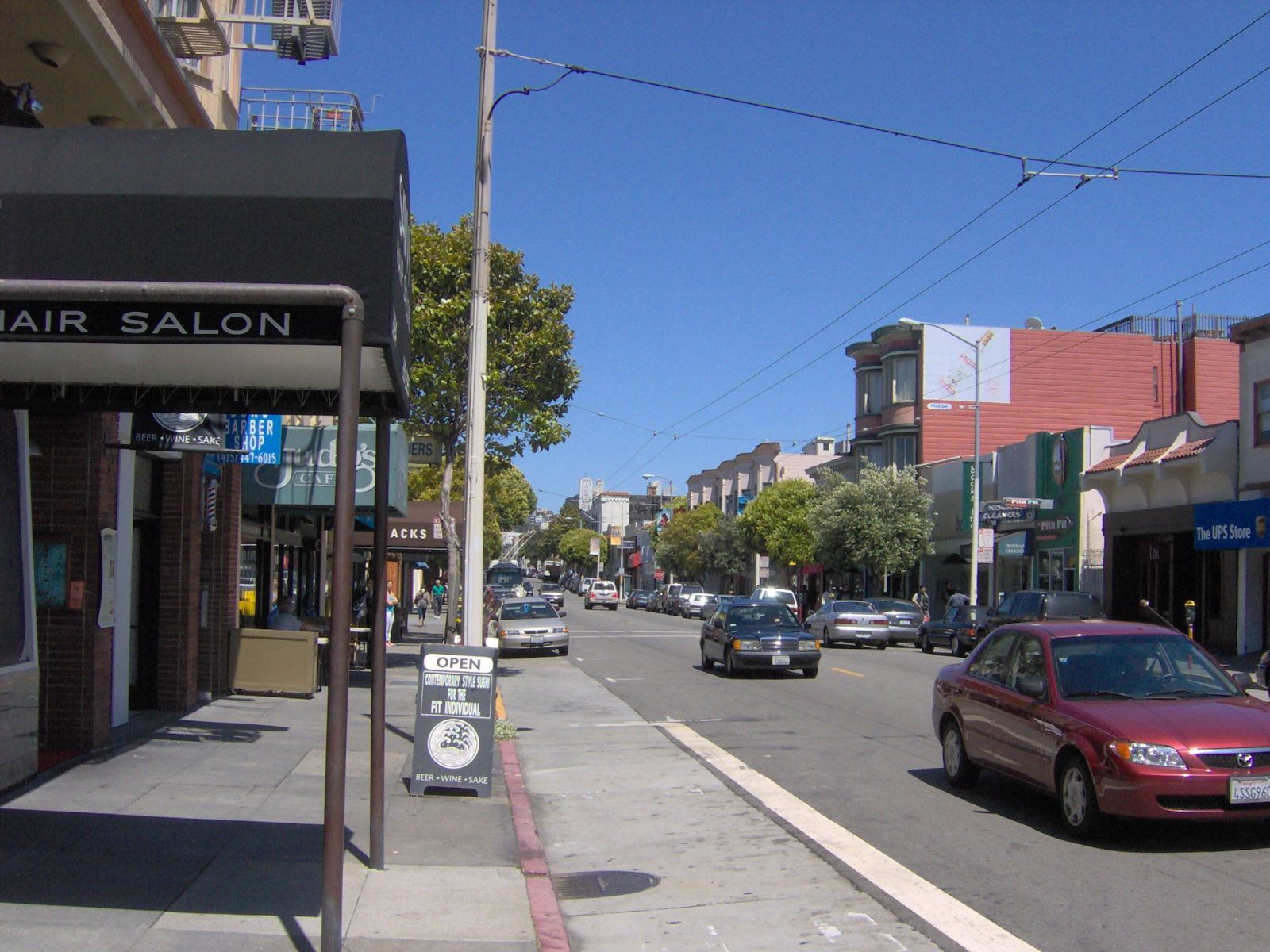
 Chestnut Street, the main commercial street of the Marina District.
The neighborhood is also most noted and famous for its demographic population, which has rapidly shifted in the 1980s from mostly middle class families and pensioners, to twentysomething to thirtysomething young urban professionals who now make up more than half of its population, although a very small, affluent middle age to elderly population remains.[1][3] Most of these type of residents live a "swinger" lifestyle[citation needed] and have thus turned the neighborhood's main commercial streets (Chestnut Street, a section of Fillmore Street south of Lombard Street, as well Lombard Street itself) into one of the city's more lively and famous nightlife scenes.[4][5] The Marina Safeway supermarket is particularly notable for its swinger scene — it is frequently listed as one of the city's best pick-up spots and is affectionately known as the "Singles Safeway" or more recently, "Dateway." This concept was first popularized by the San Francisco author Armistead Maupin in his late 1970s novel "Tales of the City", a television mini-series which has been broadcast on PBS.[4][5]


The Marina District from the Marina Green and the municipal Marina. References
- ^ a b c d "94123 Zip Code Detailed Profile". City-Data.com. Advameg, Inc.. http://www.city-data.com/zips/94123.html. Retrieved 2011-06-15.
- ^ (http://gis.abag.ca.gov/website/liq/viewer.htm - click Map of Location, then Search by Zip Code 94123)
- ^ "San Francisco: The Marina". SF Gate. Hearst Communications Inc.. http://www.sfgate.com/neighborhoods/sf/marina/. Retrieved 2011-06-15.
- ^ a b Anderson, Lessley (Jan 24 2001). "Forgive Me, for I Live in the Marina". SF Weekly. http://www.sfweekly.com/2001-01-24/news/forgive-me-for-i-live-in-the-marina/. Retrieved 2011-06-15.
- ^ a b Smith, Heather. "Strangers in the night: Bars, cheap sex, and boozy anthropology". SF Bay Guardian. http://www.sfbg.com/38/38/cover_strangers.html. Retrieved 2011-06-15.
External links
- The Chronicle's standing article about the Marina
- "Strangers in the night - Bars, cheap sex, and boozy anthropology". San Francisco Bay Guardian. http://www.sfbg.com/38/38/cover_strangers.html.
- "Forgive Me, for I Live in the Marina". SF Weekly. http://www.sfweekly.com/2001-01-24/news/forgive-me-for-i-live-in-the-marina/.
- Google maps
Neighborhoods of San Francisco, California Downtown Chinatown · Civic Center · Financial District · Mid-Market · Nob Hill · North Beach · Mission Bay · South of Market · Telegraph Hill · Tenderloin · Union Square
North of Downtown Cow Hollow · Fisherman's Wharf · Marina District · Pacific Heights · Presidio · Russian Hill · Treasure Island · Yerba Buena Island
Outside Lands Forest Hill · Ingleside · Ingleside Terraces · Ocean View · Parkside · Richmond · Sea Cliff · St. Francis Wood · Sunset District · West Portal · Westwood Highlands · Westwood Park
Western Addition Alamo Square · Anza Vista · Cathedral Hill · Cole Valley · Corona Heights · Duboce Triangle · Fillmore · Haight-Ashbury · Hayes Valley · Japantown · Laurel Heights · Lower Haight · Pacific Heights · Presidio · Western Addition
Southern Bayview-Hunters Point · Bernal Heights · Castro · Crocker-Amazon · Diamond Heights · Dogpatch · Eureka Valley · Excelsior District · Glen Park · Mission District · Noe Valley · Outer Mission · Portola · Potrero Hill · Visitacion Valley
Categories:- Neighborhoods in San Francisco, California
- World's Fair sites


Wikimedia Foundation. 2010.