- Crissy Field
-
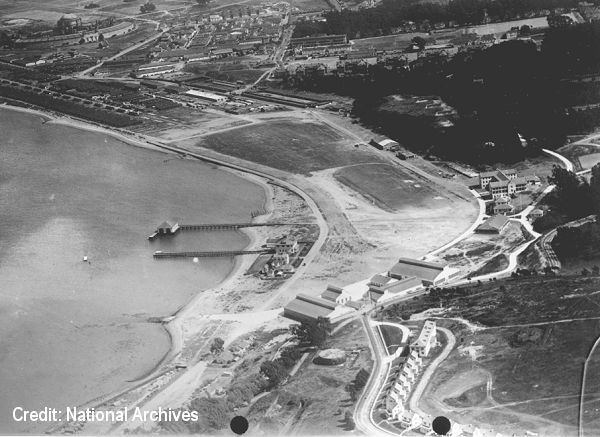
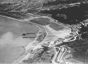 Aerial view of Crissy Field, while an airmail terminal
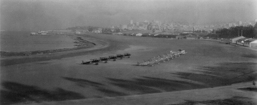
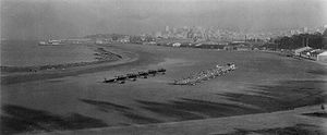 Planes lined up at Crissy Field
Crissy Field is a park in San Francisco. Crissy Field was originally an airfield, part of the United States' Presidio Army Base.[1] The Presidio ceased all military operations and the base became part of the federal Golden Gate National Recreation Area under the Base Closure Act, in the 1990s.
Contents
History
The area was originally a rich salt marsh and a gathering ground for the Ohlone. It later served as the landing site of Spanish explorers and Russian, English and Boston traders. Shortly after the Panama-Pacific International Exposition (1915) was held there in 1915 it became one of America's foremost military airfields and a portion of the Presidio army base.
When the Post Office scouted for a suitable landing field in San Francisco, none presented better possibilities than the U.S. Army Air Service airport, then called the Flying Field at the Presidio.
Major Henry "Hap" Arnold led the successful effort to change the name to Crissy Field in honor of Major Dana H. Crissy, who crashed and died on 8 October 1919 in a de Havilland DH-4B during an Air Service transcontinental reliability test while attempting a landing at Salt Lake City, Utah.[2]
Under the auspices of the Air Mail Service, San Francisco and Crissy Field gained fame as the site of many early aviation milestones.
In 1920, airmail pilot Edison Mouton, flying the final leg of the first transcontinental run, landed at San Francisco’s Marina Field. (One year later the Post Office moved from Marina Field to the Army’s Crissy Field.) The date was September 11, at 2:20 p.m. The actual flying time for the bold experiment was 34 hours and 5 minutes, elapsed time 75 hours and 52 minutes. Upon landing, Mouton was greeted by eager dignitaries and a bevy of flashing camera bulbs.
Anticipation gripped San Francisco and the nation on February 21, 1921, the day of the experimental first day/night transcontinental. At 4:30 a.m. two planes departed from New York and two from Crissy Field, piloted by Farr Nutter and Ray Little. Two and one half hours later, after crossing the 14,000-foot Sierra Nevada range, Nutter and Little landed in Reno. Their successful effort, in combination with that of the other east and westbound pilots, launched Air Mail.
Crissy Field also played a major role in trial night flying. On August 21, 1923, the first day of the four-day demonstration of the transcontinental service, airmail pilot Claire K. Vance completed the west-bound flight, landing at Crissy Field at 6:24 p.m. It was also the terminus of the Air Service's "dawn to dusk" transcontinental speed flight on June 23, 1924. Taking off from Mitchel Field, New York, in a modified Curtiss PW-8 fighter, 1st Lt. Russell Maughan crossed the United States in 21 hours 48 minutes, landing in front of 50,000 people at Crissy.
In 1962, along with the entire Presidio of San Francisco, it was designated a National Historic Landmark.
The airfield was closed in 1974.[3] The closure left San Francisco as the only county in California without an airport in its boundaries.[4] (San Francisco International Airport is located in San Mateo County.)
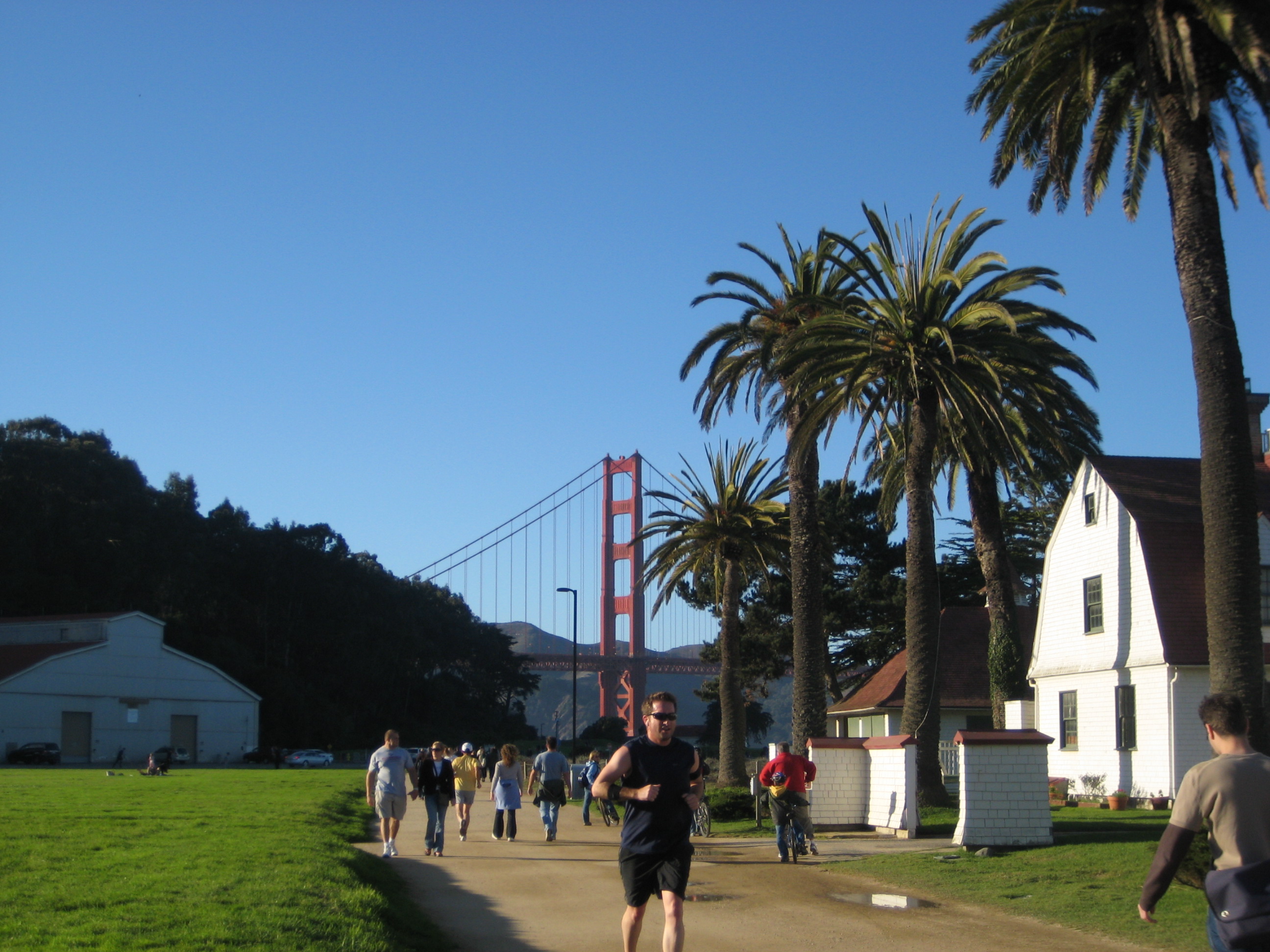
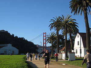 Crissy Field today.
After becoming part of the Golden Gate National Recreation Area, much of Crissy Field was restored to its former condition. During 1998-2000, individuals and groups from schools, civic organizations and corporations planted over 100,000 native plants, in efforts to restore natural systems at Crissy Field. Community volunteers are still an important part of the efforts to maintain long-term stewardship of Crissy Field.
Today, most of Crissy Field's buildings from its 1920s glory years remain standing, including the U. S. Coast Guard station and pier. Some buildings are in private use with businesses leasing hangars and offices and families renting the former officer housing. The area also has museums, cafés, gift shops and bike/pedestrian lanes. One can spend a pleasant morning or afternoon biking through the area on the way to the Golden Gate Bridge and taking a break to enjoy a snack. The area also provides views of the city, Alcatraz and the Golden Gate Bridge.
The beach at the east end of Crissy Field (East Beach) remains popular for windsurfers and kite surfers. The summer winds that build in the early afternoon make for good sailing.
Architectural facts
Redesigned by Hargreaves Associates in 1994, Crissy Field passed from being a military airport, into becoming open space for the people of San Francisco, now a part of the Golden Gate National Recreation Area. Divided into 6 major zones: 1.the rehabilitation of a 1920s grassed airfield 2.a mile-long promenade 3.newly restored tidal wetlands 4.beach & dunes 5.West Bluff(a picnic area) 6.East Beach(gathering)
In order to create the new site, 87,000 tons of hazardous materials were removed from the site itself and the tidal wetlands were redesigned to simulate the wetlands that existed before the military appropriated the site and used the area as a dump and landfill location. The site provides great views of the San Francisco bay area, Alcatraz and the Golden Gate Bridge.[5]
See also
References
- ^ "Crissy Field (historical)". Geographic Names Information System, U.S. Geological Survey. http://geonames.usgs.gov/pls/gnispublic/f?p=gnispq:3:::NO::P3_FID:2107432. Retrieved 2009-05-04.
- ^ Maurer Maurer, "Aviation in the U.S. Army, 1919-1939", United States Air Force Historical Research Center, Office of Air Force History, Washington, D.C., 1987, ISBN 0-912799-38-2, page 31.
- ^ Haller, Stephen A. (Spring 2001). "Aviation at Crissy Field". National Park Service. http://www.nps.gov/archive/prsf/history/crissy/crissyaf.htm. Retrieved 2008-03-03.
- ^ List of airports in California
- ^ Reed, Peter. Groundswell: Constructing the contemporary landscape
External links
- Crissy Field official website
- Crissy Field Aviation Museum Association
- Presidio of San Francisco - Golden Gate National Recreation Area
- Aviation: From Sand Dunes to Sonic Booms, a National Park Service Discover Our Shared Heritage Travel Itinerary
- Crissy Field on San Francisco's Golden Gate
- Abandoned & Little-Known Airfields - Crissy Army Airfield (CSY), San Francisco, CA
Airports in the San Francisco Bay Area International Federal General aviation (tower) Concord/Buchanan (KCCR) · Hayward (KHWD) · Livermore (KLVK) · Napa (KAPC) · Palo Alto (KPAO) · San Jose/Reid-Hillview (KRHV) · San Carlos (KSQL) · Santa Rosa/Sonoma County (KSTS)General aviation (non-tower) Angwin-Parrett (2O3) · Byron (C83) · Cloverdale (O60) · Marin County/Gnoss (KDVO) · Half Moon Bay (KHAF) · Healdsburg (O31) · Hollister (KCVH) · Vacaville/Nut Tree (KVCB) · Petaluma (O69) · Rio Vista (O88) · Sonoma Skypark (0Q9) · Sonoma Valley (0Q3) · San Martin/South County (E16) · Watsonville (KWVI)Historical Coordinates: 37°48′15″N 122°27′35″W / 37.8041667°N 122.4597222°W
Categories:- Airports in the San Francisco Bay Area
- Golden Gate National Recreation Area
- Defunct airports in California
- History of San Francisco, California
- Parks in San Francisco, California
- Wetlands of the San Francisco Bay Area
- San Francisco Bay Area beaches
Wikimedia Foundation. 2010.