- Reid-Hillview Airport
Infobox Airport
name = Reid-Hillview Airport of Santa Clara County
nativename =
nativename-a =
nativename-r =
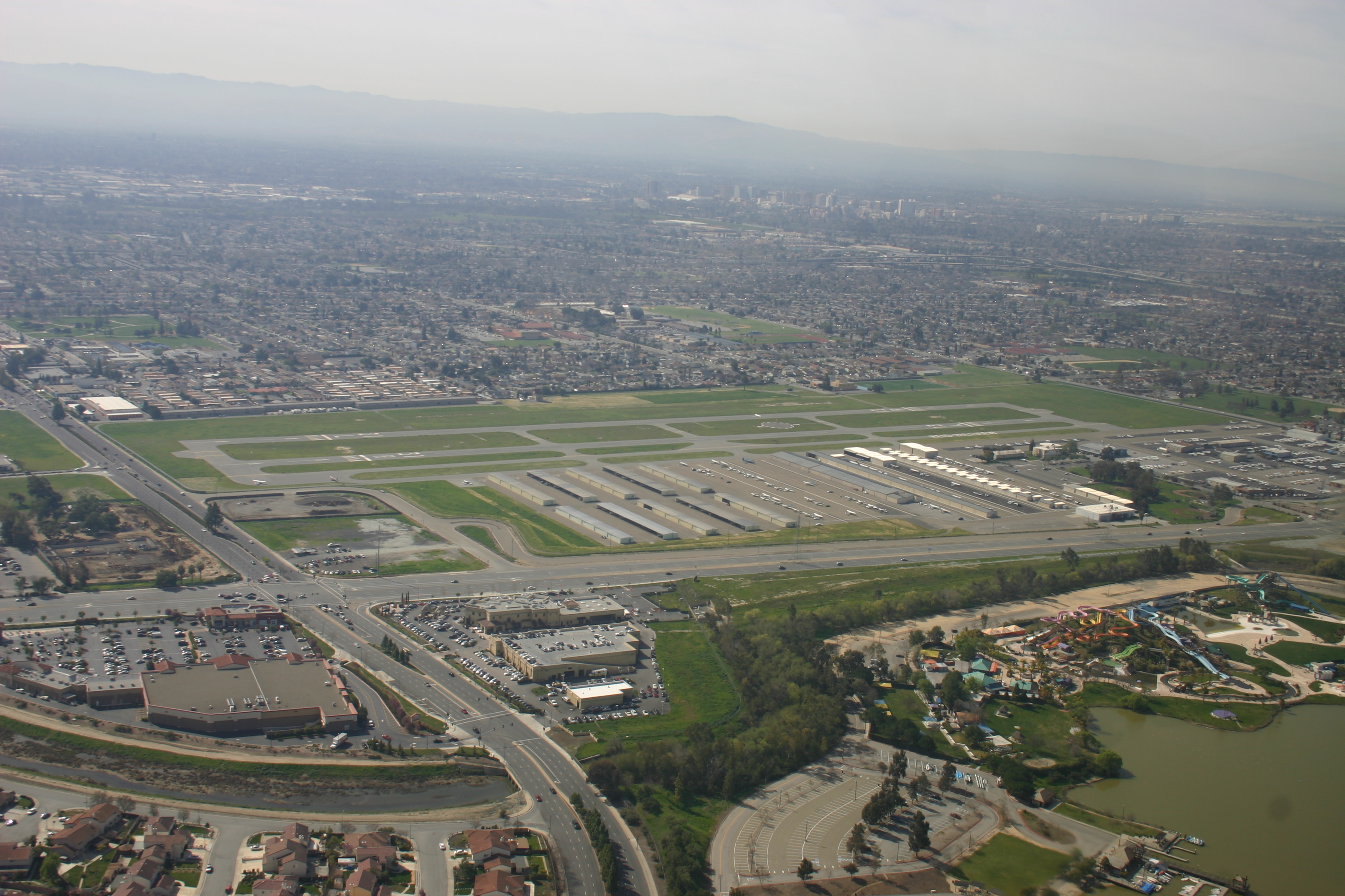
image-width =
caption =
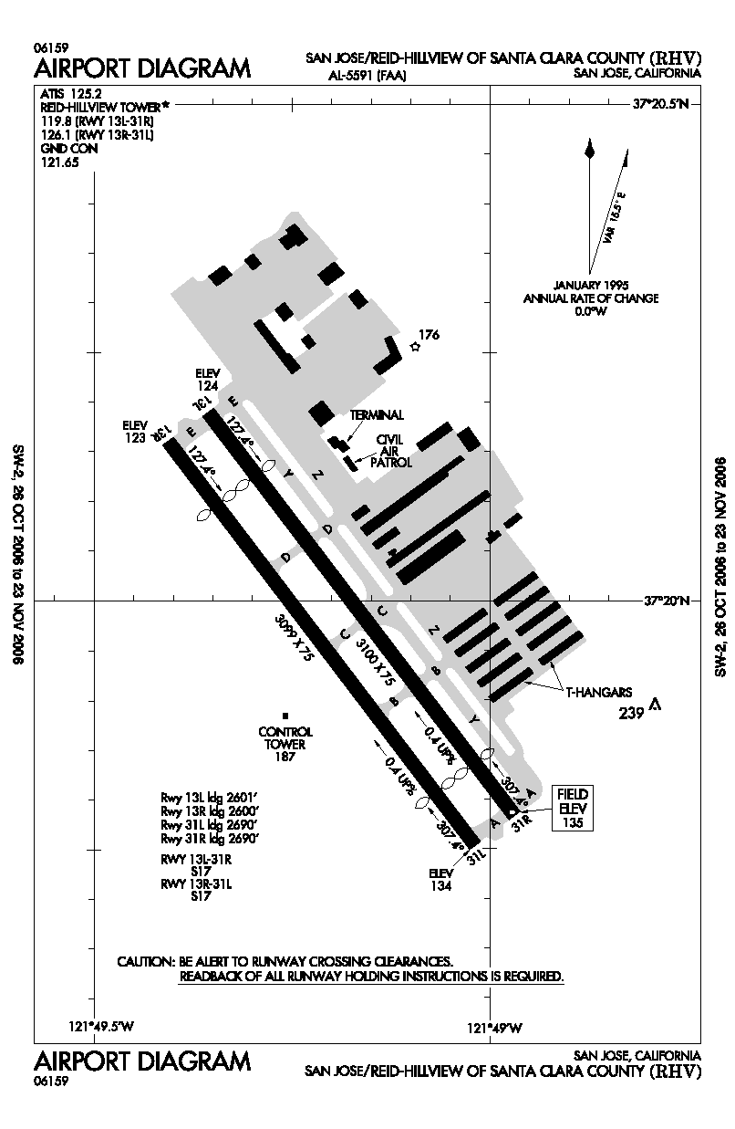
image2-width =
caption2 = Reid-Hillview Airport diagram
IATA = RHV
ICAO = KRHV
FAA = RHV
LID =
type = Public
owner =Santa Clara County, California
operator =
owner-oper =
city-served =
location =San Jose, California
built =
used =
commander =
occupants =
elevation-f = 133
elevation-m = 40.5
coordinates = coord|37|19|58|N|121|49|11|W|type:airport|display=inline,title
website =
metric-elev =
metric-rwy =
r1-number = 13L/31R
r1-length-f = 3100
r1-length-m = 945
r1-surface =Asphalt
r2-number = 13R/31L
r2-length-f = 3099
r2-length-m = 945
r2-surface = Asphalt
footnotes =Reid-Hillview Airport of Santa Clara County Airport codes|RHV|KRHV|RHV is located in the eastern part of San Jose [cite gnis|1653953|Reid-Hillview Airport of Santa Clara County] , south of
San Francisco Bay , in Santa Clara County,California , USA. The airport is owned by Santa Clara County.Reid-Hillview is a
general aviation airport - there is no scheduled airline service. However, as with most general aviation airportsair charter operations are available. The airport has acontrol tower which operates between the hours of 7 a.m. and 10 p.m. local time. The FAA classifies Reid-Hillview as areliever airport forSan Jose International Airport , [cite web
title = National Plan of Integrated Airport Systems (NPIAS) Reports
url = http://www.faa.gov/airports_airtraffic/airports/planning_capacity/npias/reports/
publisher =Federal Aviation Administration
accessdate = 2008-02-22 ] providing public access via general aviation to the San Jose area while separating the faster and slower traffic to different airports.History
Groundbreaking for Reid-Hillview airport came in 1937. Bob and Cecil Reid first built the Garden City Airport in 1935, which was quickly closed to make room for
United States Highway 101 . Their second site was northwest of the Hillview golf course, hence the name. Until 1946, the single runway at the airport was unpaved.Reid-Hillview was a single runway airport until 1965, when a second runway was added. Reid-Hillview's control tower was added in October 1967. [cite web
title = A Brief History of Reid-Hillview Airport
url = http://www.niceairaviation.com/about_reidhillview_airport.htm
publisher = Nice Air Aviation
accessdate = 2008-02-22 ]Following the 1989
Loma Prieta earthquake , Reid-Hillview became the origin point for an emergency supply airlift to theWatsonville Municipal Airport after mountain and coastal roads were blocked, cutting off Santa Cruz and Watsonville from relief efforts by ground. The Watsonville Airport estimates that it received 100 tons of supplies via the airlift during the week following the quake. [cite web
title = Watsonville's Airports: Past - Present - Future
publisher = Watsonville Airport
url = http://www.watsonvilleairport.com/history.html
accessdate = 2008-02-29 ] John McAvoy and Bill Dunn of the Reid-Hillview Airport Association received the 1990 Grand Award from the Bay Area's Metropolitan Transportation Commission for organizing the airlift. [cite web
title = MTC Awards: Grand Award
publisher = Metropolitan Transportation Commission
date = 2007-03-22
url = http://www.mtc.ca.gov/about_mtc/awards/winners/grandaward.htm
accessdate = 2008-02-29 ]Fixed base operators
At Reid-Hillview, fixed base operators (FBOs) compete for fuel sales, aircraft rentals and/or flight training.
* [http://www.air-accord.com/ Air Accord]
* [http://www.ameliareid.com/ Amelia Reid Aviation]
* [http://www.niceairaviation.com/ Nice Air Aviation]
* [http://www.squadron2.com/ Squadron 2 Flying Club]
* [http://tradewindsaviation.com/ Trade Winds Aviation]Ground transportation
Capitol Expressway (County Route G21) is at the entrance to the airport at Cunningham Ave.
Car/taxi
Taxis are not located on-field. They may be dispatched by phone to the terminal building.
Rental cars (Enterprise) are located in the same building with the Airport Shoppe at the airport entrance. [cite web
title = Reid-Hillview Airport
publisher = Santa Clara County Airports Department
date = 2007-02-23
url = http://www.reidhillviewairport.com/docs/PilotInsert-RHV.pdf
format = PDF
accessdate = 2008-02-26 ]Bus
The
Santa Clara Valley Transportation Authority (VTA) has itsEastridge Transit Center across Tully Road at Eastridge Mall, about 1/2 mile walk southbound along Capitol Expressway. For transit options, see a [http://www.google.com/maps?saddr=RHV&dirflg=r&ttype=dep Google Transit search starting from Reid-Hillview Airport] .VTA has future plans for a
bus rapid transit line from the Diridon train station in downtown San Jose to theEastridge Transit Center . Further distant future plans with less certain funding include a light rail extension from the Alum Rock station to Eastridge. In both cases, the segment along Capitol Expressway would serve Reid-Hillview.See also
*
List of attractions in Silicon Valley
*San Jose International Airport
*Palo Alto Airport
*South County Airport
*List of airports in the San Francisco Bay Area References
External links
* [http://www.reidhillviewairport.com/ Reid-Hillview Airport] (official site)
* [http://www.airportshoppe.com/ The Airport Shoppe] - on-field pilot supplies
* [http://www.rhvaa.org/ Reid-Hillview Airport Association]
* [http://www.eaa62.org/ Experimental Aircraft Association (EAA) Chapter 62] - local chapter of theExperimental Aircraft Association
* [http://www.santaclaravalley99s.org/ Santa Clara Valley Chapter of Ninety-Nines] - local chapter of theNinety-Nines international organization for women pilots
*Civil Air Patrol squadrons based at RHV: search & rescue, aerospace education
** [http://sq80.cawg.cap.gov/ Squadron 80] - senior squadron, adult volunteers
** [http://sq36.cawg.cap.gov/ Squadron 36] - cadet squadron, youth volunteers
* [http://www.takeflightforkids.org/ Take Flight for Kids] - charity which gives rides to disabled children in private aircraft
* [http://www.informart.com/GaryAir/ GaryAir] - air taxi service
* [http://www.clearancewiki.com/wiki/index.php?title=KRHV_San_Jose%2C_CA_Reid-Hillview_Airport_of_Santa_Clara_County KRHV page at ClearanceWiki] - airport notes for instrument-rated pilots
* Photos and video
** [http://www.flickr.com/search/?q=reid-hillview+airport search for "reid-hillview airport" at Flickr]
** [http://www.webshots.com/search?query=reid-hillview+airport search for "reid-hillview airport" at WebShots]
** [http://www.youtube.com/results?search_query=reid-hillview+airport search for "reid-hillview airport" at YouTube]
* [http://www.epa.gov/fedrgstr/EPA-IMPACT/2004/December/Day-21/i27823.htm Approval Of Noise Compatibility Program for Reid-Hillview Airport, San Jose, CA] atEnvironmental Protection Agency
*FAA-airport|ID=RHV|use=PU|own=PU|site=02203.*A
*FAA-diagram|05591
Wikimedia Foundation. 2010.