- Palo Alto Airport of Santa Clara County
Infobox Airport
name = Palo Alto Airport
of Santa Clara County
nativename =
nativename-a =
nativename-r =
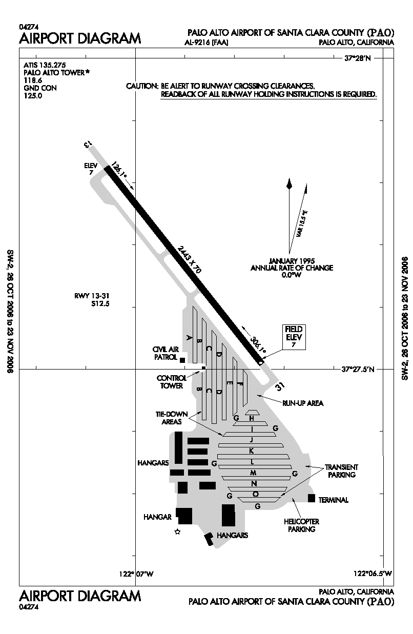
image-width =
caption =
IATA = PAO
ICAO = KPAO
FAA = PAO
type = Public
owner =
operator = County of Santa Clara
city-served =
location = Palo Alto, California
elevation-f = 4
elevation-m = 1.2
coordinates = Coord|37|27|40|N|122|06|54|W|type:airport_region:US|display=inline,title
website =
metric-elev =
metric-rwy =
r1-number = 13/31
r1-length-f = 2,443
r1-length-m = 745
r1-surface =Asphalt
stat-year =
stat1-header =
stat1-data =
stat2-header =
stat2-data =
footnotes =Palo Alto Airport of Santa Clara County Airport codes|PAO|KPAO|PAO is a
general aviation airport in the city of Palo Alto in Santa Clara County,California , USA, near the south end ofSan Francisco Bay on the western shore. [cite gnis|1653802|Palo Alto Airport of Santa Clara County]Facilities
Palo Alto Airport of Santa Clara County covers convert|102|acre|ha|0|lk=on and has one
asphalt pavedrunway (13/31) measuring 2,443 x 70 ft. (745 x 21 m).First time pilots should familiarize themselves with the complex SF Bay Area airspace, especially the overlying SFO Class B and the abutting SJC
Class C airspace . Landing pilots should also watch out for bird andjackrabbit activity.Facilities at this busy towered airport include multiple aircraft repair shops and a staffed terminal, including a car rental counter. The airport is located within one-half mile of U.S. Route 101.
Fifteen miles of hiking and biking trails, affording multiple opportunities for birdwatching, form part of the adjacent convert|1940|acre|ha|0|lk=on|sing=on Palo Alto Baylands Nature Preserve [http://www.city.palo-alto.ca.us/community-services/pk-baylands.html] . The airport is also adjacent to a public golf course [http://www.city.palo-alto.ca.us/community-services/golf-index.html] . Dining options within a short walk include the Abundant Air Cafe [http://abundantair.com/] and the popular Ming's Restaurant [http://www.mings.com] .
Instrument Approaches
Palo Alto airport has two approaches, both to runway 31 with 460' MDA/ 1-mi visibility minimums:
* GPS Runway 31
* VOR/DME Runway 31 from San Jose VORThe VOR approach is almost impossible to get from ATC if you are GPS-equipped, because of the conflict with airline traffic in San Jose International.
Area history
In 1989 a comprehensive area history analysis was conducted by Earth Metrics, based upon review of extant
aerial photograph s.(Earth Metrics, 1989) The photo reconnaissance flights were flown in 1956, 1960, 1973, 1974 and 1980 by theU.S. Department of the Interior , and are archived by theU.S. Geological Survey in Menlo Park, California.Comparison of the aerial photographs indicate that no development had begun in the vicinity prior to 1956 other than the Palo Alto Airport and the Regional Water Quality Control Board Plant (terminus of Embarcadero Way). Between 1956 and 1960, no new development had taken place in the area; however, by 1973, the Harvey Gum Factory was on the subject site and structures were either completed or under construction at 1890 Embarcadero Road and 2440-2450 Embarcadero Way. Conditions were identical in the 1974 aerial photograph. In the 1980 aerial photograph, the Harvey Gum Factory is standing, and additional infill construction can be seen in the area such as the Baylands Business Park adjacent and to south of the site and the structure now located at 1860 Embarcadero Road. The Harvey Gum Factory was demolished in 1982, based upon Palo Alto Planning Department records.
Notes
* [http://www.countyairports.org/PAO_Facts.htm Santa Clara County Airports Official Site: Palo Alto Airport]
*Earth Metrics. Inc, "Phase One Environmental Site Assessment, 1870 Embarcadero Road, Palo Alto", Report No. 7897W0.001, June 2, 1989See also
*
List of attractions in Silicon Valley
*Reid-Hillview Airport
*South County Airport
*List of airports in the San Francisco Bay area References
External links
* [http://www.countyairports.org/PAO_Facts.htm County of Santa Clara Airports Department: Palo Alto Airport] (official site)
* [http://www.paloaltoairport.org/ Palo Alto Airport Association]
* [http://www.dr-amy.com/rich/flying/kpao.html Rich Acuff's Palo Alto Airport page]
* [http://www.zachary.com/s/pao_jcrc/ PAO Airport Joint Community Relations Committee]
*FAA-airport|ID=PAO|use=PU|own=PU|site=02022.*A
*FAA-diagram|09216
Wikimedia Foundation. 2010.