- Hayward Executive Airport
Infobox Airport
name = Hayward Executive Airport
nativename =
nativename-a =
nativename-r =
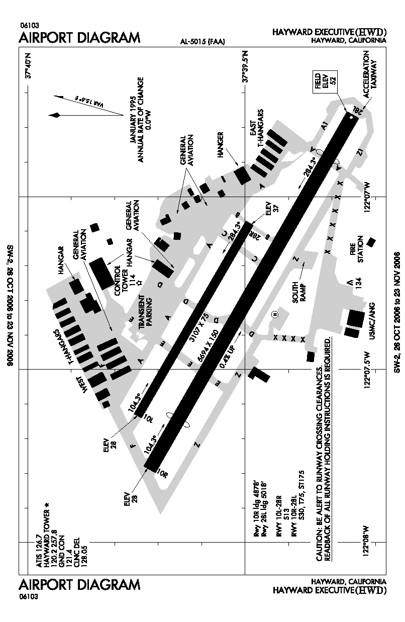
image-width =
caption =
IATA = HWD
ICAO = KHWD
type = Public
owner =
operator = City of Hayward
city-served =
location = Hayward, California
elevation-f = 50
elevation-m = 15.2
coordinates = Coord|37|39|33.4|N|122|07|20.7|W|type:airport|display=inline,title
website =
metric-elev =
metric-rwy =
r1-number = 10R/28L
r1-length-f = 5,024
r1-length-m = 1,531
r1-surface = Asphalt
r2-number = 10L/28R
r2-length-f = 3,107
r2-length-m = 947
r2-surface = Asphalt
stat-year =
stat1-header =
stat1-data =
stat2-header =
stat2-data =
footnotes =Hayward Executive Airport Airport codes|HWD|KHWD is located in Hayward,
California , USA, near the eastern shore ofSan Francisco Bay . [cite gnis|1653514|Hayward Air Terminal Airport]History
The airport was built in 1942 during
World War II for use as a fighter base as an auxiliary field to Chico Army Air Field and was originally named Hayward Army Airfield. The primary aircraft stationed at the field were Lockheed P-38 Lightning fighter aircraft. This post may have also been named "Russell City Army Air Field" for the unincorporated area outside of the Hayward city limits where it was located. The airfield was assigned to theUnited States Army Air Forces Fourth Air Force .After the war ended, the airport was declared surplus property by the Federal Government.
In April 1947, the
War Assets Administration quitclaimed the airfield, comprising some convert|690|acre|ha|0|lk=on and related buildings and equipment, to the City of Hayward. The airfield was then renamed the Hayward Municipal Airport. [http://www.hayward-ca.gov/departments/publicworks/documents/airport/AirportHistory.pdf]The
California Air National Guard moved onto land adjoining the airport in 1949. A control tower was erected in 1960. Initially it was the home of the 61st Fighter Wing which included the 194th Fighter Squadron on 25 June 1948.The 61st Fighter Wing was redesignated as the 144th Fighter Bomber Wing on 1 November 1950. The wing also consited of the 192nd Fighter Squadron at
Reno, Nevada and the 191st Fighter Squadron atSalt Lake City, Utah .The North American P-51D Mustang and later the P-51H were flown from 1948 until 31 October 1954. During its early years with the P-51D/H, the unit earned prominence as one of the Air Force's most respected aerial gunnery competitors. In June, 1953, while still flying the P-51, the unit qualified for the first all-jet, worldwide gunnery meet. Using borrowed F-86A Sabre jets, the 144th, which represented the Air National Guard, placed fifth in competition.
On April 3, 1955 the 129th Air Resupply Squadron was established at Hayward and equipped with Curtiss C-46D Commandos in the Summer 1955 supplemented by Grumman SA-16A Albatrosses in 1958. The C-46Ds were phased out 1 November 1958, and the unit was redesignated as the 129th Troop Carrier Squadron (Medium). On January 20, 1962 the unit reached Group status with federal recognition of the 129th Troop Carrier Group.
On May 1, 1980 the California Air National Guard units at Hayward were reassigned to NAS Moffett Field near San Jose.
Facilities
Hayward Executive Airport covers convert|543|acre|ha|0|lk=on and has two runways:
* Runway 10R/28L: 5,024 x 150 ft. (1,531 x 46 m), Surface: Asphalt
* Runway 10L/28R: 3,107 x 75 ft. (947 x 23 m), Surface: AsphaltSee also
*
List of airports in the San Francisco Bay Area
*List of airports in California
*California World War II Army Airfields References
External links
* [http://www.haywardair.org/ Hayward Executive Airport]
*
Wikimedia Foundation. 2010.