- Downtown Hayward
-
Coordinates: 37°40′24.66″N 122°4′52.72″W / 37.6735167°N 122.0813111°W
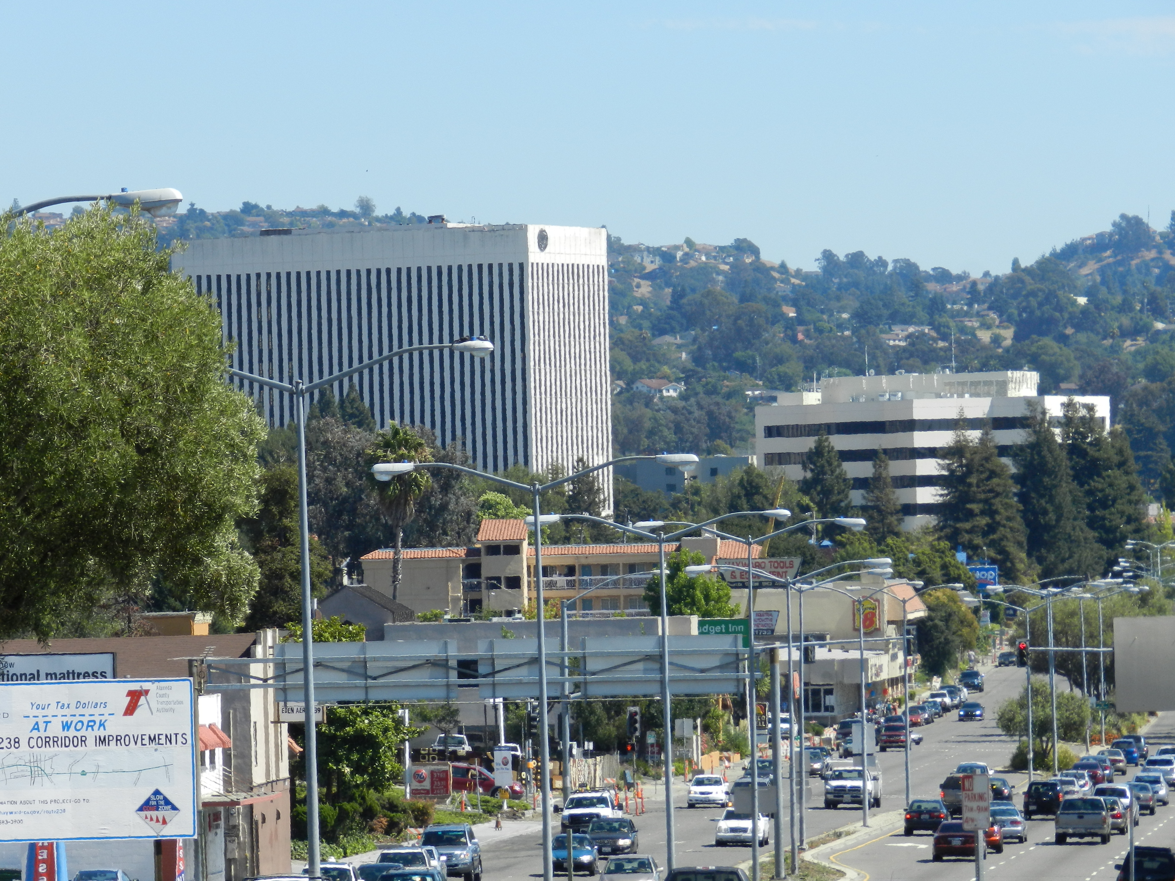
 Downtown Hayward, with City Center Building (left)
Downtown Hayward is the original and current city center of Hayward, California, and is home to the current Hayward City Hall, along with the two previous city halls, Alex Giualini Plaza and The Tower at Hayward City Center. The Hayward Fault runs through the area, and is the cause of the two previous city halls being taken out of use.
Its approximate boundaries are Foothill Boulevard to the east, Watkins Street and Hayward BART to the west, Jackson Street to the south, and City Center Drive to the north.[1] Foothill Boulevard is also known as "The Hayward Strip", a retail business corridor that was built in the 1950s. Parks include Newman Park and The Julio Bras Portuguese Park. San Lorenzo Creek runs through downtown. The Hayward Public Library is located there. "Hayward City Center", located at the northern end of downtown, contains the former Centennial Tower/City Center Building, which served as the city's second City Hall from 1969 to 1991, and is now an abandoned 11 story building, Hayward's second tallest after California State University's Warren Hall. The City Center complex previously contained the now demolished Centennial Hall Convention Center. The bankrupt Mervyn's department store chain's former headquarters is across the street from the City Center mall. The Hayward Area Historical Society operates a museum downtown, which is currently closed to the public until a move is completed.[2] The FBI operates a resident agency in downtown Hayward.[3]
Contents
Cinema Place
Cinema Place is a 12,000 square feet (1,100 m2) entertainment and shopping center, comprising a single structure, which opened October 24, 2008.[4] Directly adjacent to the center is a large city run parking garage. The City of Hayward has commissioned 3 large murals, designed by Hayward artist Andrew Kong Knight, decorating the exterior of the garage, featuring scenes from Hollywood and Hayward, which are being executed in 2011.[5] An additional mural by Knight is found at the northern end of The Hayward Strip.[6][7]
The main tenant is a Century Theatre multiplex, which is Hayward's lone movie theater since Mann's Festival Cinemas closed in 2003. In 2011, the Hayward Art Council opened a gallery on the ground floor of the center, in a storefront that has remained unused since the center's opening.[8][9]
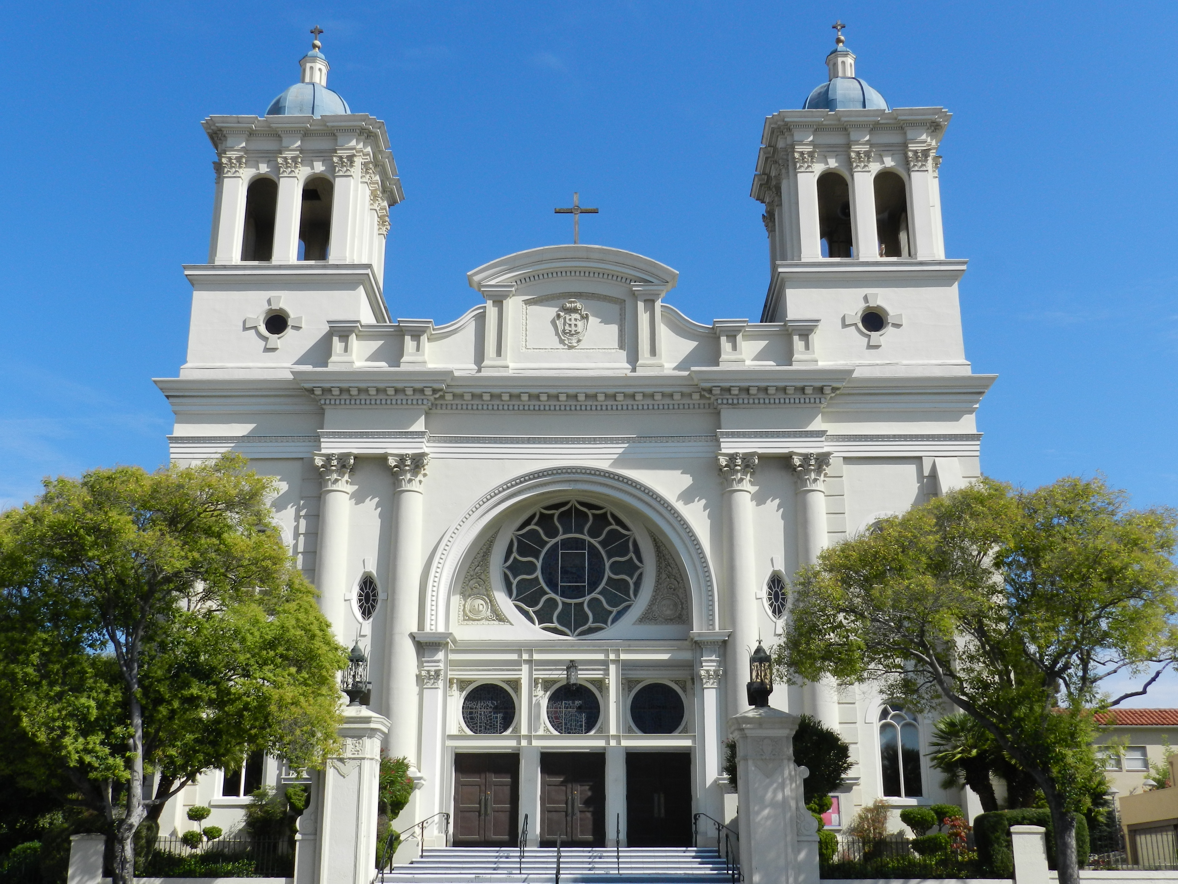
 All Saints Catholic Church
Other businesses
Lucky and Safeway operate supermarkets there. California Historical Landmark the Green Shutter Hotel is located downtown. Buffalo Bill's Brewery, founded in 1983 by photographer Bill Owens[10][11], is one of the first brewpubs to open in California since Prohibition, after legislation passed in 1982 legalizing brewpubs again.[12] A Marinello School of Beauty is downtown.[13] The Daily Review newspaper operates from downtown.
Services
The All Saints Catholic Church is located downtown. It operates the Mount Saint Joseph Cemetery. The Hayward Veterans' Memorial Building, built in 1932, is adjacent to the old City Hall building, and is available for public events.[14]
Road improvements
The Route 238 Corridor Improvement Project broke ground July 2010, with an expected completion date of 2012. It will include extensive landscaping, bringing parks and improved traffic flow to the downtown region.
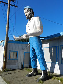 "Big Mike", advertising statue for defunct business, Mission Boulevard[15]
References
- ^ [1]
- ^ Hayward Area Historical Society. Haywardareahistory.org. Retrieved on 2010-12-25.
- ^ FBI — Hayward Resident Agency. Fbi.gov. Retrieved on 2010-12-25.
- ^ [2]
- ^ [http://www.andrewkongknight.com/art/murals/index.html artist website
- ^ artist website
- ^ mural completion announcement at tribe.net weblog
- ^ Hayward Art Council website
- ^ [3]
- ^ [4]
- ^ [5]
- ^ Tom Bates: Beer Savior, East Bay Express, September 13, 2007
- ^ [6]
- ^ [7]
- ^ [8]
Hayward, California Landmarks Hayward City Hall · The Tower at Hayward City Center · Alex Giualini Plaza · Hayward Hall of Justice · Eden Congregational Church · Green Shutter HotelParks Hayward Area Recreation and Park District · Don Castro Regional Recreation Area · Dry Creek Pioneer Regional Park · Garin Regional Park · Hayward Regional Shoreline · Kennedy Park · Japanese GardensEducation Transportation San Mateo – Hayward Bridge · Mission Boulevard · Hayward Executive Airport · Hayward Amtrak station · Hayward BART Station · South Hayward BART station · AC TransitBusiness History 1868 Hayward earthquake · Harry Rowell Rodeo Ranch · Hunt Brothers Cannery · Meek Mansion · Mervyns · Ukraina Honcharenko · William Dutton Hayward37°40′16″N 122°05′06″W / 37.671°N 122.085°W
Categories:- Hayward, California
- Neighborhoods in California
- Central business districts in the United States
- Alameda County, California geography stubs

Wikimedia Foundation. 2010.