- Downtown Mountain View station
-
Downtown Mountain View
Caltrain commuter rail station
VTA light rail station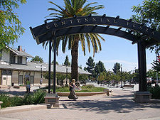
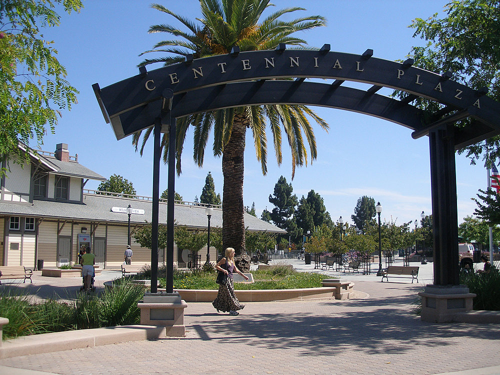
Centennial Plaza at the Downtown Mountain View Station. The station building can be seen on the left.Station statistics Address 600 West Evelyn Avenue near Castro Street
Mountain View, CaliforniaCoordinates 37°23′40″N 122°04′33″W / 37.394394°N 122.075872°WCoordinates: 37°23′40″N 122°04′33″W / 37.394394°N 122.075872°W Lines Caltrain Local serviceLimited-stop serviceBaby BulletVTA Light RailMountain View–WinchesterPlatforms Caltrain 2 side platforms
VTA 1 island platformParking 338 spaces Bicycle facilities Lockers available Other information Opened 1987 (Caltrain)
December 17, 1999 (VTA Light Rail)Accessible 
Fare zone Fare Zone 3 (Caltrain) Traffic Passengers (2007) 2,999 (Caltrain)[1]  8.5%
8.5%Services Preceding station Caltrain Following station toward 4th & KingLocal service toward Tamientoward 4th & KingLimited-stop service toward Tamien
Gilroy during peak hourstoward 4th & KingLimited-stop service Santa Claratoward Tamien
Gilroy during peak hourstoward 4th & KingLimited-stop service toward Tamien
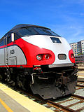
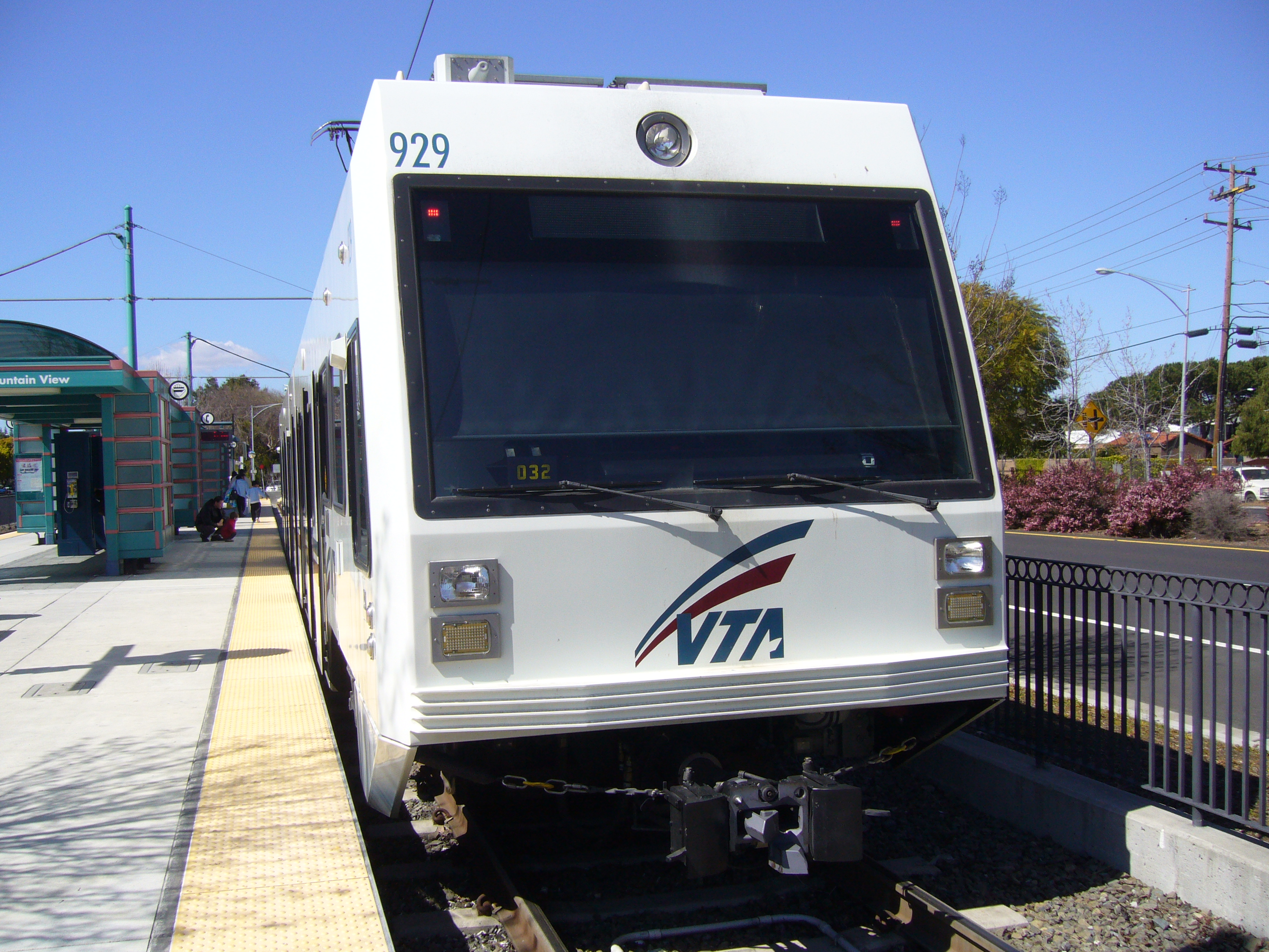
Gilroy during peak hourstoward 4th & KingBaby Bullet toward TamienVTA Light Rail Terminus Mountain View–Winchester toward WinchesterDowntown Mountain View station is an intermodal passenger transportation station that serves the Santa Clara Valley Transportation Authority light rail system, Caltrain commuter rail line, and numerous bus and shuttle routes.
Contents
Station amenities
- Park and Ride lot
- Bicycle lockers
- Bicycle shelter
- Station building with a meeting room
- Payphones
- Newspaper racks
- Refreshment cart
Connecting bus service
References
External links
- Caltrain Mountain View station page
- The Tasman West Light Rail Project: Art and Aesthetics Program at VTA
- Park & Ride Lots - Downtown Mountain View Caltrain Station at VTA
Management Stations 22nd Street • Atherton • Bayshore • Belmont • Blossom Hill • Broadway • Burlingame • California Avenue • Capitol • College Park • Gilroy • Hayward Park • Hillsdale • Lawrence • Menlo Park • Millbrae • Morgan Hill • Mountain View • Palo Alto • Redwood City • San Antonio • San Bruno • San Carlos • San Jose Diridon • San Martin • San Mateo • San Francisco 4th & King Street • Santa Clara • South San Francisco • Stanford • Sunnyvale • Tamien
Former: Bay Meadows • Castro • Paul AvenueConnecting services San Francisco Municipal Railway • Bay Area Rapid Transit • SamTrans • VTA • Altamont Commuter Express • AC Transit • Amtrak Thruway Motorcoach • Monterey-Salinas Transit • San Benito Transit • Santa Cruz Metro • California Shuttle Bus • Dumbarton Express • Highway 17 Express • SMARTOther 
VTA Light Rail Stations Almaden • Alum Rock • Bascom • Baypointe • Bayshore/NASA • Berryessa • Blossom Hill • Bonaventura • Borregas • Branham • Capitol • Champion • Children's Discovery Museum • Cisco Way • Civic Center • Component • Convention Center • Cottle • Cropley • Crossman • Curtner • Downtown Campbell • Downtown Mountain View • Evelyn • Fair Oaks • Fruitdale • Gish • Great America • Great Mall/Main • Hamilton • Hostetter • I-880/Milpitas • Japantown/Ayer • Karina • Lick Mill • Lockheed Martin • McKee • Metro/Airport • Middlefield • Moffett Park • Montague • Oakridge • Ohlone/Chynoweth • Old Ironsides • Orchard • Paseo de San Antonio • Penitencia Creek • Race • Reamwood • River Oaks • Saint James • San Jose Diridon • San Fernando • Santa Clara • Santa Teresa • Snell • Tamien • Tasman • Vienna • Virginia • Whisman • WinchesterConnecting services Other Categories:- Caltrain stations in Santa Clara County, California
- Santa Clara Valley Transportation Authority light rail stations
- Santa Clara Valley Transportation Authority bus stations
- Railway stations in Mountain View, California
- California railway station stubs

Wikimedia Foundation. 2010.