- North West England
-
This article is about the government office region. For the European constituency, see North West England (European Parliament constituency).
North West England 
North West region shown within EnglandGeography Status Region Area
— TotalRanked 6th
14,165 km²
5,469 sq miNUTS 1 UKD Demographics Population
— Total
— DensityRanked 3rd
6,853,200 (2006)
475/km²GVA per capita £17,433 (6th) Government Admin HQ St Helens Leadership North West Regional Leaders Board Regional development Northwest European parliament North West England Website North West England, informally known as The North West, is one of the nine official regions of England.
North West England had a 2006 estimated population of 6,853,201[1] the third most populated region after London and the South East. The North West comprises five ceremonial counties of England – Cumbria, Lancashire, Greater Manchester, Merseyside, and Cheshire.
North West England is bounded on the west by the Irish Sea, and North Wales on the south west. The region extends from the Scottish Borders in the north to the northern margins of the English Midlands in the south. Geographically, the North West is also known for the Lake District and is bounded by the Peak District and the Pennines to the south and the east. The highest point in North West England (and the highest peak in England) is Scafell Pike, Cumbria, at a height of 3,209 feet (978 m).
A mix of rural and urban landscape, two large conurbations, centred on the urban cities of Liverpool and Manchester, occupy the south of the region. The north of the region, comprising Cumbria and northern Lancashire, is largely rural.
Contents
Local government
England 
This article is part of the series:
Politics and government of
EnglandGovernance
The official region consists of the following subdivisions:
Ceremonial county County/Unitary Metropolitan/non-metropolitan districts Cheshire Cheshire East U.A. Cheshire West and Chester U.A. Halton U.A. Warrington U.A. Cumbria † Barrow-in-Furness, South Lakeland, Copeland, Allerdale, Eden, Carlisle Greater Manchester * Bolton, Bury, Manchester, Oldham, Rochdale, Salford, Stockport, Tameside, Trafford, Wigan Lancashire Lancashire † West Lancashire, Chorley, South Ribble, Fylde, Preston, Wyre, Lancaster, Ribble Valley, Pendle, Burnley, Rossendale, Hyndburn Blackpool U.A. Blackburn with Darwen U.A. Merseyside * Knowsley, Liverpool, St. Helens, Sefton, Wirral Key: shire county = † | metropolitan county = *
After abolition of the Greater Manchester and Merseyside County Councils in 1986, power was transferred to the Metropolitan Boroughs, effectively making them Unitary Authorities. In April 2011, Greater Manchester gained a top-tier administrative body in the form of the Greater Manchester Combined Authority, which means the 10 Manchester Boroughs are once again second-tier authorities.
Demographics
Population, density and settlements
Source: Office for National Statistics Mid Year Population Estimates [2]
Region/County Population Population Density Largest town/city Largest urban area Lancashire 1,449,600 468/km² Blackpool (142,900) Preston/Chorley/Leyland urban Area (335,000) Merseyside 1,353,600 2,118/km² Liverpool (436,100) Liverpool Urban Area (816,000) Cheshire 1,003,600 424/km² Chester (77,040) Warrington (194,700) Cumbria 496,200 73/km² Carlisle (71,773) City of Carlisle (105,200) North West England's population accounts for just over 13% of England's overall population. 37.86% of the North West's population resides in Greater Manchester, 21.39% in Lancashire, 20.30% in Merseyside, 14.76% in Cheshire and 7.41% live in the largest county geographically, Cumbria.
Ethnicity
According to 2009 Office for National Statistics estimates,[3] 91.6% (6,323,300) of people in the region describe themselves as 'White': 88.4% (6,101,100) White British, 1.0% (67,200) White Irish and 2.2% (155,000) White Other.
The Mixed Race population makes up 1.3% (93,800) of the region's population. There are 323,800 South Asians, making up 4.7% of the population, and 1.1% Black Britons (80,600). 0.6% of the population (39,900) are Chinese and 0.5% (36,500) of people belong to another ethnic group.
North West England is a very diverse region, and cities such as Manchester and Liverpool are amongst the most diverse in Europe. 19.4% of Blackburn with Darwen's population are Muslim, the third highest among all local authorities in the United Kingdom and the highest outside London. Areas such as Moss Side in Greater Manchester are home to a 30%+ Black British population. In contrast, the town of St. Helens in Merseyside, unusually for a city area, has a very low percentage of ethnic minorities with 98% identifying as White British[4]. The City of Liverpool, over 800 years old, is one of the few places in Britain where ethnic minority populations can be traced back over dozens of generations: being the closest major English city to Ireland, it is home to a significant Irish population, and links to the British Slave Trade resulted in the city being home to one of the first ever Afro-Caribbean communities in the UK.
Summarised
- There are around 400,000 people living in the North West of any Asian ethnicity
- Around 125,000 people from the North West are of full or partial Sub-African and/or Caribbean descent
- The single largest non-white ethnic group in the North West are Pakistanis, numbering at least 144,400
Place of birth
The list below is not how many people belong to each ethnic group (e.g. there are over 25,000 ethnic Italians in Manchester alone,[5] whilst only 6,000 Italian-born people live in the North West). The fifteen most common countries of birth in 2001 for North West citizens were as follows (2008 estimates, where available, in brackets)[6][7]
- England - 6,169,753
- Scotland - 109,163
- Wales - 73,850
- Ireland - 56,887 (51,000 in 2008)
- Pakistan - 46,529 (58,000 in 2008)
- Northern Ireland - 34,879
- India - 34,600 (48,000 in 2008)
- Germany - 19,931 (25,000 in 2008)
- China and Hong Kong - 15,491
- Bangladesh - 13,746
- South Africa - 7,740
- United States - 7,037
- Jamaica - 6,661
- Italy - 6,325
- Australia - 5,880
- Poland - (37,000 in 2008)
Religion
The table below is based in the 2001 UK Census.
Region Christian Muslim Hindu Sikh Jewish Buddhist Other No Religion/ Not Stated North West England 78.0% 3.0% 0.4% 0.1% 0.4% 0.2% 0.2% 17.7% United Kingdom 71.6% 2.7% 1.0% 0.6% 0.5% 0.3% 0.3% 23.2% Teenage pregnancy
For top-tier authorities, Manchester has the highest teenage pregnancy rate in the region. For council districts, Burnley has the highest rate, closely followed by Hyndburn, both in Lancashire. For top-tier authorities, Cheshire has the lowest teenage pregnancy rate. For council districts, Eden has the lowest rate closely followed by South Lakeland, both in Cumbria.
Social deprivation
Being in Northern England, the region has significant multiple deprivation, but also very affluent areas south of Manchester. As measured by the Indices of deprivation 2007, the region has many more Lower Layer Super Output Areas in the 20% most deprived districts than the 20% least deprived council districts.[8] Only North East England shows more indicators of deprivation than the North West, but the number of affluent areas in the North West is very similar to Yorkshire and the Humber.
The most deprived council districts in the region are, in descending order - Liverpool (1st in England), Manchester (4th), Knowsley (5th), Blackpool (12th), Salford (15th), Blackburn with Darwen (17th), Burnley (21st), Rochdale (25th), Barrow-in-Furness (29th), Halton (30th), Hyndburn (40th), Oldham (42nd), Pendle (44th), St Helens (47th), Preston (48th), Bolton (51st), Tameside (56th), Wirral (60th), Wigan (67th), Copeland (78th), Sefton (83rd) and Rossendale (92nd). These areas mostly have Labour MPs except for Conservative MPs in the west part of Wirral and Rossendale, and Lib Dem MPs in Sefton (Crosby/Formby/Southport/Maghull), Manchester (Withington) and Burnley. Wirral, Rossendale and Burnley are the only three of these not to have a Labour council, and Sefton has no overall control (Lib Dem largest party).
In 2007 when Cheshire still had district councils, the least deprived council districts in the region by council district, in descending order, were - Congleton, Ribble Valley, Macclesfield, and South Lakeland.[9] These areas have Conservative MPs, except South Lakeland has a Lib Dem and Labour MPs. At county level, before it was split into two, Cheshire was the least deprived, followed by Trafford, and by Warrington and Stockport.
In March 2011, the overall unemployment claimant count was 4.2% for the region. Inside the region the highest was Liverpool with 6.8%, followed by Knowsley on 6.3%, Halton with 5.5% and Rochdale with 5.1%. The lowest claimant count is in Eden (Cumbria) and Ribble Valley (Lancashire) each with 1.3%, followed by South Lakeland with 1.4%.[10]
Elections
In the 2010 General Election, the area was dominated by the Labour Party. 40% of the region's electorate voted Labour, 32% Conservative and 22% Liberal Democrat; however, by number of parliamentary seats, Labour have 47, the Conservatives have 22, and the Liberal Democrats have 6.[11] The Lib Dems' North West seats are concentrated around southern Manchester; Labour dominates the remainder of Greater Manchester, and the Conservatives' only inroad in 2010 in the city region was Bury North, having always held Altrincham and Sale West. Labour seats also predominate in Merseyside. All of Cheshire (pre-2009), apart from Ellesmere Port and Neston, is Conservative, and Lancashire is now majority Conservative (9 seats); the Labour seats in Lancashire are in the south of the county along the M65. For the region, the Conservatives gained 12 seats, with the Lib Dems gaining 1; there was a 4.3% swing from Labour to Conservative.
In the 2009 European Election, 26% voted Conservative, 20% Labour, 16% UKIP and 14.3% Liberal Democrat.
Language and dialect
Up until the 12th Century, Cumbric (a Celtic language), was spoken throughout Northwest England. This language was gradually replaced by Old/Middle English, but the language still survives in various placenames throughout the North West and possibly also in some traditional counting rhymes (Yan Tan Tethera), and reconstructions of the language are being attempted. In modern times, English is the most spoken language in the North West, with a large percentage of the population fluent in it, and close to 100% conversational in it. To the north-east of the region, within the historic boundaries of Cumberland, the Cumbrian dialect is dominant. The historical county of Lancashire covered a vast amount of land, and the Lancashire dialect and accent is still predominant throughout the county, and stretches as far north as Furness in South Cumbria to parts of north Greater Manchester and Merseyside in the south of the region. The region boasts some of the most distinctive accents in the Scouse accent which originates from Liverpool and its surrounding areas and the Manc accent deriving from the central Manchester district. The region's accents are among those referred to as 'Northern English'.
Large immigrant populations in the North West result in the presence of significant immigrant languages. South Asian languages such as Urdu, Hindi and Punjabi are widespread, with the largest amount of speakers residing in Preston, Blackburn and Manchester. The Chinese once made up the largest minority in the region (as Liverpool has one of the oldest Chinese settlements in Europe), and still do to the far north where Chinese is spoken by small but significant communities. Since the enlargement of the EU, over 1 million Poles have immigrated to the UK, a large number of them settling in the North West. Places such as Crewe as well as larger cities make Polish written information available for the public, to much controversy.[citation needed] Other immigrant languages with a presence in the North West are Spanish, mainly amongst the Latin American communities in Barrow-in-Furness, Lancaster, Liverpool and Manchester, as well as various other Eastern European and Asian languages.
The most taught languages in schools across the North West are English, French and German. Spanish and Italian are available at more senior levels and, in cities such as Manchester and Liverpool, even Urdu and Mandarin are being taught to help maintain links between the local minority populations.
Cities and towns
- GM = Greater Manchester, ME = Merseyside, CU = Cumbria, LA = Lancashire, CH = Cheshire
Population > 400,000
- Manchester, GM
- Liverpool, ME
Population > 100,000
- Blackpool, LA
- Bolton, GM
- Stockport, GM
- Preston, LA
- Blackburn, LA
- Oldham, GM
- St Helens, ME
- Rochdale, GM
- Southport, ME
Population > 70,000
- Birkenhead, ME
- Wigan, GM
- Warrington, CH
- Chester, CH
- Burnley, LA
- Salford, GM
- Carlisle, CU
Population > 50,000
- Barrow-in-Furness, CU
- Crewe, CH
- Wythenshawe, GM
- Ellesmere Port, CH
- Runcorn, CH
- Bury, GM
- Bootle, ME
- Wallasey, ME
- Huyton, ME
- Widnes, CH
- Sale, GM
- Macclesfield, CH
Population > 30,000
- Lancaster, LA
- Middleton, GM
- Morecambe, LA
- Stretford, GM
- Ashton-under-Lyne, GM
- Leigh, GM
- Swinton, GM
- Lytham St Annes, LA
- Urmston, GM
- Walkden, GM
- Altrincham, GM
- Leyland, LA
- Skelmersdale, LA
- Eccles, GM
- Accrington, LA
- Darwen, LA
- Denton, GM
- Radcliffe, GM
- Tyldesley, GM
- Chorley, LA
- Chadderton, GM
- Prestwich, GM
- Hyde, GM
- Thornton-Cleveleys, LA
- Wilmslow, CH
- Winsford, CH
- Reddish, GM
Population > 20,000
- Northwich, CH
- Nelson, LA
- Maghull, ME
- Ashton-in-Makerfield, GM
- Heywood, GM
- Fleetwood, LA
- Kendal, CU
- Whitehaven, CU
- Farnworth, GM
- South Turton, GM
- Workington, CU
- Formby, ME
- Saddleworth, GM
- Marple, GM
- Hindley, GM
- Ormskirk, LA
- Whitefield, GM
- Droylsden, GM
- Golborne, GM
- Westhoughton, GM
- Congleton, CH
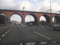
- Stalybridge, GM
- Clitheroe, LA
- Rawtenstall, LA
- Shaw and Crompton, GM
- Penwortham, LA
- Royton, GM
- Failsworth, GM
- Colne, LA
- Maghull, ME
Metropolitan areas
See also: List of metropolitan areas in the United KingdomThe five largest metropolitan areas in the North West are as follows:
- Manchester metropolitan area - 2,556,000[12]
- Liverpool/Birkenhead metropolitan area - 2,241,000[12]
- Blackburn/Burnley - 391,000[12]
- Preston - 354,000 [12]
- Blackpool -304,000[12]
Liverpool and Manchester are sometimes considered parts of a single large polynuclear metropolitan area,[13][14] or megalopolis[15] but are usually treated as separate metropolitan areas.[12] In some studies, part of Wigan in Greater Manchester is considered part of the Liverpool metropolitan area.[12]
Elected regional assembly
It is one of the two regions (along with Yorkshire and the Humber) that were expected to hold a referendum on the establishment of an elected regional assembly. However, when the North East region of England rejected having an elected regional assembly in a referendum, further referendums were cancelled and the proposals for elected regional assemblies in England put on hold. The regional leaders' forum, 4NW, an unelected quango, is based on Waterside Drive in Wigan.
European Parliament
The North West England European Parliament constituency has the same boundaries as the Region.
History
Main articles: History of Cumbria, History of Lancashire, History of Manchester, History of Liverpool, and History of CheshireTen English regions were established by the government in 1994. At that time, Merseyside, which already had its own Government Office, formerly the Merseyside Task Force, was regarded as a separate region. In 1998, Merseyside was merged into the North West region. This action was controversial in some quarters.[citation needed]
Scientific and industrial heritage
The Bridgewater Canal was the first recognised canal of the modern era. The Liverpool and Manchester Railway was the world's first passenger inter-city railway in 1830. Sir Richard Owen from Lancaster coined the word dinosaur in 1842. The University of Manchester built the world's first programmable computer, the Manchester Small-Scale Experimental Machine, in 1948. Calder Hall was the world's first nuclear power station in 1956.
Transport
Transport policy
As part of the national transport planning system, the Regional Assembly is required to produce a Regional Transport Strategy (RTS) to provide long term planning for transport in the region. This involves region wide transport schemes such as those carried out by the Highways Agency and Network Rail.[16] Within the region the local transport authorities plan for the future by producing Local Transport Plans (LTP) which outline their strategies, policies and implementation programmes.[17] The most recent LTP is that for the period 2006–11. In the North West region the following transport authorities have published their LTP online: Blackburn with Darwen U.A,[18] Blackpool U.A.,[19] Cheshire,[20] Cumbria,[21] Greater Manchester,[22] Halton U.A.,[21] Lancashire,[23] Merseyside[24] and Warrington U.A.[25] Since 1 April 2009, when the county of Cheshire was split into two unitary councils[26] the Cheshire transport authority ceased to exist, however it is the most recent LTP for the area.
Road
Regionwide
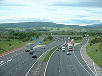
Regionwide the principal road link is the M6, this runs all the way from Carlisle and Scotland in the north to Warrington in the south, connecting such towns and cities as Penrith, Kendal, Lancaster, Preston, Liverpool and Manchester. The M6 intersects many of the North West's motorways and A-roads, and carries almost 120,000 vehicles per day (41,975,000 per year).[27]
Greater Manchester and Merseyside
The Greater Manchester and Merseyside areas are home to almost 4 million people, and over half the region's population. The road networks intertwining these metropolitan areas are extremely important to the economy and are largely motorway, including the M62 which crosses the entire country (east to west – Hull to Liverpool), this motorway directly connects the cities of Manchester and Liverpool. The M62 sees 78,000 vehicles using the motorway in the North West per day.[28] The Merseyside-Manchester region has many motorways, that serve many millions on a daily basis, other include the M61 which connects Manchester to Preston, the M56 which runs south of Manchester to Cheshire and Wales, The M57 and M58 motorways run north of Liverpool, and connect towns such as St Helens and Wigan. The M60 is Manchester's ring road, the M67 and M66 motorways run east and north respectively, both of these motorways are under 10 miles (16 km) and link Manchester to smaller outlying settlements. On top of this there are countless numbers of A-roads, B-roads and minor roads which circle, entwine and serve these two major metropolises. For more information, see: Transport in Manchester.
Cumbria
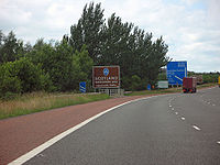
In Cumbria the M6 runs all the way down the east of the county connecting the very north of England to the Lancashire border. The A590 links Barrow-in-Furness to Kendal with around 14,000 vehicles per day.[29] The A595 runs all the way along the West Cumbrian coast beginning near Barrow and ending in Carlisle, linking towns such as Whitehaven and Workington. The A591 road runs from Kendal to the centre of the county connecting Lake District settlements like Windermere, Ambleside and Keswick. Other important A-roads include the A5092, A66, A596 and formerly the A74, until this was upgraded to motorway standard as an extension of the M6 between 2006 and 2008 to meet the A74(M) at the Scottish border.
Lancashire
The Lancashire economy relies strongly on the M6 which also runs from north to south (Lancaster to Chorley). Other motorways in the region include the fairly short M55 which connects the city of Preston and the town of Blackpool at 11.5 miles (18.5 km) in length. The M65 motorway runs from east to west starting in the town of Colne, running through Burnley, Accrington, Blackburn and terminating in Preston. Lancashire is home to many A-roads. The Lancaster-Morecambe area is served by the A683, A6 and A589 roads, the Blackpool-Fylde-Fleetwood area is home to the A587, A584, A583 and A585 roads. The city of Preston and its surroundings are served by the A6, A59, A585, A584, A583, A582 and to the very south-east, the M61 motorway. To the east of the county are the A59, A6119, A677, A679, A666, A680, A56, A646 and A682.
Cheshire
In Cheshire there are four motorways the M6, the M56 (linking Chester to the east), the M53 (linking Chester to Birkenhead) and the M62, which runs just along the county's northern border with Merseyside and Greater Manchester. The Cheshire road system is made up of 3,417 miles (5,499 km) of highway, and the principal one (M6) carries 140,000[30] vehicles in the county daily, linking the North West to the West Midlands.
The county town of Chester is served by the A55, A483 and A494 roads which lead to all directions of the UK including Wales, which part of the city lies in. To the west of the M6, Crewe, Northwich and Sandbach are served by the A54, A51, A49, A533 and A530 roads, these all eventually link up connecting the towns to the larger cities, including Stoke-on-Trent to the south. To the east of the M6 in Cheshire lies the Peak District, and towns such as Macclesfield and Congleton which are served by the A6, A537, A536, A34, A523 and A566 roads.
Air
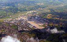
The primary international airport in the region is Manchester Airport, which served 22.1 million passengers in 2007 (18.7 million of which were international),[31] more than some of the world's major aviation hubs. The airport is home to three terminals (plus the World Freight Terminal), which serve destinations worldwide. The largest airlines at the airport in terms of flights in 2007 were Flybe, BMI, British Airways, Jet2.com and Lufthansa, although several long-haul carriers such as American Airlines, Delta Air Lines, Virgin Atlantic, Singapore Airlines and Emirates also operate from the airport.
In 2007 Manchester had a recorded 222,703 aircraft movements,[31] the airport is also a hub for major holiday airlines such as Thomas Cook Airlines, Monarch Airlines, First Choice Airways and Thomson Airways.
The region's second largest, but fastest growing airport is Liverpool John Lennon Airport, where passenger numbers have increased from around 690,000 in 1997 to nearly 5.5 million in 2007.[31] The airport serves destinations primarily in the UK and Europe and is a major hub for EasyJet and Ryanair.
The only other significant passenger airport in the region is Blackpool Airport, which was refurbished in 2006 and handles around half a million passengers annually. Destinations range from the Canary Islands in Spain to the Republic of Ireland.
Cheshire
- Hawarden Airport – Operated by Airbus UK, public and company use
Cumbria
- Barrow/Walney Island Airfield – Operated by BAE Systems Marine Ltd - Submarines, private use
- Carlisle Lake District Airport – Operated by Stobart Air Ltd, public use
Greater Manchester
- City Airport Manchester – Operated by City Airport Manchester Ltd, public use
- Manchester Airport – Major international airport operated by Manchester Airport Group, destinations worldwide
- Woodford Aerodrome – Operated by BAE Systems Regional Aircraft, private use
Lancashire
- Blackpool International Airport – Operated by Balfour Beatty, public use to UK and European destinations
- Warton Aerodrome – Operated by BAE Systems, private use
Merseyside
- Liverpool John Lennon Airport – International airport operated by Liverpool Airport plc, destinations worldwide
- RAF Woodvale – Operated by the Royal Air Force, military use
- Southport Birkdale Sands airstrip – Sand runway located on Southport beach (infrequent use, subject to prior permission)
Rail
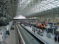
The main connection by train is the West Coast Main Line (Virgin Trains), connecting most of the North West. Other important lines are the Liverpool to Manchester Lines and the North TransPennine which connects Liverpool to Manchester through Warrington. East-west connections in Lancashire are carried via the Caldervale Line to Blackpool. Liverpool and Manchester both have extensive local passenger rail networks operating high-frequency commuter trains.
Sea
Sea ferries depart from Liverpool (Gladstone Dock) to Dublin (P&O Irish Sea) and to Douglas on the Isle of Man (Isle of Man Steam Packet); Birkenhead (Twelve Quays Terminal) to Belfast and Dublin (Norfolkline Irish Sea Ferries – former Norse Merchant Ferries); Fleetwood to Larne (Stena Line) in Northern Ireland; and Heysham to Douglas (Isle of Man Steam Packet).
Economy
The North West is historically linked with the textiles industry, mainly before the mid 20th century. The Greater Manchester region produces the most economic output according to GVA in 2007 with £46,189m. Followed by Lancashire with £22,470m, Cheshire £21,317m and Merseyside £19,112m and Cumbria with £7,379m.
According to research by Cushman and Wakefield in 2008, Manchester is the second best city to locate a business in the UK whilst Liverpool is the eleventh best city.[32] The Financial Times stated that the North West economy, led by the redevelopment of Manchester and Liverpool, is a genuine rival to 'overheated London'.[33]
The area's electricity, formerly looked after by MANWEB and NORWEB, is now looked after by ScottishPower Energy Networks and United Utilities respectively. The Morecambe Bay gas field provides 6% of the UK's natural gas.
Electricity generation in North West England Power stations ActiveActiveClosedAgecroft · Back o' th' Bank · Barton · Blackburn · Bloom Street · Bold · Bolton · Carlisle · Carrington · Chadderton · Dickinson Street · Fleetwood · Hartshead · Huncoat · Ince A · Kearsley · Lancaster · Lister Drive · Merseyside · Padiham · Radcliffe · Ribble · Roosecote · Salford · Slacks Valley · Southport · Spa Road · Stockport · Stuart Street · Trafford · Warrington · Westwood · WhitebirkActiveProposed/FutureCarringtonIncinerators/WasteActiveProposed/FutureInce · Weston PointActiveHeyshamClosedClosedInce A + BActiveAskam and Ireleth · Barrow Offshore · Baywind · Burbo Bank · Coal Clough · Scout Moor · Winscales MoorProposed/Future
Organisations Cheshire
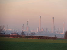
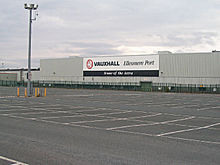
Cheshire is linked with the salt industry. Ineos (the site was previously owned by ICI Chemicals) has a large plant in Runcorn. AstraZeneca is in Macclesfield. BNFL and its subsidiary Sellafield Ltd (former British Nuclear Group), and ABB UK are based in Daresbury near Runcorn, although most of BNG's operations take place at Sellafield in Cumbria. Vauxhall, home of the Astra, on a former airfield next to the M53, and Shell are in Ellesmere Port. Lex Vehicle Leasing, the UK's largest vehicle leasing company is in Chester. Quinn Glass UK is at Elton. Sandbach used to be home of ERF and Fodens trucks. Brunner Mond has a large works in Winnington, just west of Northwich. British Salt is in Middlewich; Bisto used to be made there, but production moved to Worksop (Nottinghamshire) in 2008. Henkel UK (maker of Pritt and Sellotape) is in Winsford, home of the UK's largest salt mine at Meadowbank run by Salt Union, who are owned by Compass Minerals. Focus, Mornflake and Bentley Motors are in Crewe. Betfred and United Utilities are based in Warrington, and Unilever makes Persil and Surf next to the Bank Quay train station. Bensons for Beds is based nearby to the north in Burtonwood and Westbrook next to the M62 and Burtonwood services. Diageo bottles Guinness at Preston Brook, next to the M56. Konftel UK is at Thelwall. Pets at Home is at Handforth near Wilmslow.
Lancashire
The main private employer in Lancashire is BAE Systems Military Air Solutions who have two sites either side[clarification needed] of Preston (Warton and Samlesbury) for the manufacture of military aircraft. Silentnight is in Barnoldswick. Crown Paints is in Darwen. The boiler firm BAXI originates from Preston also, and InBev have a brewery nearby in Samlesbury (former Whitbread). Leyland Trucks manufactures several highly popular truck ranges from Leyland, home of Enterprise Plc. Other brands originating in Lancashire include: TVR, Reebok, Jaguar Cars and Warburtons. Nationwide fashion retailer Matalan has its head office and main distribution centre in Skelmersdale, which is where Walker's make Monster Munch at West Pimbo. B & M Retail is in Blackpool, as is the Federation of Small Businesses (FSB), Premium Bonds and National Savings and Investments. Victrex make PEEK (a thermoplastic) just north of Blackpool at Cleveleys. Rolls-Royce make (turbofan) fan blades at Barnoldswick.
Greater Manchester
Kelloggs is in Trafford Park (Manchester), and nearby the Brooke Bond division of Unilever make PG Tips, and TDG is on the industrial estate. Robertson's (now owned by Premier Foods since it was bought from Rank Hovis McDougall) moved their marmalade (Golden Shred) and jam processing from Droylsden to Histon and Impington (Cambridgeshire) in October 2008. Makro is in Eccles. JJB Sports is in Wigan. JD Sports is in Bury as is Birthdays. Scottish & Newcastle have their large Royal Brewery in Manchester. The Co-op is based in Manchester and Rochdale as is Zen Internet. Heinz, although based in Hayes in Middlesex, has the largest food processing complex in Europe at a 55-acre (220,000 m2) site at Kitt Green in Wigan, which produces 1.4 billion cans of food each year. Also in Wigan are The Tote, Shearings Holidays and Girobank, and R&R Ice Cream (former Richmond Foods) make De Roma ice cream.
Sock Shop is in Bolton, and MBDA (former BAe Dynamics) makes missiles in Lostock near junction 6 of the M61. BAE Systems build aircraft in Chadderton and Woodford in Manchester, and Warton and Samlesbury near Preston. PZ Cussons, MAN B&W Diesel, the Institute of Advanced Motorists, National Tyre Service, Umbro and the internet bank Smile are in Stockport. Adidas UK is in Hazel Grove. BASF UK is in Cheadle Hulme next to the A34. Russell Hobbs is in Failsworth. Inventive Leisure, who own the Revolution pub chain, are in Ashton-under-Lyne. Timpson is in Wythenshawe; Sharwood's used to make their sauces there until Premier Foods moved production to Bury St Edmunds in 2008. Nearby in Moss Nook is Franke UK, the world's largest manufacturer of domestic sinks. Sarson's make vinegar in Middleton. Cotton Traders are in Altrincham, and Dulux Decorator Centres is in West Timperley. McVitie's make their Jaffa Cakes, Penguins and chocolate digestives at a factory in South Manchester.[34]
Merseyside
Pilkington is in St Helens. Littlewoods are in Garston, who are owned by the Shop Direct Group in Speke. Princes, Johnsons Cleaners UK, Maersk Line UK, the Beetham Organization, Home Bargains, the Royal Liver Assurance and T J Hughes have their headquarters in Liverpool. Towards Aintree, Jacob's and their crackers are historically based, and also make Twiglets at their site at Hartley's Village in Fazakerley, and nearby is Sportech PLC, owner of the football pools. Dairy Crest makes Vitalite and Utterly Butterly in Kirkby. Ethel Austin is in Knowsley, near junction 4 of the M57.
Jaguar Land Rover has a main production site (formerly owned by Ford) in Halewood, making the Freelander. Halewood International, who make Lambrini, Red Square, Lamb's Navy Rum and some alcopops, are in Whitefield Lane End, in the south of Huyton at the M62/M57 junction. Belling Ltd (owned by Glen Dimplex) is in Whiston, next to the large Whiston Hospital. At Speke on the A561, west of the JLR plant, Novartis make vaccines such as Fluvirin. At Hunts Cross, the Eli Lilly manufacturing plant produces antibiotics such as Capreomycin, and in 1981 produced the worlds first biosynthetic product, by manufacturing biologic insulin, and has also produced biosynthetic human growth hormone since 1985. Near the A561/A562 junction, the NWDA-funded National Biomanufacturing Centre was built in 2006.
Pontins is in Ainsdale, Sefton. Ty·phoo tea is made in Moreton, and there is a factory of Burton's Foods who make Cadbury's cakes. Cereal Partners (Nestlé) make Cheerios and Golden Nuggets at Bromborough, also the base of CSM UK, the baking ingredients company. At Port Sunlight, Unilever make and research detergents and shampoo, such as Timotei and Sunsilk. Vimto is owned by Nichols plc of Newton-le-Willows in St Helens, although actually made by Cott Beverages in north Leicestershire.
Cumbria
Royal Navy submarines and ships are made by BAE Systems Submarine Solutions in Barrow-in-Furness. The coat of Cumbria is known as Britains Energy Coast due to the large amounts of energy being produced along the coast of the county; Sellafield is a power station which is located in West Cumbria and is a major contributor to the "Energy Coast" also, Barrow-in-Furness is major town in contributing to the "Energy Coast" with a power station (Roosecote Power Station), Gas Terminals (Rampside Gas Terminal) and an offshore wind farm (Walney Wind Farm) which is approximately 14 km (8.6 miles) west of the town's coastline with some of the largest wind turbines on Earth. The Lake District is popular with holiday makers. The Nuclear Decommissioning Authority is near Whitehaven. Lakeland, who make kitchenware, are in Windermere. Stobart Group is in Carlisle. M-Sport, the rally team at Dovenby Hall, and Jennings Brewery are in Cockermouth.
Education
Secondary education
Secondary schools are mostly comprehensive, but Trafford retains a wholly selective school system, and there are some other grammar schools in Lancashire, Wirral, Liverpool and Cumbria.
There are around 345,000 at secondary school in the region, the third highest in England, after South East England and Greater London. This is around three times as much as there are in North East England. For school truancy the most number of persistent truants are in Manchester with a rate of 7.3%, followed by Knowsley with 6.9%, and Blackpool with 6.6%. The lowest truancy rate is in South Ribble with 2.4% followed by Ribble Valley with 2.9% (both in Lancashire).
At GCSE, the lowest performing area is Knowsley, consistently the worst performing LEA in England. No schools in this LEA usually get above average GCSE results. Blackpool and Manchester get the region's next lowest results. Sefton has performed much better than its neighbour, Liverpool. Wirral is the best performing area in Greater Merseyside, closely followed by Sefton. In Greater Manchester, Manchester performs the worst, closely followed by Salford. The best performing area in Greater Manchester is Trafford (one of the best in England), followed by Bury, then Stockport. Trafford has the best results in the North-West followed by Cheshire East, Bury, Stockport then Warrington; in order of results, Wirral, Lancashire, Sefton, Cheshire West and Chester also perform higher than the England average.[citation needed]
Liverpool produces the most school children who pass no GCSEs, followed closely by Knowsley. Trafford has the lowest proportion.[citation needed]
At A level in 2010, Trafford performed the best and, again like its results at GCSE, is one of the best areas in England. The lowest performing area is, again, Knowsley but followed by Rochdale. Knowsley has some dreadful results at A-level. For traditional counties, Lancashire gets excellent results at A-level, being one of the best in England. Areas also performing above the England average, in order of results, are Blackpool, Warrington, Wigan, Cheshire West and Chester, Bury, Cumbria, Wirral, and Stockport. Blackpool performs not particularly well at GCSE, yet produces much better results at A level – even better than Cheshire West and Chester, and the third best in the region.[citation needed]
Top forty state schools in the North West (2010 A level results)
- 1. Altrincham Grammar School for Girls
- 2. Lancaster Girls' Grammar School
- 3. Bacup and Rawtenstall Grammar School
- 4. Winstanley College
- 5. Cardinal Newman College, Preston
- 6. The Blue Coat School, Liverpool
- 7. Altrincham Grammar School for Boys
- 8. Lancaster Royal Grammar School
- 9. Clitheroe Royal Grammar School
- 10. St. Ambrose College, Hale Barns, Altrincham
- 11. St. Mary's Catholic College (Blackpool)
- 12. Urmston Grammar School
- 13. Wirral Grammar School for Girls
- 14. Canon Slade CofE School, Bradshaw, Bolton
- 15. West Kirby Grammar School
- 16. Sale Grammar School
- 17. Upton Hall School FCJ, Upton
- 18. The Nelson Thomlinson School, Wigton
- 19. Queen Elizabeth Grammar School, Penrith
- 20. The Queen Katherine School, Kendal
- 21. Calday Grange Grammar School, West Kirby
- 22. Holy Cross College, Bury
- 23. The Bluecoat CofE School, Oldham
- 24. Sir John Deane's College, Northwich
- 25. Carmel College (St Helens)
- 26. Loreto Grammar School, Altrincham
- 27. Crompton House CofE School, Shaw, Oldham
- 28. Wirral Grammar School for Boys
- 28. Audenshaw School
- 30. The Fallibroome Academy, Macclesfield
- 31. The Belvedere Academy, Princes Park, Liverpool
- 32. King David High School, Childwall, Liverpool
- 32. Birkenhead High School Academy, Oxton
- 34. Stretford Grammar School
- 35. Bishop Heber High School, Malpas, Cheshire
- 36. Ormskirk School
- 37. William Hulme's Grammar School, Whalley Range
- 38. Aquinas College, Stockport
- 39. The Blackpool Sixth Form College
- 40. The Lakes School, Troutbeck Bridge, Windermere (899)[citation needed]
The areas that have school children most likely to attend university are Trafford and Cheshire, followed by Wirral, Sefton, Stockport and Bury. Four of these areas are or were part of Cheshire - the most traditionally middle-class part of the North West.[citation needed]
Colleges
- Aquinas College, Stockport
- Ashton Sixth Form College, Ashton-under-Lyne
- Barrow-in-Furness Sixth Form College, Barrow-in-Furness
- Blackburn College, Blackburn
- Blackpool and The Fylde College, Blackpool
- Blackpool Sixth Form College, Blackpool
- Bolton College, Bolton
- Bolton Sixth Form College, Bolton
- Burnley College, Burnley
- Bury College, Bury
- Carmel College, St Helens
- Cheadle and Marple Sixth Form College, Cheadle
- Furness College, Barrow-in-Furness
- Holy Cross College (UK), Bury
- Hopwood Hall College, Rochdale
- Hugh Baird College, Bootle
- Kendal College, Kendal
- King George V College, Southport
- Lancaster and Morecambe College, Lancaster
- Liverpool Community College, Liverpool
- Loreto College, Manchester
- Macclesfield College, Macclesfield
- The Manchester College, Manchester
- Mid Cheshire College, Northwich
- The Oldham College, Oldham
- Oldham Sixth Form College, Oldham
- Preston College, Preston
- Priestley College, Warrington
- Rainford College, St Helens
- Runshaw College, Leyland
- Salford City College, Salford
- South Cheshire College, Crewe
- Southport College, Southport
- Sir John Deane's College, Macclesfield
- Stockport College, Stockport
- St Helens College, St Helens
- St John Rigby College, Wigan
- St. Mary's 6th form College, Blackburn
- St. Wilfrids C of E Sixth Form College, Blackburn
- Thomas Whitham Sixth Form, Burnley
- Trafford College, Trafford
- West Cheshire College Ellesmere Port
- Wigan and Leigh College, Wigan
- Winstanley College, Wigan
- Xaverian College, Manchester
The two main higher education colleges in the region are Blackburn College and Blackpool and The Fylde College. There are forty three FE colleges. The regional LSC was in central Manchester; this is now the SFA and the YPLA.
Universities
The universities in the North West are listed below:
- University of Manchester, Manchester - The largest single-site University in the UK with 36,907 students
- Manchester Metropolitan University, Manchester - Also one of the country's largest universities with 40,420 students - second largest university in the region
- UCLAN, Preston - The University of Central Lancashire in Preston, 28,850 students - third largest university in the region
- Liverpool John Moores University, Liverpool - 24,085 students
- University of Liverpool, Liverpool - 20,765 students
- University of Salford, Salford - 20,185 students
- Lancaster University, Lancaster - 17,415 students
- Edge Hill University, Ormskirk - 15,645 students
- University of Chester, Chester and Warrington - 15,095 students
- University of Bolton, Bolton - 8,540 students
- Liverpool Hope University, Liverpool - 8,205 students
- University of Cumbria - The region's newest university located across Cumbria, parts of Lancashire and London, and formerly known as the Cumbria Institute of the Arts
Over 60% of university students in the region are native to the region. The region with the next-highest number of students in the North-West is Yorkshire and the Humber, so approximately 80% of university students in the area are from the north of England. The region's students have the highest proportion of students from so-called low-participation neighbourhoods.[citation needed]
Once graduated, over 65% of graduates find work in the region, with plenty of graduate vacancies, especially in Manchester.[citation needed]
Local media
Local media include:
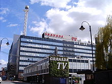
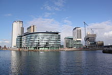
- The North West region of BBC Television is based on Oxford Road in Manchester; it produces the North West Tonight regional programme. The north of Cumbria is covered by Look North in Newcastle-upon-Tyne. The BBC intends to move its Sport and children's television departments and Radio Five Live to Salford Quays. Granada Television is based in Manchester, and produces many ITV well-known programmes such as Coronation Street. It has the regional Granada Reports programme. Border Television is based in Carlisle, producing the regional Lookaround programme. Digital TV comes from Winter Hill for the south of the region, and Caldbeck for Cumbria. Digital switchover took place in mid-2009 for Cumbria and late-2009 for the south of the region.
- BBC Radios Manchester, Merseyside, Lancashire and Cumbria. National radio comes from Holme Moss (for Merseyside, Greater Manchester, and Cheshire) and Sandale for Cumbria. There is a main MW transmitter for the region (and England), over the border in Kirklees, at Moorside Edge.
- Several commercial radio stations including: Real Radio North West (former 105.4 Century FM - Salford), 97.4 Rock FM (Preston), Radio City 96.7 (Liverpool), 102 Capital FM (former Galaxy Manchester), Key 103 (Castlefield), Juice FM (Liverpool), The Bay (Lancaster, Barrow-in-Furness, Morecambe and other surrounding areas), CFM Radio (Carlisle), Lakeland Radio (Kendal), XFM Manchester (Salford), Wire FM in Warrington, The Revolution (Oldham), 104.9 Imagine FM (Stockport), 106.5 Central Radio (former Proud FM - Preston), Heart North West and Wales, Tower FM (Bolton), RadioWave 96.5 (Blackpool), Dune FM (Southport), Wish FM (Wigan and St Helens), 2BR (Burnley and Pendle), and 107 The Bee (Blackburn).
- Local newspapers in the region include:
- Manchester Evening News, Manchester
- Liverpool Echo, Liverpool
- North-West Evening Mail, Barrow-in-Furness
- Lancashire Evening Post, Preston
- News and Star, Carlisle
- Liverpool Daily Post, Liverpool
- Blackpool Gazette, Blackpool
- Wigan Evening Post, Wigan
- Oldham Evening Chronicle, Oldham
- The Reporter,[35] St Helens
- The Star,[36] St Helens
- Chester Evening Leader, Chester
- Southport Visiter, Southport
- Lancashire Telegraph, Blackburn
- Bury Times, Bury
- Bolton News, Bolton
- Westmorland Gazette, Kendal
- See also: List of newspapers in the United Kingdom
Town and City Twinnings
Ashton-under-Lyne  Chaumont, France
Blackburn  Altena, Germany
 Péronne, France
Blackpool  Bottrop, Germany
Bolton  Le Mans, France
 Paderborn, Germany
Burnley  Vitry Sur Seine, France
Bury  Angoulême, France
 Datong, China
 Tulle, France
 Schorndorf, Germany
 Woodbury, New Jersey, USA
Carlisle  Flensburg, Germany
 Słupsk, Poland
Carnforth  Sailly-sur-la-Lys, France
Chadderton  Geesthacht, Germany
Chester  Sens, France
Chorley  Székesfehérvár, Hungary
Dalton-in-Furness  Dalton, Pennsylvania, USA
Denton  Montigny-le-Bretonneux, France
Droylsden  Villemomble, France
Dukinfield  Champagnole, France
Ellesmere Port  Reutlingen, Germany
Failsworth  Landsberg am Lech, Germany
Fleetwood  Fleetwood, Pennsylvania, USA
Halton  Leiria, Portugal
 Marzahn-Hellersdorf, Germany
 Tongling, China
 Ústí nad Labem, Czech Republic
Heywood  Peine, Germany
Kendal  Killarney, Ireland
 Rinteln, Germany
Knowsley  Moers, Germany
Lancaster  Aalborg, Denmark
 Rendsburg, Germany
Liverpool  Cologne, Germany
 Dublin, Ireland
 Odessa, Ukraine
 Shanghai, China
Longdendale  Ruppichteroth, Germany
Manchester  Amsterdam, Netherlands
 Chemnitz, Germany
 Córdoba, Spain
 Faisalabad, Pakistan
 Los Angeles, California, USA
 Puerto Cabezas, Nicaragua
 Rehovot, Israel
 Saint Petersburg Russia
 Wuhan, China
Mossley  Hem, France
Oldham  Kranj, Slovenia
Oswaldtwistle  Falkenberg, Sweden
Preston  Almelo, Netherlands
 Kalisz, Poland
 Nîmes, France
 Recklinghausen, Germany
Rochdale  Bielefeld, Germany
 Lviv, Ukraine
 Sahiwal, Pakistan
 Tourcoing, France
Salford  Clermont-Ferrand, France
 Lunen, Germany
 Narbonne, France
 Saint-Ouen, France
Sedbergh  Zreĉe, Slovenia
Sefton  Gdańsk, Poland
 Mons, Belgium
 Fort Lauderdale, USA
Stalybridge  Armentières, France
Stockport  Béziers, France
 Heilbronn, Germany
St Helens  Stuttgart, Germany
 Chalon-sur-Saône, France
Tameside  Bengbu, China
 Mutare, Zimbabwe
Ulverston  Albert, France
Warrington  Hilden, Germany
 Lake County, Illinois, USA
 Náchod, Czech Republic
Wigan  Angers, France
Workington  Selm, Germany
 Val-de-Reuil, France
Wrea Green  St Bris le Vineux, France
Football
Here is a list of the Premier League and Football League teams in the North West ranked on their 2010-11 league position:
Premier League teams
- 1) Manchester United (Trafford, Greater Manchester) (1st)
- 2) Manchester City FC (Manchester) (3rd) (also FA Cup holders)
- 3) Liverpool FC (Liverpool, Merseyside) (6th)
- 4) Everton FC (Liverpool, Merseyside) (8th)
- 5) Blackburn Rovers (Blackburn with Darwen, Lancashire) (9th)
- 6) Bolton Wanderers (Bolton, Greater Manchester) (13th)
- 7) Wigan Athletic (Wigan, Greater Manchester) (16th)
Championship teams
- 8) Burnley FC (Burnley, Lancashire) (18th in Premier League, relegated)
- 9) Blackpool FC (Blackpool, Lancashire) (19th in Premier League, relegated)
- 10) Preston North End (Preston, Lancashire) (17th)
League One teams
- 11) Carlisle United (Carlisle, Cumbria) (14th)
- 12) Oldham Athletic (Oldham, Greater Manchester) (16th)
- 13) Tranmere Rovers (The Wirral, Merseyside) (19th)
- 14) Rochdale FC (Rochdale, Greater Manchester) (3rd in League Two, promoted)
League Two teams
- 15) Stockport County (Stockport, Greater Manchester) (24th in League One, relegated)
- 16) Morecambe FC (Morecambe, Lancashire) (4th)
- 17) Bury FC (Bury, Greater Manchester) (9th)
- 18) Accrington Stanley (Hyndburn, Lancashire) (15th)
- 19) Crewe Alexandra (Cheshire East, Cheshire) (18th)
- 20) Macclesfield Town (Cheshire East, Cheshire) (19th)
There are 21 Premier League and Football League teams in the North West as of the 2010-11 season with:
8 from Greater Manchester (40%)
6 from Lancashire (30%)
3 from Merseyside (15%)
2 from Cheshire (10%)
1 from Cumbria (5%)Of all the teams in the Premier League and Football League 23% come from the North West. The next nearest region is Greater London with 10 teams (11%). The North West also has 7 teams in the Premier League, more than any other region. Greater London is the next nearest with 5 despite having a slightly larger population.
Teams in the North West have won 53 out of 109 English football League titles (49%), more than any other region.
Rugby League
Here is a list of the Super League and National League teams in the North West ranked on their 2009 league position:
- 1) St. Helens- Super League (2nd)
- 2) Wigan Warriors- Super League (6th)
- 3) Warrington Wolves- Super League (10th)
- 4) Salford City Reds- Super League (13th)
- 5) Barrow Raiders- Co-operative Championship (4th)
- 6) Widnes Vikings- super league (not in yet)
- 7) Whitehaven- Co-operative Championship (5th)
- 8) Leigh Centurions- Co-operative Championship (9th)
- 9) Oldham Roughyeds- Co-operative Championship 1 (4th)
- 10) Blackpool Panthers- Co-operative Championship 1 (5th)
- 11) Swinton Lions- Co-operative Championship 1 (7th)
- 12) Rochdale Hornets- Co-operative Championship 1 (8th)
- 13) Workington Town- Co-operative Championship 1 (9th)
Weather
The North West is generally regarded[who?] as having the most average weather in the UK. Temperatures are generally close to the national average. Cumbria usually experiences the most severe weather, with high precipitation and the risk of floods during summer rainfall. In winter, the most severe weather occurs in the east in Greater Manchester and East Lancashire, over the Pennine areas, where snowfall is the most severe. The A635 A road was closed for almost a month in January 2010 due to high amounts of snowfall.[citation needed] Parts of Oldham and Saddleworth experienced a White Christmas in 2009, where sleet and snow fell on 25 December.
See also
- Outline of England
- Cumbric language
- Envirolink Northwest
- List of schools in the North West of England
- Northwest Development Agency
References
- ^ "Mid-2006 population estimates for the United Kingdom" (XLS). Office of National Statistics. 2007. http://www.statistics.gov.uk/statbase/Expodata/Spreadsheets/D9664.xls. Retrieved 2007-06-29.
- ^ http://www.statistics.gov.uk/statbase/Product.asp?vlnk=15106
- ^ "Current Estimates - Population Estimates by Ethnic Group Mid-2009 (experimental)". Office for National Statistics. http://www.statistics.gov.uk/downloads/theme_population/lad-tables-2009.xls. Retrieved 21 May 2011.
- ^ http://www.ons.gov.uk/ons/rel/census/census-2001-key-statistics/urban-areas-in-england-and-wales/urban-areas-in-england-and-wales-ks06--ethnic-group.xls
- ^ Green, David (29 November 2003). "Italians revolt over church closure". BBC News Online. http://news.bbc.co.uk/1/hi/england/manchester/3223776.stm.
- ^ Neighbourhood Statistics: Manchester, Office for national Statistics, 18 November 2004.
- ^ "Table 1.3: Estimated population resident in the United Kingdom, by foreign country of birth, 60 most common countries of birth, January 2008 to December 2008". Office for National Statistics. http://www.statistics.gov.uk/downloads/theme_population/Population-by-country-of-birth-and-nationality-Jan08-Dec08.zip. Retrieved 2009-10-20.
- ^ LSOA data 2007
- ^ 2007 deprivation data
- ^ Claimant count
- ^ 2010 General Election BBC
- ^ a b c d e f g "British urban pattern: population data" (pdf). ESPON project 1.4.3 Study on Urban Functions. European Spatial Planning Observation Network. March 2007. p. 119. http://www.espon.eu/export/sites/default/Documents/Projects/ESPON2006Projects/StudiesScientificSupportProjects/UrbanFunctions/fr-1.4.3_April2007-final.pdf#page=119. Retrieved 2010-02-22.
- ^ https://www.escholar.manchester.ac.uk/uk-ac-man-scw:89997
- ^ http://www.world-gazetteer.com/wg.php?x=1122670315&men=gcis&lng=en&des=wg&geo=-81&srt=pnan&col=adhoq&msz=1500&va=&pt=a
- ^ http://www2.mssociety.org.uk/download/Achieving_equality_in_Service_Provision_across_the_Northwest_by_David_Stockdale.a9e2968a.pdf#page=2
- ^ "Regional Transport Strategy: the National Picture". Government Office for Yorkshire and The Humber. http://www.gos.gov.uk/gonw/Transport/RegionalTransportStrategy/?a=42496. Retrieved 2009-05-08.
- ^ "The LTP Process". Department for Transport. Archived from the original on 2007-10-09. http://web.archive.org/web/20071009193023/http://www.dft.gov.uk/pgr/regional/ltp/theltpprocess. Retrieved 2009-05-08.
- ^ "Blackburn with Darwen 2006–11 Local Transport Plan". Blackburn with Darwen Borough Council. http://www.blackburn.gov.uk/server.php?show=ConWebDoc.22943&viewPage=2. Retrieved 2009-05-08.
- ^ "Blackpool 2006–11 Local Transport Plan". Blackpool Council. http://www.blackpool.gov.uk/Services/S-Z/TransportPolicy/FAQs/WhatisaLocalTransportPlan.htm. Retrieved 2009-05-08.
- ^ "Cheshire 2006–11 Local Transport Plan". Cheshire County Council. Archived from the original on 2007-10-19. http://web.archive.org/web/20071019020114/http://www.cheshire.gov.uk/localtransportplan/home.htm#localtransportplan. Retrieved 2009-05-08.
- ^ a b "Cumbria 2006–11 Local Transport Plan". Cumbria County Council. Archived from the original on 2008-04-11. http://web.archive.org/web/20080411155959/http://www.cumbria.gov.uk/roads-transport/transportplan/ltp2from2006.asp. Retrieved 2009-05-08.
- ^ "Greater Manchester2006-11 Local Transport Plan". Greater Manchester LTP. http://www.gmltp.co.uk/. Retrieved 2009-05-08.
- ^ "Lancashire 2006–11 Local Transport Plan". Lancashire County Council. http://www.lancashire.gov.uk/environment/ltp/. Retrieved 2009-05-08.
- ^ "Merseyside 2006–11 Local Transport Plan". Merseyside LTP. http://www.letstravelwise.org/content83_The-Local-Transport-Plan.html. Retrieved 2009-05-08.
- ^ "Warrington 2006–11 Local Transport Plan". Warrington Borough Council. http://www.warrington.gov.uk/Transportandstreets/Transportpolicy/Documents/LTP2.aspx. Retrieved 2009-05-08.
- ^ "Cheshire County Council Home Page". Cheshire County Council. http://www.cheshire.gov.uk/. Retrieved 2009-05-08.
- ^ "Final strategy report – Area 9, M6 (Jct 11a to Jct 20)". Route Management Strategy. Highways Agency. Archived from the original on 2007-09-30. http://web.archive.org/web/20070930201501/http://www.highways.gov.uk/roads/projects/7204.aspx. Retrieved 2007-10-16.
- ^ "Road Traffic Statistics 2006" (XLS). Department for Transport. http://www.dft.gov.uk/172974/173025/221412/221546/227050/261688/roadtraffdata.xls. Retrieved 2007-10-16.[dead link]
- ^ "A590 High and Low Newton Bypass". Highways Agency. http://www.highways.gov.uk/roads/projects/5066.aspx. Retrieved 2007-10-16.
- ^ "Road Policing". Cheshire Police Web Site. http://www.cheshire.police.uk/showcontent.php?pageid=76. Retrieved 2007-10-16.
- ^ a b c CAA 2007 Annual Airport Statistics
- ^ "London and Manchester lead UK business survey". Cushman & Wakefield web pages. Cushman & Wakefield. 24 September 2008. http://www.cushwake.com/cwglobal/jsp/newsDetail.jsp?repId=c19200007p&LanId=EN&LocId=GLOBAL. Retrieved 2008-09-24.
- ^ "Living in the North West". AstraZeneca. http://careers.astrazeneca.co.uk/working-here/our-locations/alderley-park/living-in-the-North-West/. Retrieved 2011-09-20.
- ^ United Biscuits - About United Biscuits
- ^ St Helens Today: News, Sport, Jobs, Property, Cars, Entertainments & More
- ^ St Helens Star - News, Sport, Saints Rugby League, Property for sale, rent in St Helens, Merseyside
External links
- Government Office for the North West
- Fact Files: North West
- Northwest Regional Development Agency
- North West Regional Assembly
 United Kingdom of Great Britain and Northern Ireland
England • Wales • Scotland • Northern Ireland
Regions of England: East of England • East Midlands • London • North East • North West • South East • South West • West Midlands • Yorkshire and the Humber
 Districts of North West England
Cheshire 
Cumbria Allerdale • Barrow-in-Furness • Carlisle • Copeland • Eden • South Lakeland
Greater Manchester Lancashire Blackburn with Darwen • Blackpool • Burnley • Chorley • Fylde • Hyndburn • Lancaster • Pendle • Preston • Ribble Valley • Rossendale • South Ribble • West Lancashire • Wyre
Merseyside  United Kingdom topics
Geography Administrative Physical Lakes and lochs · Mountains · Rivers · Volcanoes · Great Britain · Geology of Great Britain · Geology of Northern Ireland
History Maritime · Economic · Military · British Empire · Timeline
Politics · Government Economy Pound sterling · London Stock Exchange · Banks (Bank of England) · Taxation · Transport · Communications · Economic geography · Mining · Energy · Budget
Military Society · Demography Cities · Crime · Ethnic groups · Immigration · Languages · Poverty · Social structure · Towns
Culture Art · Cinema · Cuisine · Identity · Literature · Media · Music · Sport · Television · Theatre · Public holidays
England Northern Ireland Scotland Wales History · Welsh Government · Welsh Assembly · First Minister · Politics · Education · Health care · Religion · Tourism
Categories:- NUTS 1 statistical regions of England
- North West England
- NUTS 1 statistical regions of the European Union
Wikimedia Foundation. 2010.

