- Scafell Pike
-
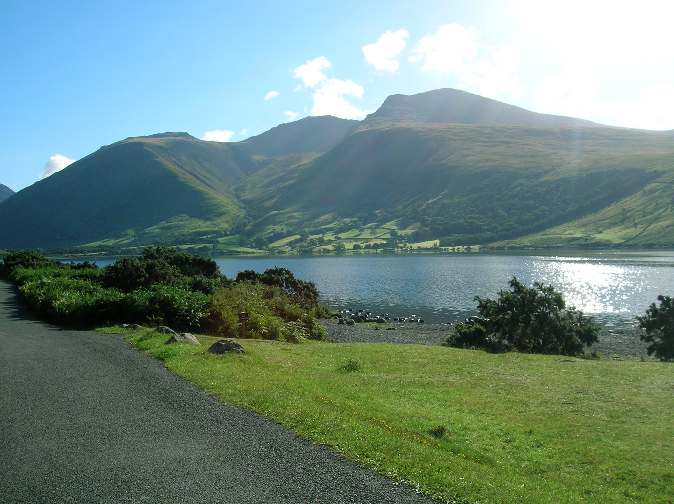
Scafell Pike 
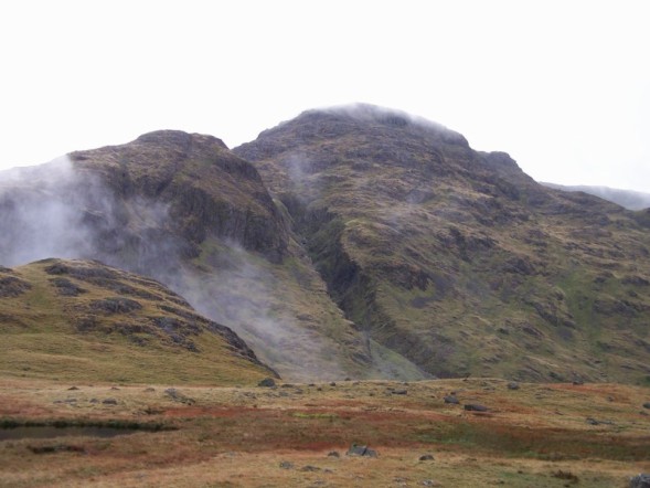
Scafell Pike viewed from WastwaterElevation 978 m (3,209 ft) Prominence 912 m (2,992 ft)
Ranked 13th in British IslesParent peak Snowdon Listing Marilyn, Hewitt, Wainwright, County Top, Nuttall, Country high point Location Cumbria, England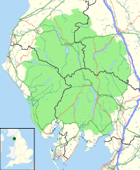
 Scafell Pike
Range Lake District, Southern Fells Coordinates 54°27′15.2″N 3°12′41.5″W / 54.454222°N 3.211528°WCoordinates: 54°27′15.2″N 3°12′41.5″W / 54.454222°N 3.211528°W Topo map OS Landrangers 89, 90, Explorer OL6 OS grid NY215072 Scafell Pike (
 /ˈskɔːˈfɛl/)[1] is the highest mountain in England at 978 metres (3,209 ft). It is located in Lake District National Park sometimes confused with the neighbouring Sca Fell, to which it is connected by the col of Mickledore. The name Pikes of Sca Fell was originally applied collectively to the peaks now known as Scafell Pike, Ill Crag and Broad Crag, which were considered subsidiary tops of Sca Fell (which looks higher from many angles). The contraction Scafell Pike originated as an error on an Ordnance Survey map,[citation needed] but is now standard.
The summit was donated to the National Trust in 1919 by Lord Leconfield in memory of the men of the Lake District "who fell for God and King, for freedom, peace and right in the Great War".[2]
Scafell Pike is one of three British peaks climbed as part of the National Three Peaks Challenge, and is the highest ground for over 90 miles.
Listed summits of Scafell Pike Name Grid ref Height Status Ill Crag NY223073 935 m (3,068 ft) Hewitt, Nuttall Broad Crag NY218075 934 m (3,064 ft) Hewitt, Nuttall Middleboot Knotts NY213080 703 m (2,306 ft) Nuttall Contents
Topography
Scafell Pike is one of a horseshoe of high fells, open to the south, which surrounds the head of Eskdale, Cumbria. It stands on the western side of the cirque with Sca Fell to the south and Great End to the north. This ridge forms the watershed between Eskdale and Wasdale, which lies to the west.
The narrowest definition of Scafell Pike begins at the ridge of Mickledore in the south, takes in the wide, stony summit area and ends at the next depression, Broad Crag Col, c. 920 m (3,030 ft). A more inclusive view also takes in two further tops, Broad Crag, 934 m (3,064 ft) and Ill Crag, 935 m (3,068 ft), the two being separated by Ill Crag Col. This is the position taken by most guidebooks.[3][4] North of Ill Crag is the more definite depression of Calf Cove 850 m (2,800 ft) before the ridge climbs again to Great End.
Scafell Pike also has outliers on either side of the ridge. Lingmell, to the north west is invariably regarded as a separate fell,[3][4] whilst Pen, 760 m (2,500 ft), a shapely summit above the Esk, is normally taken as a satellite of the Pike. The gloriously un-anatomical Middleboot Knotts is a further top lying on the Wasdale slopes of Broad Crag, which is listed as a Nuttall.
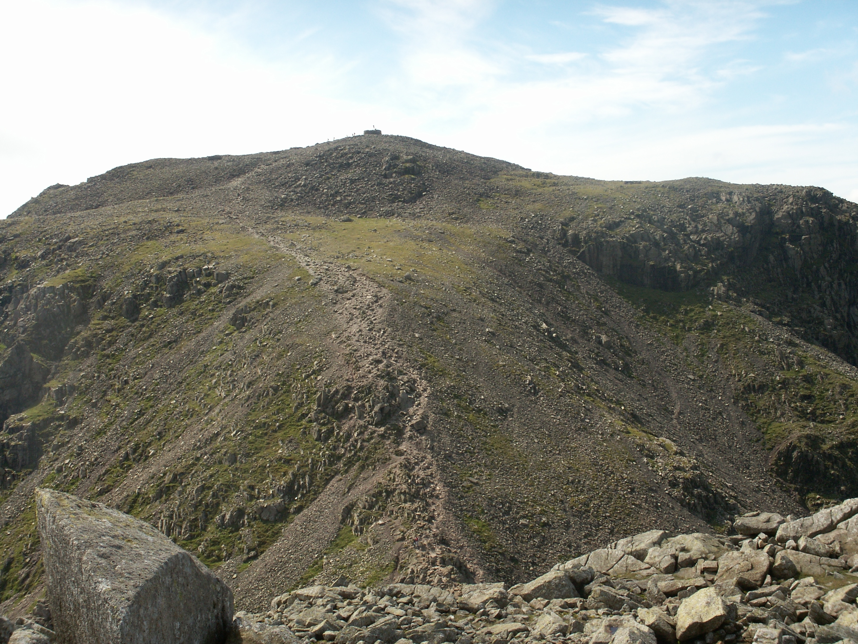
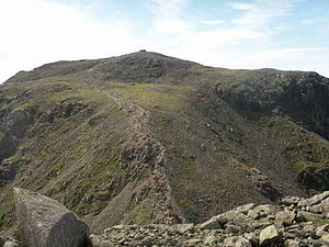 The summit of Scafell Pike, seen from neighbouring Broad Crag
The rough summit plateau is fringed by crag on all sides with Pikes Crag and Dropping Crag above Wasdale and Rough Crag to the east. Below Rough Crag and Pen is a further tier, named Dow Crag and Central Pillar on Ordnance Survey maps, although also known as Esk Buttress among climbers.[5] Esk Buttress and Pikes Crag are well known rock climbing venues.
Broad Crag Col is the source of Little Narrowcove Beck in the east and of Piers Gill in the west. The latter works its way around Lingmell to Wast Water through a spectacular ravine, one of the most impressive in the District. It is treacherous in winter , as when it freezes over it creates an icy patch with lethal exposure should you slip . Broad Crag is a small top with its principle face on the west and the smaller Green Crag looking down on Little Narrowcove. From Broad Crag the ridge turns briefly east across Ill Crag Col and onto the shapel pyramidal summit of Ill Crag. Here the main crags are on the Eskdale side, Ill Crag having little footing in Wasdale.
Scafell Pike has a claim to the highest standing water in England, although Foxes Tarn on Sca Fell is of similar height. The waterbody in question is Broad Crag Tarn, which rather confusingly is on Scafell Pike proper rather than Broad Crag. It lies at about 820 m (2,700 ft), a quarter of a mile south of the summit.[6]
The summit ridge from Ill Crag to Mickledore is notoriously stony, the surface being composed in many places of fields of boulders. Paths are not marked by the usual erosion of soil, but by coloured marks on the rock following the passage of many thousands of booted feet. The summits of Ill and Broad Crags are bypassed by the ridge path, but it leads unerring to the highest point. This bears an Ordnance Survey triangulation column beside a massive cairn. This is not now in the best of repair, but is unmistakable from any distance, still six feet high and much greater in diameter. A little distance away is the lower south peak, a place to escape the crowds and marvel at the view over Eskdale.
Geology
Scafell Pike consists of igneous rock dating from the Ordovician geologically part of the Borrowdale Volcanics. The summit plateau of Scafell Pike, and that of other neighbouring peaks, is covered with shattered rock debris which provides the highest altitude example of a summit boulder field in England.[7] The boulder field is thought to have been caused in part by weathering, such as frost action. Additional factors are also considered to be important, however opinion varies as to what these may be. Clifton Ward suggested that weathering with earthquakes as a secondary agent could be responsible, while J E Marr and R A Daly believed that earthquakes were unnecessary and suggested that frost action with other unspecified agents was more likely.[8] To the north of the summit are a number of high altitude gills which flow into Lingmell Beck. These are good examples in Cumbria for this type of gill and are also biologically important due to their species richness.[7]
Ascent routes
The ascent of the Pike is most often attempted from Wasdale Head. This is at the north end of Wastwater to the west of the Pike, and is at about 80 metres above sea level. There is a famous climber's hotel here, the Wasdale Head Inn, made popular in the Victorian period by Owen Glynne Jones and others. On summer weekends, crowds of people can be found attempting this steep but straightforward walk. An alternative ascent from Wasdale approaches up a hanging valley whose head is at Mickledore, which is itself ascended, before following the path from Sca Fell to the Pike.
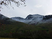
 Scafell Pike from Hardknott Roman Fort
 A view of the classic corridor route taken from Styhead Stretcher box
A more taxing, but scenically far superior, approach begins at Seathwaite Farm at the end of Borrowdale, proceeding via Styhead Tarn, then taking the Corridor Route (formerly known as the Guides Route), a delightful walk along the western flank of the Sca Fell massif with intimate views of the fell, before joining the route from Wasdale near the summit. The return journey can then be made along a high ridge, taking in any or all of the neighbouring summits of Broad Crag, Ill Crag, Great End, Allen Crags and Glaramara. An alternative route from Borrowdale, longer but perhaps less taxing than that via the Corridor Route, runs from Seathwaite via Grains Gill and the high pass of Esk Hause.
 Scafell Pike (left) and Sca Fell (right), with the ridge of Lingmell in the foreground.
A further ascent may be made from Langdale. From the Old Dungeon Ghyll hotel, the route proceeds up alongside Rossett Gill (which perhaps has a more fearsome reputation than it deserves), past Angle Tarn, and then onto Esk Hause before joining a rocky path to the summit. Energetic walkers can vary the return route by ascending Esk Pike and Bowfell from Esk Hause and then come down the Bowfell Band. Another variant which avoids simply returning down Rossett Gill is to head north at the Angle Tarn, over Rossett Pike to join The Cumbrian Way, and descend via Stake Pass adding a mile to the walk. The total distance is about 21 kilometres. Esk Hause is also accessible from Styhead Tarn, making another possible route from Seathwaite.
Another ascent can be made from Eskdale, the longest and most arduous way up but it has some very fine scenery. The route follows the River Esk as far as the Great Moss boggy plateau; walkers then have a choice of ascending steeply up to Mickledore, the low ridge between Sca Fell and Scafell Pike, or following the Esk to its source at Esk Hause. A third possible route up from Great Moss is Little Narrowcove, a steep ascent which emerges onto the ridge a few hundred metres north-east of the summit.
The view from Scafell Pike
 A panorama from the summit of Scafell Pike, August 2007
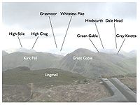 View from the summit of Scafell Pike
As the highest ground in England, Scafell Pike naturally has a very extensive view, ranging from the Mourne Mountains to Snowdonia. On a clear day, the following Marilyns can be seen from the summit.
Data from the first 'external link' below.
North
- Dun Rig, 77 miles (124 km), 2 degrees
- Binsey, 18 miles (29 km), 2 degrees
- Turner Cleuch Law, 71 miles (114 km), 4 degrees
- Dale Head, 5 miles (8.0 km), 5 degrees
- Wisp Hill, 58 miles (93 km), 11 degrees
- Skiddaw, 14 miles (23 km), 12 degrees
- Roan Fell, 55 miles (89 km), 15 degrees
- Knott, 17 miles (27 km), 17 degrees
- Peel Fell, 63 miles (101 km), 24 degrees
- Blencathra, 14 miles (23 km), 28 degrees
- The Cheviot, 83 miles (134 km), 31 degrees
- Cold Fell, 39 miles (63 km), 39 degrees
East
- Howgill Fells, 29 miles (47 km), 103 degrees
- Bow Fell, 2 miles (3.2 km), 105 degrees
- Yorkshire Three Peaks, 36, 44 and 38 miles (61 km), 119 degrees
- Boulsworth Hill, 63 miles (101 km), 135 degrees
- Pendle Hill, 55 miles (89 km), 138 degrees
- Ward's Stone, 38 miles (61 km), 142 degrees
- The Old Man of Coniston, 7 miles (11 km), 149 degrees
- Winter Hill, 64 miles (103 km), 154 degrees
South
- Scafell, 1-mile (1.6 km), 278 degrees
- Snaefell, 52 miles (84 km), 257 degrees
- Slieve Donard, 111 miles (179 km), 262 degrees
- Slieve Croob, 112 miles (180 km), 268 degrees
West
- Beneraird, 80 miles (130 km), 303 degrees
- Merrick, 69 miles (111 km), 315 degrees
- Pillar, 4 miles (6.4 km), 318 degrees
- Cairnsmore of Carsphairn, 68 miles (109 km), 326 degrees
- High Stile, 6 miles (9.7 km), 328 degrees
- Criffel, 37 miles (60 km), 334 degrees
- Grasmoor, 8 miles (13 km), 342 degrees
- Great Gable, 2 miles (3.2 km), 351 degrees
See also
- List of mountains and hills of the United Kingdom
- Geology of the United Kingdom
References
- ^ Daniel Jones, Everyman's English Pronouncing Dictionary (13th ed.), p. 421.
- ^ Scafell Pike on UKNIWM
- ^ a b Richards, Mark: Mid-Western Fells: Collins (2004): ISBN 0-00-711368-4
- ^ a b Wainwright, A. (1960). The Southern Fells. London: Francis Lincoln. ISBN 0-7112-2230-4.
- ^ British Mountain Maps: Lake District: Harvey (2006): ISBN 1-8513-7467-1
- ^ Blair, Don: Exploring Lakeland Tarns: Lakeland Manor Press (2003): ISBN 0-9543-9041-5
- ^ a b "Scafell Pikes SSSI citation sheet" (PDF). English Nature. http://www.english-nature.org.uk/citation/citation_photo/1001922.pdf. Retrieved 2006-11-10.
- ^ Hay, T (1942). "Physiographical Notes from Lakeland". The Geographical Journal (The Geographical Journal, Vol. 100, No. 4) 100 (4): 165–173. doi:10.2307/1788974. JSTOR 1788974.
External links
- Computer generated virtual panoramas North South Index
- Scafell Pike is at coordinates 54°27′16″N 3°12′37″W / 54.454435°N 3.210168°W
- Lake District Walks
- [1] Scafell Pike Walk From Wasdale Head
Wainwright's Southern Fells Allen Crags · Black Fell · Bowfell · Brim Fell · Cold Pike · Coniston Old Man (Old Man of Coniston) · Crinkle Crags · Dow Crag · Esk Pike · Glaramara · Great Carrs · Great End · Green Crag · Grey Friar · Hard Knott · Harter Fell (Eskdale) · Holme Fell · Illgill Head · Lingmell · Lingmoor Fell · Pike O'Blisco (Pike of Blisco) · Rossett Pike · Rosthwaite Fell · Scafell · Scafell Pike · Seathwaite Fell · Slight Side · Swirl How · Wetherlam · Whin RiggHighest mountains of the United Kingdom (by country) Scotland Ben Nevis (Beinn Nibheis) - 1,344 metres (4,409 ft)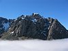
Wales Snowdon (Yr Wyddfa) - 1,085 m (3,560 ft)England Scafell Pike - 978 m (3,209 ft)Northern Ireland Slieve Donard (Sliabh Dónairt) - 849 m (2,785 ft)Marilyns of Northern England 1. Northumberland 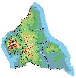
2. Northern Lakeland 3. Western Lakeland Blake Fell • Dale Head • Dent • Grasmoor • Great Gable • Grisedale Pike • High Stile • Kirk Fell • Lord's Seat • Low Fell • Mellbreak • Pillar • Robinson • Seatallan • Swinside • Watch Hill4. Central and
Southern LakelandBlack Combe • Claife Heights • Coniston Old Man • Hard Knott • Harter Fell • High Raise • High Rigg • Holme Fell • Illgill Head • Kirkby Moor • Lingmoor Fell • Loughrigg Fell • Muncaster Fell • Pike of Blisco • Scafell Pike • Top o' Selside • Whitfell5. Eastern Lakeland Arnside Knott • Fairfield • Grayrigg Forest • Great Mell Fell • Gummer's How • Hallin Fell • Helvellyn • High Street • Hutton Roof Crags • Lambrigg Fell • Little Mell Fell • Place Fell • Red Screes • St Sunday Crag • Seat Sandal • Stony Cove Pike • Tarn Crag • Wansfell • Whitbarrow6. North Pennines
and Durham7. Northern Yorkshire Dales Baugh Fell • The Calf • Great Shunner Fell • Hoove • Kisdon • Nine Standards Rigg • Rogan's Seat • Wild Boar Fell • Yarlside8. Southern Yorkshire Dales Aye Gill Pike • Birks Fell • Buckden Pike • Calf Top • Cracoe Fell • Dodd Fell Hill • Fountains Fell • Great Coum • Great Knoutberry Hill • Great Whernside • Ingleborough • Pen-y-ghent • Rombald's Moor • Sharp Haw • Whernside9. North York Moors
to the Humber10. Forest of Bowland Categories:- Wainwrights
- Marilyns of England
- Hewitts of England
- Fells of the Lake District
- Nuttalls
- Climbing areas of England


Wikimedia Foundation. 2010.