- The Storr
-
Not to be confused with Old Man of Stoer.
The Storr 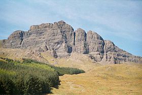
The Storr, seen from the eastElevation 719 m (2,359 ft) Prominence c. 674 metres (2,211 ft) Ranked 73rd in British Isles Parent peak Sgurr Alasdair Listing Graham, Marilyn Translation Great man (Old Norse) Location Location Trotternish, Skye, Scotland Topo map Ordnance Survey Landranger 23 OS grid NG495540 The Storr is a rocky hill on the Trotternish peninsula of the Isle of Skye. The hill presents a steep rocky eastern face overlooking the Sound of Raasay, contrasting with gentler grassy slopes to the west.
Contents
Geology
The Storr is prime example of the Trotternish landslip, the longest such feature in Great Britain.
The area in front of the cliffs of the Storr is known as the Sanctuary. This has a number of weirdly shaped rock pinnacles, the remnants of ancient landslips. One of the most famous of these is known as the Old Man of Storr.
Ascent routes
A well constructed path, used by many sightseers, leaves the A855 just north of Loch Leathan. It heads up through an area of forestry, with glimpses of the scenery beyond. After about 1.6 kilometres (1.0 mi) the walker emerges from the trees, into a spectacular, almost lunar, landscape.
Most day-trippers are content simply to wander around the Sanctuary, admiring the pinnacles and gazing up at cliffs of The Storr. Walkers can easily ascend to the summit however by skirting below the cliffs whilst heading north. After passing over a fence and climbing a brief steep section of loose rock, the recommended route heads north west as far as Coire Scamadal, 1 km north of the summit, then doubling back and heading southwards, climbing towards the summit. From this route, visible breaks in the cliffs offer tempting short cuts, but these are steep, may not save time and may not be safe.
An alternative route to or from the summit starts 500 metres (⅓ mile) south-west of the car park and heads north west to Bealach Beag, about 1 kilometre (0.6 mi) south-west of the summit, following the course of a stream which breaches the cliffs. A steep section of this course is slippery and requires care.
The Storr is often climbed as part of a much longer expedition, following the full length of the Trotternish landslip.
Media and the arts
From 1 August to 17 September 2005 one of Britain's single largest environmental artworks was staged on the walk up to Coire Faoin at the base of the Old Man of Storr and the Storr cliffs. Created by NVA, a Scottish environmental arts company directed by Angus Farquhar (formerly of Test Dept) and designed by a team including "<slight>" and David Bryant, the work contained music by Geir Jenssen, Paul Mounsey, live performance by Gaelic singer Anne Martin and recordings of the works of Gaelic poet Somhairle MacGill-Eain (Sorley MacLean).
In October 2009 a photograph taken of the pinnacles looking towards Raasay and South Rona won the "Take a view: Landscape photo of the year 2009".[1]
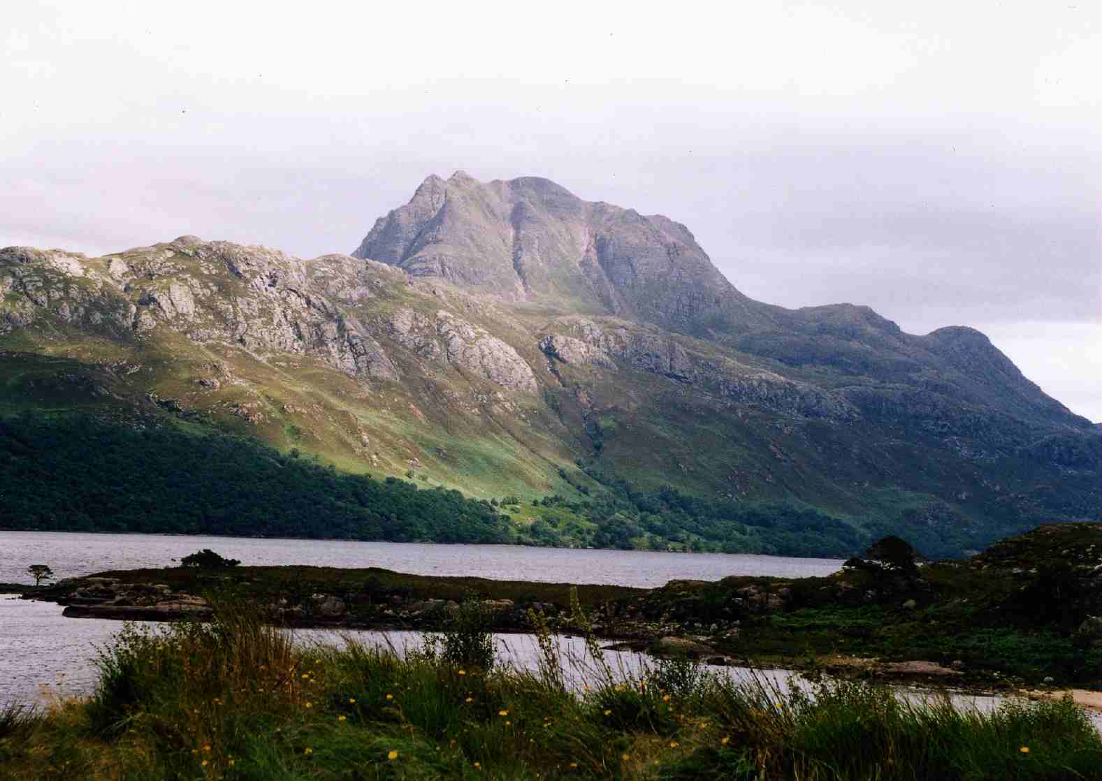
Gallery
-

The Old Man of Storr, Skye
-

The Old Man of Storr, Skye
-

Old Man of Storr 2008, Skye
Citations
- ^ "In pictures: Landscape photo of the year 2009" BBC. Retrieved 20 October 2009.
References
- The Corbetts and Other Scottish Hills. Scottish Mountaineering Club and Trust. ISBN 0-907521-71-1
External links
- The 2005 art installation - from The Guardian
- Images of illumination of landscape
- Isle of Skye Walks
Coordinates: 57°30′24″N 6°11′01″W / 57.50669°N 6.18368°W
Categories:- Grahams
- Marilyns of Scotland
- Mountains and hills of Skye
- Volcanic plugs of Scotland
-


Wikimedia Foundation. 2010.