- Tameside
-
Metropolitan Borough of Tameside — Metropolitan borough — Tameside Council Offices, in Ashton-under-Lyne

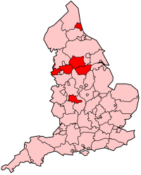
Coat of Arms of the Borough CouncilMotto: "Industry and Integrity" Tameside shown within England
Coordinates: 53°29′24″N 2°05′39″W / 53.49°N 2.09417°WCoordinates: 53°29′24″N 2°05′39″W / 53.49°N 2.09417°W Sovereign state United Kingdom Constituent country England Region North West England Ceremonial county Greater Manchester Admin HQ Ashton-under-Lyne Founded 1 April 1974 Government - Type Metropolitan borough - Governing body Tameside Metropolitan Borough Council - Mayor Cllr. Jean Brazil - MPs: Andrew Gwynne (L)
David Heyes (L)
Jonathan Reynolds (L)Area - Total 39.8 sq mi (103.17 km2) Elevation 495 ft (151 m) Population (2010 est.) - Total 216,900 (Ranked 72nd of 326) - Density 5,382/sq mi (2,078/km2) - Ethnicity
(2005 estimate)[1]93.1% White
5.0% S. Asian or mixed
1.2% Black or mixed
0.6% Chinese and otherTime zone Greenwich Mean Time (UTC+0) Postcode OL, SK, M Area code(s) 0161 / 01457 ISO 3166-2 GB-TAM ONS code 00BT OS grid reference SJ931997 NUTS 3 UKD31 Website www.tameside.gov.uk The Metropolitan Borough of Tameside is a metropolitan borough of Greater Manchester in North West England. It is named after the River Tame which flows through the borough and spans the towns of Ashton-under-Lyne, Audenshaw, Denton, Droylsden, Dukinfield, Hyde, Mossley and Stalybridge. Its western border is approximately 4 miles (6.4 km) east of Manchester city centre. It borders Derbyshire to the east, the Metropolitan Borough of Oldham to the north, the Metropolitan Borough of Stockport to the south, and the City of Manchester to the west. Tameside has a population of 214,400.[2]
The history of the area extends back to the Stone Age. There are over 300 listed buildings in Tameside and three Scheduled Ancient Monuments, which includes a castle of national importance. The settlements in Tameside were small townships centred around agriculture until the advent of the Industrial Revolution. The towns of the borough grew and became involved in the cotton industry, which dominated the local economy. The current borough was created in 1974 as part of the provisions of the Local Government Act 1972. Since then the area has been administered by Tameside Borough Council, which has been judged by the Audit Commission to be "performing strongly".
Contents
History
The history of the area stretches back up to 10,000 years; there are 22 Mesolithic sites in Tameside, the oldest dating to around 8,000 BC; 21 of the 22 sites are in the hilly uplands in the north east of the borough.[3] Evidence of Neolithic[4] and Bronze Age activity is more limited in the borough, although the Bronze Age Stalybridge Cairn is the most complete prehistoric funerary monument in the borough.[5] The people in the area changed from hunter-gatherers to farmers around 2500 BC–1500 BC due to climate change.[6] Werneth Low is the most likely Iron Age farmstead site in the borough, probably dating to the late 1st millennium BC.[7] Before the Roman conquest of Britain in the 1st century AD, the area was probably part of the territory of the Brigantes, the Celtic tribe controlling most of what is now north west England.[8]
The area came under control of the Roman Empire in the second half of the 1st century. Roads through the area were established from Ardotalia fort in Derbyshire to Mamucium (Manchester) west of Tameside and Castleshaw Roman fort in the north.[9] Romano-British finds in the borough include a bog body in Ashton Moss, occupation sites at Werneth Low, Harridge Pike, Roe Cross, and Mottram.[10] A 4th century coin hoard was found in Denton and is one of only four hoards from the 4th century in the Mersey basin.[11] A Byzantine coin from the 6th or 7th centuries, also found in Denton, indicates continued or renewed occupation once the Romans left Britain in the early 5th century.[12]
Nico Ditch, an earthwork stretching from Stretford to Ashton-under-Lyne, is evidence of Anglo-Saxon activity in Tameside. It was probably dug between the 7th and 9th centuries and may have been used as a boundary between the kingdoms of Mercia and Northumbria.[13] Further evidence of Anglo-Saxon era activity in Tameside comes from the derivation of settlement names from Old English such as -tun, meaning farmstead, and leah meaning clearing.[14]
According to the Domesday Survey of 1086, Tameside was divided into four manors, those of Tintwistle, Hollingworth, Werneth, and Mottram. The land east or the River Tame was in the Hundred of Hamestan in Cheshire and held by the Earl of Chester while to the west of the river was in the Hundred of Salford under Roger de Poitevin.[15] These manors were divided to create further manors, so that by the 13th century. Most of them were owned by local families and remained in the hands of the same families until the 16th century.[16] Manorialism continued as the main for of administration and governance until the mid-19th century.[17]
The Industrial Revolution had a significant impact on Tameside; the area, whose main towns had previously been Ashton-under-Lyne and Mottram-in-Longdendale, was transformed from a collection of the rural, farming communities into mill towns. The towns of Ashton-under-Lyne, Dukinfield, Hyde, Mossley and Stalybridge have been described as "amongst the most famous mills towns in the North West".[18] With only a brief interruption for the Lancashire Cotton Famine of 1861 to 1865, factories producing and processing textiles were the main industry in Tameside from the late-18th century until the mid-20th century.[18][19]
In 1964, Dukinfield Borough Council convened a meeting of neighbouring local authorities with the aim of formulating a policy of cross-authority social improvement for the districts in the Tame Valley.[20] Following deindustrialisation, the area had suffered "gross-neglect" and had large areas of housing unsuitable for human habitation.[20] This joint enterprise comprised the nine districts that would become Tameside ten years later, plus the County Borough of Stockport.[20] This collective agreed on creating "a linear park in the valley [of the River Tame] for the use of the townspeople and as a major recreational resource within the Manchester metropolis".[20]
Tameside was created on 1 April 1974, by the Local Government Act 1972 as one of the ten metropolitan districts of Greater Manchester. It took over the local government functions of nine districts which were formerly in the administrative counties of Lancashire and of Cheshire.[21] In 1986 Tameside effectively became a unitary authority with the abolition of the Greater Manchester County Council.
A name for the metropolitan borough proved problematic.[22] The Redcliffe-Maud Report had used the name Ashton-Hyde, but double-barrelled names were prohibited for the new districts.[22] Had Ashton-under-Lyne been a county borough, or had had a less common name, "it might have been chosen as the new name" for the new district.[22] The eight other towns objected, adamant that "a new name should be found".[22] Thirty suggestions were put forward, including Brigantia, Clarendon, Hartshead, Kayborough, Tame, Ninetowns, and West Pennine, with Hartshead (with reference to Hartshead Pike) being the most popular throughout most of the consultation period.[22] However, the name Tameside (with reference to the River Tame) won 15 votes to Hartshead's 10 in a final stage of voting.[22]
The borough underwent a boundary review in 2002. The review altered the areas covered by some wards to ensure councillors represented roughly equal numbers.[23] Between 12 October 2006–8 January 2007, a dispersal order was enforced in the Dukinfield and Newton Hyde areas of the borough. The move was designed to reduce anti-social behaviour. A representative of Stalybridge police post said "Due to the serious nature of recent incidents in Dukinfield and Newton Hyde involving a number of confrontations between large groups of youths, the decision has been made to introduce a Dispersal Order".[24]
Geography
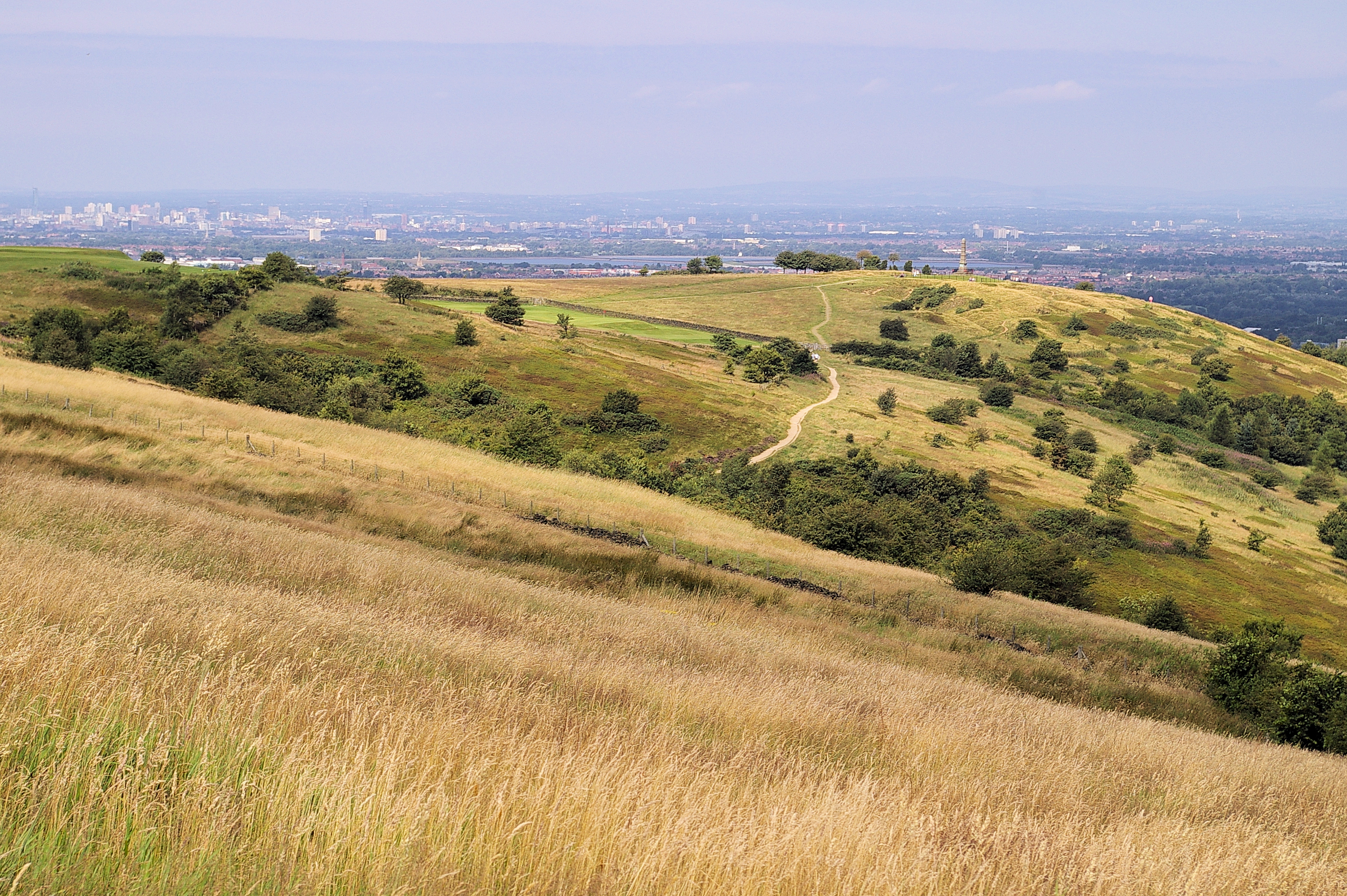
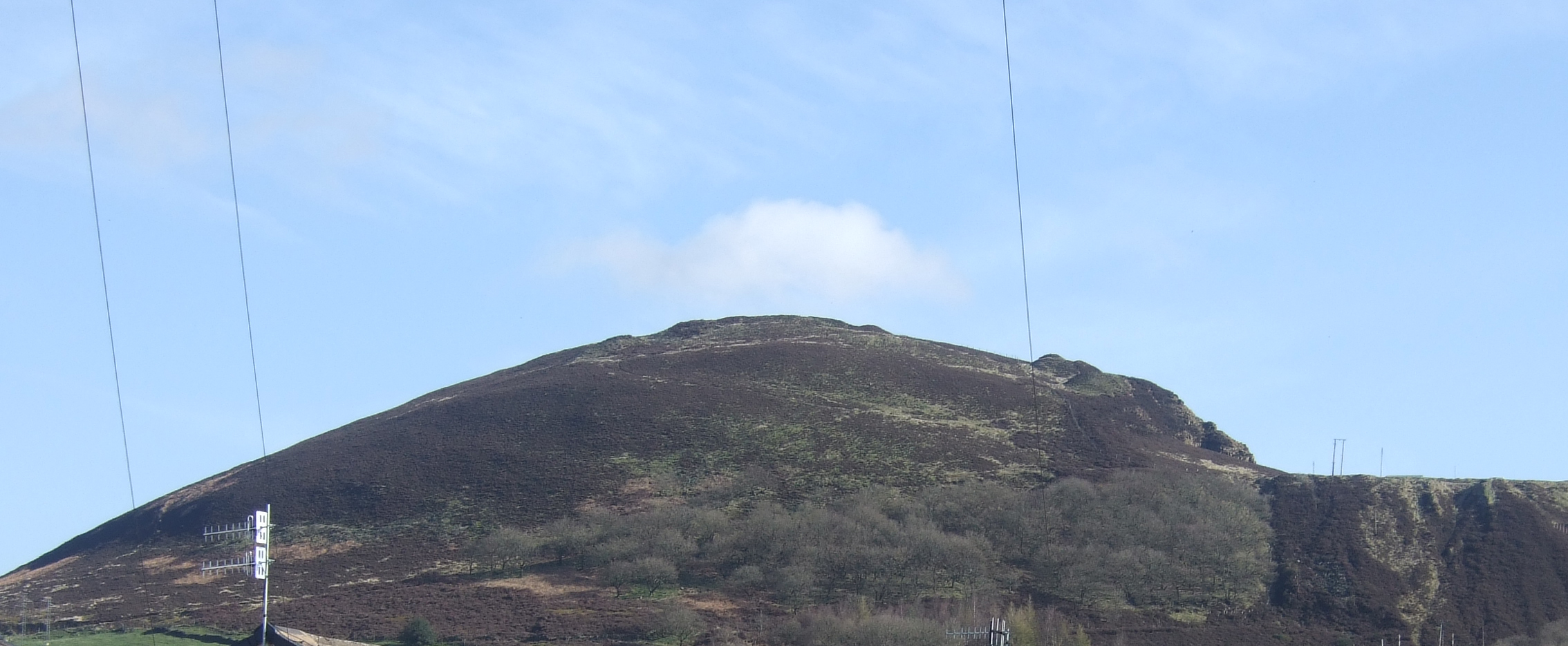
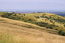 Werneth Low with the Greater Manchester Urban Area in the background.
Tameside is bordered by the metropolitan boroughs of Stockport and Oldham to the south and north respectively, the city of Manchester to the west and the borough of High Peak in Derbyshire to the east. Tameside features flat lowlands in the west and highlands in the east where the western edge of the Pennines encroaches on the borough.[25] The hills in the east include Hartshead Pike and Werneth Low which is also a country park. As well as coal measures running north-south through the centre of the borough, there are areas of peat in the north east and there are large areas of boulder clay all over Tameside.[26] Ashton Moss is a peat bog covering about 107 hectares (260 acres) and Denton Moor is an area of about 81 hectares (200 acres) of peat.[27]
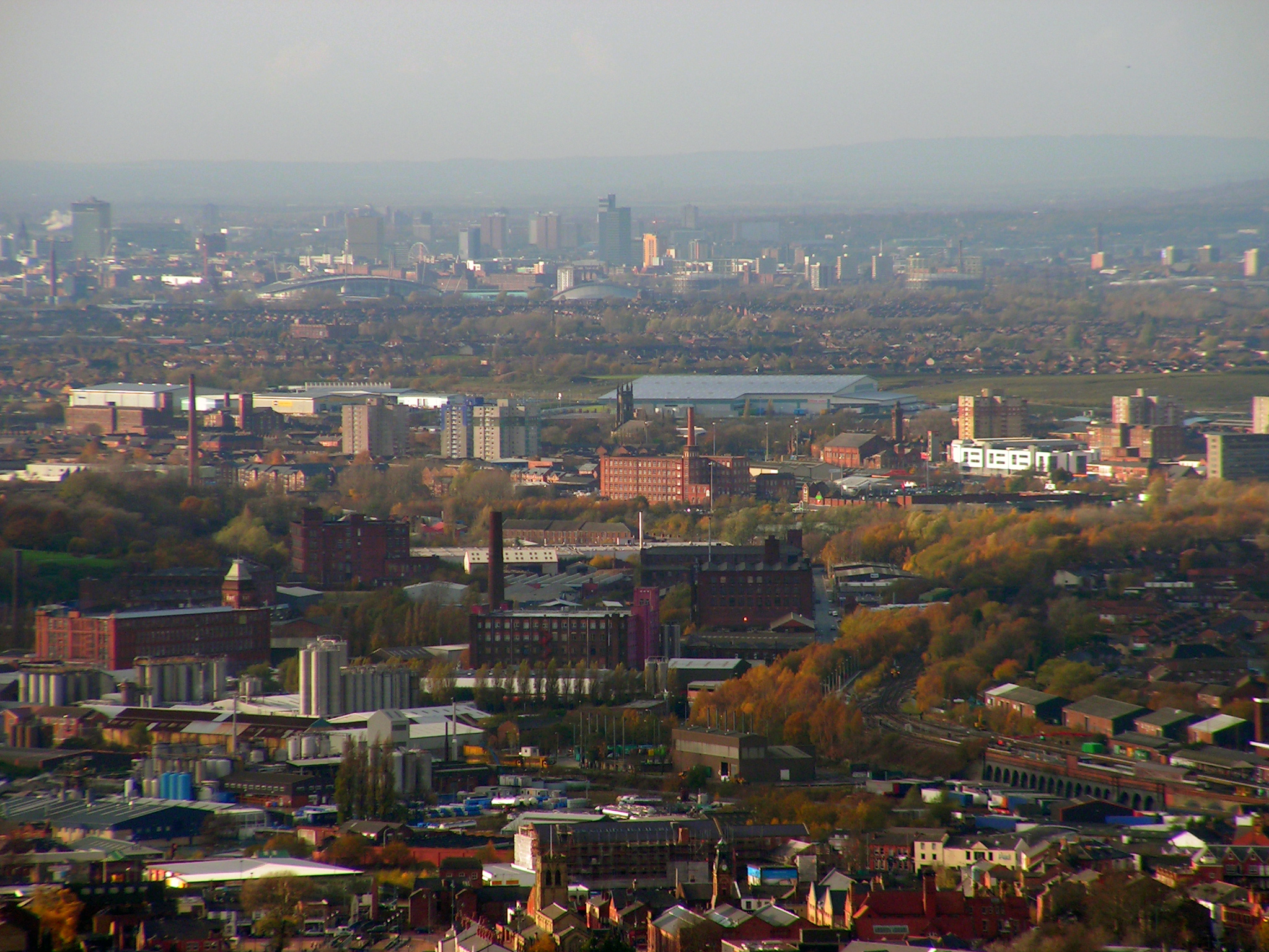
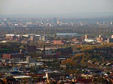 A view over Tameside, towards Manchester city centre.
Waterways in Tameside include the rivers Medlock and Etherow, which form parts of Tameside's western and eastern boundaries respectively, and the River Tame crosses the borough north to south, giving Tameside its name.[27] The Ashton Canal, the Hollinwood Branch Canal, the Huddersfield Narrow Canal, and the Peak Forest Canal all run through the borough. There are also several reservoirs, including the Audenshaw Reservoirs. Greenspace accounts for 63.5% of the Tameside's total area, domestic buildings and gardens comprise 17.4%, and the rest is made up of roads and non-domestic buildings.[28]
Localities within the boundaries of Tameside include: Ashton-under-Lyne, Audenshaw, Broadbottom, Carrbrook, Copley, Denton, Droylsden, Dukinfield, Flowery Field, Gee Cross, Godley, Godley Green, Guide Bridge, Hartshead Green, Hattersley, Haughton Green, Hazelhurst, Heyrod, Hollingworth, Hyde, Landslow Green, Luzley, Millbrook, Mossley, Mottram in Longdendale, Newton, Park Bridge, Roe Cross, Stalybridge, Warhill, and Woolley Bridge.
Governance
Parliamentary constituencies
The residents of the Tameside are represented in the United Kingdom Parliament by Members of Parliament (MPs) for three separate parliamentary constituencies. Ashton-under-Lyne, which also includes parts of the Metropolitan Borough of Oldham, is represented by Mr. David Heyes MP (Labour).[29] Denton and Reddish, which also covers parts of the Metropolitan Borough of Stockport, is represented by Mr. Andrew Gwynne MP (Labour).[30] Stalybridge and Hyde, which is entirely within Tameside, is represented by Mr. Jonathan Reynolds MP (Labour).[31] Tameside is part of the North West England constituency in the European Parliament. North West England elects eight MEPs, as at 2009 made up of three Conservatives, two from the Labour Party, one member of the United Kingdom Independence Party, one Liberal Democrat, and one member of the BNP.[32]
Council
As of the 2008 local elections, Tameside Council is controlled by Labour with the majority of 44 seats, second is the Conservative party with 10 seats, third is taken by 3 independents in Mossley. The Leader of the Council is Councillor Kieran Quinn.
Tameside Borough Council was assessed by the Audit Commission and judged to be "improving strongly" in providing services for local people. Overall the council was awarded "four star" status meaning it was "performing strongly" and "well above minimum requirements", putting it in the top 38% of all local authorities.[33]
Civil parishes form the bottom tier of local government; the parish councils are involved in planning, management of town and parish centres, and promoting tourism.[34] Mossley is the only civil parish in Tameside, in 2001 9,856 people lived there, 4.6% of the borough's population.[35] Prior to becoming a civil parish, it was a Municipal Borough. The unparished areas are: Ashton-under-Lyne (Municipal Borough), Audenshaw (Urban District), Denton (Urban District), Droylsden (Urban District), Dukinfield (Municipal Borough), Hyde (Municipal Borough), Longdendale (Urban District), and Stalybridge (Municipal Borough). The status of each area prior to 1974 is shown in brackets. An urban district was a type of local government district which covered an urbanised area. Ashton-under-Lyne, Audenshaw, Denton, Droylsden, and Mossley were previously in Lancashire and Dukinfield, Hyde, Longdendale, and Stalybridge were in Cheshire.
Party political make-up of Tameside Council Party Seats Current Council (2010–11) 2007[36] 2008[37] 2010[37] Labour 45 44 46 Conservative 8 10 9 Independent 3 3 2 Lib Dems 1 0 0 Demography
Tameside Compared 2001 UK Census Tameside Greater Manchester England Total population 213,043 2,514,757 49,138,831 White 94.6% 91.2% 90.9% Asian 4.0% 5.6% 4.6% Black 0.3% 1.2% 2.3% As of the 2001 UK census, the Metropolitan Borough of Tameside had a total population of 213,043.[38] Of the 89,981 households in Tameside, 35.7% were married couples living together, 31.0% were one-person households, 7.8% were co-habiting couples and 9.3% were lone parents, following a similar trend to the rest of England.[39]
The population density was 2,065 /km2 (5,350 /sq mi)[40] and for every 100 females, there were 94.2 males. Of those aged 16–74 in Tameside, 35.2% had no academic qualifications, significantly higher than 28.9% in all of England.[38] 4.8% of Tameside's residents were born outside the United Kingdom, significantly lower than the national average of 9.2%.[41] The largest minority group was Asian, at 4.0% of the population.[42]
In 1841, 8.5% of Tameside's population was middle class compared to 14% in England and Wales; this increased to 13.1% in 1931 (15% nationally) and 37.0% in 2001 (48% nationally). From 1841 to 1991, the working class population of Tameside and across the country was in decline, falling steadily from 58.0% (36% nationally) to 22.8% in 1991 (21% nationally). It has since increased slightly, up to 32.9% (26% nation-wide). The rest of the population was made up of clerical workers and skilled manual workers.[43]
Population change
Although Tameside has only existed as a Metropolitan Borough since 1974, the table below details the population change – including the percentage change since the last census 10 years earlier – in the area since 1801 using figures from the towns, villages, and civil parishes that would later become constituent parts of Tameside.
Population growth in Tameside since 1801 Year 1801 1811 1821 1831 1841 1851 1861 1871 1881 1891 1901 1911 1921 1931 1941 1951 1961 1971 1981 1991 2001 Population 20,716 27,219 45,440 64,044 103,928 120,183 129,346 138,509 147,672 158,343 175,877 195,353 192,764 190,210 198,492 207,137 213,973 221,067 217,050 219,769 213,043 % change – +31.4 +66.8 +40.9 +62.3 +15.6 +7.6 +7.1 +6.6 +7.2 +11.1 +11.1 -1.3 -1.3 +4.4 +4.4 +3.3 +3.3 -1.8 +1.3 -3.1 Source: A Vision of Britain through Time Religion
Religion in Tameside 2001 UK Census[38] Tameside North West England England Population 213,043 6,729,764 49,138,831 Christian 75.5% 78.0% 71.7% Muslim 2.5% 3.0% 3.1% Hindu 1.4% 0.4% 1.1% No religion 12.1% 10.5% 14.6% See also: List of churches in Greater ManchesterAs of the 2001 UK census, 75.5% of Tameside's residents reported themselves as being Christian, 2.5% Muslim, 1.4% Hindu, and 0.1% Buddhist. 12.1% had no religion, 0.2% had an alternative religion and 8.1% did not state their religion.[38] Tameside is covered by the Catholic Dioceses of Shrewsbury and Salford,[44][45] and the Church of England Diocese of Manchester.[46]
There are two Grade I listed churches in Tameside, St Anne's Church, in Haughton, was built in 1881 in the Gothic Revival style by J Medland Taylor.[47] St Michael and All Angels' Church in Ashton-under-Lyne is a 15th century parish church which was virtually rebuilt in the 19th century. A church on the site dates back to at least 1262.[48][49] St Lawrence's Church, in Denton, is a Grade II* listed building and a timber framed church. It was remodelled by J Medland Taylor in 1872.[50]
Economy
 IKEA's store in Ashton-under-Lyne, which opened in 2006, was their first in a town centre.
The Ashton Arcades shopping centre opened in 1995. The centre covers 13,000 square metres (140,000 sq ft) on two floors with over 40 shops. In 2006, after failing twice to gain permission to develop a site in the neighbouring borough of Stockport, IKEA announced plans to build its first town centre-store in Ashton-under-Lyne. The store is expected to create 500 new jobs as well as attract other businesses to the area.[51] The store opened on 19 October 2006 and covers 27,500 square metres (296,000 sq ft) At the time of its creation, the store was the tallest in Britain.[52] Life science industries have been identified as growth industries in Greater Manchester and are concentrated in Oldham and Tameside.[53] Average house prices in Tameside are the 7th highest out of the ten metropolitan boroughs in Greater Manchester, 11.9% below the average for the county.[54]
Tameside Compared 2001 UK Census[55] Tameside North West England England Population of working age 152,313 4,839,669 35,532,091 Full time employment 43.5% 38.8% 40.8% Part time employment 11.5% 11.9% 11.8% Self employed 6.5% 7.1% 8.3% Unemployed 3.3% 3.6% 3.3% Retired 13.3% 14.3% 13.5% As of the 2001 UK census, Tameside had 152,313 residents aged 16 to 74. 2.0% of these people were students with jobs, 5.7% looking after home or family, 7.9% permanently sick or disabled and 3.2% economically inactive for other reasons.[55]
In 2001, of 96,255 residents of Tameside in employment, the industry of employment was 21.7% manufacturing, 10.4% health and social work, 18.2% retail and wholesale, 10.2% property and business services, 7.2% construction, 6.8% transport and communications, 6.4% education, 5.3% public administration and defence, 4.2% finance, 4.0% hotels and restaurants, 0.9% energy and water supply, 0.5% agriculture, and 4.0% other. This was roughly in line with national figures, except for the proportion of jobs in agriculture which is less than half the national average, and property which was also below the national average. Manufacturing was 50% more than the national average.[56]
Landmarks
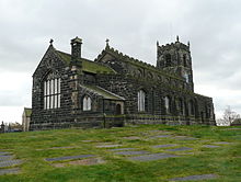 The Church of St Michael and All Angels, Mottram in Longdendale, is one of Tameside's Grade II* listed buildings.
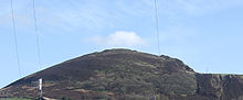 View of Buckton Castle from below
In February 2001, Tameside had one Grade I listed buildings, 19 Grade II*, and 289 Grade II.[57] The number of Grade I listed buildings in Tameside has increased to three, these are St Anne's Church in Haughton;[58] St Michael and All Angels' Church in Ashton-under-Lyne;[48] and Fairbottom Farm Barn, a 17th century farm building.[59] In Tameside are three of Greater Manchester's Sites of Special Scientific Interest, Boar Flat, part of Dark Peak,[60] the Hollinwood Branch Canal[61] and the Huddersfield Narrow Canal. The Huddersfield Narrow Canal runs for 20 miles (32 km) from Huddersfield to Ashton-under-Lyne; it is protected for its biological interest, and is "the best example of a flowing eutrophic water system in Greater Manchester".[62]
There are three Scheduled Ancient Monuments in the borough, a Bronze Age cairn in Stalybridge,[63] Buckton Castle, and Nico Ditch. Buckton Castle is a 12th century ringwork near Carrbrook. It was probably built for William de Neville and was the centre of lordship of Longdendale.[64] The castle lay ruinous by 1360, and has been described as "one of England's most important castles".[65] Nico Ditch is an earthwork running from Ashton-under-Lyne in the east to Stretford in the west, in the borough of Trafford. It survives to a depth of 1.5 metres (4.9 ft) in some places and is up to 4 metres (13 ft) wide.[13] Tameside also has nine conservation areas: Ashton and Stalybridge town centres; Carrbrook, Copley St.Paul's, and Millbrook in Stalybridge; Fairfield in Droylsden; Mottram-in-Longdendale; Portland Basin; and St.Anne's in Haughton.[66]
The Museum of the Manchester Regiment is housed in Ashton-under-Lyne's town hall. The museum displays relics related to the Manchester Regiment including five Victoria Crosses awarded to members of the regiment.[67] Park Bridge Heritage Centre in the Medlock Valley is a museum dedicated to the history of the settlement of Park Bridge and its industry.[68] Broad Mills Heritage Site, in Broadbottom, preserves the remains of an early 19th century textile works.[69] Art galleries in the borough include Astley Cheetham Art Gallery in Stalybridge and Central Art Gallery in Ashton-under-Lyne.[70][71]
Tameside has eight designated Local Nature Reserves which are Knott Hill, Hollinwood Branch Canal, Great Wood, Haughton Dale, Hulmes and Hardy Woods, Castle Clough and Cowbury Dale, Hurst Clough and Rocher Vale. Four more are to be designated. [72]
Education
Tameside council announced in 2007 a £180M plan to refurbish the borough's schools. The plan involves closing six schools and building six new ones. Overall the number of places available in schools will decrease as the number of school children is expected to decline.[73] In 2007 Tameside was ranked 61st out of the all the local education authorities in SATs performance – and 5th in Greater Manchester.[74] Authorised absences from and unauthorised absences from Tameside secondary schools in 2006–07 were 6.0% and 0.4%, lower than the national average (7.8% and 1.4%).[75] In 2007, the Tameside LEA was ranked 100th out of 148 in the country – and 6th in Greater Manchester – based on the percentage of pupils attaining at least 5 A*-C grades at GCSE including maths and English (41.8% compared with the national average of 46.7%).[76] In 2007, Audenshaw School was the most successful school in Tameside at both GCSE and A–level; 64% of the pupils gaining five or more GCSEs at A*-C grade including maths and English.[77] The secondary schools in Tameside are Alder Community High School, All Saints Catholic College, Astley Sports College, Audenshaw School, Copley High School, Denton Community College, Droylsden Academy, Fairfield High School for Girls, Hyde Technology School, Longdendale Community Language College, Mossley Hollins High School, New Charter Academy, St Damian's RC Science College, St Thomas More RC High School and West Hill School
See also: List of schools in TamesideTransport
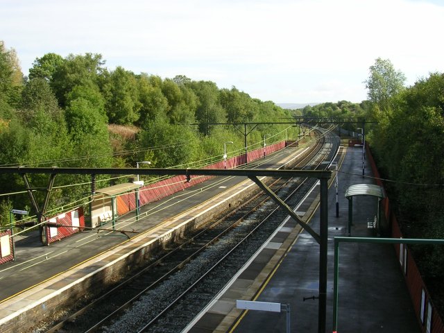
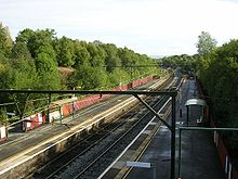 Fairfield railway station
Tameside is served by 13 train stations. Denton railway station is on the Stockport to Stalybridge Line. Fairfield railway station, Guide Bridge railway station, Hyde Central railway station, and Hyde North railway station are all on the Hope Valley Line between Sheffield and Manchester. Broadbottom railway station, Flowery Field railway station, Godley railway station, Guide Bridge railway station, Hattersley railway station, and Newton for Hyde railway station are served by the Glossop Line between Glossop and Manchester. Ashton-under-Lyne railway station, Mossley railway station, and Stalybridge railway station are on the Huddersfield Line.
Work on an extension of the Manchester Metrolink costing £260M is expected to begin in 2008. The original plan was to extend the metrolink to Ashton-under-Lyne, but due to reduced funding from the government, the plans were scaled back and it was planned that the extension would go only as far as Droylsden.[78] However, work has started to bring the Metrolink to Ashton centre; currently work has extended to Lord Sheldon Way.
Tameside council is responsible for maintaining the public rights of way in the borough, including 145 mi (233 km) of footpaths.[79] In 2003, the government passed a scheme to create a bypass between the M67 and the A628. The Longdendale Bypass is expected to cost between £240M and £315M and although it received support from the communities effected by the bypass in the form of a petition with 9,000 signatures,[80][81] the scheme ran into opposition. A enquiry was launched in 2007, costing £15M,[82] however the fate of the bypass remains undecided.[83]
Twin towns
The Metropolitan Borough of Tameside has formal twinning links with places in China, France, Germany and Zimbabwe.[84] The arrangement with Mutare in Zimbabwe has been suspended due to the political unrest in that country.[85] Some localities were originally twinned with a place within the Metropolitan Borough prior to its creation in 1974.[86][87][88][89][90][91]
Country Place County / District / Region / State Originally twinned with Date 
China Bengbu Anhui Metropolitan Borough of Tameside 1995 
France 
Colmar 
Alsace Municipal Borough of Hyde 1963 France Champagnole 
Franche-Comté Municipal Borough of Dukinfield 1958 France 
Chaumont 
Champagne-Ardenne Municipal Borough of Ashton-under-Lyne 1956 France 
Montigny-le-Bretonneux 
Île-de-France Denton Town Twinning Association 1991 France 
Villemomble Île-de-France Droylsden Town Twinning Association 1983 France 
Armentières Nord-Pas de Calais Municipal Borough of Stalybridge 1955 France 
Hem Nord-Pas de Calais Municipal Borough of Mossley 1972 
Germany 
Ruppichteroth 
Nordrhein-Westfalen Longdendale Urban District 1974 
Zimbabwe Mutare Manicaland Metropolitan Borough of Tameside 1989 See also
References
- ^ "Tameside Metropolitan Borough resident population estimates by ethnic group (percentages) 2005 estimate". Statistics.gov.uk. http://www.neighbourhood.statistics.gov.uk/dissemination/LeadTableView.do?a=3&b=276783&c=tameside&d=13&e=13&g=355472&i=1001x1003x1004&m=0&r=1&s=1206306522902&enc=1&dsFamilyId=1812. Retrieved 2008-05-05.
- ^ Anon (2007-08-21). "Population estimates 2006 by district". Statistics.gov.uk. http://www.statistics.gov.uk/statbase/ssdataset.asp?vlnk=9666&More=Y. Retrieved 2007-12-21.
- ^ Nevell (1992), pp. 21, 25.
- ^ Nevell (1992), pp. 29–31.
- ^ Nevell (1992), pp. 40–41.
- ^ Nevell (1992), p. 34.
- ^ Nevell (1992), p. 51.
- ^ Nevell (1992), p. 55.
- ^ Nevell (1992), p. 56–59.
- ^ Nevell (1992), p. 60.
- ^ Nevell (1992), p. 75.
- ^ Nevell (1992), p. 76.
- ^ a b Nevell (1992), pp. 77–83.
- ^ Nevell (1992), p. 85.
- ^ Nevell (1991), pp. 7–9.
- ^ Nevell (1991), pp. 46–47.
- ^ Nevell (1993), p. 13.
- ^ a b McNiel and Nevell (2005), p. 54.
- ^ Nevell (1993), p. 170.
- ^ a b c d Frangopulo 1977, p. 168.
- ^ HMSO. Local Government Act 1972. 1972 c.70
- ^ a b c d e f Clark 1973, p. 102.
- ^ "Boundary shake-up means 'all out' vote". Manchester Evening News. 29 August 2002. http://www.tamesideadvertiser.co.uk/news/s/382238_boundary_shakeup_means_all_out_vote. Retrieved on 4 September 2008.
- ^ Tameside Metropolitan Borough Council (16 January 2007). "The Tameside Citizen: Orders to tackle crime and disorder". Tameside.gov.uk. http://www.tameside.gov.uk/thecitizen/issue39/page3. Retrieved on 4 September 2008.
- ^ Nevell (1992), p. 8.
- ^ Nevell (1992), p. 10.
- ^ a b Nevell (1992), p. 11.
- ^ "Tameside physical environment". Statistics.gov.uk. http://neighbourhood.statistics.gov.uk/dissemination/LeadKeyFigures.do?a=3&b=276783&c=Tameside&d=13&e=8&g=355472&i=1001x1003x1004&o=1&m=0&r=1&s=1211747935609&enc=1. Retrieved 2008-05-25.
- ^ "Ashton-under-Lyne constituency election results". London: Guardian.co.uk. http://politics.guardian.co.uk/hoc/constituency/0,,-680,00.html. Retrieved 2007-12-26.
- ^ "Denton and Reddish constituency election results". London: Guardian.co.uk. http://politics.guardian.co.uk/hoc/constituency/0,,-869,00.html. Retrieved 2007-12-26.
- ^ "Stalybridge constituency election results". London: Guardian.co.uk. http://politics.guardian.co.uk/hoc/constituency/0,,-1330,00.html. Retrieved 2007-12-26.
- ^ "European Election 2009 Results". news.bbc.co.uk. 2009-04-19. http://news.bbc.co.uk/1/shared/bsp/hi/elections/euro/09/html/ukregion_34.stm. Retrieved 2009-11-11.
- ^ "Tameside Metropolitan Borough Council comprehensive performance assessment (CPA) scorecard 2007". Audit Commission. 2007. http://cpa.audit-commission.gov.uk/STCCScorecard.aspx?TaxID=108243. Retrieved on 8 September 2008.
- ^ National Association of Local Councils. "What is a town, parish or community council?". nalc.gov.uk. http://www.nalc.gov.uk/About_NALC/What_is_a_parish_or_town_council/What_is_a_council.aspx. Retrieved 2008-01-26.
- ^ "Mossley civil parish census data". Statistics.gov.uk. http://neighbourhood.statistics.gov.uk/dissemination/LeadTableView.do?a=3&b=790588&c=Mossley&d=16&e=15&g=355915&i=1001x1003x1004&o=1&m=0&r=1&s=1203604074412&enc=1&dsFamilyId=781. Retrieved 2008-02-21.
- ^ "Tameside local elections 2007". BBC Online. 2007-05-04. http://news.bbc.co.uk/1/shared/vote2007/councils/html/bt.stm. Retrieved 2008-03-08.
- ^ a b "Tameside local elections 2008". BBC Online. 2008-05-02. http://news.bbc.co.uk/1/shared/bsp/hi/elections/local_council/08/html/bt.stm. Retrieved 2008-05-05.
- ^ a b c d "Tameside Metropolitan Borough key statistics". Statistics.gov.uk. http://neighbourhood.statistics.gov.uk/dissemination/LeadKeyFigures.do?a=3&b=276783&c=Tameside&d=13&e=16&g=355472&i=1001x1003x1004&o=1&m=0&r=1&s=1198202002570&enc=1. Retrieved 2007-12-21.
- ^ "Tameside Metropolitan Borough household data". Statistics.gov.uk. http://neighbourhood.statistics.gov.uk/dissemination/LeadTableView.do?a=3&b=276783&c=Tameside&d=13&e=16&g=355472&i=1001x1003x1004&o=1&m=0&r=1&s=1198202583539&enc=1&dsFamilyId=165. Retrieved 2007-12-21.
- ^ "Tameside Metropolitan Borough population density". Statistics.gov.uk. http://neighbourhood.statistics.gov.uk/dissemination/LeadTableView.do?a=3&b=276783&c=Tameside&d=13&e=16&g=355472&i=1001x1003x1004&o=1&m=0&r=1&s=1198202583570&enc=1&dsFamilyId=789. Retrieved 2007-12-21.
- ^ "Tameside Metropolitan Borough country of birth data". Statistics.gov.uk. http://neighbourhood.statistics.gov.uk/dissemination/LeadTableView.do?a=3&b=276783&c=Tameside&d=13&e=16&g=355472&i=1001x1003x1004&o=1&m=0&r=1&s=1198202583523&enc=1&dsFamilyId=85. Retrieved 2007-12-21.
- ^ "Tameside Metropolitan Borough ethnic group data". Statistics.gov.uk. http://neighbourhood.statistics.gov.uk/dissemination/LeadTableView.do?a=3&b=276783&c=Tameside&d=13&e=16&g=355472&i=1001x1003x1004&o=1&m=0&r=1&s=1198202583523&enc=1&dsFamilyId=87. Retrieved 2007-12-21.
- ^ "Tameside social class". Vision of Britain. http://www.visionofbritain.org.uk/data_cube_table_page.jsp?data_theme=T_SOC&data_cube=N_RGSOC_G&u_id=10056871&c_id=10001043&add=Y. Retrieved on 6 September 2008.
·"England social class". Vision of Britain. http://www.visionofbritain.org.uk/data_cube_table_page.jsp?data_theme=T_SOC&data_cube=N_RGSOC_G&u_id=10061325&c_id=10001043&add=Y. Retrieved on 6 September 2008. - ^ "Parishes of the Catholic Diocese of Shrewsbury". Dioceseofshrewsbury.org. http://www.dioceseofshrewsbury.org. Retrieved 2008-01-17.
- ^ "Parishes of the Diocese". Salforddiocese.org.uk. Archived from the original on January 11, 2008. http://web.archive.org/web/20080111021859/http://www.salforddiocese.org.uk/parishes/masstimes.html. Retrieved 2008-01-17.
- ^ "The Church of England Diocese of Manchester". Manchester.anglican.org. http://www.manchester.anglican.org/default.asp. Retrieved 2008-01-17.
- ^ "Church of St Anne". Images of England. http://www.imagesofengland.org.uk/Details/Default.aspx?id=212705. Retrieved 2007-12-22.
- ^ a b "Church of St Michael and All Angels". Images of England. http://www.imagesofengland.org.uk/Details/Default.aspx?id=212681. Retrieved 2007-12-22.
- ^ Nevell (1991), p. 121, 135.
- ^ Nevell (1991), p. 123–124.
- ^ "Ikea's superstore plans approved". BBC Online. 11 January 2006. http://news.bbc.co.uk/1/hi/england/manchester/4604024.stm. Retrieved on 3 September 2008.
- ^ Emma Unsworth (16 October 2006). "IKEA's finally here". Manchester Evening News. http://www.manchestereveningnews.co.uk/lifestyle/health_and_beauty/style/s/225/225588_ikeas_finally_here.html. Retrieved on 3 September 2008.
- ^ "Promoting a Dynamic Economy". Greater Manchester e-Government Partnership. http://www.gmep.org.uk/ccm/content/agma/promoting-a-dynamic-economy.en;jsessionid=64C7688F205BEE012F17A5E3001818D5. Retrieved on 4 September 2008.
- ^ "House prices for Greater Manchester Local Authorities". BBC News Online. 2010-03-16. http://news.bbc.co.uk/1/shared/spl/hi/in_depth/uk_house_prices/counties/html/county38.stm. Retrieved 2010-04-01. Retrieved on 4 September 2008.
- ^ a b "Tameside Local Authority economic activity". Statistics.gov.uk. http://neighbourhood.statistics.gov.uk/dissemination/LeadTableView.do?a=7&b=276783&c=Tameside&d=13&e=16&g=355472&i=1001x1003x1004&o=1&m=0&r=1&s=1220287706082&enc=1&dsFamilyId=107. Retrieved on 1 September 2008.
- ^ "Tameside Local Authority industry of employment". Statistics.gov.uk. http://neighbourhood.statistics.gov.uk/dissemination/LeadTableView.do?a=7&b=276783&c=Tameside&d=13&e=16&g=355472&i=1001x1003x1004&o=1&m=0&r=1&s=1220287706082&enc=1&dsFamilyId=119. Retrieved on 1 September 2008.
- ^ "Images of England Statistics by County". 2001. http://www.imagesofengland.org.uk/StatisticsPage/default.aspx?StatsCounty=GREATER%20MANCHESTER. Retrieved 2007-12-22.
- ^ "Church of St Anne". Tameside Metropolitan Borough Council. http://public.tameside.gov.uk/forms/listedbuildings.asp?propno=0570600202000&district=&address=. Retrieved 2007-12-22.
- ^ "Fairbottom Farm Barn". Tameside Metropolitan Borough Council. http://public.tameside.gov.uk/forms/listedbuildings.asp?propno=0014800013001&district=&address=. Retrieved 2007-12-22.
- ^ "Dark Peak" (PDF). EnglishNature.org. http://www.english-nature.org.uk/citation/citation_photo/1003028.pdf. Retrieved 2008-01-27.
- ^ "Hollinwood Branch Canal" (PDF). EnglishNature.org. http://www.english-nature.org.uk/citation/citation_photo/1002786.pdf. Retrieved 2008-01-26.
- ^ "Huddersfield Narrow Canal" (PDF). EnglishNature.org. http://www.english-nature.org.uk/citation/citation_photo/1002803.pdf. Retrieved 2008-01-26.
- ^ "Monument no. 78454". Pastscape.org.uk. http://www.pastscape.org.uk/hob.aspx?hob_id=78454. Retrieved 2008-01-27.
- ^ Nevell and Walker (1999), p. 95.
- ^ "The lost castle of Stalybridge". BBC Online. 30 July 2008. http://www.bbc.co.uk/manchester/content/articles/2008/07/23/230708_buckton_castle_feature.shtml. Retrieved on 9 September 2008.
- ^ Tameside Metropolitan Borough Council (November 1992). "Appendix 6: Conservation Areas and Scheduled Ancient Monuments (Policies C11 and C30)". Tameside.gov.uk. http://www.tameside.gov.uk/udp/udp1996/appendix6. Retrieved on 4 September 2008.
- ^ "Museum of the Manchester Regiment". 24hourmuseum.org.uk. http://www.culture24.org.uk/am10929. Retrieved on 4 September 2008.
- ^ Tameside Metropolitan Borough Council (13 September 2007). "Park Bridge". Tameside.gov.uk. http://www.tameside.gov.uk/parkbridge. Retrieved on 4 September 2008.
- ^ "Broad Mills Heritage Site: site introduction". BroadbottomVillage.com. http://www.broadbottomvillage.com/broad%20mills.htm. Retrieved on 4 September 2008.
- ^ Tameside Metropolitan Borough Council (15 October 2007). "Astley Cheetham Art Gallery". Tameside.gov.uk. http://www.tameside.gov.uk/museumsgalleries/astleycheetham. Retrieved on 4 September 2008.
- ^ Tameside Metropolitan Borough Council (16 August 2007). "Central Art Gallery". Tameside.gov.uk. http://www.tameside.gov.uk/centralartgallery. Retrieved on 4 September 2008.
- ^ "Local Nature Reserves - Nature On Your Doorstep". Tameside Council. http://www.tameside.gov.uk/countryside/naturereserves. Retrieved 27 January 2011.
- ^ Tameside Metropolitan Borough Council (16 January 2007). "The Tameside Citizen: Our children's future". Tameside.gov.uk. http://www.tameside.gov.uk/thecitizen/issue39/page2. Retrieved on 4 September 2008.
- ^ "LEA SATs performance 2007". BBC Online. 2007-12-06. http://news.bbc.co.uk/1/hi/education/7130024.stm. Retrieved 2008-01-17.
- ^ "Tameside schools". BBC Online. 2008-01-10. http://news.bbc.co.uk/1/shared/bsp/hi/education/07/school_tables/secondary_schools/html/357_5400.stm. Retrieved 2008-01-17.
- ^ "How different LEAs performed 2007". BBC Online. 2008-01-10. http://news.bbc.co.uk/1/hi/education/7180228.stm. Retrieved 2008-01-17.
- ^ "Education results in Tameside 2007". BBC Online. 2008-01-10. http://news.bbc.co.uk/1/shared/bsp/hi/education/07/school_tables/secondary_schools/html/357_gcse_lea.stm. Retrieved 2008-01-17.
- ^ "Metrolink wins a 'Little Bang'". Manchester Evening News. 6 July 2006. http://www.manchestereveningnews.co.uk/news/s/217/217405_metrolink_wins_a_little_bang.html. Retrieved on 5 September 2008.
- ^ Tameside Metropolitan Borough Council (16 January 2007). "Rights of way". Tameside.gov.uk. http://www.tameside.gov.uk/rightsofway. Retrieved on 5 September 2008.
- ^ "Highways Agency Major Roads Programme:Updated Scheme Cost Estimates" (PDF). Highways Agency. 16 July. http://child.of.lewin.googlepages.com/costestimates.pdf. Retrieved on 2 November 2008.
- ^ Alan Salter (1 April 2003). "Mottram bypass to go ahead". Manchester Evening News. http://www.manchestereveningnews.co.uk/news/s/55/55236_mottram_bypass_to_go_ahead.html. Retrieved on 6 September 2008.
- ^ "Tintwistle Hollingworth and Mottram Bypass". Parliament.uk. 6 May 2008. http://www.publications.parliament.uk/pa/cm200708/cmhansrd/cm080506/text/80506w0006.htm. Retrieved on 6 September 2008.
- ^ Alan Salter (18 June 2003). "Bypass plans still on track for autumn". Tameside Advertiser. http://www.tamesideadvertiser.co.uk/news/s/1054548_bypass_plans_still_on_track_for_autumn. Retrieved on 8 September 2008.
- ^ Tameside Metropolitan Borough Council (27 September 2006). "Town twinning". Tameside.gov.uk. http://www.tameside.gov.uk/towntwinning. Retrieved on 4 September 2008
- ^ Tameside Metropolitan Borough Council : Report to Executive Cabinet : 3 September 2008 : Kiagware Project Retrieved 8 January 2010
- ^ "British Towns Twinned with French Towns". France Magazine (Archant Life). http://www.francemag.com/Editorial.aspx?page=3073. Retrieved 13 September 2008.
- ^ Gemeinde Ruppichteroth : Städtepartnerschaft mit Longdendale Retrieved 8 January 2010
- ^ Ville de Champagnole : Jumelage Retrieved 8 January 2010
- ^ Ville de Villemomble : Les Villes Européennes Jumelées avec Villmomble Retrieved 8 January 2010
- ^ Tameside Metropolitan Borough Council : Tameside's Link with Bengbu Retrieved 8 January 2010
- ^ Tameside Advertiser : Cut Ties with African Town : 28 August 2002 Retrieved 8 January 2010
Bibliography
- Clark, David M. (1973). Greater Manchester Votes: A Guide to the New Metropolitan Authorities. Redrose
- Frangopulo, Nicholas Joseph (1977). Tradition in action: the historical evolution of the Greater Manchester County. Wakefield: EP Publishing. ISBN 0-7158-1203-3.
- McNeil, R. & Nevell, M (2000). A Guide to the Industrial Archaeology of Greater Manchester. Association for Industrial Archaeology. ISBN 0-9528930-3-7
- Nevell, Mike (1991). Tameside 1066–1700. Tameside Metropolitan Borough and Greater Manchester Archaeological Unit. ISBN 1-871324-02-5
- Nevell, Mike (1992). Tameside Before 1066. Tameside Metropolitan Borough and Greater Manchester Archaeological Unit. ISBN 1-871324-07-6
- Nevell, Mike (1993). Tameside 1700–1930. Tameside Metropolitan Borough and Greater Manchester Archaeological Unit. ISBN 1-871324-08-4
- Nevell, Mike and Walker, John (1999). Tameside in Transition. Tameside Metropolitan Borough with University of Manchester Archaeological Unit. ISBN 1-871324-24-6.
External links
- Tameside Council
- TamesideWeb The Online Interactive Community for Tameside
- TamesideConnect Connecting People To Tameside
Video clips
 Districts of North West England
Cheshire 
Cumbria Allerdale • Barrow-in-Furness • Carlisle • Copeland • Eden • South Lakeland
Greater Manchester Lancashire Blackburn with Darwen • Blackpool • Burnley • Chorley • Fylde • Hyndburn • Lancaster • Pendle • Preston • Ribble Valley • Rossendale • South Ribble • West Lancashire • Wyre
Merseyside Metropolitan counties and metropolitan districts Greater Manchester 
Merseyside South Yorkshire Tyne and Wear West Midlands West Yorkshire Categories:- Districts of England established in 1974
- Metropolitan boroughs
- Tameside
- Local government in Tameside
- Local government districts of North West England


Wikimedia Foundation. 2010.