- North Tyneside
-
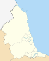
North Tyneside — Metropolitan borough — Metropolitan Borough of North Tyneside Wallsend Town Hall, the seat of North Tyneside Council 
Coat of Arms of the Borough CouncilMotto: We Serve North Tyneside within Tyne and Wear and England
Coordinates: 55°00′44″N 1°32′44″W / 55.0123°N 1.5456°W Country United Kingdom Constituency England County Tyne and Wear Established 1 April 1974 Admin HQ Wallsend Government – Type Mayor and Cabinet – MPs Nick Brown
Mary Glindon
Alan CampbellArea – Land 31.8 sq mi (82.38 km2) Population (2001) – Total 191,659 – Estimate (2007) 196,000 – Density 6,025.6/sq mi (2,326.5/km2) Time zone Greenwich Mean Time (UTC+0) – Summer (DST) British Summer Time (UTC+1) Website www.northtyneside.gov.uk The Metropolitan Borough of North Tyneside is a metropolitan borough of Tyne and Wear, in North East England and is part of the Tyneside conurbation. Its seat is Wallsend Town Hall.
North Tyneside is bounded by Newcastle upon Tyne to the west, the North Sea to the east, the River Tyne to the south and Northumberland to the north. Within its bounds are the towns of Wallsend, North Shields and Whitley Bay, which form a continuously built-up area contiguous with Newcastle.
Contents
History
The borough was formed on 1 April 1974 by the merger of the county borough of Tynemouth, with the borough of Wallsend, part of the borough of Whitley Bay, the urban district of Longbenton and part of the urban district of Seaton Valley, all of which were in Northumberland.
Geography
The following places are located in North Tyneside:
- Annitsford
- Backworth
- Benton
- Burradon
- Camperdown
- Cullercoats
- Earsdon
- Forest Hall
- Holystone
- Killingworth
- Monkseaton
- Moorside
- Murton
- New York
- North Shields
- Northumberland Park
- Preston
- Seaton Burn
- Shiremoor
- Tynemouth
- Wallsend
- West Allotment
- Whitley Bay
Administration and elections
Unlike most English districts, its council is led by a directly-elected mayor, currently the conservative Linda Arkley. After the 2011 elections the council was Labour led, Labour having 35 councillors, the Conservatives 19 and the Lib Dems 6.
The council is elected "in thirds", with one councillor from each three-member ward elected each year for the first three years, the mayoral election being held on the fourth year. With three councillors elected from each of 20 wards, there are 60 councillors in total.
Past election results
2008 Results
A third of the councillors were elected as part of the English local elections of 2008.
Party No. of 2007 Councillors No. of 2008 Councillors % ±% Labour 23 21 35 -3.3 from 2007 Conservative 28 31 52 +5 from 2007 Liberal Democrats 9 8 13 -1.6 from 2007 2007 Results
A third of the councillors were elected as part of the English local elections of 2007.
Party No. of 2006 Councillors No. of 2007 Councillors % ±% Labour 23 23 38.3 0 from 2006 Conservative 28 28 46.6 0 from 2006 Liberal Democrats 8 9 15 +1.6 from 2006 Independent 1 0 0 - 1.6 from 2006 2006 Results
Party No. of 2004 Councillors No. of 2006 Councillors % ±% Labour 26 23 38.3 -5 from 2004 Conservative 27 28 46.6 +1.6 from 2004 Liberal Democrats 7 8 13.3 +1.6 from 2004 Independent 0 1 1.6 +1.6 from 2004 2005 Mayoral Results
Party Name of Candidate Votes % Labour John Lawrence Langford Harrison 40,460 42.52 Conservative Linda Arkley 39,458 41.47 Liberal Democrats Dr Joan Harvey 12,761 13.41 British National Front Robert Nigel Batten 2,470 2.6 2004 Results
Party No. of 2003 Councillors No. of 2004 Councillors % ±% Labour 29 26 43.3 -4.8 from 2003 Conservative 21 27 45 +9.6 from 2003 Liberal Democrats 8 7 11.6 -1.6 from 2003 Independent 2 0 0 -3.3 from 2003 2003 Mayoral and Election Results
Party Name of Candidate Votes % Conservative Linda Arkley 21,288 43.38 Labour Gordon Adam 16,427 33.47 Liberal Democrats Michael Huscroft 8,404 17.12 British National Front Robert Nigel Batten 2,554 5.20 Socialist Alliance Louise Van Der Hoeven 400 0.81 Party No. of 2002 Councillors No. of 2003 Councillors % ±% Labour 34 29 48.3 -8.3 from 2003 Conservative 19 21 35 +3.3 from 2002 Liberal Democrats 7 8 13.3 +1.6 from 2002 Independent 0 2 3.2 +3.3 from 2002 2002 Results
Party No. of 2001 Councillors No. of 2002 Councillors % ±% Labour 35 34 56.6 -1.6 from 2001 Conservative 17 19 31.6 +3.3 from 2001 Liberal Democrats 8 7 11.6 -1.6 from 2001 Economy
North Tyneside lies in the coalfield that covers the South-East of the historic county of Northumberland. It has traditionally been a centre of heavy industry along with the rest of Tyneside, with for example the Swan Hunter shipyard in Wallsend, and export of coal. Today most of the heavy industry has gone, leaving high unemployment in some areas (over the borough, 3.2% compared to 2.7% for the UK). The borough is the 69th most deprived in England, out of 354. However some parts function as wealthy dormitory suburbs of Newcastle, such as Tynemouth. Recent growth has come in the A19 corridor with new industrial estates and retail parks.
Transport
Two key roads serve North Tyneside:
- The A19 which leaves the A1 north of Newcastle and runs through the borough and then through the Tyne Tunnel to South Tyneside, Teesside and towards the South.
- The Coast Road (A1058) runs from Newcastle to the coast. For most of its length it is grade-separated.
North Tyneside is served by 17 stations on the Tyne & Wear Metro on a loop from Newcastle through Wallsend, North Shields, Whitley Bay, Benton and back to Newcastle. Trains operate at least every 15 minutes, with extra services in the peak hours. Most of the stations serving North Tyneside fall into fare zones B and C.
There are no National Rail stations in the borough, despite the East Coast Main Line and Blyth and Tyne routes passing through. The nearest National Rail station is Newcastle Central, which is also served by the Tyne and Wear Metro.
North Tyneside has an extensive bus network, with most areas benefiting from direct services to Newcastle. Many areas have direct bus services to Cramlington, Blyth or Morpeth. The principle bus operators in the area are Arriva (all areas), Go North-East (most areas) and Stageoach in Newcastle (Benton, Forest Hall, Killingworth and Wallsend).
The Shields Ferry links North Shields to South Shields, in South Tyneside.
There is an international ferry terminal at Royal Quays in North Shields, with services to Norway, Sweden and the Netherlands.
Places of interest
- Segedunum Roman fort is in Wallsend (at the end of Hadrian's wall).
- The Stephenson Railway Museum in New York, named after George Stephenson and Robert Stephenson who hailed from Tyneside and lived in West Moor in North Tyneside 1802–1824.
- Tynemouth Castle and Priory
- North Tyneside includes a vast coastline covering Tynemouth, Cullercoats and Whitley Bay
Twinned Towns
- Frederikshavn in Denmark
- Monchengladbach in Germany
- Oer-Erkenschwick in Germany
- Halluin in France
- Klaipėda in Lithuania
External links
Archives of North Tyneside (including boroughs of Tynemouth, Wallsend and Whitley Bay and Longbenton Urban District are preserved and accessible at Tyne and Wear Archives Service [1]
- North Tyneside Online Information regarding the areas in North Tyneside. Sport, news, Events and So are found here.
Metropolitan districts - City of Newcastle upon Tyne
- City of Sunderland
- Metropolitan Borough of Gateshead
- Metropolitan Borough of North Tyneside
- Metropolitan Borough of South Tyneside
Major settlements Topics - Museums
- Parliamentary constituencies
- People
- Places
- SSSIs
 Districts of North East England
County Durham 
Northumberland Tyne and Wear Gateshead • Newcastle upon Tyne • North Tyneside • South Tyneside • Sunderland
North Yorkshire Metropolitan counties and metropolitan districts Greater Manchester 
Merseyside South Yorkshire Tyne and Wear - Gateshead
- Newcastle upon Tyne
- North Tyneside
- South Tyneside
- Sunderland
West Midlands West Yorkshire Categories:- Local government in Tyne and Wear
- Metropolitan boroughs
- North Tyneside
- Local government districts of North East England
Wikimedia Foundation. 2010.

