- Dunston, Tyne and Wear
-
Coordinates: 54°57′07″N 1°38′20″W / 54.952°N 1.639°W
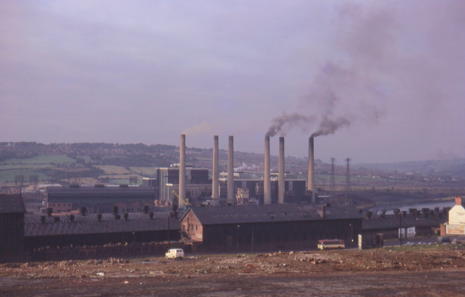
 Dunston Power Station, 1971
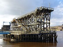 Dunston Staiths, 2006
Dunston was originally an independent village on the south bank of the River Tyne. It has now been absorbed into the Metropolitan Borough of Gateshead in the English county of Tyne and Wear. Much of Dunston forms part of the inner Gateshead regeneration area.
The Dunston area is serviced by the Dunston railway station, along the Tyne Valley Line.
Dunston is now split into two distinct areas separated by the A1 dual carriageway. Much of the area south of the A1 is known as Dunston Hill.
To the west of Dunston is the site of Dunston Power Station, now demolished. The site is now home to the MetroCentre, which was the largest shopping and leisure centre in Europe before the Stratford Westfield complex was opened in 2011.[1] Another Dunston landmark is the Derwent Tower, commonly known as the "Dunston Rocket", a tower block that was once the highest in Gateshead, and was designed by the Owen Luder Partnership and completed in 1973.[2] Luder also designed the Trinity Centre Multi-Storey Car Park in Gateshead town centre.
On 6 June 1993 the IRA attacked a gas holder in the nearby area of Low Team. The damage was limited and no one was injured.[3]
Contents
Dunston staithes
Dunston is particularly known for its wooden staithes, first opened in 1893 as a structure for loading coal from the North Durham coalfield onto ships. In the 1920s 140,000 tons of coal per week were loaded from the staithes, and they continued to be used until the 1970s. They were finally closed and partially dismantled in 1980.
The staithes were restored and reopened for the Gateshead Garden Festival in 1990. Following similar events in Liverpool (1984), Stoke on Trent (1986) and Glasgow (1988), the Garden Festival occupied a large area of Dunston and Team Valley. Though other parts of the Garden Festival site, such as the Eslington and Norwood areas of Team Valley, gained an immediate spur for regeneration, the area around the staithes remained derelict and inaccessible for the whole of the 1990s.
Today, the staithes are reputed to be the largest wooden structure in Europe[4], and are protected as a Listed Building and a Scheduled Ancient Monument.
In 2002, work began on a development of riverside apartments and houses designed by Wayne Hemingway. Known as Staiths South Bank, this development celebrates the area's heritage as well as improving the setting for the historic structure. Unfortunately, in the early hours of 20 November 2003, a section of the staithes was destroyed by fire.[5] As a result, access onto the Staithes themselves is not possible, but the structure can be viewed from the new riverside walkway constructed as part of the Staiths South Bank development. In 2005 Gateshead Council commissioned a study into possible options for the Staithes' restoration.
The Staithes suffered further fire damage in July 2010.[6]
Notable people
Footballers Paul Gascoigne[7] and Ray Hudson[8] and lead singer of AC/DC Brian Johnson grew up in Dunston, as well as a Maltese International Rugby Player, Ryan Robson.
Champion rower and boat-builder Harry Clasper[9] was born in Dunston.
References
- ^ MetroCentre
- ^ SINE Project: Derwent Tower
- ^ "Damages bid over bombing arrests". The Northern Echo. 2003-01-20. http://archive.thisisthenortheast.co.uk/2003/1/20/107101.html. Retrieved 2007-07-29.
- ^ Sitelines archaeology project: Dunston Staithes
- ^ "Coal heritage goes up in flames" (from BBC News)
- ^ [1]
- ^ English-Football.org.uk: Paul Gascoigne
- ^ Ray Hudson
- ^ Harry Clasper
External links
Categories:- Towns in Tyne and Wear

Wikimedia Foundation. 2010.