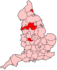
- City of Wakefield
-
Coordinates: 53°40′59″N 1°29′56″W / 53.683°N 1.499°W
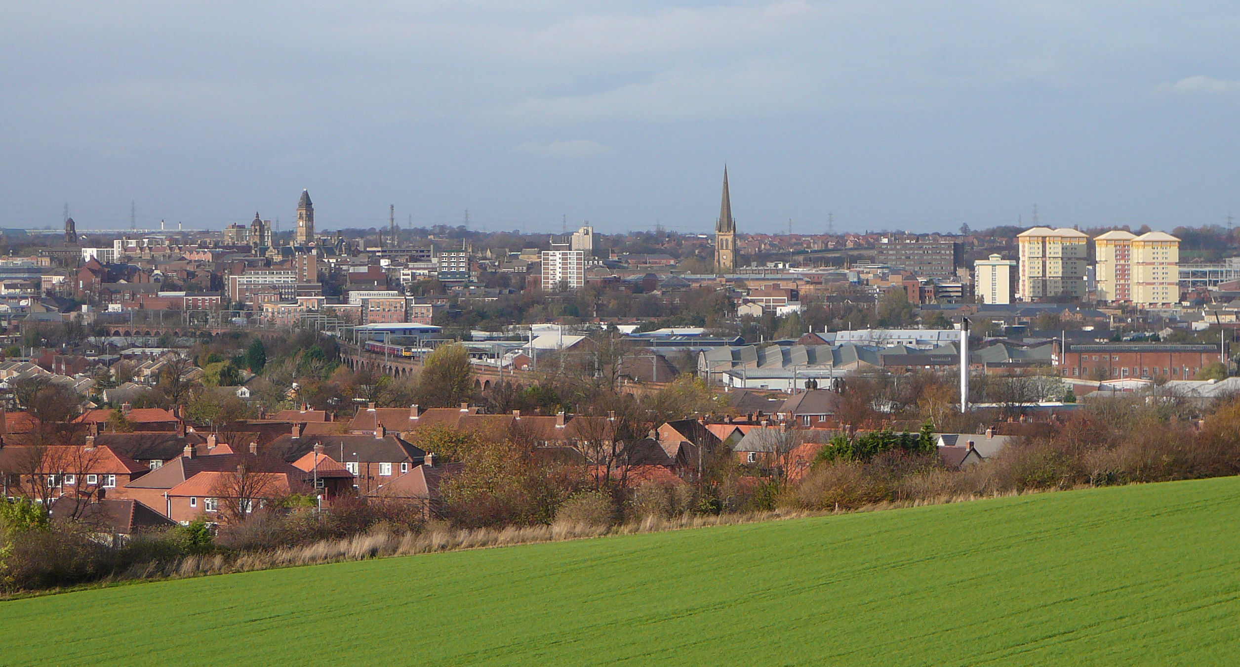
City of Wakefield — Metropolitan borough, City — A view over central Wakefield, from Sandal Magna
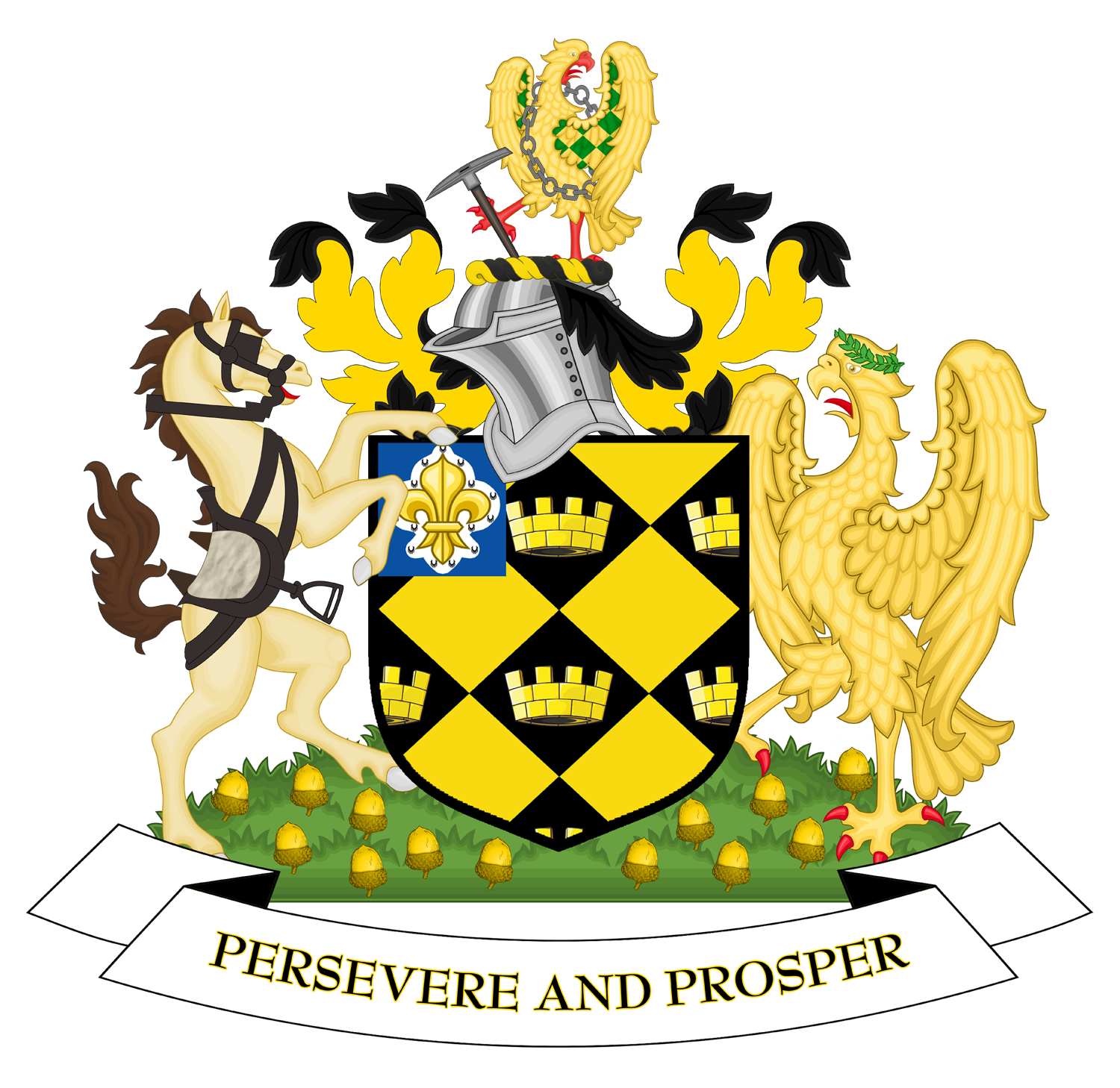
Coat of arms of Wakefield City CouncilWakefield
Sovereign state United Kingdom Constituent country England Region Yorkshire and the Humber Ceremonial county West Yorkshire Founded Admin. HQ Wakefield Government – Type Wakefield Council – Leadership: Leader & Cabinet – Executive: Labour – MPs: Ed Balls (Labour),
Yvette Cooper (Labour),
Mary Creagh (Labour),
Jon Trickett (Labour)Area – Total 130.7 sq mi (338.6 km2) Area rank 127th Population (2010 est.) – Total 325,600 – Rank Ranked 17th – Density 2,490.5/sq mi (961.6/km2) Time zone Greenwich Mean Time (UTC+0) – Summer (DST) British Summer Time (UTC+1) Postcode ISO 3166-2 ONS code 00DB OS grid reference NUTS 3 Ethnicity 97.7% White
1.4% S.AsianWebsite wakefield.gov.uk The City of Wakefield (
 /ˈweɪkfiːld/) is a local government district of West Yorkshire, England, with the status of a city and metropolitan borough. Wakefield is the district's administrative centre. The district includes the "Five Towns" of Normanton, Pontefract, Featherstone, Castleford and Knottingley. Other towns include Ossett, Hemsworth, South Kirkby & Moorthorpe and South Elmsall. Wakefield lies between Leeds and Sheffield and is ranked as the 87th largest city in the European Union. In 2010, Wakefield was named as the UK's third 'most musical' City by PRS for Music.[1][1]
Contents
Economy
In recent years, the economic and physical condition of several of the former mining towns and villages in Wakefield District have started to improve due to the booming economy of Leeds - and an increase in numbers of commuters to the city from the sub-region - and a recognition of undeveloped assets. For instance Castleford, to the North East of Wakefield is seeing extensive development and investment because of the natural asset of its outlook on to the River Aire, its easy access to the national motorway network and the availability of former mining land for house-building. In Ossett, house prices have risen from an average of £50,000 in 1998 to £130,000 in 2003.
Although unemployment was amongst the highest in the country for most of the 1980s and 1990s, Wakefield District now has below-average unemployment. The "Wakefield East" ward had 4.7% unemployment in May 2005 (source: Office for National Statistics) - which was more than 1% higher than any other ward. The eastern half of the district remains considerably less prosperous than the western half, with several deprived wards
The district is mainly made out of old coal-mining towns, although other industries include wool, chemicals, machine tools, glass and other forms of manufacturing. Horbury is something of an anomaly in having had a large steel works. When Margaret Thatcher came to power in 1979 there were 21 pits in the district. By the time the 1984 Strike began this had decreased to 15, however it still had more colleries than any other district in the country. At the time of privatisation in November 1994, only two remained: the Prince of Wales at Pontefract, which closed in 2002, and Kellingley at Knottingley which is now the sole remainder of the industry that once dominated the district. Most of the district's pits had been very hardline during the 1984 strike.
History
The former Borough of Wakefield was raised to city status by letters patent in 1888. It became a county borough in 1913, taking it out of the jurisdiction of the West Riding County Council. The present boundaries were set in 1974 by the Local Government Act 1972, when the county borough of Wakefield merged with the West Riding municipal boroughs of Castleford, Ossett and Pontefract, the urban districts of Featherstone, Hemsworth, Horbury, Knottingley, Normanton and Stanley, along with Wakefield Rural District and parts of Hemsworth Rural District and Osgoldcross Rural District. The new metropolitan district's city status was reconfirmed by letters patent in 1974. The Council's headquarters are County Hall, originally built for the West Riding County Council and acquired by Wakefield in 1989.
Governance
The district is divided into 21 wards and each is represented on the district council by three councillors. Each councillor is elected on a first past the post basis, normally for a four-year period which is staggered with the other councillors of that ward so that only one councillor per ward is up for election at any one time. Exceptions to this include by-elections and ward boundary changes.
Wakefield Metropolitan District wards
Ward areas covered[2] 1 Ackworth, North Elmsall & Upton Ackworth, Ackworth Central, Huntwick with Foulby & Nostell, Hessle & Hill Top, West Hardwick, Badsworth, North Elmsall, Thorpe Audlin, Wentbridge & Kirk Smeaton, Ackworth West, Upton 2 Airedale & Ferry Fryston Airedale, Ferry Fryston, Townville, Fryston Village 3 Altofts & Whitwood Normanton (Altofts), Normanton (Lee Brigg), Whitwood, Whitwood Mere, Roundhill, Half Acres, Normanton Industrial Estate, Featherstone North West 4 Castleford Central & Glasshoughton The Potteries, Central Castleford, Wheldon Road & Lock Lane, Glasshoughton, Redhill (part), Smawthorne Estate, The Maltkilns, Healdfield Area 5 Crofton, Ryhill & Walton Chevet, Notton, Notton - Bleakley, Walton South, Walton North, Crofton, Ryhill, Wintersett, Havercroft with Cold Hiendley, Havercroft East 6 Featherstone Featherstone Central, Featherstone East, Featherstone North West, Featherstone South, Sharlston 7 Hemsworth Hemsworth South, Hemsworth East, Fitzwilliam, Kinsley, Hemsworth West, South Hiendley 8 Horbury & South Ossett Horbury Bridge, Horbury Central, Horbury Junction, Horbury North, Horbury West, Ossett Low Common, Ossett South East, Storrs Hill 9 Knottingley Ferrybridge, Hill Top, Knottingley South, Simpsons, Weeland, Cridling Stubbs (part) 10 Normanton Newland with Woodhouse Moor, Normanton, Normanton Woodhouse, Warmfield-cum-Heath (Heath), Warmfield-cum-Heath (Warmfield), Normanton Common 11 Ossett Broadowler, Flushdyke, Gawthorpe & Paleside, Headlands, Holme Lees, Ossett Central, Ossett Towngate, Ossett East, Ossett West, 12 Pontefract North Castle, Park, Monkhill, Central, Nevison, Barracks’ Estate 13 Pontefract South Baghill, Carleton, Chequerfield, Darrington, East Hardwick, Wakefield Road, Westbourne, Wentbridge (North) 14 South Elmsall & South Kirkby Moorthorpe, South Kirkby, South Elmsall 15 Stanley & Outwood East St John’s North, Outwood West, Bottomboat, Lake Lock, Newton Hill East, Outwood (Leeds Road), Stanley, Newmarket Lane, Stanley Lee Moor, Lofthouse Gate, Lofthouse 16 Wakefield East Heath View, Northgate, St Swithuns, Windhill, Pinders Heath, Belle Vue, Greenhill, Northgate South, Primrose Hill, Portobello, Northgate North, Stanley Marsh 17 Wakefield North Plumpton, Peacock, St John’s East, St John’s West, West Alverthorpe Central, Westgate Common, Silcoates, Kirkgate, Alverthorpe North, Newton Bar, Whitehall Rise, Batley Road, Flanshaw 18 Wakefield Rural Crigglestone, Durkar, Hall Green, Newmillerdam, Painthorpe, Middlestown, Netherton, West Bretton, Woolley East, Woolley (Haigh Hill), Woolley West, Calder Grove 19 Wakefield South Agbrigg South, Kettlethorpe, Sandal Castle, Sandal Woodthorpe, Agbrigg North, Belle Vue, Milnthorpe 20 Wakefield West Snapethorpe & Roundwood, West Alverthorpe South, Calder, Kirkgate South, Lupset East, Lupset East Central, Snapethorpe South, Lupset West Central, Westgate Central, Westgate North, Westgate South, Lupset Park, Roundwood, Wakefield Road 21 Wrenthorpe & Outwood West Kirkhamgate, West Alverthorpe North, Gentian Court, Newton Hill West, Carr Gate, Outwood (Ledger Lane), Outwood North, Lingwell Gate, Wrenthorpe, Silcoates Elections
Party political make-up of Wakefield Council Party Seats Current Council (2011) 2008[3] 2010[4] 2011 [5] Labour 32 33 40 Conservative 23 24 20 Independent 6 5 3 Lib Dems 2 1 0 The city was the safest Labour council in England in 2003, but there has been a huge swing against Labour in recent years. After the 2008 election results the Labour Party had a majority of just one. However the death of Labour councillor Graham Phelps meant that the authority was for a time in no overall control.[6] Labour did however,hold the seat in the by-election in January 2010 restoring their majority.[7]
In the May 2010 local elections Labour held all of their seats and made a net gain of one seat from the Independents increasing Labour's majority on the Council to three. Following the defection of an Independent to Labour, Labour's majority was increased to 5.[8] In January 2011 a Conservative Councillor defected to become an independent Councillor, leaving the Tories with 23 seats.[9]
In May 2011 Labour increased their majority on the council to 15 making 5 gains, taking 3 seats from the Conservatives (Horbury and South Ossett, Pontefract South and Wrenthorpe and Outwood West), and 2 from the Independents (Featherstone and South Elmsall and South Kirkby). The Conservatives gained Ossett from the Liberal Democrats, which means there are no Liberal Democrat councillors in Wakefield.
The Current Council make up is Labour 40, Conservative 20, Independent 3 following a by-election in Horbury in July 2011 resulting from the resignation of a Conservative Councillor, Labour's Janet Holmes gained the seat.[10]
Sports
The city is home to three professional rugby league clubs, the Wakefield Trinity Wildcats, Castleford Tigers who both play in the Super League and Featherstone Rovers who play in the Championship. All three have had periods of success. The city is also home to Wakefield & Emley F.C association football club.
Social aspects
Crime is generally lower in this district than in the rest of West Yorkshire. Other problems typical of such an area include rates of suicide that are consistently amongst the highest in the country and a heroin problem that saw addiction rise by an incredible 3361% between 2000 and 2004.
A decision was made, in 2004, to transfer the district's extensive council housing to Wakefield and District Housing (WDH), an 'independent' housing association, who would be more efficient with repairs and maintaining decent accommodation; as council housing represented almost 30% of the district, this was the second-largest stock transfer in British history. WDH are investing over £700 million to regenerate the District and working with partners, such as WMDC, are investing in new housing within the District.
References
- ^ a b Richard Smith. "Bristol named Britain's most musical city". http://www.mirror.co.uk/celebs/news/2010/03/13/bristol-named-britain-s-most-musical-city-115875-22107650.
- ^ Wards, wakefield.gov.uk, http://www.wakefield.gov.uk/CouncilAndDemocracy/Councillors/Wards/default.htm, retrieved 2009-12-16
- ^ http://www.wakefield.gov.uk/CouncilAndDemocracy/ElectoralServices/PreviousElectionResults/Local+Elections/LocalMay2008.htm
- ^ http://www.wakefield.gov.uk/CouncilAndDemocracy/ElectoralServices/PreviousElectionResults/Local+Elections/localelection2010.htm
- ^ http://www.wakefield.gov.uk/CouncilAndDemocracy/ElectoralServices/Elections/localelection2011.htm
- ^ "Tributes to Councillor Graham Phelps". Wakefield Council. 2009-11-19. http://www.wakefield.gov.uk/News/PressReleases/news/pr2418.htm. Retrieved 2009-11-23.
- ^ "Airedale and Ferry Fryston by-election result". http://www.yorkshireeveningpost.co.uk/news/Airedale-and-Ferry-Fryston-byelection.6005252.jp.
- ^ "Local election results 2010". www.wakefield.gov.uk. http://www.wakefield.gov.uk/CouncilAndDemocracy/ElectoralServices/PreviousElectionResults/Local+Elections/localelection2010.htm. Retrieved 2011-03-09.
- ^ "Jesty, Graham". www.wakefield.gov.uk. http://www.wakefield.gov.uk/cgi-bin/MsmGo.exe?grab_id=0&page_id=17592&query=jesty&SCOPE=www.wakefield.gov.uk&hiword=JESTYS%20jesty%20. Retrieved 2011-03-09.
- ^ http://www.wakefield.gov.uk/News/PressReleases/news/pr3084.htm
Ceremonial county of West Yorkshire Metropolitan districts City of Bradford • City of Leeds • City of Wakefield • Metropolitan Borough of Calderdale • Metropolitan Borough of KirkleesMajor settlements Batley • Bingley • Bradford • Brighouse • Castleford • Cleckheaton • Denholme • Dewsbury • Elland • Farsley • Featherstone • Garforth • Guiseley • Halifax • Hebden Bridge • Hebden Royd • Heckmondwike • Hemsworth • Holmfirth • Horsforth • Huddersfield • Ilkley • Keighley • Knottingley • Leeds • Meltham • Mirfield • Morley • Mytholmroyd • Normanton • Ossett • Otley • Pontefract • Pudsey • Rothwell • Shipley • Silsden • South Elmsall • Sowerby Bridge • Todmorden • Wakefield • Warley Town • Wetherby • Yeadon
See also: List of civil parishes in West YorkshireTopics Parliamentary constituencies • West Yorkshire Joint Services • Monastic houses • Museums • Windmills Districts of Yorkshire and the Humber
Lincolnshire 
North Yorkshire Craven • Hambleton • Harrogate • Richmondshire • Ryedale • Scarborough • Selby • York
South Yorkshire West Yorkshire Bradford • Calderdale • Kirklees • Leeds • Wakefield
East Riding of Yorkshire Cities of the United Kingdom England Bath · Birmingham · Bradford · Brighton and Hove · Bristol · Cambridge · Canterbury · Carlisle · Chester · Chichester · Coventry · Derby · Durham · Ely · Exeter · Gloucester · Hereford · Kingston upon Hull · Lancaster · Leeds · Leicester · Lichfield · Lincoln · Liverpool · London · Manchester · Newcastle upon Tyne · Norwich · Nottingham · Oxford · Peterborough · Plymouth · Portsmouth · Preston · Ripon · St Albans · Salford · Salisbury · Sheffield · Southampton · Stoke-on-Trent · Sunderland · Truro · Wakefield · Wells · Westminster · Winchester · Wolverhampton · Worcester · York
Scotland Wales Northern Ireland Metropolitan counties and metropolitan districts Greater Manchester 
Merseyside South Yorkshire Tyne and Wear West Midlands West Yorkshire - Bradford
- Calderdale
- Kirklees
- Leeds
- Wakefield
Categories:- Wakefield District
- Cities in Yorkshire and the Humber
- Leeds City Region
- Local government districts in West Yorkshire
- Local government districts of Yorkshire and the Humber
- Local government in Wakefield
- Metropolitan boroughs


Wikimedia Foundation. 2010.