- Cleckheaton
-
Coordinates: 53°43′30″N 1°43′08″W / 53.725°N 1.719°W
Cleckheaton 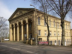
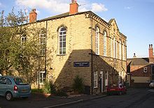
Former Providence Congregational Chapel
 Cleckheaton shown within West Yorkshire
Population 14,937 OS grid reference SE1825 Metropolitan borough Kirklees Metropolitan county West Yorkshire Region Yorkshire and the Humber Country England Sovereign state United Kingdom Post town CLECKHEATON Postcode district BD19 Dialling code 01274 Police West Yorkshire Fire West Yorkshire Ambulance Yorkshire EU Parliament Yorkshire and the Humber UK Parliament Batley and Spen List of places: UK • England • Yorkshire Cleckheaton is a town within the Metropolitan Borough of Kirklees, in West Yorkshire, England, situated south of Bradford, east of Brighouse, west of Batley and south-west of Leeds. It is at the centre of the Spen Valley and was the major town in the former borough of Spenborough.
Historically a part of the West Riding of Yorkshire, Cleckheaton has a history as a mill town, like much of West Yorkshire, although this industry has now all but vanished.
Contents
History
Early history
Like much of England, the Spen Valley was once heavily wooded. Human habitation began thousands of years ago and Mesolithic and Neolithic remains have been found in various places. Roman remains have been found in the valley and it is thought that the roads from York to Chester, and from settlements in Halifax and Wakefield, ran through Cleckheaton and the junction gave rise to a staging post.
Cleckheaton was included in the ancient parish of Birstall. A chapel-of-ease, known as the White Chapel (later Whitechapel) was established in the area.[1]
Textile working
The area was very disorganised for a long time after the Norman Conquest and the richest townships at the time of the Norman Conquest were still the richest 300 years later as the Poll Tax returns of 1379 show. They also demonstrate the lack of administration as only the richest four of the 227 families living in the Spen Valley were made to pay more than the 4d minimum tax. These tax returns also show the recent deviation form the traditional sources of wealth in the area (i.e. farming and allied trades). These were centred around textiles and included dyeing, weaving and fulling (common names in the area nowadays still recall these early trades: Lister- dyer, Webster- weaver, Walker- fuller). The spread of these trades was also a result of the absence of regulation of the area. Due to the lack of manorial control, land was divided between all the sons in a family rather than just passing to the eldest. As the farmland owned by a family got smaller they became unable to support the family and so people turned to production of woollens to gain extra income.[citation needed]
After the Reformation, Kirklees Priory was largely destroyed, many families were driven from the area and new non-aristocratic lords of the manor who were sympathetic to Protestantism were introduced by Elizabeth I, as was a puritan clergyman who was installed at Birstall Church. By 1570, at the time of the Rising of the Northern Earls, the last of the old Norman noble families had been swept away. Sir John Neville went into exile and forfeited his estate and Thomas Hussey (heir to the de Tilly family of Oakwell Hall) was imprisoned in the Tower of London for some time before being pardoned.[citation needed]
By the 17th century land-owning farmers were finding it increasingly difficult as were their landlords and some payments were still in kind as farmers had no money to pay their debts. Meanwhile the textile workers were becoming more and more prosperous and paid less and less attention to their hard up and increasingly impotent landlords. During the English Civil War the clothiers were on one side and the landlords on the other. Lords of the area were made Royalist officers and made some progress such as at the battle of Adwalton Moor about a mile east of Birkenshaw and the siege of Bradford, before the Parliamentarians took control of the area. Royalist families were forced, after the war, to pay large fines to keep their lands and avoid imprisonment. All the time clothiers were growing wealthier and by the end of the 17th century more than half of the wills in the parish of Birstall came from men whose wealth came from textiles.[citation needed]
Nonconformity
After the restoration of the Monarchy, Anglicanism was reintroduced also. However many people had found puritan teachings more to their taste and it took many years to re-install an Anglican vicar to Whitechapel. Despite the draconian nonconformist laws, there was a large number of non-Anglican meeting houses and nonconformity flourished; a fifth of the population of the Birstall Parish was estimated to be nonconformist. Quakers were widespread and even now a number of 17th and 18th century Quaker burial grounds remain in the area. In the 18th century Presbyterianism was widespread but then lost a large minority of its flock to Unitarianism and to the Baptist church. Methodism also flourished from the 1740s after visits from John Wesley and Charles Wesley, as did the Moravian Church. Indeed John Wesley lived in Birstall for some time as it was near to many large towns in the West Riding.[citation needed]
In spite of the religious strength in the Valley, the inhabitants were somewhat unconventional and still went to astrologers, quack doctors and prophets. Men like Eli Collins, the "Wizard of Wyke", and Alvery Newsome, the "Wise Man of Heckmondwike", were widespread. Furthermore, to increase the isolation, the area had no canals and had few roads, apart from a few turnpike roads, including the major ones from Leeds to Huddersfield and Bradford to Halifax.[citation needed]
Industrial Revolution
After the discovery of good quality coal in the north of the valley industry spread quickly.
In 1804 the Reverend Hammond Roberson, annoyed that the administration of Liversedge was disorganised, promoted a system of reform - the select vestry - which quickly spread to Cleckheaton and Heckmondwike. In 1810, after his wife's death, Roberson turned his attention to church building in the area. In 1818 Parliament voted a million pounds for the building of new churches in the country and Roberson was able to secure funding to build Cleckheaton church.[2]
Spen Valley
By the mid 19th century the Spen Valley entered its golden era. In 1800 children were paid starvation wages for putting staples into leather for carding wool, but by 1838 there were eleven carding factories in Cleckheaton and by 1893 the town was recognised as the carding capital of the world.[citation needed]
The mill owners built turnpike roads between the villages to enable their employees to get to work and lobbied to get railways built to get their products to reach customers. After a great deal of wrangling with the various railway companies in the 1840s railways were finally built which enabled the textile mills, ironworks, chemical factories and collieries to compete with those around the country. More than this, the railways brought together the people of the individual villages of the valley and quickly the villages grew until they merged together.[citation needed]
20th century
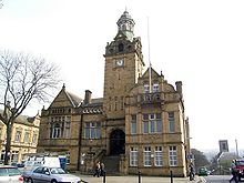
Around the turn of the century, many huge and expensive buildings were erected and became symbols for the area's wealth; massive chapels and a new Grammar School were built in Cleckheaton, and to mark the new urban district and the fact that it was the centre of it, Cleckheaton built a town hall in 1892, paid for by public subscription.[citation needed]
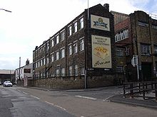
In 1903 Lion Confectionery began making "Midget Gems" in Cleckheaton, and 1904 saw the opening of the Phelon & Moore motorcycle factory in the town, soon followed by a car factory.[3] BBA (formerly British Belting & Asbestos), the large asbestos, friction material, and conveyor belting firm, built its headquarters at Moorend where they manufactured automotive disc brake pads under the Mintex banner. A tourist industry developed to serve visitors to the area made famous by Charlotte Brontë's "Shirley" and by the Luddite attacks. The Mowatt family paid for Cleckheaton Library and also the reference library at Cleckheaton's grammar (later secondary) school, Whitcliffe Mount which bears their name.[citation needed]
From the 1920s, however, Spenborough's fortunes began to decline. Pits began to close and trade waned. Slowly, central government took on responsibilities previously held by Spenborough such as water supply, gas production, public health and education. By this time the level of industry was in serious decline as the textile mills, foundries and other factories slowly closed.
In the 1960s and 1970s many new houses were built in Cleckheaton, as the town attracted commuters to Leeds and Bradford. Ashtons built many houses around Cleckheaton and neighbouring Mirfield.
Cleckheaton station
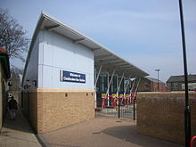
In 1972 a singular case was heard at Wakefield Crown Court. A Dewsbury man was accused of, as counsel for the prosecution put it, effectively stealing Cleckheaton railway station. The station had closed to passenger traffic in 1965 and to freight four years later. British Rail had contracted for the clearing of the site, part of the deal being that the contractors would sell and retain the proceeds from disposal of the materials and scrap. On arrival, they discovered that the station and most of the material were already gone. It transpired that the man had been contracted by another firm to clear the site, had been advanced a sum for hire of plant, and had spent three weeks clearing the site. Subsequent efforts to trace the second firm failed, and the court found the man not guilty, deciding that he had been duped and left significantly out of pocket.[4]
Governance
Local government
Cleckheaton is an unparished area and ward of the Metropolitan Borough of Kirklees. The ward elects three of the borough council's sixty-nine councillors. As of 2007 all three councillors were members of the Liberal Democrats.[5] Under the borough council's decentralisation scheme, Cleckheaton's councillors are grouped with those of the neighbouring wards of Heckmondwike and Liversedge & Gomersal to form the Spen Valley Area Committee.[6]
Civic history
Cleckheaton adopted the Local Government Act 1858 in 1864 and a local board was formed to govern the area. In 1885 Cleckheaton and the three neighbouring townships of Gomersal, Heckmondwike and Liversedge were grouped to form the Parliamentary constituency of Spen Valley. The Local Government Act 1894 reconstituted the area of the local board as Cleckheaton Urban District. There were at this time attempts to involve all the local authorities in the valley in joint projects such as installation of sewers and water. In 1915, the three urban districts of Cleckheaton, Liversedge and Gomersal were amalgamated to form Spenborough Urban District. In 1937 a county review order enlarged the urban district to include Birkenshaw, Hunsworth and Hartshead.[7]
Spenborough (which now included all of the Spen Valley save Heckmondwike) was granted a charter of incorporation and became a municipal borough on 23 May 1955. The borough continued to use the coat of arms which bore the motto "Industry Enriches" which it had been granted in 1949.[8]
On April 1, 1974 the Local Government Act 1972 reorganised administration throughout England and Wales. The borough of Spenborough was abolished, and its area combined with that of ten other local authorities to form the Metropolitan Borough of Kirklees, one of five metropolitan boroughs of West Yorkshire.[9]
Parliamentary representation
For elections to the UK parliament, Cleckheaton ward forms part of Batley and Spen borough constituency.[10] The constituency was created in 1983 and was represented by a Conservative MP from 1983 to 1997. Since that date the constituency has been held by Labour MP Mike Wood.
Parliamentary history
From 1885 to 1950 the town formed part of the Spen Valley county constituency.[7] The seat was held at various times by the Liberal, National Liberal and Labour parties.
From 1950 to 1983 Cleckheaton was included in the borough constituency of Brighouse and Spenborough.[7] It was a marginal seat, changing hands between the Conservative and Labour parties on six occasions.
Geography
Cleckheaton is at the centre of a number of villages which together form the Spen Valley:
Oakenshaw, East Bierley, Hunsworth, Birkenshaw, Drub, Gomersal, Little Gomersal, Littletown, Millsbridge, Liversedge, Roberttown, Hartshead, Clifton, Hightown and Scholes.
The town itself is made up of areas such as Moorend, Whitechapel, Whitcliffe, Moorbottom, Moorside, the Marsh and Rawfolds.
Sports
Cleckheaton's rugby union team play in the North Division 1 and are a constituent part of Cleckheaton Sports Club and play at their grounds in Moorend, where they also have "one of the best bowling greens in West Yorkshire", often holding local league games and such competitions as the John Smith's Classic.[citation needed]
Liversedge F.C. are the town's highest football club in the football league pyramid, playing in the Northern Counties East Football League Premier Division for the 06-07 season. They play at Clayborn, 1 km from Cleckheaton town centre. They have an associated junior club Gomersal and Cleckheaton F.C.[citation needed]
There are many Sunday League football teams around Cleckheaton and cricket is also big locally, with Cleckheaton (also part of Cleckheaton Sports Club) Scholes, Gomersal, Spen Victoria, Hartshead Moor, East Bierley and Liversedge all within the Spen Valley.[citation needed]
Notable people
- John Bentley, the first man to play both Rugby Union and Rugby League for England, is from Cleckheaton; he played for Cleckheaton RUFC (part of Cleckheaton Sports Club) and is their Director of Rugby
- Danny Cadamarteri, Huddersfield Town F.C. footballer, was born in Cleckheaton in 1979.[11]
- Andrew Gale, Captain of Yorkshire Cricket Club was educated at Whitcliffe Mount School and played for Cleckheaton CC (part of Cleckheaton Sports Club)
- Roger Hargreaves, author of the Mr Men and Little Misses series of books, was born in Cleckheaton in 1935.[12]
References
- ^ Samel Lewis (1848). "Cleckheaton". A Topographical Dictionary of England. British History Online. http://www.british-history.ac.uk/report.aspx?compid=50882#s6. Retrieved 1 March 2008.
- ^ Port, M.H.: 'Six Hundred New Churches. A study of the Church Building Commission, 1816-1856', Spire Books, 2006
- ^ Bradford Timeline (Belle Vue Grammar School) accessed January 29, 2008
- ^ Body, Geoffrey: Railway Oddities, Tempus, 2007 ISBN 978-0-75244399-7
- ^ Your Councillors in Cleckheaton, Kirklees Council, accessed April 1, 2008
- ^ Spen Valley Area Committee, Kirklees Council, accessed April 1, 2008
- ^ a b c Frederic A Youngs Jr., Local Administrative Units of England, Vol II: Northern England, London 1991
- ^ Geoffrey Briggs, Civic and Corporate Heraldry, London 1971
- ^ Local Government Act 1972, (1972 c.70), Schedule I
- ^ The Parliamentary Constituencies (England) Order 2007, Office of Public Sector Information, accessed April 1, 2008
- ^ "Danny Cadamarteri". First Team. Huddersfield Town FC. http://www.htafc.com/page/ProfilesDetail/0,,10312~5701,00.html. Retrieved 2009-03-30.
- ^ Malam, John (October 2005). "Hargreaves, (Charles) Roger (1935–1988)". Oxford Dictionary of National Biography. Oxford University Press. http://www.oxforddnb.com/public/dnb/76335.html. Retrieved 2008-04-01.
External links
- Google map
- Direct line to past
- Gomersal and Cleckheaton FC
- Website of Mike Wood, the town's Member of Parliament
Ceremonial county of West Yorkshire Yorkshire Portal Metropolitan districts Major settlements Batley • Bingley • Bradford • Brighouse • Castleford • Cleckheaton • Denholme • Dewsbury • Elland • Farsley • Featherstone • Garforth • Guiseley • Halifax • Hebden Bridge • Hebden Royd • Heckmondwike • Hemsworth • Holmfirth • Horsforth • Huddersfield • Ilkley • Keighley • Knottingley • Leeds • Meltham • Mirfield • Morley • Mytholmroyd • Normanton • Ossett • Otley • Pontefract • Pudsey • Rothwell • Shipley • Silsden • South Elmsall • Sowerby Bridge • Todmorden • Wakefield • Warley Town • Wetherby • Yeadon
See also: List of civil parishes in West YorkshireTopics Parliamentary constituencies • West Yorkshire Joint Services • Monastic houses • Museums • WindmillsCategories:- Towns in West Yorkshire
- Heavy Woollen District
- Local Government Districts created by the Local Government Act 1858
- Kirklees
- Geography of Kirklees
Wikimedia Foundation. 2010.


