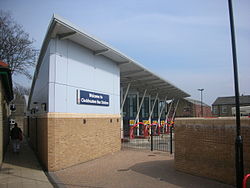
- Cleckheaton bus station
-
Coordinates: 53°43′19″N 1°42′43″W / 53.722°N 1.712°W
Cleckheaton 

Location Locale Dewsbury Rd, Cleckheaton Local authority Kirklees Operation Opened 2005 Managed by Metro No. of stands 6 Operators [[Arriva Yorkshire][Halifax joint commitee]] Travel centre No Rail connection Dewsbury  5 miles (8 km) or Leeds
  11 miles (18 km)
Cleckheaton bus station serves the town of Cleckheaton, West Yorkshire, England. The station is owned and maintained by Metro (WYPTE)
The station is situated in Cleckheaton Town Centre with entrances from Dewsbury Road and Greenside.
The bus station was rebuilt by Metro in April 2005 replacing the previous Arriva Yorkshire owned site.
There are six stands at the bus station with a real-time information board. The main operator at the bus station is Arriva. In line with all other recently built West Yorkshire Metro bus stations, the passenger waiting area is fully enclosed.
Services
Buses run from the bus station around the Heavy Woollen District (North Kirklees) and as far as Huddersfield, Halifax, Bradford, Leeds and Wakefield.
The bus services that use Cleckheaton bus station and their stand letter are shown below[1]: (Places in bold are where services terminate)
No. Operator Destination Stand 220 Arriva Yorkshire Leeds City bus station via Birstall, Morley and White Rose Centre B Huddersfield via Liversedge D 225 Arriva Yorkshire Brighouse via Clifton A1 253 Arriva Yorkshire Bradford via Gomersal B Wakefield via Mirfield and Dewsbury D 254
255Arriva Yorkshire Leeds City bus station via Gomersal and Drighlington E 254 Arriva Yorkshire Wakefield via Liversedge Heckmondwike and Dewsbury A 255 Arriva Yorkshire Halifax via Scholes, Wyke and Hipperholme A 256 Arriva Yorkshire Bradford via Hunsworth and East Bierley B Brighouse via Clifton D 268 Arriva Yorkshire Dewsbury via Heckmondwike C Bradford via Oakenshaw F X25 Arriva Yorkshire Leeds City bus station via M621 motorway E2 Notes:
1 Weekday afternoons 2 Weekday mornings References
- ^ "Metro - Bus stations - Cleckheaton Bus Station". Metro. http://www.wymetro.com/BusTravel/BusStationsAndStops/CleckheatonBusStationStatistics. Retrieved 6 February 2011.
External links
Bus stations in West Yorkshire Major stations Bradford Interchange · Halifax · Huddersfield · Leeds · Wakefield
Other stations Categories:- Bus stations in West Yorkshire
- Buildings and structures in Kirklees
Wikimedia Foundation. 2010.

