- City of Carlisle
-
This article is about the local government district of Cumbria. For other uses, see Carlisle.For the settlement in Cumbria named Carlisle, see Carlisle, Cumbria.
City of Carlisle — City & non-metropolitan district — Carlisle City Council offices at Carlisle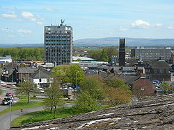
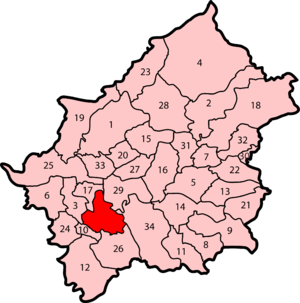
Coat of arms of Carlisle City CouncilMotto: "Be Just and Fear Not" [[File:]]Carlisle Castle Carlisle shown within Cumbria
Coordinates: 54°53′27″N 2°56′38″W / 54.89083°N 2.94389°WCoordinates: 54°53′27″N 2°56′38″W / 54.89083°N 2.94389°W Sovereign state United Kingdom Constituent country England Region North West England Ceremonial county Cumbria Admin HQ Carlisle City status (Carlisle) Non-metropolitan district status 1 April 1974 City status 1 April 1974 Government - Type City - Governing body Carlisle City Council - Mayor - MPs: John Stevenson, Rory Stewart Area - Total 401.5 sq mi (1,039.97 km2) Population (2010 est.) - Total 104,500 (Ranked 216th) - Ethnicity 97.6% White
0.9% South Asian
0.6% Mixed
0.2% Black
0.5% Chinese or OtherTime zone Greenwich Mean Time (UTC+0) Postcode CA postcode area ONS code 16UD OS grid reference NY394555 Website www.carlisle.gov.uk The City of Carlisle (
 /kɑrˈlaɪl/, locally /ˈkɑːlaɪl/[1]) is a local government district of Cumbria, England, with the status of a city and non-metropolitan district. It is named after its largest settlement, Carlisle, but covers a far larger area which includes the towns of Brampton and Longtown, as well as outlying villages including Dalston, Scotby and Wetheral. The city has a population of 100,739,[2] and an area of 1,039.97 square kilometres (402 sq mi),[2] making it the largest city in England by area (although the majority of its territory is not urbanised, but rural).[3]
The current city boundaries were set as part of the provisions of the Local Government Act 1972, and cover an amalgamation of two former local government districts—the City and County Borough of Carlisle and the Border Rural District of Cumberland.[4] The City of Carlisle shares a border with Scotland (to the north), and is bounded on the southwest by the borough of Allerdale, and on the south by Eden. The county of Northumberland is to the east.
Although the present boundaries date to the 20th century, the city traces its origins to a 1st-century Roman outpost associated with Hadrian's Wall. The Brythonic settlement that expanded from this outpost was destroyed by the Danes in 875. Thereafter the region formed part of the Southern Uplands of Scotland, until colonised under King William II of England in 1092. William II built Carlisle Castle, which houses a military museum. Carlisle Cathedral, founded in the 12th century, is one of the smallest in England.
A border city, and the second most northerly city in England, Carlisle predominantly spans the flood plain of the River Eden. Commercially, it is linked to the rest of England via the M6 motorway, and to the Scottish Lowlands via the A74(M) and M74 motorways.
Contents
History
See also: History of CumbriaFollowing both the Local Government Act 1888 and Local Government Act 1894, local government in England had been administered via a national framework of rural districts, urban districts, municipal boroughs and county boroughs, which (apart from the latter which were independent), shared power with strategic county councils of the administrative counties.[5] The areas that were incorporated into the City of Carlilse in 1974 had formed part of the Border Rural District from the administrative county of Cumberland, and the politically independent County Borough of Carlisle.
After the exploration of reform during the mid-20th century, such as the proposals made by the Redcliffe-Maud Report in the late 1960s, the Local Government Act 1972 restructured local government in England by creating a system of two-tier metropolitan and non-metropolitan counties and districts throughout the country.[6] The act formally established the City of Carlisle as a local government district of the new shire county of Cumbria on 1 April 1974. The new dual local authorities of Carlisle City Council and Cumbria County Council had been running since elections in 1973 however.[7] The leading article in The Times on the day the Local Government Act came into effect noted that the "new arrangement is a compromise which seeks to reconcile familiar geography which commands a certain amount of affection and loyalty, with the scale of operations on which modern planning methods can work effectively".[8]
In 2011 Carlisle played host to Radio 1's Big Weekend which featured The Foo Fighters, Lady Gaga and The Strokes.
Governance
Parliamentary constituencies
The residents of the City of Carlisle are represented in the House of Commons of the United Kingdom by Members of Parliament (MPs) for two parliamentary constituencies. As of the 2010 general election, Conservative Party MPs represent the constituencies of Carlisle and Penrith and The Border, John Stevenson an Rory Stewart respectively.[9][10] The City of Carlisle is part of the North West England constituency in the European Parliament. North West England elects nine MEPs, as at 2008 made up of four Conservatives, three from the Labour Party, one Liberal Democrat, and one member of the United Kingdom Independence Party.[11]
Council
Further information: Carlisle local electionsIn 1974, Carlisle City Council was created to administer the newly formed non-metropolitan district. The council offices are located in Carlisle, at the Civic Centre. The Labour Party have broadly been in control of the council since its formation in 1974. From 1979 to 1998 they had an overall majority. Since then the Conservative Party has periodically taken control or there has been no overall control.[12] The council has a constitution detailing how they should operate in performing their duties.[4]
Carlisle City Council shares power with the strategic Cumbria County Council.
Party political make-up of Carlisle City Council Party Seats[13] Current Council (2011–12) Labour 23 Conservative 22 Lib Dems 5 Independent 2 Electoral wards
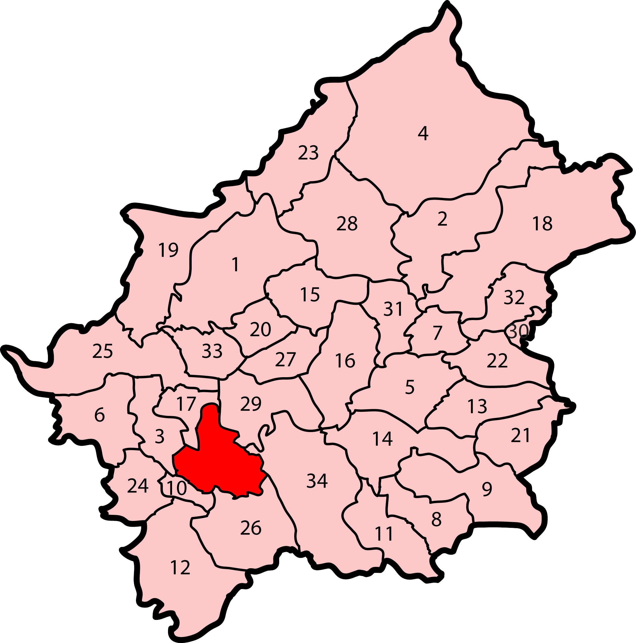
There are 52 councillors representing the electoral wards of the City of Carlisle. Together they form the Carlisle City Council. Councillors are elected and accountable to the residents of their wards.[4]
Ward name Population Councillors' party Ref. Belah 5,986 3 Conservatives [14][15] Belle Vue 5,625 2 Labour, 1 Conservative [14][16] Botcherby 5,866 2 Labour, 1 Independent [14][17] Brampton 4,361 2 Conservatives [14][18] Burgh 1,973 1 Conservative [14][19] Castle 5,452 2 Liberal Democrats, 1 Labour [14][20] Currock 5,927 3 Labour [14][21] Dalston 5,943 2 Conservatives, 1 Liberal Democrat [14][22] Denton Holme 5,172 3 Labour [14][23] Great Corby and Geltsdale 2,028 1 Conservative [14][24] Harraby 5,685 3 Labour [14][25] Hayton 2,031 1 Independent [14][26] Irthing 1,979 1 Conservative [14][27] Longtown and Rockcliffe 3,973 2 Conservatives [14][28] Lyne 1,937 1 Conservative [14][29] Morton 5,942 2 Labour, 1 Liberal Democrat [14][30] St Aidans 5,670 3 Labour [14][31] Stanwix Rural 3,976 2 Conservatives [14][32] Stanwix Urban 5,724 3 Conservatives [14][33] Upperby 5,487 3 Labour [14][34] Wetheral 4,039 2 Conservatives [14][35] Yewdale 5,963 2 Labour, 1 Conservative [14][36] Parishes
See also: List of civil parishes in CumbriaCivil parishes form the bottom tier of local government in England; parish councils are involved in planning permission, management of town and parish centres, and promoting tourism.[37] The City of Carlisle is almost entirely parished, the exception being the central settlement of Carlisle—an unparished area. As of 2008, there were 34 civil parishes in the city, which are:[38]
- Arthuret
- Askerton
- Beaumont
- Bewcastle
- Brampton
- Burgh by Sands
- Burtholme
- Carlatton and Cumrew
- Castle Carrock and Geltsdale
- Cummersdale
- Cumwhitton
- Dalston
- Farlam
- Hayton
- Hethersgill
- Irthington
- Kingmoor
- Kingwater
- Kirkandrews-on-Esk
- Kirklinton Middle
- Midgeholme
- Nether Denton
- Nicholforest
- Orton
- Rockcliffe
- St Cuthbert Without
- Scaleby
- Solport and Stapleton
- Stanwix Rural
- Upper Denton
- Walton
- Waterhead
- Westlinton
- Wetheral
Unparished area of CarlisleCoat of arms
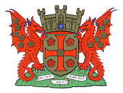
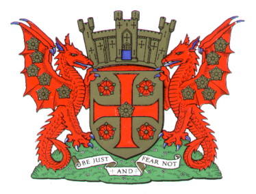
 The coat of arms of Carlisle City Council
The coat of arms of Carlisle City Council are those granted to the city council of the County Borough of Carlisle by the College of Arms on 7 July 1924. These arms are derived from more ancient designs of or relating to Carlisle and its governance.[39]
The city council's coat of arms are emblematic of the city's history. The arms incorporate a golden shield with a red cross, upon a green mount, surmounted by a mural crown, relating to Carlisle's history as an ancient walled city. This is supported by two red wyverns—legendary dragons used in heraldry—their wings strewn with golden roses, with reference to the city's Brythonic history. The motto beneath the arms comes from Thomas Wolsey's speech to Thomas Cromwell, in Shakespeare's play, Henry VIII.[39]
Geography
The City of Carlisle is located at the extreme north of North West England. It encompasses Cumbria's county town, Carlisle, and its surrounding rural hinterland,[40] which together total 1,039.97 square kilometres (402 sq mi) ,[2] making the city the largest in England by area. Although 70% of the city's 100,750 people live in central Carlisle, 98% of the city's land use is rural.[40] The city is traversed by several major rivers, including the Caldew, Eden, and Petteril, and is bisected by the M6, A74(M) and M74 motorways.[41]
Along the City of Carlisle's northern extent is the Solway Firth, which forms the western section of the Anglo-Scottish border, and thus divides the city from Dumfries and Galloway, one of the council areas of Scotland. To the east is the English county of Northumberland; to the south is the district of Eden and to the west and south-west the borough of Allerdale, both in the county of Cumbria.
Much of the city spans the flood plain of the River Eden resulting in large parts of the district being vulnerable to flooding.[42][43] Two further tributaries, the Petteril and Caldew nearly surround the historic walled centre.
Carlisle experiences an oceanic climate (Köppen climate classification Cfb).
Climate data for Carlisle Month Jan Feb Mar Apr May Jun Jul Aug Sep Oct Nov Dec Year Average high °C (°F) 7
(45)8
(46)10
(50)12
(54)16
(61)17
(63)19
(66)20
(68)17
(63)14
(57)10
(50)7
(45)13 Average low °C (°F) 3
(37)3
(37)4
(39)5
(41)7
(45)10
(50)12
(54)12
(54)10
(50)8
(46)5
(41)3
(37)7 Precipitation mm (inches) 63.3
(2.492)76.7
(3.02)46.5
(1.831)43.9
(1.728)54.1
(2.13)61.9
(2.437)57.1
(2.248)71.9
(2.831)62.6
(2.465)90.6
(3.567)69.8
(2.748)83.8
(3.299)782.2
(30.795)Source: [44] Demography
Further information: Demography of CumbriaCarlisle compared 2001 UK Census Carlisle[45] Cumbria[46] England Total population 100,739 487,607 49,138,831 White 99.1% 99.3% 90.9% Asian 0.3% 0.2% 4.6% Black 0.1% 0.1% 2.3% As of the 2001 UK census, the City of Carlisle had a total population of 100,739.[47] Of the 43,963 households in the city, 37.0% were married couples living together, 32.1% were one-person households, 7.6% were co-habiting couples and 9.2% were lone parents. These figures were similar to the national averages.[48]
The population density was 96.9 /km2 (251 /sq mi)[49] and for every 100 females, there were 93.7 males. Of those aged 16–74 in Carlisle, 31.9% had no academic qualifications, significantly higher than 28.9% in all of England.[47] Although Carlisle's ethnic breakdown is similar to that of the wider county of Cumbria, it different to that of England. In comparison to national averages, Carlisle has a low proportion of non-whites.
In 1841, 15.7% of Carlisle's population was middle class compared to 14% in England and Wales; this increased to 18.9% in 1931 (15% nationally) and 35.7% in 2001 (48% nationally). Carlisle's proportion of working class people increased slowly from 1841 to 1931, changing from 33.0% to 37.9 while the national average changed from 37% to 36% in the same period. Since 1931 it has fallen and risen again to 34.0% in 2001 (26% nationally). The rest of the population was made up of clerical workers and skilled manual workers.[50][51]
Population change
The table below details the population change since 1801, including the percentage change since the last available census data. Although the City of Carlisle has existed as a district since 1974, figures have been generated by combining data from the towns, villages, and civil parishes that would later be constituent parts of the city.
Population growth in City of Carlisle since 1801 Year 1801 1811 1821 1831 1841 1851 1861 1871 1881 1891 1901 1911 1921 1931 1941 1951 1961 1971 1981 1991 2001 Population 32,825 37,176 43,500 49,571 51,972 57,378 61,857 66,336 70,816 71,950 74,989 78,160 80,640 83,200 90,127 97,667 99,124 100,607 99,507 101,948 100,798 % change – +13.3 +17.0 +14.0 +4.8 +10.4 +7.8 +7.2 +6.8 +1.6 +4.2 +4.2 +3.2 +3.2 +8.3 +8.4 +1.5 +1.5 −1.1 +2.5 -1.2 Source: Vision of Britain[52] Religion
As of the 2001 UK census, 80.7% of Carlisle's residents reported themselves as Christian, 0.1% Muslim, 0.1% Buddhist, and 0.1% Hindu and 0.1% had an alternative religion. 11.0% had no religion and 7.8% did not state any religion.[47] The city is covered by the Roman Catholic Diocese of Lancaster,[53] and the Church of England Diocese of Carlisle.[54]
Economy
Carlisle compared 2001 UK Census City of Carlisle[55] Cumbria[56] England Population of working age 73,431 354,183 35,532,091 Full time employment 39.0% 36.9% 40.8% Part time employment 14.6% 13.6% 11.8% Self employed 8.2% 9.9% 8.3% Unemployed 3.5% 3.4% 3.3% Retired 15.8% 16.7% 13.5% As of the United Kingdom Census 2001, Carlisle had 73,431 residents aged 16 to 74. Of these people, 2.4% were students with jobs, 3.1% students without jobs, 4.9% looking after home or family, 6.1% permanently sick or disabled and 2.3% economically inactive for other reasons.[55]
In 2001, of 46,858 residents of the City of Carlisle in employment, the industry of employment was 20.4% retail and wholesale, 15.9% manufacturing, 11.1% health and social work, 8.1% property and business services, 7.7% transport and communications, 7.3% construction, 6.4% education, 5.9% hotels and restaurants, 5.8% public administration and defence, 3.1% agriculture, 2.3% finance, 0.7% energy and water supply, 0.3% mining, and 4.5% other. This was roughly in line with national figures, although the proportion of jobs in agriculture which was more than the national average of 1.5% and the percentage of people working in finance was less than half the national average of 4.8%; the proportion of people working in property was also below the national average of 13.2%.[57]
Transportation
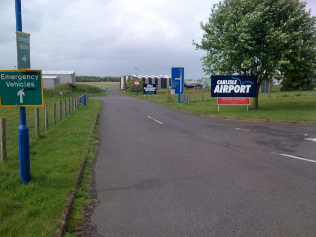
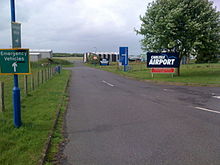 Carlisle Lake District Airport
Carlisle Lake District Airport, owned by the Stobart Group, serves Carlisle, Cumbria. However, as of 2011, Carlisle Lake District Airport does not provide any commercial passenger flights operated by any airline to any destination. Subject to planning application approval by Carlisle City Council, Aer Arann hope to commence a link from Carlisle Lake District Airport to Stobart Air's other base at London Southend Airport before the 2012 Summer Olympics begin in London.
Twin cities
Carlisle has formal twinning arrangements with two northern border cities on mainland Europe. They are Flensburg in northern Germany and Słupsk in northern Poland.[58][59]
Country Place County / District / Region / State Date 
Germany 
Flensburg 
Schleswig-Holstein 1961 
Poland 
Słupsk 
Pomeranian Voivodeship 1987 References
Notes
- ^ Roach, Peter; Hartman, James; Setter, Jane et al., eds. (2006), Cambridge English Pronouncing Dictionary (17th ed.), Cambridge: CUP, ISBN 978-0-521-68086-8
- ^ a b c http://www.cumbriaobservatory.org.uk/elibrary/Content/Internet/536/642/1750/3782414656.pdf Cumbria County Council Census key statistics summary
- ^ About Carlisle, www.historic-carlisle.org.uk, http://www.historic-carlisle.org.uk/historiccarlisle/main.asp?page=4, retrieved 2009-06-22, "Carlisle is the most northerly English City and ... largest in land area"
- ^ a b c Carlisle City Council (2009-05-20) (PDF), Council Constitution and Financial Procedure Rules, carlisle.gov.uk, http://www.carlisle.gov.uk/pdf/COUNCIL%20CONSTITUTION%20and%20FINANCIAL%20PROCEDURE%20RULES%20MAY%202009.pdf, retrieved 2009-06-22[dead link]
- ^ Visionofbritain.org.uk
- ^ HMSO. Local Government Act 1972. 1972 c.70
- ^ British Local Election Database, 1889-2003, AHDS – Arts and Humanities data service, 28 June 2006, http://ahds.ac.uk/catalogue/collection.htm?uri=hist-5319-1 retrieved on 5 March 2008.
- ^ "All change in local affairs", The Times, 1 April 1974
- ^ Carlisle, The Guardian, http://www.guardian.co.uk/politics/constituency/793/carlisle, retrieved 2011-07-15
- ^ Penrith and The Border, The Guardian, http://www.guardian.co.uk/politics/constituency/1218/penrith-and-the-border, retrieved 2011-07-15
- ^ UK MEPs, Europarl.org.uk, http://www.europarl.org.uk/uk_meps/MembersMain.htm[dead link] Retrieved on 23 February 2008.
- ^ "Carlisle local elections 2008", BBC News (news.bbc.co.uk), 2008-05-02, http://news.bbc.co.uk/1/shared/bsp/hi/elections/local_council/08/html/16ud.stm, retrieved 2009-06-22
- ^ Elections 2011, Carlisle.gov.uk, http://www.carlisle.gov.uk/council_and_democracy/democracy_and_elections/elections_2011.aspxhttp://www.carlisle.gov.uk/council_and_democracy/democracy_and_elections/elections_2011.aspx, retrieved 2011-07-15
- ^ a b c d e f g h i j k l m n o p q r s t u v Carlisle City Council members, Carlisle.gov.uk, http://cmis.carlisle.gov.uk/cmis/Members.aspx, retrieved 2011-07-15
- ^ (PDF) Ward profile: Belah, Carlisle.gov.uk, August 2006, http://www.carlisle.gov.uk/pdf/Belah%20Ward%20Profile.pdf, retrieved 2009-06-26
- ^ (PDF) Ward profile: Belle Vue, Carlisle.gov.uk, August 2006, http://www.carlisle.gov.uk/pdf/Belle%20Vue%20Ward%20Profile.pdf, retrieved 2009-06-26
- ^ (PDF) Ward profile: Botcherby, Carlisle.gov.uk, August 2006, http://www.carlisle.gov.uk/pdf/Botcherby%20Ward%20Profile.pdf, retrieved 2009-06-26
- ^ (PDF) Ward profile: Brampton, Carlisle.gov.uk, August 2006, http://www.carlisle.gov.uk/pdf/Brampton%20Ward%20Profile.pdf, retrieved 2009-06-26
- ^ (PDF) Ward profile: Burgh, Carlisle.gov.uk, August 2006, http://www.carlisle.gov.uk/pdf/Burgh%20Ward%20Profile.pdf, retrieved 2009-06-26
- ^ (PDF) Ward profile: Castle, Carlisle.gov.uk, August 2006, http://www.carlisle.gov.uk/pdf/Castle%20Ward%20Profile.pdf, retrieved 2009-06-26
- ^ (PDF) Ward profile: Botcherby, Carlisle.gov.uk, August 2006, http://www.carlisle.gov.uk/pdf/Currock%20Ward%20Profile.pdf, retrieved 2009-06-26
- ^ (PDF) Ward profile: Dalston, Carlisle.gov.uk, August 2006, http://www.carlisle.gov.uk/pdf/Dalston%20Ward%20Profile.pdf, retrieved 2009-06-26
- ^ (PDF) Ward profile: Dalston, Carlisle.gov.uk, August 2006, http://www.carlisle.gov.uk/pdf/Denton%20Holme%20Ward%20Profile.pdf, retrieved 2009-06-26
- ^ (PDF) Ward profile: Longtown & Rockcliffe, Carlisle.gov.uk, August 2006, http://www.carlisle.gov.uk/pdf/Great%20Corby%20Ward%20Profile.pdf, retrieved 2009-06-26[dead link]
- ^ (PDF) Ward profile: Harraby, Carlisle.gov.uk, August 2006, http://www.carlisle.gov.uk/pdf/Harraby%20Ward%20Profile.pdf, retrieved 2009-06-26
- ^ (PDF) Ward profile: Hayton, Carlisle.gov.uk, August 2006, http://www.carlisle.gov.uk/pdf/Hayton%20Ward%20Profile.pdf, retrieved 2009-06-26
- ^ (PDF) Ward profile: Irthing Urban, Carlisle.gov.uk, August 2006, http://www.carlisle.gov.uk/pdf/Irthing%20Ward%20Profile.pdf, retrieved 2009-06-26
- ^ (PDF) Ward profile: Longtown & Rockcliffe, Carlisle.gov.uk, August 2006, http://www.carlisle.gov.uk/pdf/Longtown%20and%20Rockcliffe%20Ward%20Profile.pdf, retrieved 2009-06-26
- ^ (PDF) Ward profile: Lyne, Carlisle.gov.uk, August 2006, http://www.carlisle.gov.uk/pdf/Lyne%20Ward%20Profile.pdf, retrieved 2009-06-26
- ^ (PDF) Ward profile: Morton, Carlisle.gov.uk, August 2006, http://www.carlisle.gov.uk/pdf/Morton%20Ward%20Profile.pdf, retrieved 2009-06-26
- ^ (PDF) Ward profile: St Aidans, Carlisle.gov.uk, August 2006, http://www.carlisle.gov.uk/pdf/St%20Aidans%20Ward%20Profile.pdf, retrieved 2009-06-26
- ^ (PDF) Ward profile: Stanwix Rural, Carlisle.gov.uk, August 2006, http://www.carlisle.gov.uk/pdf/Stanwix%20Rural%20Ward%20Profile.pdf, retrieved 2009-06-26
- ^ (PDF) Ward profile: Stanwix Urban, Carlisle.gov.uk, August 2006, http://www.carlisle.gov.uk/pdf/Stanwix%20Urban%20Ward%20Profile.pdf, retrieved 2009-06-26
- ^ (PDF) Ward profile: Upperby, Carlisle.gov.uk, August 2006, http://www.carlisle.gov.uk/pdf/Upperby%20Ward%20Profile.pdf, retrieved 2009-06-26
- ^ (PDF) Ward profile: Wetheral, Carlisle.gov.uk, August 2006, http://www.carlisle.gov.uk/pdf/Wetheral%20Ward%20Profile.pdf, retrieved 2009-06-26
- ^ (PDF) Ward profile: Yewdale, Carlisle.gov.uk, August 2006, http://www.carlisle.gov.uk/pdf/Yewdale%20Ward%20Profile.pdf, retrieved 2009-06-26
- ^ National Association of Local Councils, What is a town, parish or community council?, nalc.gov.uk, http://www.nalc.gov.uk/About_NALC/What_is_a_parish_or_town_council/What_is_a_council.aspx Retrieved on 26 January 2008.
- ^ Cumbria Association of Local Councils (2008-09-02), Parishes in Carlisle, calc.org.uk, http://www.calc.org.uk/search/carlisle_parishes.asp, retrieved 2009-06-24
- ^ a b Cumbria and Palatine Counties area, civicheraldry.co.uk, http://www.civicheraldry.co.uk/cumbria_palatine_counties.html, retrieved 2009-06-22
- ^ a b Andrew 2004, p. 6.
- ^ Andrew 2004, p. 7.
- ^ "Carlisle 'cut off' by flood water" at BBC News – 8 January 2005, 13:15 UTC
- ^ "Floods leave homes without power" at BBC News – 8 January 2005, 23:31 UTC
- ^ Averages for Carlisle, http://weather.uk.msn.com/monthly_averages.aspx?&wealocations=wc%3aUKXX0226&q=Carlisle%2c+England&setunit=C
- ^ Carlisle Local Authority ethnic group, Statistics.gov.uk, http://neighbourhood.statistics.gov.uk/dissemination/LeadTableView.do?a=7&b=276912&c=Carlisle&d=13&e=16&g=432052&i=1001x1003x1004&o=1&m=0&r=1&s=1245702347445&enc=1&dsFamilyId=87, retrieved 2009-06-22
- ^ Cumbria Education Authority ethnic group, Statistics.gov.uk, http://neighbourhood.statistics.gov.uk/dissemination/LeadTableView.do?a=7&b=3567653&c=Cumbria&d=180&e=16&g=431429&i=1001x1003x1004&o=1&m=0&r=1&s=1245702878179&enc=1&dsFamilyId=87, retrieved 2009-06-22
- ^ a b c Carlisle Local Authority key statistics, Statistics.gov.uk, http://neighbourhood.statistics.gov.uk/dissemination/LeadKeyFigures.do?a=7&b=276912&c=Carlisle&d=13&e=16&g=432052&i=1001x1003x1004&o=1&m=0&r=1&s=1245702347445&enc=1, retrieved 2009-06-22
- ^ Carlisle Local Authority household data, Statistics.gov.uk, http://neighbourhood.statistics.gov.uk/dissemination/LeadTableView.do?a=7&b=276912&c=Carlisle&d=13&e=16&g=432052&i=1001x1003x1004&o=1&m=0&r=1&s=1245702347445&enc=1&dsFamilyId=165, retrieved 2009-06-22
- ^ Carlisle Local Authority population density, Statistics.gov.uk, http://neighbourhood.statistics.gov.uk/dissemination/LeadTableView.do?a=7&b=276912&c=Carlisle&d=13&e=13&g=432052&i=1001x1003x1004&o=1&m=0&r=1&s=1245704012679&enc=1&dsFamilyId=789, retrieved 2009-06-22
- ^ City of Carlisle social class, Vision of Britain, http://www.visionofbritain.org.uk/data_cube_table_page.jsp?data_theme=T_SOC&data_cube=N_SOC_redist&u_id=10057050&c_id=10001043&add=Y, retrieved 2009-06-22
- ^ England social class, Vision of Britain, http://www.visionofbritain.org.uk/data_cube_table_page.jsp?data_theme=T_SOC&data_cube=N_RGSOC_G&u_id=10061325&c_id=10001043&add=Y, retrieved 2009-06-22
- ^ Carlisle District: total population, Vision of Britain, http://www.visionofbritain.org.uk/data_cube_table_page.jsp?data_theme=T_POP&data_cube=N_TPop&u_id=10057050&c_id=10001043&add=N, retrieved 2009-06-22
- ^ The Diocese of Lancaster, Lancaster Diocese, http://www.lancasterdiocese.org.uk/Diocese.asp, retrieved 2009-06-22
- ^ Welcome to the website of the Diocese of Carlisle, Carlisle Diocese, http://www.carlislediocese.org.uk/, retrieved 2009-06-22
- ^ a b Carlisle Local Authority economic activity, Statistics.gov.uk, http://neighbourhood.statistics.gov.uk/dissemination/LeadTableView.do?a=7&b=276912&c=Carlisle&d=13&e=16&g=432052&i=1001x1003x1004&o=1&m=0&r=1&s=1245704141367&enc=1&dsFamilyId=107, retrieved 2009-06-23
- ^ Cumbria Education Authority economic activity, Statistics.gov.uk, http://neighbourhood.statistics.gov.uk/dissemination/LeadTableView.do?a=7&b=3567653&c=Cumbria&d=180&e=16&g=431429&i=1001x1003x1004&o=1&m=0&r=1&s=1245702878179&enc=1&dsFamilyId=107, retrieved 2009-06-23
- ^ City of Carlisle Local Authority industry of employment, Statistics.gov.uk, http://neighbourhood.statistics.gov.uk/dissemination/LeadTableView.do?a=7&b=276912&c=Carlisle&d=13&e=16&g=432052&i=1001x1003x1004&o=1&m=0&r=1&s=1245704141398&enc=1&dsFamilyId=119, retrieved 2009-06-23
- ^ Carlisle City Council, Town twinning, carlisle.gov.uk, http://www.carlisle.gov.uk/leisure_and_culture/tourism_and_travel/town_twinning.aspx, retrieved 2009-06-24
- ^ Town Twinning at Carlisle City Council, carlisletwins.org.uk, http://www.carlisletwins.org.uk/eng/frame.htm, retrieved 2009-06-24
Bibliography
- Andrew, Bennett (2004), Homelessness: Written Evidence: House of Commons Papers 2003-04 1116-Ii, 2, Great Britain: The Stationery Office, ISBN 9780215019691
External links
 Districts of North West England
Cheshire 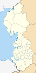
Cumbria Allerdale • Barrow-in-Furness • Carlisle • Copeland • Eden • South Lakeland
Greater Manchester Lancashire Blackburn with Darwen • Blackpool • Burnley • Chorley • Fylde • Hyndburn • Lancaster • Pendle • Preston • Ribble Valley • Rossendale • South Ribble • West Lancashire • Wyre
Merseyside Ceremonial county of Cumbria Boroughs or districts City of Carlisle • Borough of Allerdale • Borough of Barrow-in-Furness • Borough of Copeland • District of Eden • District of South LakelandMajor settlements Alston • Ambleside • Appleby-in-Westmorland • Aspatria • Barrow-in-Furness • Bowness-on-Windermere • Brampton • Broughton-in-Furness • Carlisle • Cleator Moor • Cockermouth • Dalton-in-Furness • Egremont • Grange-over-Sands • Harrington • Kendal • Keswick • Kirkby Lonsdale • Kirkby Stephen • Longtown • Maryport • Millom • Penrith • Sedbergh • Silloth • Ulverston • Whitehaven • Wigton • Windermere • Workington
See also: List of civil parishes in CumbriaTopics Demography • Economy • Education • Geography • History • People • Places of interest • Settlements • Sport • Symbols and county emblems • TransportCities of the United Kingdom England Bath · Birmingham · Bradford · Brighton and Hove · Bristol · Cambridge · Canterbury · Carlisle · Chester · Chichester · Coventry · Derby · Durham · Ely · Exeter · Gloucester · Hereford · Kingston upon Hull · Lancaster · Leeds · Leicester · Lichfield · Lincoln · Liverpool · London · Manchester · Newcastle upon Tyne · Norwich · Nottingham · Oxford · Peterborough · Plymouth · Portsmouth · Preston · Ripon · St Albans · Salford · Salisbury · Sheffield · Southampton · Stoke-on-Trent · Sunderland · Truro · Wakefield · Wells · Westminster · Winchester · Wolverhampton · Worcester · York
Scotland Wales Northern Ireland Categories:- Local government in Cumbria
- Carlisle, Cumbria
- 1974 establishments
- Cities in North West England
- Non-metropolitan districts of Cumbria
- Local government districts of North West England


Wikimedia Foundation. 2010.