- Wells
-
Coordinates: 51°12′26″N 2°39′07″W / 51.2073°N 2.6519°W
Wells 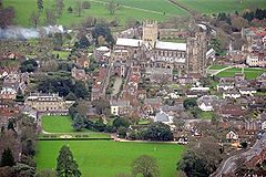
Aerial photograph of Wells
 Wells shown within Somerset
Population 10,406 [1] OS grid reference ST545455 District Mendip Shire county Somerset Region South West Country England Sovereign state United Kingdom Post town WELLS Postcode district BA5 Dialling code 01749 Police Avon and Somerset Fire Devon and Somerset Ambulance South Western EU Parliament South West England UK Parliament Wells List of places: UK • England • Somerset Wells is a cathedral city and civil parish in the Mendip district of Somerset, England, on the southern edge of the Mendip Hills. Although the population recorded in the 2001 census is 10,406,[1] it has had city status since 1205. It is the smallest city in England[2][3] excluding the City of London.
The name Wells derives from the three wells dedicated to Saint Andrew, one in the market place and two within the grounds of the Bishop's Palace and cathedral.[4] There was a small Roman settlement around the wells, but its importance grew under the Saxons when King Ine of Wessex founded a minster church in 704, around which the settlement grew. Wells became a trading centre and involved in cloth making before its involvement in both the English Civil War and the Monmouth Rebellion during the 17th century. In the 19th century, transport infrastructure improved with stations on three different railway lines.
The cathedral and the associated religious and architectural history have made Wells a tourist destination, which provides much of the employment. The city has a variety of sporting and cultural activities and houses several schools including The Blue School, a state coeducational comprehensive school originally founded in 1654 and the independent Wells Cathedral School, which was founded in 909 and is one of the five established musical schools for school-age children in Britain. The historic architecture of the city has also been used as a location for several films and television programmes.
Contents
History
The city was a Roman settlement but only became an important centre under the Saxons when King Ine of Wessex founded a minster church in 704.[5] Two hundred years later, this became the seat of the local bishop; but in 1088, this had been removed to Bath.[6] This caused severe arguments between the canons of Wells and the monks of Bath until the bishopric was renamed as the Diocese of Bath and Wells, to be elected by both religious houses. Wells became a borough some time before 1160 when Bishop Robert granted its first charter. Fairs were granted to the City before 1160.[6]
Wells was listed in the Domesday Book of 1086 as Welle, from the Old English wiells,[7] which was not listed as a town, but included four manors with a population of 132, which implies a population of 500–600.[8] Earlier names for the settlement have been identified which include Fontanetum,[9] in a charter of 725 granted by King Ina to Glastonbury and Fontanensis Ecclesia.[9] Tidesput or Tithesput furlang relates to the area east of the bishops garden in 1245.[10] An established market had been created in Wells by 1136, and it remained under episcopal control until its city charter from Elizabeth I in 1589.[8]
During the English Civil War, Parliamentarian troops used the cathedral to stable their horses and damaged much of the ornate sculpture by using it for firing practice.[11] William Penn stayed in Wells shortly before leaving for America, spending a night at The Crown Inn. Here he was briefly arrested for addressing a large crowd in the market place, but released on the intervention of the Bishop of Bath and Wells.[12]
During the Monmouth Rebellion the rebel army attacked the cathedral in an outburst against the established church and damaged the west front. Lead from the roof was used to make bullets, windows were broken, the organ smashed and horses stabled in the nave.[13] Wells was the final location of the Bloody Assizes on September 23, 1685. In a makeshift court lasting only one day, over 500 men were tried and the majority sentenced to death.[14]
There was a port at Bleadney on the River Axe in the 8th century that enabled goods to be brought to within 3 miles (5 km) of Wells. In the Middle Ages overseas trade was carried out from the port of Rackley. In the 14th century a French ship sailed up the river and by 1388 Thomas Tanner from Wells used Rackley to export cloth and corn to Portugal, and received iron and salt in exchange.[15] Wells had been a centre for cloth making, however in the 16th and 17th centuries this diminished, but the town retained its important market focus.[16]
Wells has had three railway stations. The first station, Priory Road, opened in 1859 and was on the Somerset Central Railway (later the Somerset and Dorset Joint Railway) as the terminus of a short branch from Glastonbury.[17] A second railway, the East Somerset, opened a branch line from Witham in 1862 and built a station to the east of Priory Road.[17] In 1870, a third railway, the Cheddar Valley line branch of the Bristol and Exeter Railway from Yatton, reached Wells and built yet another station, later called Tucker Street.[18] Matters were somewhat simplified when the Great Western Railway acquired both the Cheddar Valley and the East Somerset lines and built a link between the two that ran through the S&DJR's Priory Road station. In 1878, when through trains began running between Yatton and Witham, the East Somerset station closed, but through trains did not stop at Priory Road until 1934. Priory Road closed to passenger traffic in 1951 when the S&DJR branch line from Glastonbury was shut, though it remained the city's main goods depot. Tucker Street closed in 1963 under the Beeching Axe, which closed the Yatton to Witham line to passengers. Goods traffic to Wells ceased in 1964. A Pacific SR West Country, West Country Class steam locomotive no 34092 built by the British Railways Board was named City of Wells following a ceremony in the city's Priory Road station in 1949. It was used to draw the Golden Arrow service between London and the Continent. It was withdrawn from service in 1964, and rescued from a scrapyard in 1971. It is now undergoing a complete restoration on the Keighley and Worth Valley Railway in Yorkshire.[19]
During World War II, Stoberry Park in Wells was the location of a Prisoner of War camp, housing Italian prisoners from the Western Desert Campaign, and later German prisoners after the Battle of Normandy. Penleigh Camp on the Wookey Hole Road was a German working camp.[20]
City status was confirmed and formalised by Queen Elizabeth II by letters patent issued under the Great Seal dated 1 April 1974.[21][22]
Governance
Wells City Council has sixteen councillors, elected from three wards: Central, St.Thomas and St.Cuthbert.[23] It was previously known as Wells Municipal Borough.[24] The City Council has responsibility for local issues, including setting an annual precept (local rate) to cover the council's operating costs and producing annual accounts for public scrutiny. They also evaluate local planning applications and work with the local police, district council officers, and neighbourhood watch groups on matters of crime, security, and traffic. This includes City Centre management including CCTV, an alcohol ban and regulating street trading permissions including the two funfairs held in the Market Place in May and November each year and the Wells In Bloom competition.[23]
The city council's role also includes initiating projects for the maintenance and repair of city facilities, as well as consulting with the district council on the maintenance, repair, and improvement of highways, drainage, footpaths, public transport, and street cleaning. They are involved in the management of the Community Sports Development Centre at the Blue School, the skateboard park and allotments in the grounds of the Bishop's Palace, Burcott Road and Barnes Close. Conservation matters (including trees and listed buildings) and environmental issues are also the responsibility of the council.[23] The Wells city arms show an ash tree surrounded by three wells, with the Latin motto Hoc fonte derivata copia (the fullness that springs from this well).[25]
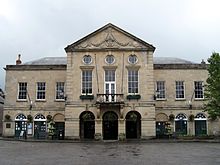
The Town Hall was built in 1778, with the porch and arcade being added in 1861 and the balcony and round windows in 1932. It is a Grade II listed building.[26] It replaced the former on the site of the Market and Assize Hall in the Market Place,[27] and a Canonical House also known as 'The Exchequer', on the authority of an Act of Parliament dated 1779. The building also houses the magistrates courts and other offices. The Assize court last sat here in October 1970.[26]
Wells elects five councillors to Mendip District Council from the same three wards as are used for the City Council.[28] The Mendip District was formed on April 1, 1974 under the Local Government Act 1972. The district council is responsible for local planning and building control, local roads, council housing, environmental health, markets and fairs, refuse collection and recycling, cemeteries and crematoria, leisure services, parks, and tourism.
Wells has one councillor on the Somerset County Council,[29] which is responsible for running the largest and most expensive local services such as education, social services, libraries, main roads, public transport, policing and fire services, trading standards, waste disposal and strategic planning. Wells is part of the UK Parliament constituency of Wells. The current Member of Parliament is Tessa Munt of the Liberal Democrats.[30] Wells is within the South West England constituency of the European Parliament which elects six Members of the European Parliament using the d'Hondt method of party-list proportional representation.
Wells is twinned with Bad Dürkheim in Germany and Paray-le-Monial in the Burgundy region of France.[31][32] HMS Somerset, The Rifles and Harry Patch have the Freedom of the City.[33][34][35]
Geography
Wells lies at the foot of the southern escarpment of the Mendip Hills where they meet the Somerset Levels. The hills are largely made of carboniferous limestone, which is quarried at several nearby sites. In the 1960s, the tallest mast in the region, the Mendip UHF television transmitter, was installed on Pen Hill above Wells.[36]
The water from the springs fills the moat around the Bishops Place and then flows into Keward Brook, which carries it for approximately a mile west to the point where the brook joins the River Sheppey in the village of Coxley.[37]
Along with the rest of South West England, the Mendip Hills have a temperate climate which is generally wetter and milder than the rest of England. The annual mean temperature is about 10 °C (50 °F) with seasonal and diurnal variations, but due to the modifying effect of the sea, the range is less than in most other parts of the United Kingdom. January is the coldest month with mean minimum temperatures between 1 °C (34 °F) and 2 °C (36 °F). July and August are the warmest months in the region with mean daily maxima around 21 °C (70 °F). In general, December is the dullest month and June the sunniest. The south west of England enjoys a favoured location, particularly in summer, when the Azores High extends its influence north-eastwards towards the UK.[38]
Cloud often forms inland, especially near hills, and reduces exposure to sunshine. The average annual sunshine totals around 1600 hours. Rainfall tends to be associated with Atlantic depressions or with convection. In summer, convection caused by solar surface heating sometimes forms shower clouds and a large proportion of the annual precipitation falls from showers and thunderstorms at this time of year. Average rainfall is around 800–900 mm (31–35 in). About 8–15 days of snowfall is typical. November to March have the highest mean wind speeds, with June to August having the lightest. The predominant wind direction is from the south west.[38]
Demography
The population of the civil parish, recorded in the 2001 census, is 10,406.[1] Their average age is 44 years with 2,602 of the people being over the age of 65 years.[39] 4,208 of the population are considered to be economically active.[40] Within the 1,702 people living in the central ward 1,690 are white,[41] and the predominant religion is Christian.[42] Similar profiles are seen amongst the 4,577 people living in St Cuthberts Ward,[43] and the 4,126 living in St Thomas's ward.[44]
Economy
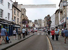
Following construction of the A39/A371 bypass, the centre of town has returned to being a quiet market city. It has all the modern conveniences plus shops, hotels and restaurants.[45] Wells is a popular tourist destination, due to its historical sites,[46] its proximity to Bath, Stonehenge and Glastonbury and its closeness to the Somerset coast. Also nearby are Wookey Hole Caves, the Mendip Hills and the Somerset Levels. Somerset cheese, including Cheddar, is made locally. Wells is part of the Wells & Shepton Mallet Travel to Work Area which also includes Glastonbury, Cheddar and surrounding areas.[47]
Transport
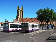
Wells is situated at the junction of three numbered routes. The A39 goes north-east to Bath and south-west to Glastonbury and Bridgwater. The A371 goes north-west to Cheddar and east to Shepton Mallet. The B3139 goes west to Highbridge and north-east to Radstock. Wells is served by FirstGroup bus services to Bristol, Bath, Frome, Shepton Mallet, Yeovil, Street, Bridgwater, Taunton, Burnham on Sea and Weston-super-Mare, as well as providing some local service. Some National Express coach services call at Wells. The bus station is in Princes Road. The Mendip Way and Monarch's Way long-distance footpaths pass through the city, as does National Cycle Route 3.[48]
Education
The Blue School, founded in 1654,[49][50] is a state coeducational comprehensive school and has been awarded Specialist science college status. It has 1,453 students aged 11–18 of both sexes and all ability levels.[51]
Wells Cathedral School, founded in 909, is an independent school that has a Christian emphasis and is one of the five established musical schools for school-age children in Britain. The school teaches over 700 pupils between the ages of 3 and 18. The school's boarding houses line the northern parts of the city and the music school retains close links with Wells Cathedral.[52] The primary schools in Wells are Stoberry Park School, St Cuthbert's Church of England Infants School, St Joseph and St Teresa Catholic Primary School, and Wells Central CofE Junior School.
Culture
Wells and Mendip Museum includes many historical artefacts from the city and surrounding Mendip Hills.[53] Wells is part of the West Country Carnival circuit.
The Wells Film centre shows current releases and, in conjunction with the Wells Film Society shows less well known and historical films.[54] The previous cinema, The Regal in Priory Road, closed in 1993 and is now Kudos Nightclub. It was built in 1935 by ES Roberts from Flemish bond brickwork with Art Deco features. It is a Grade II listed building,[55] and was on the Buildings at Risk Register until its restoration which included the restoration and repair of the stained glass façade.[56] Wells Little Theatre is operated by a voluntary society which started in 1902. In 1989 they took over the old boy's building of Wells Blue School, where they put on a variety of operatic and other productions.[57]
Religious sites
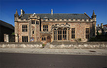
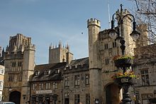
A walled precinct, the Liberty of St Andrew, encloses the twelfth century Cathedral, the Bishop's Palace, Vicar's Close and the residences of the clergy who serve the cathedral. Entrances include the Penniless Porch[58] The Bishop's Eye[59] and Brown's Gatehouse[60] which were all built around 1450.
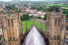
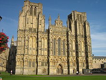
The cathedral is of the Church of England Diocese of Bath and Wells. Wells has been an ecclesiastical city of importance for hundreds of years. Parts of the building date back to the tenth century, and it is a grade I listed building.[61] It is known for its fine fan vaulted ceilings, Lady Chapel and windows, and the scissor arches which support the central tower. The west front is said to be the finest collection of statuary in Europe,[62] retaining almost 300 of its original medieval statues,[63] carved from the cathedral's warm, yellow Doulting stone.[64] The Chapter House, at the top of a flight of stone stairs, leading out from the north transept is an octagonal building with a fan-vaulted ceiling.[65] It is here that the business of running the cathedral is still conducted by the members of the Chapter, the cathedral's ruling body. Wells Cathedral clock is famous for its 24-hour astronomical dial and set of jousting knights that perform every quarter hour. The cathedral has the heaviest ring of ten bells in the world. The tenor bell weighs just over 56 CWT (6,272 lb, 2,844 kg).[66]
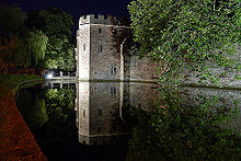
The Bishop's Palace has been the home of the bishops of the Diocese of Bath and Wells for 800 years. The hall and chapel date from the 14th century.[67] There are 14 acres (5.7 ha) of gardens including the springs from which the city takes its name. Visitors can also see the Bishop's private chapel, ruined great hall and the gatehouse with portcullis and drawbridge beside which mute swans ring a bell for food.[68] The Bishop's Barn was built in the 15th century.[69]
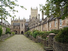
The Vicars' Close is the oldest residential street in Europe.[22] The Close is tapered by 10 feet (3.0 m) to make it look longer when viewed from the bottom. When viewed from the top, however, it looks shorter.[70][71][72][73][74][75] The Old Deanery dates from the 12th century,[76][77][78] and St John's Priory from the 14th.[79]
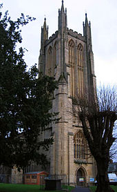
The Church of St Cuthbert (which tourists often mistake for the cathedral) has a fine Somerset stone tower and a superb carved roof. Originally an Early English building (13th century), it was much altered in the Perpendicular period (15th century).[22] The nave's coloured ceiling was repainted in 1963 at the instigation of the then Vicar's wife, Mrs Barnett.[80][81] Until 1561 the church had a central tower which either collapsed or was removed, and has been replaced with the current tower over the west door.[82] Bells were cast for the tower by Roger Purdy.[83]
Sport
The city has two football clubs, one being Wells City F.C., past winners of the Western League.[84] The oldest football club in Wells though is Belrose FC who play their football in the Mid-Somerset Football League at Haybridge Park. Wells Cricket Club runs eight sides across senior, junior and ladies cricket.[85] Wells Wanderers Cricket Club are based in Meare.[86]
Mid Somerset Hockey Club and Wells City Acorns Hockey Club both play on the Astroturf pitches at the Blue School,[87] where several other sports clubs are based.[88] Wells Leisure Centre has a 25 metres (82 ft) swimming pool, gymnasium, sports hall, sauna, steam room, relaxation area and solarium.[89] The 18 hole Wells Golf Club is on the outskirts of the city and also has a driving range.[90]
In popular culture
Elizabeth Goudge used Wells as a basis for the fictional cathedral city of Torminster, in her book City of Bells[91]
Wells has been used as the setting for several films including: The Canterbury Tales (1973),[92] A Fistful of Fingers (1994),[93] The Gathering (2002),[94] The Libertine (2005),[95] The Golden Age (2007),[95] and Hot Fuzz (2007)[96] The cathedral interior stood in for Southwark Cathedral during filming for the Doctor Who episode The Lazarus Experiment.[95]
Notable people
- Herbert E. Balch – cave explorer and founder of Wells Museum.[97][98] His name was given to Balch Road, a council estate that was built in the 1950s.
- Mary Bignall-Rand – Gold medalist and world record breaker in the long jump at the 1964 Summer Olympics.[99]
- Harry George Crandon – awarded the Victoria Cross during the Boer War.[100]
- Sir Chris Clarke – county councillor for Wells from 1985 to 2005.[101]
- Alexander Davie – born in Wells 1847, became 7th Premier of British Columbia.[102]
- Roger Hollis – Director General of MI5.[103]
- John Holloway – Governor of Newfoundland (1807–1809) and Admiral of the Blue.[104]
- John Keate – born in Wells 1773, went on to become headmaster at Eton where he restored discipline with the birch, and once flogged 80 boys in one day.[105]
- James Keene – professional footballer formerly of Portsmouth FC, playing for IF Elfsborg in Sweden.[106]
- Harry Patch – last trench veteran of World War I, and at 111, briefly the oldest man in Europe and 3rd oldest man in the world. He was born in the nearby village of Combe Down and at the time of his death in July 2009 he was living in local care home Fletcher House.[107]
- Hugh of Wells – native of Wells, Bishop, elder brother of Jocelin of Wells.[108][109]
- Jocelin of Wells – native of Wells, Bishop, aided in creation of Magna Carta and largely responsible for the construction of the cathedral.[110]
- Edgar Wright – film and television director.[111] Directed Hot Fuzz, which was filmed in the city.
See also
- Visitor attractions in Somerset
References
- ^ a b c "Parish Population Statistics". ONS Census 2001. Somerset County Council. http://www.webcitation.org/5lRyC5ccr. Retrieved 14 December 2009.
- ^ Else, David (2009). "Great Britain (Lonely Planet Country Guides)". amazon.co.uk. pp. 339. ISBN 978-1741044911. http://books.google.co.uk/books?id=6cBuHueeTCMC&pg=PA339. Retrieved 14 October 2011.
- ^ "Wells City Council". wells.gov.uk. 2011 [last update]. http://www.wells.gov.uk/. Retrieved 14 October 2011. "Wells is Englands smallest city"
- ^ "The Well House". Images of England. http://www.imagesofengland.org.uk/details/default.aspx?id=483263. Retrieved 24 August 2006.
- ^ "Wells Cathedral". Britania.com. http://www.britannia.com/history/somerset/churches/wellscath.html. Retrieved 23 January 2010.
- ^ a b Gathercole, Clare. "An archaeological assessment of Wells". English Heritage Extensive Urban Survey. Somerset County Council. http://www1.somerset.gov.uk/archives/hes/downloads/EUS_WellsText.pdf. Retrieved 4 February 2010.
- ^ Robinson, Stephen (1992). Somerset Place Names. Wimbourne: The Dovecote Press Ltd. ISBN 978-1874336037.
- ^ a b Havinden, Michael (1982). The Somerset Landscape. The making of the English landscape. London: Hodder and Stoughton. pp. 210. ISBN 0340201169.
- ^ a b "A List of the Latin Names of Places in Great Britain and Ireland". White Trash Scriptorium. http://comp.uark.edu/~mreynold/recint2.htm#F. Retrieved 4 February 2010.
- ^ Reid, R.D. (1963). Wells Cathedral. Friends of Wells Cathedral. pp. 10. ISBN 0902321110.
- ^ "Changes of Monarch". History. Wells Cathedral. http://www.wellscathedral.org.uk/history/presentbuilding/changesofmonarch.shtml. Retrieved 15 March 2009.
- ^ Clarkson, Thomas (1827). Memoirs of the Private and Public Life of William Penn. S.C. Stevens. pp. 57. http://books.google.com/?id=02elBDTaOA8C&pg=RA1-PA51&lpg=RA1-PA51&dq=william+penn+wells. Retrieved 28 November 2009.
- ^ "The Monmouth Rebellion and the Bloody Assize". Aspects of Somerset History. Somerset Archive & Record Service. http://www.somerset.gov.uk/archives/ASH/Monmouthreb.htm. Retrieved 1 March 2009.
- ^ "The Bloody Assize". Somerset Archive & Record Service. http://www.somerset.gov.uk/archives/ASH/Bloodyassize.htm. Retrieved 9 October 2007.
- ^ Toulson, Shirley (1984). The Mendip Hills: A Threatened Landscape. London: Victor Gollancz. ISBN 057503453X.
- ^ "Medieval town, Wells". Somerset Historic Environment Record. Somerset County Council. http://webapp1.somerset.gov.uk/her/details.asp?prn=24810. Retrieved 4 February 2010.
- ^ a b "Wells". Somerset & Dorset Joint Railway. http://www.sdjr.net/locations/wells.html. Retrieved 4 February 2010.
- ^ Oakley, Mike (2002). Somerset Railway Stations. Wimborne: Dovecote Press,. pp. 126.
- ^ "City of Wells". Preserved UK Railway Locomotives Database. Heritage Railway Association. http://ukhrail.uel.ac.uk/cgi-bin/rlylocos?REF=1851. Retrieved 4 February 2010.
- ^ Thomas, Roger JC. "Prisoner of War Camps(1939–1948)". English Heritage. http://www.english-heritage.org.uk/upload/pdf/Prisoner_of_War_Camps.pdf. Retrieved 4 February 2010.
- ^ London Gazette, issue no. 46255, April 4, 1974
- ^ a b c Leete-Hodge, Lornie (1985). Curiosities of Somerset. Bodmin: Bossiney Books. pp. 29. ISBN 0906456983.
- ^ a b c "City of Wells". Wells City Council. http://www.wells.gov.uk/. Retrieved 21 September 2007.
- ^ "A Vision of Britain Through Time : Wells Municipal Borough". http://www.visionofbritain.org.uk/relationships.jsp?u_id=10220592&c_id=10001043.
- ^ "Cornwal and Wessex Area". Civic Heraldry of England and Wales. http://www.civicheraldry.co.uk/cornwall_wessex.html. Retrieved 4 February 2010.
- ^ a b "Town Hall". Images of England. http://www.imagesofengland.org.uk/Details/Default.aspx?id=483446. Retrieved 2 March 2009.
- ^ "The Town Hall". Wells City Council. http://www.wells.gov.uk/services/townhall.php. Retrieved 2 March 2009.
- ^ "Your Councillors". Mendip District Council. http://www.mendip.gov.uk/council/councillors.asp?cat=-1. Retrieved 21 September 2007.
- ^ "Somerset County Councillors". http://www1.somerset.gov.uk/council/divisions.asp. Retrieved 2 February 2010.
- ^ "Wells". Election 2010. BBC News. http://news.bbc.co.uk/1/shared/election2010/results/constituency/f02.stm. Retrieved 7 May 2010.
- ^ "Contact". Wells City Council. http://www.wells.gov.uk/contact/links.php. Retrieved 2 March 2009.
- ^ "British and French Twin Towns". France Magazine. http://www.francemag.com/Editorial.aspx?page=3073. Retrieved 2 March 2009.
- ^ "City of Wells". Royal Navy (crown Copyright). http://www.royalnavy.mod.uk/surface-fleet/type-23-frigates/hms-somerset/city-of-wells/174963. Retrieved 28 November 2009.
- ^ "Minutes of the City Council". Wells City Council. 14 February 2007. http://www.wells.gov.uk/pdfs/CNCLMINS-14feb07.pdf. Retrieved 3 March 2009.
- ^ "Freedom of Wells for Britain's oldest soldier". Defence News. Ministry of Defence. 11 July 08. http://www.mod.uk/DefenceInternet/DefenceNews/HistoryAndHonour/FreedomOfWellsForBritainsOldestSoldier.htm. Retrieved 3 March 2009.
- ^ "Mendip Transmitter". A.T.V. (Aerials and Television). http://www.aerialsandtv.com/mendiptx.html. Retrieved 14 March 2010.
- ^ "Nutricia, Glastonbury Rd Wells, Draionage Infrastructure Report". Robert West Consulting. 2008. pp. 6–7. http://www.mendip.gov.uk/pods/documents/documents%5C076028_032%5Cforms%5C076028_032_Drainage%20Infrastructure%20Report.pdf. Retrieved 16 March 2010.
- ^ a b "South West England: climate". Met Office. http://www.metoffice.gov.uk/climate/uk/sw/. Retrieved 14 March 2010.
- ^ "Wells CP Parish Profile - People". 2001 Census data. Office of National Statistics. http://www.neighbourhood.statistics.gov.uk/dissemination/LeadTableView.do?a=7&b=799116&c=Wells&d=16&e=13&g=483115&i=1001x1003x1004&m=0&r=1&s=1268775002518&enc=1&dsFamilyId=781. Retrieved 16 March 2010.
- ^ "Wells CP Parish Profile - Work and qualifications". 2001 Census data. Office of National Statistics. http://www.neighbourhood.statistics.gov.uk/dissemination/LeadTableView.do?a=7&b=799116&c=Wells&d=16&e=9&g=483115&i=1001x1003x1004&m=0&r=1&s=1268775667916&enc=1&dsFamilyId=783. Retrieved 16 March 2010.
- ^ "Area: Wells Central Ethnic Group". 2001 Census data. Office of National Statistics. http://www.neighbourhood.statistics.gov.uk/dissemination/LeadTableView.do?a=7&b=6162762&c=Wells&d=16&e=16&g=483115&i=1001x1003x1004&m=0&r=1&s=1268775941631&enc=1&dsFamilyId=87. Retrieved 16 March 2010.
- ^ "Area: Wells Central Religion". 2001 Census data. Office of National Statistics. http://www.neighbourhood.statistics.gov.uk/dissemination/LeadTableView.do?a=7&b=6162762&c=Wells&d=16&e=16&g=483115&i=1001x1003x1006&k=religion&m=0&r=1&s=1268776145394&enc=1&domainId=16&dsFamilyId=95. Retrieved 16 March 2010.
- ^ "Area: Wells St Cuthbert's (Ward)". 2001 Census data. Office of National Statistics. http://www.neighbourhood.statistics.gov.uk/dissemination/LeadDatasetList.do?a=7&b=799116&c=Wells&d=16&g=483115&i=1001x1003x1006x1018&k=religion&m=0&r=1&s=1268775923069&enc=1&altAreaId=6162763. Retrieved 16 March 2010.
- ^ "Area: Wells St Thomas's (Ward)". 2001 Census data. Office of National Statistics. http://www.neighbourhood.statistics.gov.uk/dissemination/LeadDatasetList.do?a=7&b=799116&c=Wells&d=16&g=483115&i=1001x1003x1006x1018&k=religion&m=0&r=1&s=1268775923069&enc=1&altAreaId=6162764. Retrieved 16 March 2010.
- ^ "Businesses & Shops in Wells". Wells Tourism Web Site. Mendip District Council. http://www.wellstourism.com/shopping/shopping.php. Retrieved 24 April 2010.
- ^ "Somerset Economy". Connexions Somerset. http://www.connexions-somerset.org.uk/jobs/Somersets_economy.html. Retrieved 24 April 2010.
- ^ "Travel to Work Areas, 2001". National Statistics. http://www.statistics.gov.uk/geography/downloads/2001_TTWA_map.pdf. Retrieved 5 March 2009.
- ^ "Ordnance Survey Get-a-map". pp. ST 548 455. http://getamap.ordnancesurvey.co.uk/getamap/frames.htm?mapAction=gaz&gazName=g&gazString=SO9850297782. Retrieved 1 March 2009.
- ^ "Wells Blue School". National Archives. http://www.nationalarchives.gov.uk/a2a/records.aspx?cat=168-ddwbs&cid=0#0. Retrieved 19 March 2010.
- ^ Davidson, Max (2008-08-02). "Town vs gown: Wells, Somerset". The Telegraph. http://www.telegraph.co.uk/education/3356799/Town-vs-gown-Wells-Somerset.html. Retrieved 19 March 2010.
- ^ "Blue School, Wells". Ofsted. http://www.ofsted.gov.uk/oxedu_providers/full/%28urn%29/123892. Retrieved 4 February 2010.
- ^ "Wells Cathedral School". Wells Cathedral School. http://www.wellscathedralschool.org/wells/. Retrieved 2 March 2009.
- ^ "Collections". Wells and Mendip Museum. http://www.wellsmuseum.org.uk/top/collections.html. Retrieved 4 February 2010.
- ^ "The Wells Film Society". The Wells Film Society. http://www.twfs.org.uk/. Retrieved 20 March 2010.
- ^ "Regal Cinema". Images of England. English Heritage. http://www.imagesofengland.org.uk/Details/Default.aspx?id=483491. Retrieved 20 March 2010.
- ^ "Historic Buildings at Risk Register Success Stories". Mendip District Council. pp. 33. http://www.mendip.gov.uk/Documents/Regeneration/Heritage%20Conservation/Documents/Mendip%20Historic%20Buildings%20at%20Risk%20Success%20Stories.pdf. Retrieved 20 March 2010.
- ^ "The Society". Little Theatre Wells. http://www.littletheatrewells.org/?tab=7. Retrieved 20 March 2010.
- ^ "Penniless Porch Gateway to Cathedral Green, Wells". Images of England. English Heritage. http://www.imagesofengland.org.uk/details/default.aspx?id=483442. Retrieved 13 January 2009.
- ^ "The Bishop's Eye, Wells". Images of England. English Heritage. http://www.imagesofengland.org.uk/details/default.aspx?id=483444. Retrieved 13 January 2009.
- ^ "Brown's Gatehouse, Wells". Images of England. English Heritage. http://www.imagesofengland.org.uk/details/default.aspx?id=483519. Retrieved 13 January 2009.
- ^ "Cathedral Church of St Andrew, Chapter House and Cloisters". Images of England. http://www.imagesofengland.org.uk/details/default.aspx?id=483287. Retrieved 24 August 2006.
- ^ "Stop 5: Wells, Somerset". Britannia's Magical History Tour. Britania Travels. http://www.britannia.com/travel/magical/magic6.html. Retrieved 4 February 2010.
- ^ "The West Front". Wells Cathedral. http://www.wellscathedral.org.uk/history/architecture/westfront.shtml. Retrieved 4 February 2010.
- ^ Ashurst, John; Francis G. Dimes (1998). Conservation of building and decorative stone (2 ed.). Butterworth-Heinemann. pp. 102. ISBN 978-0750638982. http://books.google.com/?id=Yh4xMVb7uOQC&pg=PA102&lpg=PA102&dq=Wells+Cathedral+Doulting+stone&q=Wells%20Cathedral%20Doulting%20stone.
- ^ "Chapter House to Cathedral Church of St Andrew". Images of England. http://www.imagesofengland.org.uk/details/default.aspx?id=483286. Retrieved 24 August 2006.
- ^ "Bells". Wells Cathedral. http://www.wellscathedral.org.uk/worship/bells.shtml. Retrieved 4 August 2008.
- ^ "The Bishop's Palace and Bishop's House". Images of England. http://www.imagesofengland.org.uk/details/default.aspx?id=483259. Retrieved 24 August 2006.
- ^ "Bishop receives Royal swan gift". BBC News. 19 September 2006. http://news.bbc.co.uk/1/hi/england/somerset/5359808.stm. Retrieved 10 November 2007.
- ^ "The Bishop's Barn, Wells". Images of England. English Heritage. http://www.imagesofengland.org.uk/details/default.aspx?id=483576. Retrieved 13 January 2009.
- ^ "Nos.1-13 Vicars Close, Wells". Images of England. English Heritage. http://www.imagesofengland.org.uk/details/default.aspx?id=483615. Retrieved 13 January 2009.
- ^ "Nos.14-27 Vicars Close, Wells". Images of England. English Heritage. http://www.imagesofengland.org.uk/details/default.aspx?id=483617. Retrieved 13 January 2009.
- ^ "Boundary walls to Nos.1-13 Vicars Close, Wells". Images of England. English Heritage. http://www.imagesofengland.org.uk/details/default.aspx?id=483616. Retrieved 13 January 2009.
- ^ "Boundary walls to Nos.14-27 Vicars Close, Wells". Images of England. English Heritage. http://www.imagesofengland.org.uk/details/default.aspx?id=483618. Retrieved 13 January 2009.
- ^ "The Vicars' Chapel Vicars Close, Wells". Images of England. English Heritage. http://www.imagesofengland.org.uk/details/default.aspx?id=483619. Retrieved 13 January 2009.
- ^ "The Vicars' Hall Vicars Close, Wells". Images of England. English Heritage. http://www.imagesofengland.org.uk/details/default.aspx?id=483620. Retrieved 13 January 2009.
- ^ "Gatehouse and south boundary wall to the Old Deanery, Wells". Images of England. English Heritage. http://www.imagesofengland.org.uk/details/default.aspx?id=483311. Retrieved 13 January 2009.
- ^ "Old Deanery Court, with link wall along east side The Old Deanery, Wells". Images of England. English Heritage. http://www.imagesofengland.org.uk/details/default.aspx?id=483310. Retrieved 13 January 2009.
- ^ "The Old Deanery, Wells". Images of England. English Heritage. http://www.imagesofengland.org.uk/details/default.aspx?id=483309. Retrieved 13 January 2009.
- ^ "No.2 St John's Priory, with front boundary wall and railings, Wells". Images of England. English Heritage. http://www.imagesofengland.org.uk/details/default.aspx?id=483533. Retrieved 13 January 2009.
- ^ "Church of St Cuthbert". Images of England. http://www.imagesofengland.org.uk/details/default.aspx?id=483529. Retrieved 24 August 2006.
- ^ "Nos.14-27 Vicars Close". Images of England. http://www.imagesofengland.org.uk/details/default.aspx?id=483617. Retrieved 24 August 2006.
- ^ "Our Church". St Cuthbert, Wells. http://www.stcuthbertswells.co.uk/our_church.html. Retrieved 5 March 2008.
- ^ "Bells in St Cuthberts Tower, Wells, Somerset". Notes & Queries s2-IV(93): 284–285. 1857. doi:10.1093/nq/s2-IV.93.284-b.
- ^ "Wells City". Football Club History Database. http://www.fchd.info/WELLSC.HTM. Retrieved 4 February 2010.
- ^ "Wells Cricket Club". Wells Cricket Club. http://www.wellscricketclub.co.uk/. Retrieved 4 February 2010.
- ^ "Wells Wanderers CC". Wells Wanderers CC. http://www.wellswandererscc.co.uk/. Retrieved 4 February 2010.
- ^ "Mid Somerset Hockey Club". Mid Somerset Hockey Club. http://www.midsomersethockeyclub.com/. Retrieved 4 February 2010.
- ^ "Wells Blue Sports Centre". The Blue School. http://www.theblueschoolwells.co.uk/home_wells-blue-sports-centre_7.htm. Retrieved 4 February 2010.
- ^ "Wells Leisure Centre". Avalon leisure. http://www.avalonleisure.co.uk/wells-leisure-centre.html. Retrieved 4 February 2010.
- ^ "The Course". Wells Golf Club. http://wellsgolfclub.webs.com/thecourse.htm. Retrieved 4 February 2010.
- ^ Gaudin, Deborah. "A Short Biography of Elizabeth Goudge". Elizabeth Goudge Society. http://www.elizabethgoudge.org/a_short_biography_of_elizabeth_g.htm. Retrieved 4 February 2010.
- ^ "Wells Tourist Information". iknow Somerset. http://www.iknow-somerset.co.uk/tourist_information/central_somerset/wells/wells_tourist_information.htm. Retrieved 16 March 2010.
- ^ "A Fistful of Fingers". IMDB. http://www.imdb.com/title/tt0131396/. Retrieved 4 February 2010.
- ^ "Filming locations for The Gathering". IMDB. http://www.imdb.com/title/tt0294594/locations. Retrieved 4 February 2010.
- ^ a b c "Showbiz Somerset". Art, films and television. BBC. http://www.bbc.co.uk/somerset/content/articles/2005/07/26/somerset_film_tv_locations_feature.shtml. Retrieved 4 February 2010.
- ^ "Hot Fuzz-Production Notes p.2". CinemaReview. http://www.cinemareview.com/production.asp?prodid=4056. Retrieved 23 March 2009.
- ^ Hooper, James (7 June 1994). "To he who lit the Stygian caves". Depth through thought -OUCC News. Oxford University Cave Club. http://www.oucc.org.uk/dtt/vol04/dtt4_24.htm. Retrieved 2 May 2008.
- ^ "Wells Natural History and Archaeological Society". Wells Museum website. http://www.wellsmuseum.org.uk/top/society.html. Retrieved 4 February 2010.
- ^ "Wells Market Place". City of Wells. http://www.wells.gov.uk/services/marketplace.php. Retrieved 4 February 2010.
- ^ "Grave Location for Holders of the Victoria Cross In the City of Manchester". The Victoria Cross Website. http://www.homeusers.prestel.co.uk/stewart/manchest.htm. Retrieved 25 September 2007.
- ^ Sir Chris Clarke OBE has died dated 16 December 2009 at wellslibdems.org.uk
- ^ "Davie, Alexander Edmund Batson". Dictionary of Canadian Biography Online. http://www.biographi.ca/009004-119.01-e.php?&id_nbr=5466. Retrieved 4 February 2010.
- ^ Trahair, R.C.S (2004). Encyclopedia of Cold War espionage, spies, and secret operations. Greenwood Press. pp. 122. ISBN 978-0313319556. http://books.google.com/?id=VNSMrps8mpcC&pg=PA122&lpg=PA122&dq=Roger+Hollis+Wells+Somerset&q=Roger%20Hollis%20Wells%20Somerset.
- ^ "Holloway, John". Dictionary of Canadian Biography Online. http://www.biographi.ca/009004-119.01-e.php?&id_nbr=2916. Retrieved 4 February 2010.
- ^ Wells in Venn, J. & J. A., Alumni Cantabrigienses, Cambridge University Press, 10 vols, 1922–1958.
- ^ "James Keene". Goalserve. http://www.goalserve.com/zh/info/soccer/player/james-keene/6235. Retrieved 20 March 2010.
- ^ "WWI veteran Patch dies aged 111". BBC News. 25 July 2009. http://news.bbc.co.uk/1/hi/uk/8168691.stm. Retrieved 5 January 2010.
- ^ Greenway Fasti Ecclesiae Anglicanae 1066–1300: volume 7: Bath and Wells: Bishops
- ^ Gibbs and Lang Bishops and Reform p. 186
- ^ Greenway Fasti Ecclesiae Anglicanae 1066–1300: volume 7: Bath and Wells: Canons whose prebends cannot be identified
- ^ Davidson, Max (2008-08-02). "Town vs gown: Wells, Somerset". Telegraph. http://www.telegraph.co.uk/education/3356799/Town-vs-gown-Wells-Somerset.html. Retrieved 4 February 2010.
External links
Towns, villages and hamlets in the Mendip district of Somerset, England  Ashwick · Baltonsborough · Batcombe · Beckington · Berkley · Binegar · Buckland Dinham · Chewton Mendip · Chilcompton · Coleford · Cranmore · Croscombe · Ditcheat · Doulting · Downhead · East Lydford · East Pennard · Emborough · Evercreech · Frome · Glastonbury · Godney · Great Elm · Hemington · Holcombe · Kilmersdon · Lamyat · Leigh-on-Mendip · Litton · Lullington · Lydford-on-Fosse · Meare · Mells · Milton Clevedon · North Wootton · Norton St Philip · Nunney · Pilton · Priddy · Pylle · Rode · Rodney Stoke · Rudge · Selwood · Sharpham · Shepton Mallet · St Cuthbert Out · Stoke St Michael · Ston Easton · Stratton-on-the-Fosse · Street · Tellisford · Trudoxhill · Upton Noble · Walton · Wanstrow · Wells · West Bradley · West Lydford · West Pennard · Westbury-sub-Mendip · Whatley · Witham Friary · Wookey · Wookey Hole
Cities of the United Kingdom England Bath · Birmingham · Bradford · Brighton and Hove · Bristol · Cambridge · Canterbury · Carlisle · Chester · Chichester · Coventry · Derby · Durham · Ely · Exeter · Gloucester · Hereford · Kingston upon Hull · Lancaster · Leeds · Leicester · Lichfield · Lincoln · Liverpool · London · Manchester · Newcastle upon Tyne · Norwich · Nottingham · Oxford · Peterborough · Plymouth · Portsmouth · Preston · Ripon · St Albans · Salford · Salisbury · Sheffield · Southampton · Stoke-on-Trent · Sunderland · Truro · Wakefield · Wells · Westminster · Winchester · Wolverhampton · Worcester · York
Scotland Wales Northern Ireland Ceremonial county of Somerset Unitary authorities Boroughs or districts Major settlements - Axbridge
- Bath
- Bridgwater
- Bruton
- Burnham-on-Sea
- Castle Cary
- Chard
- Clevedon
- Crewkerne
- Dulverton
- Frome
- Glastonbury
- Highbridge
- Ilminster
- Keynsham
- Langport
- Midsomer Norton
- Minehead
- Nailsea
- North Petherton
- Portishead
- Radstock
- Shepton Mallet
- Somerton
- South Petherton
- Taunton
- Watchet
- Wellington
- Wells
- Weston-super-Mare
- Wincanton
- Wiveliscombe
- Yeovil
See also: List of civil parishes in Somerset
Rivers - Alham
- Aller
- Avill
- Avon
- Axe (Bristol Channel)
- Axe (Lyme Bay)
- Badgworthy Water
- Banwell
- Barle
- Brue
- Cam Brook
- Cary
- Chew
- East Lyn
- Exe
- Fivehead
- Frome
- Haddeo
- Hoar Oak Water
- Holford
- Horner
- Huntspill
- Isle
- Land Yeo
- Mells
- Midford Brook
- Oare Water
- Parret
- Severn Estuary
- Sheppey
- Somer
- Sowy
- Tone
- Washford
- Wellow Brook
- West Lyn
- Whitelake
- Yeo (Congresbury)
- Yeo (South Somerset)
Topics - County Council
- Culture of Somerset
- Economy of Somerset
- Geography of Somerset
- Geology of Somerset
- History of Somerset
- Museums
- Transport in Somerset
Geographic areas: Blackdown Hills - Brendon Hills
- Chew Valley
- Exmoor
- Mendip Hills
- Polden Hills
- Quantock Hills
- Somerset Levels
- South West Coast Path
- West Somerset Coast Path
Categories:- Mendip Hills
- Prisoner of war camps in the United Kingdom
- Wells, Somerset
- Monarch's Way
- Civil parishes in Somerset
- Cities in South West England
- Market towns in Somerset
- Mendip
Wikimedia Foundation. 2010.


