- Cheddar
-
This article is about the settlement in Somerset, England. For the cheese, see Cheddar cheese. For other uses, see Cheddar (disambiguation).
Coordinates: 51°16′44″N 2°46′41″W / 51.279°N 2.778°W
Cheddar 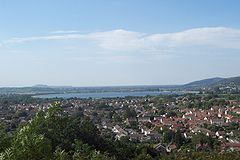
Cheddar village, looking due west from the tower at Jacob's Ladder
 Cheddar
Cheddar shown within SomersetPopulation 5,093 [1] OS grid reference ST458535 District Sedgemoor Shire county Somerset Region South West Country England Sovereign state United Kingdom Post town CHEDDAR Postcode district BS27 Dialling code 01934 Police Avon and Somerset Fire Devon and Somerset Ambulance South Western EU Parliament South West England UK Parliament Wells List of places: UK • England • Somerset Cheddar is a large village and civil parish in the Sedgemoor district of the English county of Somerset. It is situated on the southern edge of the Mendip Hills, 9 miles (14 km) north-west of Wells. The civil parish includes the hamlets of Nyland and Bradley Cross. The village, which has its own parish council, has a population of 5,093 and the parish has an acreage of 8,592 acres (3,477 ha) as of 1961.[2]
Cheddar Gorge is the largest gorge in the United Kingdom and includes several show caves including Gough's Cave. The gorge has been a centre of human settlement since Neolithic times, including a Saxon palace. It has a temperate climate and provides a unique geological and biological environment that has been recognised by the designation of several Sites of Special Scientific Interest.[3] It is also the site of several limestone quarries. The village gave its name to Cheddar cheese and has been a centre for strawberry growing, with the crop being transported on the Cheddar Valley line, which closed in the late 1960s but is now a cycle path. It is now a major tourist destination with several cultural and community facilities, including the Cheddar Show Caves Museum.[4]
The village supports a variety of community groups including religious, sporting and cultural organisations. Several of these are based on the site of The Kings of Wessex School, which is the largest educational establishment.
Contents
History
There is evidence of occupation from the Neolithic period in Cheddar. Britain's oldest complete human skeleton, Cheddar Man, estimated to be 9,000 years old, was found in 1903.[5] Older remains from the Upper Late Palaeolithic era (12,000–13,000 years ago) have been found.[6] There is some evidence of a Bronze Age field system at the Batts Combe quarry site. The remains of a Roman villa have been excavated in the grounds of the current vicarage.[7]
 Reconstruction of the Saxon royal palace at Cheddar around 1000 AD
The village of Cheddar had been important during the Roman and Saxon eras. There was a royal palace at Cheddar during the Saxon period, which was used on three occasions in the 10th century to host the Witenagemot.[8] The ruins of the palace were excavated in the 1960s.[9] They are located on the grounds of The Kings of Wessex School, together with a 14th century chapel dedicated to St. Columbanus.[10] Roman remains have also been uncovered at the site.[9][11] Cheddar was listed in the Domesday Book of 1086 as Ceder, meaning "Shear Water", from the Old English scear and Celtic dwr.[12] As early as 1130 AD, the Cheddar Gorge was recognised as one of the "Four wonders of England". Historically, Cheddar's source of wealth was farming and cheese making for which it was famous as early as 1170 AD.[13] The parish was part of the Winterstoke Hundred.[14]
As early as 1527 there are records of watermills on the river.[9] In the 17th and 18th centuries, there were several watermills which ground corn and made paper, with 13 mills on the Yeo at the peak, declining to seven by 1791 and just three by 1915.[15] In the Victorian era it also became a centre for the production of clothing.[16] The last mill, used as a shirt factory, closed in the early 1950s.[15] William Wilberforce saw the poor conditions of the locals when he visited Cheddar in 1789. He inspired Hannah More in her work to improve the conditions of the Mendip miners and agricultural workers.[17] In 1801, 4,400 acres (18 km2) of common land were enclosed under the Inclosure Acts.[18]
Tourism of the Cheddar gorge and caves began with the opening of the Cheddar Valley Railway in 1869.[19]
Cheddar, its surrounding villages and specifically the gorge has been subject to flooding. In the Great Flood of 1968 the flow of water washed large boulders down the gorge, washed away cars, and damaged the cafe and the entrance to Gough's Cave.[20][21]
Government
Cheddar is recognised as a village.[22][23] The adjacent settlement of Axbridge, although only about a third the population of Cheddar, is a town.[24][25][26] This apparently illogical situation is explained by the relative importance of the two places in historic times. While Axbridge grew in importance as a centre for cloth manufacturing in the Tudor period and gained a charter from King John, Cheddar remained a more dispersed mining and dairy-farming village. Its population grew with the arrival of the railways in the Victorian era and the advent of tourism.[27]
The parish council, which has 15 members who are elected for four years,[28] is responsible for local issues, including setting an annual precept (local rate) to cover the council’s operating costs and producing annual accounts for public scrutiny. The parish council evaluates local planning applications and works with the police, district council officers, and neighbourhood watch groups on matters of crime, security, and traffic. The parish council's role also includes initiating projects for the maintenance and repair of parish facilities, as well as consulting with the district council on the maintenance, repair, and improvement of highways, drainage, footpaths, public transport, and street cleaning. Conservation matters (including trees and listed buildings) and environmental issues are also the responsibility of the council.[29]
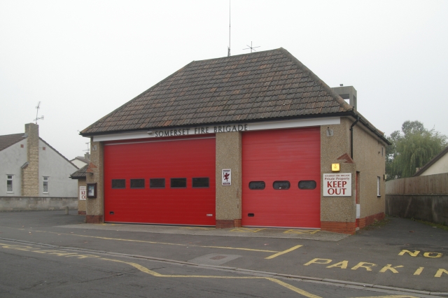
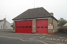 Cheddar Fire Station has a crew of retained firefighters
The village falls within the Non-metropolitan district of Sedgemoor, which was formed on 1 April 1974 under the Local Government Act 1972. It was previously part of Axbridge Rural District.[30] Sedgemoor is responsible for local planning and building control, local roads, council housing, environmental health, markets and fairs, refuse collection and recycling, cemeteries and crematoria, leisure services, parks, and tourism.[31] Somerset County Council is responsible for running the largest and most expensive local services such as education, social services, the library, roads, public transport, trading standards, waste disposal and strategic planning, although fire, police and ambulance services are provided jointly with other authorities through the Devon and Somerset Fire and Rescue Service, Avon and Somerset Constabulary and the Great Western Ambulance Service.[32]
It is also part of the Wells county constituency represented in the House of Commons of the Parliament of the United Kingdom.[33] It elects one Member of Parliament (MP) by the first past the post system of election, and is part of the South West England constituency of the European Parliament which elects six MEPs using the d'Hondt method of party-list proportional representation.
Cheddar is twinned with Felsberg, Germany and Vernouillet, France, and it has an active programme of exchange visits.[34][35] Initially, Cheddar twinned with Felsberg in 1984. In 2000, Cheddar twinned with Vernouillet, which had also been twinned with Felsberg.[36] Cheddar also has a friendship link with Ocho Rios in Saint Ann Parish, Jamaica.[34][37]
Geography
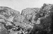 Cheddar Gorge c. 1907
The area is underlain by Black Rock slate, Burrington Oolite and Clifton Down Limestone of the Carboniferous Limestone Series, which contain ooliths and fossil debris on top of Old Red Sandstone, and by Dolomitic Conglomerate of the Keuper. Evidence for Variscan orogeny is seen in the sheared rock and cleaved shales. In many places weathering of these strata has resulted in the formation of immature calcareous soils.[38]
Gorge and caves
Main article: Cheddar GorgeCheddar Gorge, which is located on the edge of the village, is the largest gorge in the United Kingdom.[39] The gorge is the site of the Cheddar Caves, where Cheddar Man was found in 1903.[5] Older remains from the Upper Late Palaeolithic era (12,000–13,000 years ago) have been found.[6] The caves, produced by the activity of an underground river, contain stalactites and stalagmites. Gough's Cave, which was discovered in 1903,[40] leads around 400 m (437 yd) into the rock-face, and contains a variety of large rock chambers and formations. Cox's Cave, discovered in 1837,[41] is smaller but contains many intricate formations. A further cave houses a children's entertainment walk known as the "Crystal Quest".[42]
Cheddar Gorge, including Cox's Cave, Gough's Cave and other attractions, has become a tourist destination, attracting about 500,000 visitors per year.[43] In a 2005 poll of Radio Times readers, following its appearance on the 2005 television programme Seven Natural Wonders, Cheddar Gorge was named as the second greatest natural wonder in Britain, surpassed only by the Dan yr Ogof caves.[44]
Sites of Special Scientific Interest
There are several large and unique Sites of Special Scientific Interest (SSSI) around the village.
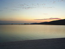
Cheddar Reservoir is a near-circular artificial reservoir operated by Bristol Water. Dating from the 1930s, it has a capacity of 135 million gallons (614,000 cubic metres).[45] The reservoir is supplied with water taken from the Cheddar Yeo, which rises in Gough's Cave in Cheddar Gorge and is a tributary of the River Axe. The inlet grate for the 54-inch (1.4 m) water pipe that is used to transport the water can be seen next to the sensory garden in Cheddar Gorge.[46] It has been designated as a Site of Special Scientific Interest (SSSI) due to its wintering waterfowl populations.[47]
Cheddar Wood and the smaller Macall's Wood form a biological Site of Special Scientific Interest from what remains of the wood of the Bishops of Bath and Wells in the 13th century and of King Edmund the Magnificent's wood in the 10th. During the 19th century, its lower fringes were grubbed out to make strawberry fields. Most of these have been allowed to revert to woodland. The wood was coppiced until 1917.[48] This site compromises a wide range of habitats which include ancient and secondary semi-natural broadleaved woodland, unimproved neutral grassland, and a complex mosaic of calcareous grassland and acidic dry dwarf-shrub heath. Cheddar Wood is one of only a few English stations for Starved Wood-sedge (Carex depauperata).[49] Purple Gromwell (Lithospermum purpurocaeruleum), a nationally rare plant, also grows in the wood.[49] Butterflies include Silver-washed Fritillary (Argynnis paphia), Dark Green Fritillary (Argynnis aglaja), Pearl-bordered Fritillary (Boloria euphrosyne), Holby Blue (Celastrina argiolus) and Brown Argus (Aricia agestis). The slug (Arion fasciatus), which has a restricted distribution in the south of England, and the Soldier beetle (Cantharis fusca) also occur.[49]
By far the largest of the SSSIs is called Cheddar Complex and covers 441.3 hectares (1,090.5 acres) of the gorge, caves and the surrounding area. It is important for both biological and geological features. It includes four SSSIs, formerly known as Cheddar Gorge SSSI, August Hole/Longwood Swallet SSSI, GB Cavern Charterhouse SSSI and Charterhouse on-Mendip SSSI.[50] It is partly owned by the National Trust who acquired it in 1910[51] and partly managed by the Somerset Wildlife Trust.[50][52]
Quarries
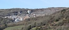 Batts Combe Quarry from the lookout tower above Cheddar Gorge
Close to the village and gorge are Batts Combe quarry and Callow Rock quarry, two of the active Quarries of the Mendip Hills where limestone is still extracted. Operating since the early 20th century, Batts Combe is owned and operated by Hanson Aggregates. The output in 2005 was around 4,000 tonnes of limestone per day, one third of which was supplied to an on-site lime kiln, which closed in 2009;[53] the remainder was sold as coated or dusted aggregates. The limestone at this site is close to 99 percent carbonate of calcium and magnesium (dolomite).[54]
The Chelmscombe Quarry finished its work as a limestone quarry in the 1950s and was then used by the Central Electricity Generating Board as a Tower testing station.[55] During the 1970s and 1980s it was also used to test the ability of containers of radioactive material to withstand impacts and other accidents.[56]
Climate
Along with the rest of South West England, Cheddar has a temperate climate which is generally wetter and milder than the rest of the country.[57] The annual mean temperature is approximately 10 °C (50.0 °F). Seasonal temperature variation is less extreme than most of the United Kingdom because of the adjacent sea, which moderates temperature. The summer months of July and August are the warmest with mean daily maxima of approximately 21 °C (69.8 °F). In winter mean minimum temperatures of 1 °C (33.8 °F) or 2 °C (35.6 °F) are common.[57] In the summer the Azores high-pressure system affects the south-west of England. Convective cloud sometimes forms inland, reducing the number of hours of sunshine; annual sunshine rates are slightly less than the regional average of 1,600 hours.[57] In December 1998 there were 20 days without sun recorded at Yeovilton. Most the rainfall in the south-west is caused by Atlantic depressions or by convection. Most of the rainfall in autumn and winter is caused by the Atlantic depressions, which are most active during those seasons. In summer, a large proportion of the rainfall is caused by sun heating the ground leading to convection and to showers and thunderstorms. Average rainfall is around 700 mm (28 in). About 8–15 days of snowfall per year is typical. November to March have the highest mean wind speeds, and June to August have the lightest winds. The predominant wind direction is from the south-west.[57]
Settlements and geographic features near Cheddar 
Shipham Mendip Hills Mendip Hills
Cheddar GorgeAxbridge 
Mendip Hills
Priddy Cheddar

Somerset Levels Somerset Levels
WedmoreWells Demography
The parish has a population of 5,093,[1] with a mean age of 43 years.[58] Residents live in 2,209 households. The vast majority of households (2,183) give their ethnic status as white.[59]
Economy
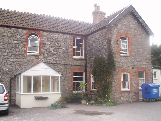
 Cheddar Youth Hostel
The village gave its name to Cheddar cheese,[60] which is the most popular type of cheese in the United Kingdom.[61] The cheese is now made and consumed worldwide, and only one producer remains in the village.
Since the 1880s, Cheddar's other main produce has been the strawberry,[62] which is grown on the south-facing lower slopes of the Mendip hills.[9] As a consequence of its use for transporting strawberries to market, the since-closed Cheddar Valley line became known as The Strawberry Line after it opened in 1869.[63][64] The line closed in the 1960s, when it became part of the Cheddar Valley Railway Nature Reserve.[65] It ran from Yatton to Wells. When the rest of the line was closed and all passenger services ceased, the section of the line between Cheddar and Yatton remained open for goods traffic. It provided a fast link with the main markets for the strawberries in Birmingham and London, but finally closing in 1964.[66]
Cheddar Ales is a small brewery based in the village, producing beer for local public houses.[67] Tourism is a significant source of employment. Around 15 percent of employment in Sedgemoor is provided by tourism,[68] but within Cheddar it is estimated to employ as many as 1,000 people.[69] The village also has a youth hostel,[70] and a number of camping and caravan sites.[71]
Culture and community
Cheddar has a number of active service clubs including Cheddar Vale Lions Club, Mendip Rotary and Mendip Inner Wheel Club.[72] The clubs raise money for projects in the local community and hold annual events such as a fireworks display, duck races in the Gorge, a dragon boat race on the reservoir and concerts on the grounds of the nearby St Michael's Cheshire Home.[73]
Several notable people have been born or lived in Cheddar. Musician Jack Bessant, the bass guitarist with the band Reef grew up on his parents' strawberry farm,[74] and Matt Goss and Luke Goss, former members of Bros, lived in Cheddar for nine months as children.[75] Trina Gulliver, eight-time World Professional Darts Champion, currently lives in Cheddar.[76] The comedian Richard Herring grew up in Cheddar.[77] His 2008 Edinburgh Festival Fringe show, The Headmaster's Son is based on his time at The Kings of Wessex School, where his father Keith was the headmaster.[78] The final performance of this show was held at the school in November 2009.[79] He also visited the school in March 2010 to perform his show Hitler Moustache.[80]
Landmarks
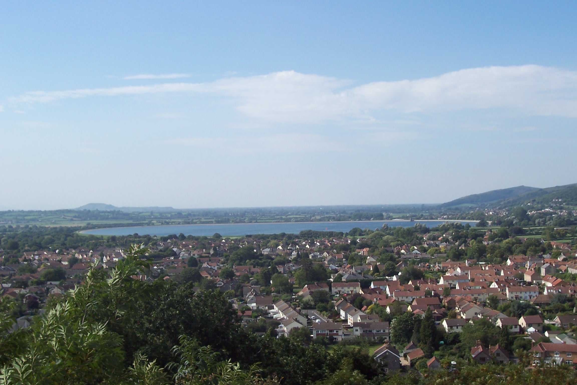
 Photochrom of Cheddar Market Cross in the 1890s
The market cross in Bath Street dates from the 15th century, with the shelter having been rebuilt in 1834. It has a central octagonal pier, a socket raised on four steps, hexagonal shelter with six arched four-centred openings, shallow two-stage buttresses at each angle, an and embattled parapet. The shaft is crowned by an abacus with figures in niches, probably from the late 19th century, although the cross is now missing. It was rebuilt by Thomas, Marquis of Bath. It is a Scheduled Ancient Monument (Somerset County No 21) and Grade II* listed building.[81] In January 2000, the cross was seriously damaged in a traffic accident.[82][83] By 2002, the cross had been rebuilt and the area around it was redesigned to protect and enhance its appearance.[84]
Hannah More, a philanthropist and educator, founded a school in the village in the late 18th century for the children of miners. Her first school was located in a 17th-century house. Now named "Hannah More's Cottage",[85] the Grade II-listed building is used by the local community as a meeting place.[86]
Transport
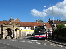 A First Somerset and Avon bus picks up passengers at the Market cross on service 126 from Weston-super-Mare to Wells, the principal bus service through Cheddar
The village is situated on the A371 road which runs from Wincanton, to Weston-super-Mare.[87] It is approximately 5 miles (8.0 km) from the route of the M5 motorway with around a 10 miles (16 km) drive to junction 21 or 22.[88]
It was on the Cheddar Valley line, a railway line that was opened in 1869 and closed in 1963. It became known as The Strawberry Line because of the large volume of locally-grown strawberries that it carried. It ran from Yatton railway station through Cheddar to Wells (Tucker Street) railway station and joined the East Somerset Railway to make a through route via Shepton Mallet (High Street) railway station to Witham. Sections of the now-disused railway have been opened as the Strawberry Line Trail, which currently runs from Yatton to Cheddar. The Cheddar Valley line survived until the "Beeching Axe". Towards the end of its life there were so few passengers that diesel railcars were sometimes used. The Cheddar branch closed to passengers on 9 September 1963 and to goods in 1964.[66] The line closed in the 1960s, when it became part of the Cheddar Valley Railway Nature Reserve,[65] and part of the National Cycle Network route 26. The cycle route also interests with the West Mendip Way and various other footpaths.[89]
Education
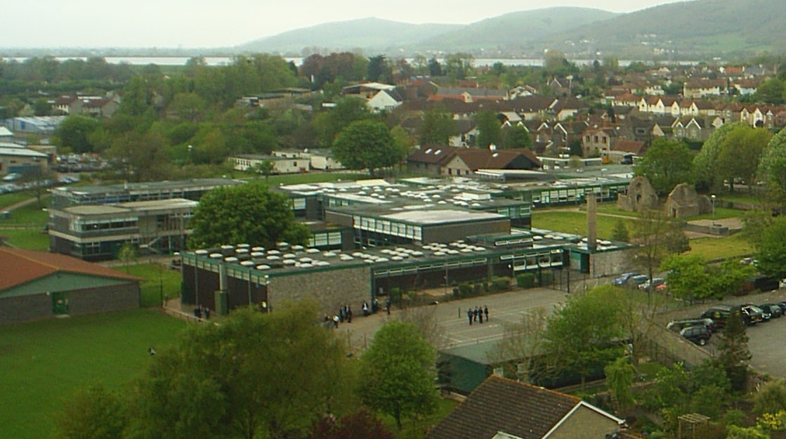
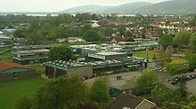 The Kings of Wessex School seen from the tower of St. Andrew's Church (looking north-west)
Cheddar has three schools belonging to the Cheddar Valley Group of Schools, twelve schools that provide Cheddar Valley's three-tier education system.[90] Cheddar First School has ten classes for children between 4 and 9 years.[91] Fairlands Middle School, a middle school categorised as a middle-deemed-secondary school, has 510 pupils between 9 and 13.[92] Fairlands takes children moving up from Cheddar First School as well as other first schools in the Cheddar Valley. The Kings of Wessex School, a coeducational comprehensive school, has been rated as "outstanding" by Ofsted.[93] It has 1,182 students aged 13 to 18,[94] including 302 in the sixth form. Kings is a faith school linked to the Church of England. It was awarded the specialist status of Technology College in 2001, enabling it to develop its Information Technology (IT) facilities and improve courses in science, mathematics and design technology. In 2007 it became a foundation school, giving it more control over its own finances. The school owns and runs a sports centre and swimming pool, Kings Fitness & Leisure, with facilities that are used by students as well as residents. Community education project I.T. for the Terrified, which was originally set up in Wedmore in 1999,[95] is based in an old cow shed on the school's grounds.[96]
Religious sites
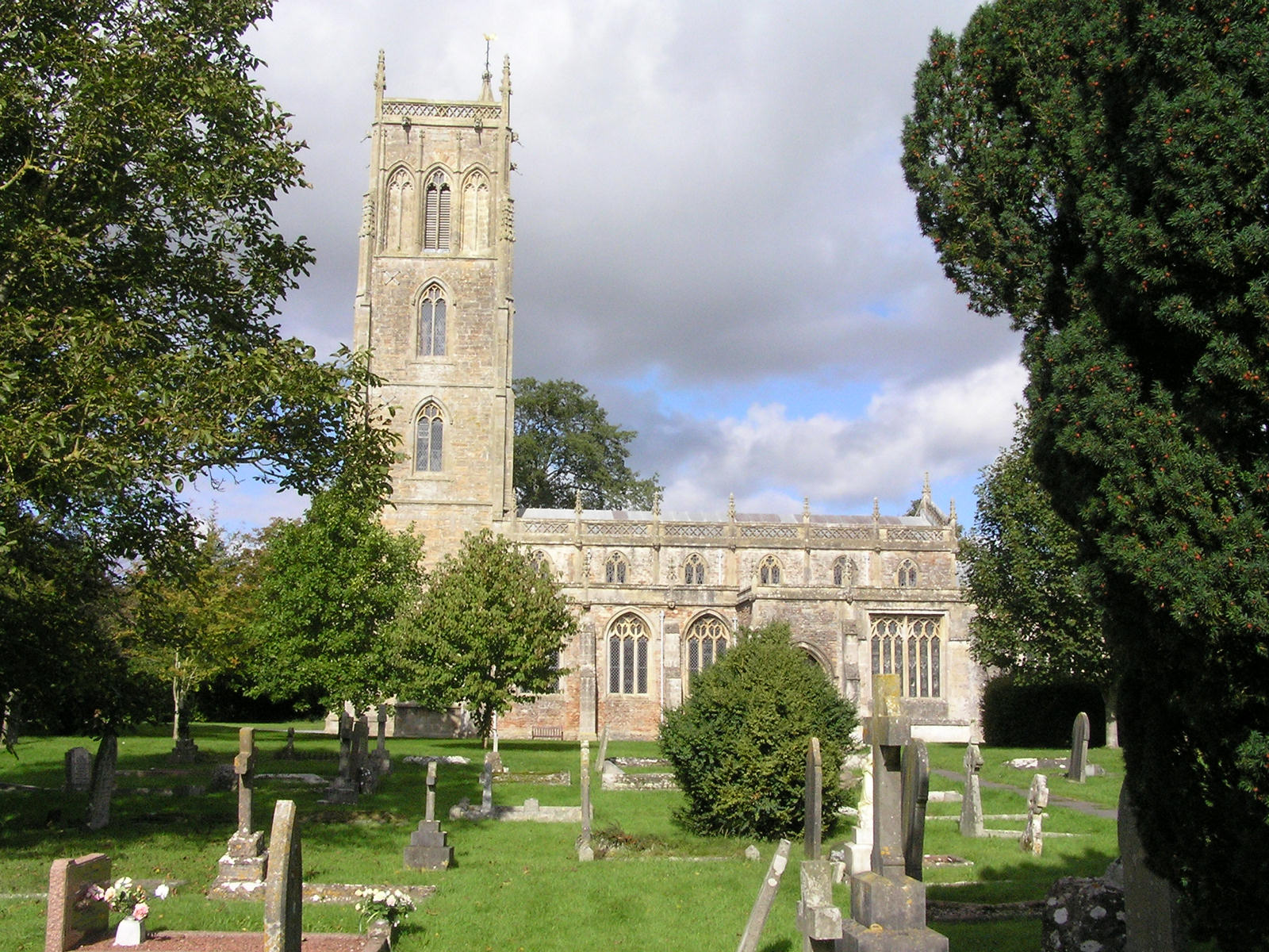
The Church of St Andrew dates from the 14th century. It was restored in 1873 by William Butterfield. It is a Grade I listed building and contains some 15th-century stained glass and an altar table of 1631. The chest tomb in the chancel is believed to contain the remains of Sir Thomas Cheddar and is dated 1442.[97] The tower, which rises to 100 feet (30 m),[7] contains a bell dating from 1759 made by Thomas Bilbie of the Bilbie family.[98]
There are also churches for Roman Catholic, Methodist and other denominations, including Cheddar Valley Community Church, who not only meet at The Kings of Wessex School on Sunday, but also have their own site on Tweentown for meeting during the week.[99] The Baptist chapel was built in 1831.[100]
Sport
Kings Fitness & Leisure, situated on the grounds of The Kings of Wessex School, provides a venue for various sports and includes a 20-metre swimming pool, racket sport courts, a sports hall, dance studios and a gym.[101] A youth sports festival was held on Sharpham Road Playing Fields in 2009.[102] In 2010 a skatepark was built in the village,[103] funded by the Cheddar Local Action Team.[104]
Cheddar Football Club, founded in 1892 and nicknamed "The Cheesemen",[105] play in the Somerset County Football League Premier Division.[106] In 2009 plans were revealed to move the club from its present home at Bowdens Park on Draycott Road to a new larger site.[105]
Cheddar Cricket Club was formed in the late 19th century and moved to Sharpham Road Playing Fields in 1964.[107] They now play in the West of England Premier League Somerset Division. Cheddar Rugby Club, who own part of the Sharpham playing fields, was formed in 1836. The club organises an annual Cheddar Rugby Tournament.[108] Cheddar Lawn Tennis Club, was formed in 1924,[109] and play in the North Somerset League and also has social tennis and coaching. Cheddar Running Club organised an annual half marathon until 2009.[110]
References
- ^ a b "Area: Cheddar CP (Parish)". ONS Census 2001 Neighbourhood Statistics. Office of National Statistics. http://www.neighbourhood.statistics.gov.uk/dissemination/LeadTableView.do?a=7&b=799138&c=Cheddar&d=16&e=15&g=483368&i=1001x1003x1004&m=0&r=1&s=1269942898757&enc=1&dsFamilyId=779. Retrieved 30 March 2010.
- ^ "Cheddar CP/AP through time acreage". A vision of Britain through time. http://www.visionofbritain.org.uk/data_cube_page.jsp?data_theme=T_POP&data_cube=N_AREA_ACRES&u_id=10423909&c_id=10001043&add=Y. Retrieved 12 February 2011.
- ^ "Cheddar Gorge and Caves". Bristol-link. http://www.bristol-link.co.uk/entertainment/cheddar-gorge.htm. Retrieved 31 January 2011.
- ^ "Chedder Man—Museum of Prehistory". Cheddar Caves. http://www.cheddarcaves.co.uk/section.php?xSec=20. Retrieved 31 January 2011.
- ^ a b "Tourist hotspots—Cheddar Gorge". BBC. http://www.bbc.co.uk/naturescalendar/summer/honeypots/cheddar/cheddar_gorge.shtml. Retrieved 12 August 2007.
- ^ a b "Gough's Cave, Cheddar Gorge, Cheddar". Somerset Historic Environment Record. Somerset County Council. January 1983. http://webapp1.somerset.gov.uk/her/details.asp?prn=10398. Retrieved 7 February 2011.
- ^ a b Leete-Hodge, Lornie (1985). Curiosities of Somerset. Bodmin: Bossiney Books. p. 20. ISBN 0906456983.
- ^ Rahtz, Phillip. "The Saxon and Medieval Palaces at Cheddar, Somerset-an Interim Report of Excavations in I 960-62" (PDF). Archaeology Data Service. http://ads.ahds.ac.uk/catalogue/adsdata/arch-769-1/ahds/dissemination/pdf/vol06-07/6_053_066.pdf. Retrieved 31 March 2008.
- ^ a b c d Richardson, Miranda (2003). "Cheddar Archaeological Assessment" (PDF). Somerset Extensive Urban Survey. Somerset County Council. http://www1.somerset.gov.uk/archives/hes/downloads/EUS_CheddarText.pdf. Retrieved 30 March 2010.
- ^ "Former chapel dedicated to St Columbanus". Images of England. English Heritage. http://www.imagesofengland.org.uk/details/default.aspx?id=268795. Retrieved 31 March 2008.
- ^ "School dig uncovers Roman grave". BBC News. 20 January 2006. http://news.bbc.co.uk/1/hi/england/somerset/4630806.stm. Retrieved 31 March 2008.
- ^ Robinson, Stephen (1992). Somerset Place Names. Wimborne, Dorset: The Dovecote Press Ltd. p. 43. ISBN 1874336032.
- ^ Searle, Muriel (2002). West Country History: Somerset. Venton Publications. p. 130. ISBN 9781841508023. http://books.google.com/?id=v3YaKvNutIsC&pg=PA130&dq=cheddar+somerset+history+farming#v=onepage&q&f=false. Retrieved 7 February 2011.
- ^ "Somerset Hundreds". GENUKI. http://www.genuki.org.uk/big/eng/SOM/Miscellaneous/. Retrieved 9 September 2011.
- ^ a b Outhwaite, John. "A Short History of Cheddar". Cheddar Parish Council. http://www.parish-council.com/Cheddar/index.asp?pageid=148051. Retrieved 30 March 2010.
- ^ "A brief history of Cheddar". Cheddar Web Site. http://www.cheddarvillage.co.uk/about.htm. Retrieved 30 March 2010.
- ^ Coysh, A.W.; E.J. Mason & V. Waite (1977). The Mendips. London: Robert Hale Ltd. pp. 96. ISBN 0709164262. http://books.google.com/?id=iA9IAAAAMAAJ&dq=A.W.%3B+E.J.+Mason+%26+V.+Waite&q=Wilberforce#search_anchor.
- ^ Havinden, Michael (1982). The Somerset Landscape. The making of the English landscape. London: Hodder and Stoughton. p. 133. ISBN 0340201169.
- ^ "About Cheddar Village, Somerset". Cheddar Village. http://www.cheddarvillage.co.uk/about.htm. Retrieved 12 February 2011.
- ^ "40 years since the Great Gorge Flood". Western Mercury. 10 July 2008. http://www.thewestonmercury.co.uk/news/40_years_since_the_great_gorge_flood_1_321776. Retrieved 24 February 2011.
- ^ "The Chew Valley floods of 1968". Environment Agency. http://www.publow-with-pensford-pc.gov.uk/pub/backlook/env_agency_leaflet.pdf. Retrieved 24 February 2011.
- ^ "Cheddar Parish Plan" (PDF). Cheddar Parish Council. http://www.cheddarparishcouncil.org/documents/CPC%20-%20Parish%20Plan.pdf. Retrieved 30 March 2010.
- ^ Richardson, Miranda (2003). "An archaeological assessment of Cheddar" (PDF). Somerset Extensive Urban Survey. Somerset County Council. p. 12. http://www1.somerset.gov.uk/archives/hes/downloads/EUS_CheddarText.pdf. Retrieved 4 March 2011. "Cheddar is one of 30 of the 45 historic towns covered by this project which is not classed as a town in the County Structure Plan."
- ^ "Axbridge, and King John's Hunting Lodge, Somerset". InfoBritain. http://www.infobritain.co.uk/Axbridge.htm. Retrieved 5 April 2010.
- ^ "Axbridge: History". Axbridge: Information for Visitors and Residents maintained by Axbridge Town Council. Axbridge Town Council. http://www.axbridge-tc.gov.uk/visitor/history.html. Retrieved 4 March 2011.
- ^ Richardson, Miranda (2001). "An archaeological assessment of Axbridge" (PDF). Somerset Extensive Urban Survey. Somerset County Council. pp. 4–5. http://www1.somerset.gov.uk/archives/hes/downloads/EUS_AxbridgeText.pdf. Retrieved 4 March 2011.
- ^ "Axbridge Cheddar—Location Report". NSDatabase. http://www.nsdatabase.co.uk/locationdetail.cfm?locationid=73. Retrieved 7 February 2011.
- ^ "Your Council". Cheddar Parish Council. http://www.parish-council.com/Cheddar/index.asp?pageid=827. Retrieved 30 March 2010.
- ^ "Your Council". Cheddar Parish Council. http://www.parish-council.com/cheddar/index.asp?pageid=827. Retrieved 4 March 2011.
- ^ "A Vision of Britain Through Time : Axbridge Rural District". Visionofbritain.org.uk. http://www.visionofbritain.org.uk/relationships.jsp?u_id=10025515&c_id=10001043. Retrieved 6 February 2011.
- ^ Axbridge, Rural District, Somerset. The official guide. Axbridge, Rural District. 1965. p. 60. ISBN 0717400700. http://books.google.com/?id=vvMmPAAACAAJ&dq=axbridge+rural+district. Retrieved 7 February 2011.
- ^ "About the Somerset Strategic Partnership". Somerset Strategic Partnership. http://www.somersetstrategicpartnership.org.uk/about-the-ssp/. Retrieved 5 March 2011.
- ^ Parliamentary Constituencies in the county of Somerset Government News, Retrieved 14 November 2001.
- ^ a b "Cheddar / Felsberg Vernouillet Friendship Association (CFVFA)". Sedgemopor German Twinning Association. http://www.sedgemoorgermantwinning.org.uk/cheddar.html. Retrieved 30 March 2010.
- ^ "Twin Towns". Local Government Association. http://www.lga.gov.uk/lga/twinning/twin-town-search.do. Retrieved 25 December 2010.
- ^ "Cheddar Felsberg And Vernouillet Friendship Association". Nailsea e-paper. http://cheddaraxbridgepaper.co.uk/newspop.php?paperid=10&id=6080. Retrieved 25 December 2010.
- ^ "Credit crunch hits trip from Jamaica". Cheddar Valley Gazette. 26 May 2009. http://www.thisissomerset.co.uk/news/Credit-crunch-hits-trip-Jamaica/article-1022312-detail/article.html. Retrieved 25 December 2010.
- ^ "The Cheddar Complex" (PDF). English Nature. http://www.english-nature.org.uk/citation/citation_photo/1003940.pdf. Retrieved 2006-07-17.
- ^ "Cheddar Gorge: Not entirely cheesy". Geotimes, a publication of the American Geological Institute. May 2005. http://www.agiweb.org/geotimes/may05/Travels0505.html. Retrieved 12 August 2007.
- ^ "Gough's Cave excavation site". Natural History Museum. http://piclib.nhm.ac.uk/results.asp?image=033406&itemw=4&itemf=0001&itemstep=1&itemx=1. Retrieved 7 February 2011.
- ^ "Cheddar Gorge". British Geological Survey. http://www.bgs.ac.uk/mendips/localities/cheddar.html. Retrieved 4 March 2011.
- ^ "Cox's Cave and the Crystal Cave". Cheddar Caves and Gorge. http://www.cheddarcaves.co.uk/section.php/22/1/cox_s_cave___the_crystal_quest. Retrieved 18 December 2009.
- ^ "Access Q&A: Cheddar Gorge". British Mountaineering Council. 1999. http://www.thebmc.co.uk/Feature.aspx?id=1843. Retrieved 12 August 2007.
- ^ "Caves win 'natural wonder' vote". BBC. 2 August 2005. http://news.bbc.co.uk/2/hi/uk_news/wales/mid_/4735935.stm. Retrieved 7 February 2011.
- ^ "Cheddar Reservoir Introduction". Bristol Water. http://www.bristolwater.co.uk/leisure/cheddar-info.asp. Retrieved 30 March 2010.
- ^ "Axbridge Raw Water Treatment Works". Axbridge Raw Water. CEEQUAL. http://www.ceequal.co.uk/awards_035.htm. Retrieved 5 March 2011.
- ^ "English Nature SSSI information for Cheddar Reservoir". English Nature. http://www.english-nature.org.uk/Special/sssi/sssi_details.cfm?sssi_id=1003948. Retrieved 7 February 2011.
- ^ Aston, Michael (1988). Aspects of the medieval landscape of Somerset. Somerset County Council. p. 30. ISBN 0861831292.
- ^ a b c "Cheddar Wood" (PDF). English Nature. http://www.english-nature.org.uk/citation/citation_photo/1003970.pdf. Retrieved 17 July 2006.
- ^ a b "The Cheddar Complex" (PDF). English Nature. http://www.english-nature.org.uk/citation/citation_photo/1003940.pdf. Retrieved 17 July 2006.
- ^ "Nature and the National Trust". National Trust. http://www.nationaltrust.org.uk/main/w-chl/w-countryside_environment/w-nature/w-nature-strategy.htm. Retrieved 4 March 2011.
- ^ "Cheddar Complex". Somerset Wildlife Trust. http://www.somersetwildlife.org/cheddar_complex.html. Retrieved 4 March 2011.
- ^ "Jobs may go as kiln is closed". Cheddar Valley Gazette. 26 March 2009. http://www.thisissomerset.co.uk/cheddarvalley/news/Jobs-kiln-closed/article-843237-detail/article.html. Retrieved 29 March 2009.
- ^ Atthill, Robin (1976). Mendip: A new study. Newton Abbott: David & Charles. pp. 22. ISBN 0715372971. http://books.google.com/?id=_KMwAAAAMAAJ&dq=Atthill%2C+Robin+Mendip%3A+A+new+study&q=99%25#search_anchor.
- ^ "West Mendip Quarries". British Geological Survey. http://www.bgs.ac.uk/mendips/more_info/west_mendip_quarries_history.htm. Retrieved 22 February 2011.
- ^ "Dropping a nuclear brick". New Scientist 60 (868): 185. October 1973. http://books.google.co.uk/books?id=RWRmXO0ut6YC&pg=PA185&lpg=PA185&dq=National+Tower+Testing+Station+Cheddar#v=onepage&q=National%20Tower%20Testing%20Station%20Cheddar&f=false. Retrieved 22 February 2011.
- ^ a b c d "South West England: climate". Met Office. http://www.metoffice.gov.uk/climate/uk/sw/. Retrieved 14 March 2010.
- ^ "Area: Cheddar CP (Parish)". Parish Profile—People ONS Neighbourhood Statistics. Office of National Statistics. http://www.neighbourhood.statistics.gov.uk/dissemination/LeadTableView.do?a=7&b=799138&c=Cheddar&d=16&e=15&g=483368&i=1001x1003x1004&m=0&r=1&s=1269942898773&enc=1&dsFamilyId=781. Retrieved 30 March 2010.
- ^ "Area: Cheddar CP (Parish) Parish Profile—Households". 2001 Census Neighbourhood Statistics. Office of National Statistics. http://www.neighbourhood.statistics.gov.uk/dissemination/LeadTableView.do?a=7&b=799138&c=Cheddar&d=16&e=14&g=483368&i=1001x1003x1004&m=0&r=1&s=1269943242688&enc=1&dsFamilyId=785. Retrieved 30 March 2010.
- ^ Smale, Will (21 August 2006). "Separating the curds from the whey". BBC Radio 4 Open Country. http://news.bbc.co.uk/1/hi/business/5241544.stm. Retrieved 7 August 2007.
- ^ "The Interview—Lactalis McLelland's 'Seriously': driving the Cheddar market". The Grocery Trader. http://www.grocerytrader.co.uk/News/October_2006/G_lactalis.html. Retrieved 9 May 2007.
- ^ Rendell, J. (1973). Economic problems of the protected strawberry crop in south west England. International Society for Horticultural Science. http://www.actahort.org/books/30/30_26.htm. Retrieved 6 February 2011.
- ^ "The Strawberry Line" (PDF). Sustrans. http://www.sustrans.org.uk/assets/files/leaflets/Strawberry%20Line%20leaflet.pdf. Retrieved 25 April 2010.
- ^ "Archive". The Strawberry Line. http://www.thestrawberryline.co.uk/d/103/Search_Results.php?doc=62. Retrieved 25 April 2010.
- ^ a b "Strawberry Line". Forest of Avon. http://www.forestofavon.org/sl.html. Retrieved 23 November 2007.
- ^ a b Gerald Daniels and L.A.Dench. Passengers No More (1974 ed.). Ian Allan. p. 16. ISBN 0711009511.
- ^ "Discovering Cheddar Ales" (PDF). Pints West No. 72 Winter 2006/2007 edition. CAMRA Bristol. p. 7. http://www.camrabristol.org.uk/pw72s.pdf. Retrieved 21 January 2008.
- ^ "Recreation, Leisure and Tourism". Sedgemoor District Local Plan 1991 - 2011 Adopted Version. Sedgemoor District Council. http://www.sedgemoor.gov.uk/localplan/text/text11.htm. Retrieved 30 March 2010.
- ^ Nagle, Garrett (1999). Focus on Geography: Tourism, leisure and recreation. Nelson Thornes. pp. 54–56. ISBN 9780174447054. http://books.google.com/?id=tA-2NAuiAa4C&dq.
- ^ "Cheddar Youth Hostel". YHA. http://www.yha.org.uk/find-accommodation/south-west-england/hostels/cheddar/index.aspx. Retrieved 30 March 2010.
- ^ "Campsites and caravan sites". Cheddar Web Site. http://www.cheddarvillage.co.uk/Accommodation/camping.htm. Retrieved 7 February 2011.
- ^ "Clubs and Charities in Cheddar". Cheddar Web Site. http://www.cheddarvillage.co.uk/Clubs%20and%20charities/index.htm. Retrieved 30 March 2010.
- ^ "St Michaels". Leonard Cheshire Disability. http://www.lcdisability.org/?lid=15056. Retrieved 5 February 2011.
- ^ McNair, James (4 April 1997). "We like big, fat voices with plenty of welly". The Independent. http://www.independent.co.uk/arts-entertainment/we-like-big-fat-voices-with-plenty-of-welly-1265034.html. Retrieved 3 April 2010.
- ^ Otter, Helen. "Matt Goss... he's a man, yes he is!". BBC Somerset. http://www.bbc.co.uk/somerset/content/articles/2004/09/20/matt_goss_minehead_interview_feature.shtml. Retrieved 3 April 2010.
- ^ "Golden Girl hits bullseye". Cheddar Valley Gazette. January 15, 2010. http://www.thisissomerset.co.uk/news/Golden-Girl-hits-bullseye/article-1716657-detail/article.html. Retrieved 8 January 2011.
- ^ Otter, Helen. "Interview: Richard Herring". BBC Somerset. http://www.bbc.co.uk/somerset/content/articles/2007/03/09/richard_herring_interview_feature.shtml. Retrieved 3 April 2010.
- ^ Bearder, Tim (10 March 2009). "Richard Herring—The Headmaster's Son". BBC Oxford. http://www.bbc.co.uk/oxford/content/articles/2009/03/10/richard_herring.shtml. Retrieved 3 April 2010.
- ^ "Celebrity funnyman to return home for charity". Cheddar Valley Gazette. 16 October 2009. http://www.thisissomerset.co.uk/cheddarvalley/news/Celebrity-funnyman-return-home-charity/article-1427661-detail/article.html. Retrieved 3 April 2010.
- ^ "Preview". Cheddar Valley Gazette. 26 March 2010. http://www.thisissomerset.co.uk/cheddarvalley/news/Preview/article-1944271-detail/article.html. Retrieved 3 April 2010.
- ^ "Market Cross". Images of England. English Heritage. http://www.imagesofengland.org.uk/details/default.aspx?id=268772. Retrieved 9 May 2006.
- ^ Mat, Ian (28 January 2010). "Market cross was reduced to rubble in costly smash". Cheddar Valley Gazette.
- ^ "Putting names to Market Cross faces". Cheddar Valley Gazette. 5 February 2010. http://www.thisissomerset.co.uk/news/Putting-names-Market-Cross-faces/article-1809464-detail/article.html. Retrieved 30 March 2010.
- ^ "Annual Report 2002" (PDF). Somerset Heritage. p. 13. http://www1.somerset.gov.uk/archives/hes/downloads/AnnualReport02.pdf. Retrieved 30 March 2010.
- ^ "Hannah More's Cottage". Images of England. English Heritage. http://www.imagesofengland.org.uk/details/default.aspx?id=268787. Retrieved 31 March 2008.
- ^ "Hannah Mores Cottage, Cheddar". British Listed Buildings. History in Structure. http://www.britishlistedbuildings.co.uk/en-268787-hannah-mores-cottage-cheddar. Retrieved 5 March 2011.
- ^ "A371". SABRE. http://www.sabre-roads.org.uk/wiki/index.php?title=A371. Retrieved 4 March 2011.
- ^ Ordnance Survey (2002). 182 Weston-super-Mare, Bridgwater and Wells (Map). 1:50000. Landranger (C2 ed.). ISBN 0-319-22782-0. http://leisure.ordnancesurvey.co.uk/products/paper-maps/paper-maps-ordnance-survey-great-britain/paper-maps-ordnance-survey-great-britain-os-landranger-map/weston-super-mare/pid-9780319228609. Retrieved 24 February 2011.
- ^ "Cycling Map 10 Cheddar and Axbridge" (PDF). Moving Somerset Forward. http://www.movingsomersetforward.co.uk/files/uploads/maps/CheddarWEB.pdf. Retrieved 30 March 2010.
- ^ "Prospectus". Mark First School. http://www.markfirstschool.ik.org/documents/1086325389.ikml#sbt8. Retrieved 5 February 2011.
- ^ "Cheddar First School". Cheddar First School. http://www.cheddarfirst.ik.org/. Retrieved 30 March 2010.
- ^ "School Profile". Fairlands Middle School. https://slp2.somerset.gov.uk/schools/fms/Site%20Pages/About%20the%20School.aspx. Retrieved 5 February 2011.
- ^ "The Kings of Wessex School Inspection report". Ofsted. 1 March 2010. http://www.ofsted.gov.uk/oxedu_reports/display/(id)/117057. Retrieved 2 March 2010.
- ^ "The Kings of Wessex School". Ofsted. http://www.ofsted.gov.uk/oxedu_providers/full/(urn)/123896. Retrieved 27 March 2010.
- ^ "Village's cyber cafe opens". BBC News. 25 March 2003. http://news.bbc.co.uk/1/hi/england/2886013.stm. Retrieved 27 January 2011.
- ^ (PDF) Kings Messenger. Issue 86. The Kings of Wessex School. July 2009. http://www.kowessex.co.uk/downloads/newsletters/kings_messenger_86.pdf. Retrieved 27 January 2010.
- ^ "Church of St. Andrew". Images of England. English Heritage. http://www.imagesofengland.org.uk/details/default.aspx?id=268768. Retrieved 9 May 2006.
- ^ Moore, James; Roy Rice & Ernest Hucker (1995). Bilbie and the Chew Valley clock makers. The authors.
- ^ "Cheddar Valley Community Church". Cheddar Valley Community Church. http://www.cheddarvalleycommunitychurch.org/. Retrieved 30 March 2010.
- ^ "Baptist Chapel". Images of England. English Heritage. http://www.imagesofengland.org.uk/Details/Default.aspx?id=268783. Retrieved 30 March 2010.
- ^ "Sport and Leisure". Cheddar Web Site. http://www.cheddarvillage.co.uk/Sport_Leisure/index.htm. Retrieved 30 March 2010.
- ^ "Cheddar Youth Sports Festival". Cheddar Youth Sports Festival. http://cheddaryouthsports.co.uk/. Retrieved 30 March 2010.
- ^ "Skate park man appears on TV". Cheddar Valley Gazette. 1 February 2010. http://www.thisissomerset.co.uk/shepton/news/Skate-park-man-appears-TV/article-1784459-detail/article.html. Retrieved 30 March 2010.
- ^ "Lions pledge skate help". The Weston Mercury. 9 July 2007. http://www.thewestonmercury.co.uk/news/lions_pledge_skate_help_1_312349. Retrieved 31 January 2011.
- ^ a b "Cheddar Football Club could move premises". Cheddar Valley Gazette. 28 May 2009. http://www.thisissomerset.co.uk/news/Cheddar-Football-Club-premises/article-1031461-detail/article.html. Retrieved 30 March 2010.
- ^ "Cheddar AFC". Cheddar AFC. http://www.cheddarfc.co.uk/. Retrieved 30 March 2010.
- ^ "History". Cheddar Cricket Club. http://www.cheddarcc.co.uk/history.html. Retrieved 30 March 2010.
- ^ "Cheddar Rugby Club". Cheddar Rugby Club. http://www.cheddar-rugby.co.uk/home.asp. Retrieved 5 February 2011.
- ^ "History". Cheddar Tennis Club. http://www.cheddartennisclub.co.uk/history.html. Retrieved 30 March 2010.
- ^ "Last Cheddar Half Marathon". Cheddar Running Club. 1 December 2009. http://www.cheddarrunningclub.co.uk/half_marathon/21__last_cheddar_half_marathon.html. Retrieved 30 March 2010.
External links
- Cheddar at the Open Directory Project
Towns, villages and hamlets in the Sedgemoor district of Somerset, England  Ashcott · Axbridge · Badgworth · Bawdrip · Berrow · Brean · Brent Knoll · Bridgwater · Broomfield · Burnham-on-Sea · Burtle · Cannington · Catcott · Chapel Allerton · Cheddar · Chedzoy · Chilton Polden · Chilton Trinity · Compton Bishop · Cossington · Durleigh · East Brent · Huntspill · Edington · Edithmead · Enmore · Fiddington · Goathurst · Greinton · Highbridge · Lympsham · Lyng · Mark · Middlezoy · Moorlinch · Nether Stowey · North Petherton · Othery · Otterhampton · Over Stowey · Pawlett · Puriton · Shapwick · Shipham · Spaxton · Stawell · Stockland Bristol · Thurloxton · Weare · Wedmore · Wembdon · Westonzoyland · WoolavingtonCategories:
- Mendip Hills
- Villages in Sedgemoor
- Civil parishes in Somerset


Wikimedia Foundation. 2010.