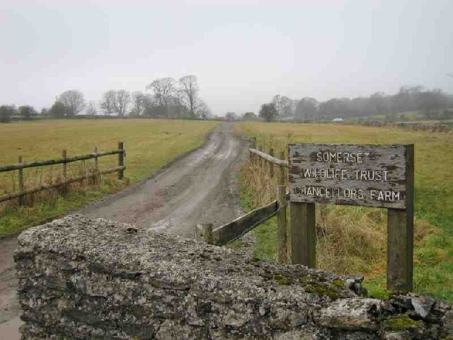
- Chancellor's Farm
-
Chancellor's Farm Site of Special Scientific Interest 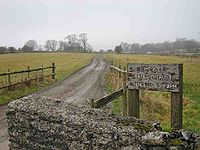
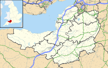
 Shown within Somerset
Area of Search Somerset Grid reference ST525525 Coordinates 51°16′11″N 2°40′56″W / 51.26966°N 2.68225°WCoordinates: 51°16′11″N 2°40′56″W / 51.26966°N 2.68225°W Interest Biological Area 34.2 hectares (0.342 km2; 0.132 sq mi) Notification 1984 Natural England website Chancellor's Farm (grid reference ST525525) is a 34.2-hectare (84.6 acre) biological Site of Special Scientific Interest just north of Priddy in the Mendip Hills, Somerset, notified in 1984.
The site, which is close to the Yoxter military range, is operated as a restricted-access nature reserve by the Somerset Wildlife Trust.[1]
This site provides outstanding examples of some of the grassland communities associated with the higher parts of the Mendip plateau. The soils include a mixture of wind-deposited silts and weathered material from the parent Carboniferous Limestone. The grassland is a type characterised by Sweet Vernal Grass (Anthoxanthum odoratum), Red Fescue (Festuca rubra), Common Bent (Agrostis capillaris), Pignut (Conopodium majus) and Sorrel (Rumex acetosa). Of particular interest is the abundance of Common Bluebell (Hyacinthoides non-scripta), a species rare outside woodland habitats in Somerset.[2]
The site includes extensive remains of lead mining from the medieval period to the early 18th century, with some evidence of iron mining in the north east corner of the site.[3]
References
- ^ "Chancellors Farm". Somerset Wildlife Trust. http://www.somersetwildlife.org/reserveview.php?id=54. Retrieved 2008-10-18.
- ^ "Chancellor's Farm". English Nature. http://www.english-nature.org.uk/citation/citation_photo/1000008.pdf. Retrieved 2006-07-17.
- ^ "Lead mining, Chancellor's Farm, Priddy". Somerset Historic Environment Record. Somerset County Council. http://webapp1.somerset.gov.uk/her/details.asp?prn=25392. Retrieved 2008-10-18.
Summarised data for all sites (biological and geological) Aller and Beer Woods · Aller Hill · Asham Wood · Axbridge Hill and Fry's Hill · Babcary Meadows · Barle Valley · Barrington Hill Meadows · Berrow Dunes · Black Down and Sampford Commons · Brean Down · Bridgwater Bay · Briggins Moor · Catcott, Edington and Chilton Moors · Chancellor's Farm · Cheddar Complex · Cheddar Reservoir · Cheddar Wood · Cleeve Hill · Cogley Wood · Crook Peak to Shute Shelve Hill · Curry and Hay Moors · Deadman · Draycott Sleights · Dunster Park and Heathlands · East Polden Grasslands · Ebbor Gorge · Edford Woods and Meadows · Exmoor Coastal Heaths · Fivehead Woods and Meadow · Freshmoor · Friar's Oven · Ge-mare Farm Fields · Great Breach and Copley Woods · Grove Farm · Hardington Moor · Hestercombe House · Holme Moor & Clean Moor · King's Sedgemoor · Kingdown and Middledown · Kingweston Meadows · Lang's Farm · Langford Heathfield · Langmead and Weston Level · Long Lye · Long Lye Meadow · Longleat Woods · Millwater · Moorlinch · Nettlecombe Park · North Brewham Meadows · North Curry Meadow · North Exmoor · North Moor · Old Ironstone Works, Mells · Perch · Porlock Ridge and Saltmarsh · Postlebury Wood · Priddy Pools · Prior's Park & Adcombe Wood · Quantock Hills · Quants · Ringdown · River Barle · Rodney Stoke · Roebuck Meadows · Ruttersleigh · Severn Estuary · Shapwick Heath · Sharpham Moor Plot · South Exmoor · Southey and Gotleigh Moors · Southlake Moor · Sparkford Wood · St. Dunstan's Well Catchment · Stowell Meadow · Street Heath · Tealham and Tadham Moors · Thurlbear Wood and Quarrylands · Twinhills Woods and Meadows · Vallis Vale · Walton and Ivythorn Hills · West Moor · West Sedgemoor · Westhay Heath · Westhay Moor · Wet Moor · Whitevine Meadows · Windsor Hill Marsh · Wookey Hole · Woolhayes FarmNeighbouring areas: Avon · Devon · Dorset · Wiltshire Categories:- Mendip Hills
- Sites of Special Scientific Interest in Somerset
- Sites of Special Scientific Interest notified in 1984
- Nature reserves in Somerset

Wikimedia Foundation. 2010.