- North Exmoor SSSI
-
North Exmoor Site of Special Scientific Interest 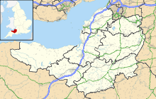
 Shown within Somerset
Area of Search Somerset & Devon Grid reference SS800430 Coordinates 51°10′25″N 3°43′05″W / 51.17361°N 3.71794°WCoordinates: 51°10′25″N 3°43′05″W / 51.17361°N 3.71794°W Interest Biological Area 12,005.3 hectares (120.053 km2; 46.353 sq mi) Notification 1954 Natural England website North Exmoor (grid reference SS800430) is a 12005.3 hectare (29665.0 acre) biological Site of Special Scientific Interest in Devon and Somerset, notified in 1954.
This site is within Exmoor National Park and includes the Dunkery Beacon and the Holnicote and Horner Water Nature Conservation Review sites, and the Chains Geological Conservation Review site. The site is nationally important for its south-western lowland heath communities and for transitions from ancient semi-natural woodland through upland heath to blanket mire. The site is also of importance for its breeding bird communities, its large population of the nationally rare Heath Fritillary butterfly (Mellicta athalia), an exceptional woodland lichen flora and its palynological interest of deep peat on the Chains. The ancient woodland is mostly to be found around Horner and Hawkcombe Woods near Porlock where it is open to the moorland and is grazed by domestic stock and Red Deer (Cervus elaphus) of which there is a large population.[1]
References
- ^ "North Exmoor". English Nature. http://www.english-nature.org.uk/citation/citation_photo/1006541.pdf. Retrieved 2006-08-19.
Categories:- Sites of Special Scientific Interest in Somerset
- Geography of Somerset
- Sites of Special Scientific Interest notified in 1954
- Exmoor

Wikimedia Foundation. 2010.