- Cleeve Hill SSSI, Somerset
-
Cleeve Hill Site of Special Scientific Interest 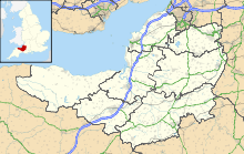
 Shown within Somerset
Area of Search Somerset Grid reference ST056428 Coordinates 51°10′36″N 3°21′07″W / 51.17662°N 3.35181°WCoordinates: 51°10′36″N 3°21′07″W / 51.17662°N 3.35181°W Interest Biological Area 15.1 hectares (0.151 km2; 0.058 sq mi) Notification 1989 Natural England website Cleeve Hill (grid reference ST056428) is a 15.1 hectare (37.4 acre) biological Site of Special Scientific Interest between Old Cleeve and Watchet in Somerset, notified in 1989.
The site covers a moderate to steeply sloping south face of the Washford River Valley. It supports a rich and diverse calcareous grassland community with associated mixed woodland and scrub. The site contains two species of plant which are nationally rare in Great Britain, Nit-grass (Gastridium ventricosum) and Rough Marsh-mallow (Althaea hirsuta).[1]
References
- ^ "Cleeve Hill". English Nature. http://www.english-nature.org.uk/citation/citation_photo/1005755.pdf. Retrieved 2006-09-09.
Categories:- Sites of Special Scientific Interest in Somerset
- Geography of Somerset
- Sites of Special Scientific Interest notified in 1989
- United Kingdom Site of Special Scientific Interest stubs
- Somerset geography stubs

Wikimedia Foundation. 2010.