- Old Cleeve
-
Coordinates: 51°10′06″N 3°22′31″W / 51.1684°N 3.3753°W
Old Cleeve 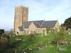
Church of St Andrew, Old Cleeve
 Old Cleeve
Old Cleeve shown within SomersetArea 20.92 km2 (8.08 sq mi) Population 1,952 [1] - Density 93 /km2 (240 /sq mi) OS grid reference ST039419 Parish Old Cleeve District West Somerset Shire county Somerset Region South West Country England Sovereign state United Kingdom Post town MINEHEAD Postcode district TA24 Dialling code 01984 Police Avon and Somerset Fire Devon and Somerset Ambulance South Western EU Parliament South West England UK Parliament Bridgwater and West Somerset List of places: UK • England • Somerset Old Cleeve is a village and civil parish 5 miles (8 km) south east of Minehead in the West Somerset district of Somerset, England. The civil parish of Old Cleeve covers an area of 2,092 hectares (5,170 acres) and includes the villages of Blue Anchor, Roadwater and Washford as well as hamlets such as Bilbrook, Chapel Cleeve, Golsoncott and Leighland Chapel. Approximately half the parish lies within the Exmoor National Park. In 2002, the population of the parish was estimated to be 1,952.[2][1]
Contents
History
The name Cleeve means cliff or hill and became known as Old Cleeve to distinguish the principal village north of the main A39 road from the later site of Cleeve Abbey to the south.[3] The parish of Old Cleeve was part of the Williton and Freemanners Hundred.[4]
Black Monkey Bridge, which was built around 1860, carries the West Somerset Railway, a steam operated heritage railway over a stream and footpath.[5]
Old Cleeve was also near the route of the West Somerset Mineral Railway which ran from the ironstone mines in the Brendon Hills to the port of Watchet on the Bristol Channel.[6]. The old railway station which was built in 1861 is now a store,[7] and there is also a bridge remaining from this line.[8]
Governance
Administratively, it falls within the West Somerset local government district and the Somerset shire county, with administrative tasks shared between county, district and parish councils.
The parish council has responsibility for local issues, including setting an annual precept (local rate) to cover the council’s operating costs and producing annual accounts for public scrutiny. The parish council evaluates local planning applications and works with the local police, district council officers, and neighbourhood watch groups on matters of crime, security, and traffic. The parish council's role also includes initiating projects for the maintenance and repair of parish facilities, as well as consulting with the district council on the maintenance, repair, and improvement of highways, drainage, footpaths, public transport, and street cleaning. Conservation matters (including trees and listed buildings) and environmental issues are also the responsibility of the council.
The village falls within the Non-metropolitan district of West Somerset, which was formed on April 1, 1974 under the Local Government Act 1972, having previously been part of Williton Rural District.[9] The district council is responsible for local planning and building control, local roads, council housing, environmental health, markets and fairs, refuse collection and recycling, cemeteries and crematoria, leisure services, parks, and tourism.
Somerset County Council is responsible for running the largest and most expensive local services such as education, social services, libraries, main roads, public transport, policing and fire services, trading standards, waste disposal and strategic planning.
It is also part of the Bridgwater and West Somerset county constituency represented in the House of Commons of the Parliament of the United Kingdom. It elects one Member of Parliament (MP) by the first past the post system of election, and part of the South West England constituency of the European Parliament which elects seven MEPs using the d'Hondt method of party-list proportional representation.
Geography
 Countyside on the coastal path
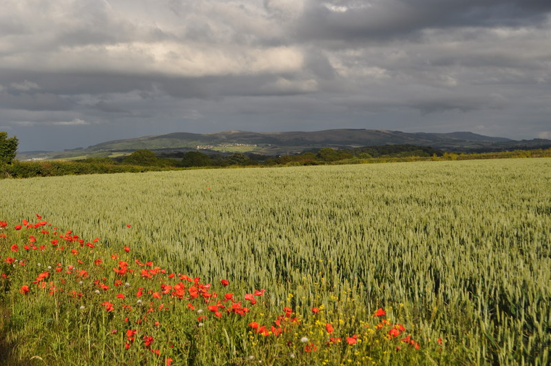
Between Old Cleeve and Watchet is Cleeve Hill a biological Site of Special Scientific Interest which covers a moderate to steeply sloping south face of the Washford River Valley. It supports a rich and diverse calcareous grassland community with associated mixed woodland and scrub. The site contains two species of plant which are nationally rare in Great Britain, Nit-grass (Gastridium ventricosum) and Rough Marsh-mallow (Althaea hirsuta).[10]
The parish extends to the coast of Bridgwater Bay between Blue Anchor and Watchet, in an area previously known as Cleeve Bay,[3] on the Blue Anchor to Lilstock Coast SSSI a geological Site of Special Scientific Interest. It provides an outstanding series of sections through the Early Jurassic Lower Lias, spanning the Hettangian and Pliensbachian Stages and named the "Lilstock Formation". The Triassic cliffs have geological interest for the variety of fossils and is on the South West Coast Path. There is the remains of a Lime Kiln complex which was used in the 18th century.[11] Bridgwater Bay consists of large areas of mud flats, saltmarsh, sandflats and shingle ridges, some of which are vegetated. It has been designated as a Site of Special Scientific Interest,[12] and is designated as a wetland of international importance under the Ramsar Convention.[13]
Religious sites
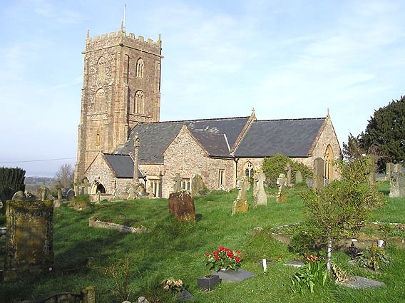
The parish church of St Andrew dates from the 12th century and has been designated by English Heritage as a Grade I listed building.[14] The floor of the porch was cobbled with alabaster stones from the beach below the village and set in the shape of a heart during the 17th century.[15]
In Leighland Chapel is the church of St Giles which was built in 1861 by C.E. Giles on the site of a previous building.[16]
Cleeve Abbey in Washford village, is a medieval monastery founded in the late twelfth century as a house for monks of the austere Cistercian order. In 1536 Cleeve was closed by Henry VIII during the Dissolution of the Monasteries and the abbey was converted into a country house. Subsequently, the status of the site declined and the abbey was used as farm buildings until the latter half of the nineteenth century when steps were taken to conserve the remains. In the twentieth century Cleeve Abbey was taken into state care; it is now looked after by English Heritage and is open to the public. Today Cleeve Abbey is one of the best-preserved medieval Cistercian monastic sites in Britain. While the church is no longer standing, the conventual buildings are still roofed and habitable and contain many features of particular interest including the 'angel' roof in the refectory and the wall paintings in the painted chamber.
Binham Farmhouse was built in the 15th century as the grange to the abbey.[17]
Chapel Cleeve Manor was a hotel, which dates from 1452, is the remains of a pilgrim's hospice attached to the chapel, which was enlarged as a country house and has been a hotel and is now a private house.[18]
References
- ^ a b "Parish Population Statistics". ONS Census 2001. Somerset County Council. http://www.webcitation.org/5lRyCc5hq. Retrieved 2009-12-13.
- ^ "Old Cleeve Parish". Exmoor National Park. http://www.exmoor-nationalpark.gov.uk/index/learning_about/living_in_communities/exmoor_parishes/old_cleeve_parish.htm. Retrieved 2008-10-10.
- ^ a b Bush, Robin (1994). Somerset: The complete guide. Wimborne: The Dovecote Press Ltd. pp. 161–163. ISBN 1874336261.
- ^ "Somerset Hundreds". GENUKI. http://www.genuki.org.uk/big/eng/SOM/Miscellaneous/. Retrieved 23 October 2011.
- ^ "Black Monkey Bridge". Images of England. English Heritage. http://www.imagesofengland.org.uk/Details/Default.aspx?id=264842. Retrieved 2009-02-01.
- ^ "Station Name: WATCHET". Subterranea Britannica. http://www.subbrit.org.uk/sb-sites/stations/w/watchet/index.shtml. Retrieved 2007-11-19.
- ^ "Brendon Hill Mineral Railway Station, at NGR ST 0225 3435". Images of England. English Heritage. http://www.imagesofengland.org.uk/Details/Default.aspx?id=264821. Retrieved 2009-02-01.
- ^ "Railway Bridge at NGR ST 0379 3625". Images of England. English Heritage. http://www.imagesofengland.org.uk/Details/Default.aspx?id=264813. Retrieved 2009-02-01.
- ^ A Vision of Britain Through Time : Williton Rural District
- ^ "Cleeve Hill". English Nature. http://www.english-nature.org.uk/citation/citation_photo/1005755.pdf. Retrieved 2006-09-09.
- ^ "Limekiln Complex at NGR ST 0567 4328". Images of England. English Heritage. http://www.imagesofengland.org.uk/Details/Default.aspx?id=264811. Retrieved 2009-02-01.
- ^ "SSSI citation sheet for Bridgwater Bay". Sites of Special Scientific Interest. English Nature. http://www.english-nature.org.uk/citation/citation_photo/1001145.pdf. Retrieved 12 November 2008.
- ^ "Bridgwater Bay NNR". National Nature Reserves. Natural England. http://www.english-nature.org.uk/special/nnr/nnr_details.asp?NNR_ID=28. Retrieved 13 November 2008.
- ^ "Church of St Andrew". Images of England. http://www.imagesofengland.org.uk/details/default.aspx?id=264851. Retrieved 2007-02-11.
- ^ Morris, Rod (Feb 2008). "I Love Somerset". Somerset Times (Media Times).
- ^ "Church of St Giles". Images of England. English Heritage. http://www.imagesofengland.org.uk/Details/Default.aspx?id=264837. Retrieved 2009-02-01.
- ^ "Binham Farmhouse". Images of England. English Heritage. http://www.imagesofengland.org.uk/Details/Default.aspx?id=264865. Retrieved 2009-02-01.
- ^ "Chapel Cleeve Hotel, balustrade flanking entrance steps and East wall terminating terrace marked by 2 steps fronting facade". Images of England. English Heritage. http://www.imagesofengland.org.uk/Details/Default.aspx?id=264823. Retrieved 2009-02-01.
External links
 Media related to Old Cleeve at Wikimedia Commons
Towns, villages and hamlets in the West Somerset district of Somerset, England 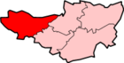 Allerford · Ashbeer · Bicknoller · Brandish Street · Brompton Ralph · Brompton Regis · Brushford · Carhampton · Clatworthy · Cockercombe · Crowcombe · Culbone · Cutcombe · Dulverton · Dunster · East Quantoxhead · Elworthy · Exford · Exton · Holford · Huish Champflower · Kilve · Lilstock · Luccombe · Luxborough · Minehead · Monksilver · Oare · Old Cleeve · Porlock · Roadwater · Sampford Brett · Selworthy · Simonsbath · Skilgate · Stogumber · Stogursey · Stringston · Timberscombe · Treborough · Upton · Washford · Watchet · West Quantoxhead · Williton · Winsford · Withycombe · Withypool · Wootton CourtenayCategories:
- Villages in West Somerset
- Civil parishes in Somerset
- Populated coastal places in Somerset


Wikimedia Foundation. 2010.