- Cockercombe
-
Coordinates: 51°05′26″N 3°12′01″W / 51.090491°N 3.2003964°W
Cockercombe 
 Cockercombe
Cockercombe shown within SomersetOS grid reference ST1602833039 Parish West Bagborough Unitary authority West Somerset Ceremonial county Somerset Region South West Country England Sovereign state United Kingdom Post town TAUNTON Postcode district TA4 4B Police Avon and Somerset Fire Devon and Somerset Ambulance South Western EU Parliament South West England UK Parliament North East Somerset List of places: UK • England • Somerset Cockercombe is a small village within the civil parish of West Bagborough in the West Somerset district of Somerset, England. Its nearest town is Taunton, which lies approximately 6.7 miles (10.8 km) away from the village.
Cockercombe tuff, a greenish-grey, hard sedimentary rock, is only found in this area.[1]
References
- ^ Prudden, Hugh. "Somerset building stone guide" (PDF). Somerset Archaeological and Natural History Society. p. 4. http://www.sanhs.org/Proc%20Building%20stone.pdf. Retrieved 16 July 2011.
Towns, villages and hamlets in the West Somerset district of Somerset, England 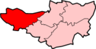 Allerford · Ashbeer · Bicknoller · Brandish Street · Brompton Ralph · Brompton Regis · Brushford · Carhampton · Clatworthy · Cockercombe · Crowcombe · Culbone · Cutcombe · Dulverton · Dunster · East Quantoxhead · Elworthy · Exford · Exton · Holford · Huish Champflower · Kilve · Lilstock · Luccombe · Luxborough · Minehead · Monksilver · Oare · Old Cleeve · Porlock · Roadwater · Sampford Brett · Selworthy · Simonsbath · Skilgate · Stogumber · Stogursey · Stringston · Timberscombe · Treborough · Upton · Washford · Watchet · West Quantoxhead · Williton · Winsford · Withycombe · Withypool · Wootton CourtenayCategories:
- Villages in West Somerset


Wikimedia Foundation. 2010.