- Old Ironstone Works, Mells
-
Old Iron Works, Mells Site of Special Scientific Interest 
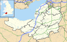
 Shown within Somerset
Area of Search Somerset Grid reference ST738488 Coordinates 51°14′16″N 2°22′36″W / 51.23777°N 2.37667°WCoordinates: 51°14′16″N 2°22′36″W / 51.23777°N 2.37667°W Interest Industrial Archaeology, Biological Area 0.25 hectares (0.0025 km2; 0.00097 sq mi) Notification 1987 Natural England website Old Iron Works, Mells (Fussells' Lower Works) (grid reference ST738488) is a 0.25 hectare biological Site of Special Scientific Interest, in the Wadbury Valley, south of the village of Mells in Somerset, notified in 1987. The site is a ruined iron works, which mainly produced agricultural edge-tools which were exported all over the world, and is now, in addition to its unique and major importance in relation to industrial archaeology, used as a breeding site by horseshoe bats. The block of buildings adjacent to the entrance is listed Grade II* and most of the rest of the site is a Scheduled Ancient Monument. It is included in the Heritage at Risk Register produced by English Heritage.[1]
Contents
Biological Interest
The site is used by both Greater and Lesser Horseshoe Bats. The roofspace of one of the former works building was used, before the building burnt down in the 1980s, as a breeding roost in summer by large numbers of Greater Horseshoes and smaller numbers of Lesser Horseshoes. Disused flues and tunnels in a low cliff are used for hibernation.[2]
History
It is likely that there was some form of foundry on or near the site since about 1500 when Mells seems to have been known as Iron Burgh.[3] There are further documentary records which indicate that iron working had been undertaken locally since at least the early 13th century.
The land on which the Lower Works were built was leased by John Horner (an alleged descendent of Little Jack Horner) to James Fussell III of Stoke Lane, on 25 December 1744, to erect "a good, firme and substantiall Mill or Mills for Grinding Edge Tools and forging Iron plates".[4][5] His son, James Fussell IV further developed the business. At one time it employed 250 people on this site and continued for many years, with various members of the Fussell family operating a total of six sites in the local area: the Upper Works further up the Wadbury Valley, the Great Elm Edge-Tool Works, the Chantry Works, the Railford Works and a small site at Gurney Slade.[6] Tools produced by Fussells were exported to Europe and America, and the family expanded its activities to include coal mining and banking, with the business issuing its own banknotes at one stage.[5]
The business declined towards the end of the 19th century, due in part to a failure to convert from water to steam power until a late stage, and also to the collapse of English agriculture in the 1870s.[5] By 1895 production had ceased,[7] and the company folded in 1900.[8]
Many of the old photographs, diagrams, plans and tools are now exhibited at Frome Museum.[9]
References
- ^ "South West England". Heritage at Risk. English Heritage. p. 183. http://www.english-heritage.org.uk/publications/HAR_Register_South_West_2009/southwest-2009-har-register.pdf. Retrieved 30 June 2010.
- ^ "English Nature citation sheet". 2006. http://www.english-nature.org.uk/citation/citation_photo/1000912.pdf. Retrieved 2006-07-25.
- ^ Toulson, Shirley (1984). The Mendip Hills: A Threatened Landscape. London: Victor Gollancz. ISBN 057503453X. (The source for this statement is not given in Toulson's book but it may be derived from a reference to a place immediately south-east of nearby Leigh-on-Mendip named as Irenborgh in a document dated 1515)
- ^ Atthill, Robin (1964). Old Mendip. Newton Abbott: David and Charles. ISBN 0715351710.
- ^ a b c Fussell, James (2001). The Fussell ironworks at Wadbury, Mells: An Introduction. Retrieved 8 February 2010.
- ^ Industrial archaeology - Fussell's iron works, British Geological Survey. Retrieved 8 February 2010.
- ^ The Fussells Iron Industry Story, Fussells Iron Industry Society. Retrieved 8 February 2010.
- ^ Mark Adler (December 2010). "When Fussells had the edge". Mendip Times 6 (7): 89.
- ^ "Collection". Frome Museum. http://www.fromemuseum.org/collection.htm. Retrieved 6 February 2010.
External links
- Fussells Iron Industry Society website
- English Nature website (SSSI information)
- Site boundary at Nature on the Map website
Categories:- Bat roosts in England
- Sites of Special Scientific Interest in Somerset
- Sites of Special Scientific Interest notified in 1987
- Industrial archaeology
- Scheduled Ancient Monuments in Somerset

Wikimedia Foundation. 2010.