- Cleeve Lock
-
Cleeve Lock[1]
Cleeve Lock from upstreamWaterway River Thames County Oxfordshire Maintained by Environment Agency Operation Hydraulic First built 1787 Latest built 1874 Length 133’ 7” (40.71m) Width 18’ 2” (5.53m) Fall 2’ 3” (0.69m) Above sea level 138' Distance to
Teddington Lock66 miles Power is available out of hours Cleeve Lock Legend


River Thames 


Benson Lock 


weir 


Old mill 


Wallingford Bridge 


Bradford's Brook 


A4130 Wallingford Bypass 


islands 


Moulsford Railway Bridge 


Cleeve Lock 


weir 


weir 


Old mill 


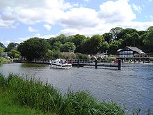
River Thames Cleeve Lock is a lock on the River Thames, in Oxfordshire, England. It is located just upstream of Streatley on the same side of the river. The village of Cleeve is on the opposite bank near Goring .
The first lock was built in 1787 by the Thames Navigation Commissioners. The lock has the smallest fall on the river at 2 ft 3 inches (0.69 m). The reach above it is the longest and the reach below it is the shortest on the non-tidal river.
The weir runs to an island below the lock, and there are further weirs between islands downstream.
Contents
Access to the lock
The lock can be reached on foot from Streatley, or by a track which comes off the A329 road to Wallingford.
History
There was a flash lock recorded on the site in the 16th century. The first pound lock was built of oak in 1787 alongside a meadow which was then known as Winch Meadow. It was originally to be called Streatley Lock, but in the event took its name from the village of Cleeve on the opposite side of the river. Until 1869 Cleeve Lock and Goring Lock were usually operated a single keeper. The lock was rebuilt in 1874.[2]
Reach above the lock
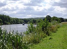
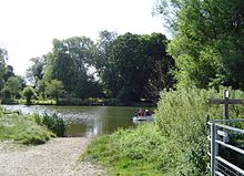
The six and a half mile reach is the longest on the river. Much of it is open country apart from the small village of Moulsford and the larger town of Wallingford. There were formerly two ferries along the reach at Little Stoke and at Chalmore Hole near Wallingford because the towpath changed sides. Brunel's Moulsford Railway Bridge crosses at some islands near Moulsford, where there was formerly another flash lock. Winterbrook Bridge a new road bridge crosses just downstream of Wallingford, relieving traffic on the ancient multi-arched Wallingford Bridge. There were formerly two historic and interesting public houses along the river, but these have both been turned into expensive restaurants.[3]
The river is an active rowing location with the Oxford University Boat Club and Oxford Brookes University boat club both having club houses on the reach near Wallingford, where Wallingford Rowing Club is also based. The Wallingford Long Distance Sculls take place on the reach in October.
The Thames Path keeps on the western bank all the way, but to compensate for thoses situations when the towpath changed sides it goes inland at Moulsford following the main road for quite a distance before returning to the river. There is also very small diversion away from the river in Wallingford and then the path stays on the western bank to Benson Lock where it crosses over to the other side of the river. The path is paralleled on the other side of the river as far as Winterbrook Bridge by the Ridgeway.
Literature and the Media
In Jerome K. Jerome's Three Men in a Boat, the narrator recounts a tale of a long and anxious journey down to Cleeve Lock, caused because he had an out of date map showing an intermediate lock at Wallingford. This has a historical basis in fact. Chalmore Lock at Chalmore Hole was established in 1838 (near the current site of the Oxford University Boat Club building), being called a "summer or low-water lock and weir". Although it appears to have been in decline by 1873 the inhabitants of Wallingford petitioned for its retention. It was removed in 1883 after a damning report from Sir John Hawkshaw.[4]
See also
- Locks on the River Thames
- Rowing on the River Thames
References
- ^ Statistics from Environment Agency A User's Guide to the River Thames:Part II
- ^ Fred. S. Thacker The Thames Highway: Volume II Locks and Weirs 1920 - republished 1968 David & Charles
- ^ Paul Goldsack River Thames: In the footsteps of the famous Englis Heritage/Bradt 2003
- ^ Fred. S. Thacker The Thames Highway: Volume II Locks and Weirs 1920 - republished 1968 David & Charles
External links
- Cleeve Lock, Goring, Oxfordshire at viewfinder.english-heritage.org.uk
Next lock upstream River Thames Next lock downstream Benson Lock
6.50 milesCleeve Lock
Grid reference: SU600818Goring Lock
0.62 milesCategories:- Locks on the River Thames
- Thames Path
Wikimedia Foundation. 2010.

![Cleeve Lock[1]](/pictures/enwiki/50/250px-CleeveLock01.JPG)


