- Goring-on-Thames
-
Coordinates: 51°31′23″N 1°08′06″W / 51.523°N 1.135°W
Goring-on-Thames 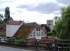
Goring mill and parish church from the bridge
 Goring-on-Thames
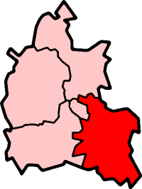
Goring-on-Thames shown within OxfordshirePopulation 3,104 (2001 census)[1] OS grid reference SU6080 Parish Goring District South Oxfordshire Shire county Oxfordshire Region South East Country England Sovereign state United Kingdom Post town Reading Postcode district RG8 Dialling code 01491 Police Thames Valley Fire Oxfordshire Ambulance South Central EU Parliament South East England UK Parliament Henley Website Goring Parish Council List of places: UK • England • Oxfordshire Goring-on-Thames (or Goring) is a large village and civil parish on the River Thames in South Oxfordshire, about 5.5 miles (8.9 km) south of Wallingford.
Contents
Geography
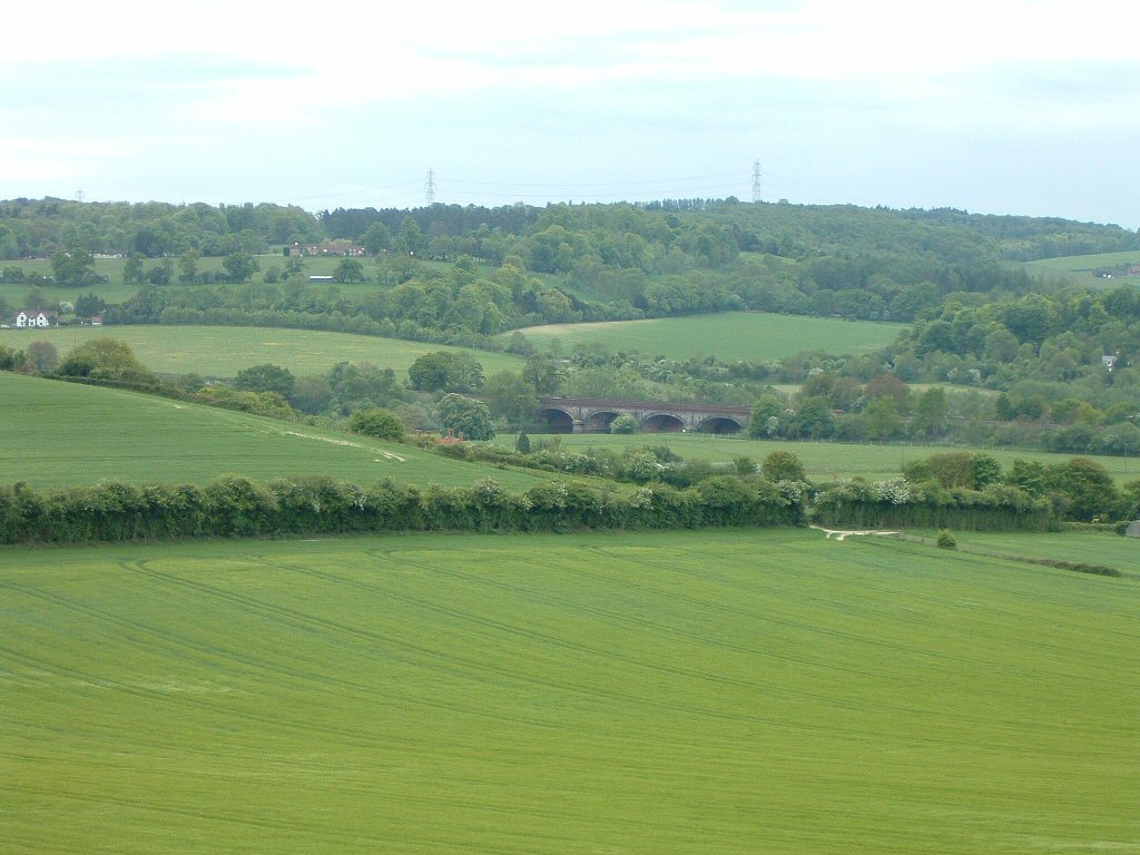
 Gatehampton Railway Bridge near Goring
Goring is on the north bank of the River Thames, in the Goring Gap which separates the Berkshire Downs and the Chiltern Hills. The village is about 8 miles (13 km) northwest of Reading and 16 miles (26 km) south of Oxford. Immediately across the river is the Berkshire village of Streatley, and the two are often considered as twin villages, linked by Goring and Streatley Bridge and its adjacent lock and weir. The Thames Path, Icknield Way and the Ridgeway cross the Thames at Goring. The Great Western Main Line railway passes through Goring, and Goring & Streatley railway station in the village is served by local First Great Western trains running between Reading and Oxford.
Religious sites
The Church of England parish church of Saint Thomas of Canterbury is Norman, built early in the 12th century.[2] The bell-stage of St. Thomas's bell tower was added in the 15th century[2] and has a ring of eight bells.[3] The church hall was added in 1901.[4]
A priory of Augustinian nuns was built late in the 12th century with its own priory church adjoining St. Thomas's.[2] The priory survived until the early part of the 16th century[5] when it was suppressed in the Dissolution of the Monasteries and then demolished. The foundations of the priory church, cloister, dormitory, vestry, chapter house and parlour were excavated in 1892.[4]
Goring Free Church is a member of the Countess of Huntingdon's Connexion.[6] The congregation was founded in 1788 and its first chapel was built in 1793.[6] At its centenary in 1893 a new church building was added[4] and the original chapel became the church hall.[6]
The Roman Catholic Church of Our Lady and Saint John was designed by the architect William Ravenscroft and built in 1898.[4] It is now part of a single parish with the Roman Catholic Church of Christ the King in Woodcote.[7]
Amenities
Goring United Football Club plays in the Reading Football League.[8] Goring-on-Thames Cricket Club was founded in 1876.[9] Two of its teams play in the Berkshire Cricket League.[10] Goring has also a lawn tennis club with teams that play in two local leagues.[11]
Goring on Thames Decorative and Fine Arts Society was founded in 1987 and is a member of the National Association of Decorative & Fine Arts Societies[12] Goring has a Women's Institute.[13]
Awards
Oxfordshire Village of the Year 2009
On 10 July 2009 Goring was named Oxfordshire's Village of the Year, ahead of 11 other villages and taking the title from neighbouring Woodcote.[14] The £1000 prize will be put towards the village's hydro-electric project[15] to generate electricity from the river Thames.
The competition looks at the depth of the infrastructure and activity within the village and Goring's plans to raise £1m to fund the hydro-electric project was instrumental to its success.
Calor Village of the Year - South England Regional Winner 2009/2010
Goring-on-Thames was the Overall Regional Winner as well as winner in the Sustainability and Communications categories of the Calor Village of the Year regional heat for South England.[16]
Twin town
See also
References
- ^ "Area: Goring CP (Parish): Parish Headcounts". Neighbourhood Statistics. Office for National Statistics. http://neighbourhood.statistics.gov.uk/dissemination/LeadTableView.do?a=7&b=798651&c=Goring&d=16&e=15&g=480909&i=1001x1003x1004&o=1&m=0&r=1&s=1269207572406&enc=1&dsFamilyId=779. Retrieved 21 March 2010.
- ^ a b c Sherwood & Pevsner, 1974, page 614
- ^ The Oxford Diocesan Guild of Church Bell Ringers, Reading Branch: Goring-on-Thames
- ^ a b c d Sherwood & Pevsner, 1974, page 615
- ^ Page, 1907, pages 103-104
- ^ a b c Goring Free Church: Our History
- ^ The Catholic Parish of Our Lady & St John & Christ the King
- ^ Goring United Football Club: Saturday 1st team - Division 1
- ^ GardinersWorld: Our History
- ^ Berkshire Cricket League
- ^ Goring Tennis Club: League Teams
- ^ Goring on Thames Decorative and Fine Arts Society
- ^ Oxfordshire Federation of Women's Institutes
- ^ BBC News, Oxfordshire. Goring Named Village of the Year
- ^ Goring & Streatley Sustainability Group
- ^ Goring on Thames Celebrates Regional Success. Village wins through for South England in national competition
Sources
- Page, William (Ed.) (1907). Victoria County History: A History of the County of Oxford, Volume 2. pp. 103–104.
- Sherwood, Jennifer; Pevsner, Nikolaus (1974). The Buildings of England: Oxfordshire. Harmondsworth: Penguin Books. pp. 613–616. ISBN 0 14 071045 0.
External links
- Goring and Streatley travel guide from Wikitravel
- Goring Gap News
- Goring and Streatley Amenity Association
- Goring and District Twinning Association
- All about Goring
Categories:- Villages in Oxfordshire
- Populated places on the River Thames
- Civil parishes in Oxfordshire


Wikimedia Foundation. 2010.