Coordinates: 51°35′N 0°58′W / 51.58°N 0.96°W / 51.58; -0.96
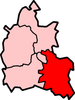
Maidensgrove is a hamlet above the Stonor valley in the Chiltern Hills, adjacent to Russell's Water common. It is about 5 miles (8.0 km) northwest of Henley-on-Thames in South Oxfordshire, England.
There is a 16th century public house called The Five Horseshoes at nearby Upper Maidensgrove. The Chiltern Way and Oxfordshire Way long distance paths pass close by and the Warburg Nature Reserve is to the south.
External links
| v · South Oxfordshire |
|
|
|
|
| Towns |
|
 |
|
| Large Villages |
|
|
Other Civil
Parishes
(Component
Villages
and Hamlets) |
Adwell • Aston Rowant • Aston Tirrold • Aston Upthorpe • Beckley and Stowood ( Beckley, Stowood) • Berrick Salome ( Berrick Prior, Roke, Rokemarsh) • Binfield Heath • Bix and Assendon ( Bix, Bix Bottom, Lower Assendon, Middle Assendon) • Brightwell Baldwin • Britwell Salome • Checkendon • Clifton Hampden (Burcot) • Crowell • Cuddesdon and Denton ( Cuddesdon, Denton) • Culham • Cuxham with Easington ( Cuxham, Easington) • Dorchester • Drayton St. Leonard • East Hagbourne ( Coscote) • Elsfield • Eye and Dunsden ( Sonning Eye, Dunsden Green, Playhatch) • Forest Hill with Shotover (Forest Hill, Shotover) • Goring Heath (Whitchurch Hill, Cray's Pond) • Great Haseley (Latchford, Little Haseley, North Weston, Rycote) • Harpsden • Highmoor (Satwell) • Holton • Ipsden • Kidmore End ( Gallowstree Common) • Lewknor ( Postcombe, South Weston) • Little Milton • Little Wittenham • Long Wittenham • Mapledurham ( Trench Green, Chazey Heath) • Marsh Baldon ( Baldon Row) • Moulsford • Nettlebed • Newington ( Great Holcombe) • North Moreton • Nuffield • Nuneham Courtenay • Pishill with Stonor ( Pishill, Stonor, Maidensgrove, Russell's Water) • Pyrton (Clare, Standhill) • Rotherfield Greys • Rotherfield Peppard • Shirburn • South Moreton ( Fulscot) • South Stoke ( Littlestoke) • Stadhampton ( Chiselhampton, Brookhampton, Ascott) • Stanton St. John (Woodperry) • Stoke Row • Stoke Talmage • Swyncombe • Sydenham (Kingston Stert) • Tetsworth • Tiddington-with-Albury (Tiddington, Albury) • Toot Baldon • Towersey • Warborough ( Shillingford) • Waterstock • West Hagbourne • Whitchurch-on-Thames • Woodeaton • Waterperry with Thomley ( Waterperry, Thomley) • Wheatfield • Wilcote
|
|
Former Districts
and Boroughs |
|
|
Former
Constituencies |
|
|
|
|
|

 Maidensgrove
