- Oakley, Oxfordshire
-
Coordinates: 51°41′56″N 0°55′08″W / 51.699°N 0.919°W
Oakley 
 Oakley
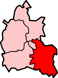
Oakley shown within OxfordshireOS grid reference SP7400 Parish Chinnor District South Oxfordshire Shire county Oxfordshire Region South East Country England Sovereign state United Kingdom Post town Chinnor Postcode district OX39 Dialling code 01844 Police Thames Valley Fire Oxfordshire Ambulance South Central EU Parliament South East England UK Parliament Henley List of places: UK • England • Oxfordshire Oakley is a spring line settlement at the foot of the Chiltern Hills on the route of the Lower Icknield Way. It is about 4.5 miles (7.2 km) southeast of Thame in Oxfordshire, England. It is in the civil parish of Chinnor, and 20th century housing developments have absorbed Oakley into that village.
External links
 Media related to Oakley, Oxfordshire at Wikimedia CommonsCategories:
- Villages in Oxfordshire
- Oxfordshire geography stubs

Wikimedia Foundation. 2010.