- Checkendon
-
Coordinates: 51°32′35″N 1°02′46″W / 51.543°N 1.046°W
Checkendon 
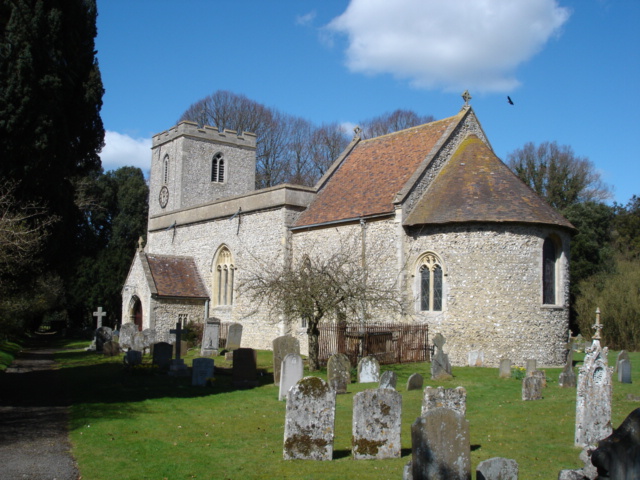
Parish church of Saints Peter & Paul
 Checkendon
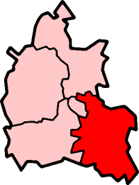
Checkendon shown within OxfordshirePopulation 479 (2001 census)[1] OS grid reference SU6683 Parish Checkendon District South Oxfordshire Shire county Oxfordshire Region South East Country England Sovereign state United Kingdom Postcode district RG8 Dialling code 01491 Police Thames Valley Fire Oxfordshire Ambulance South Central EU Parliament South East England UK Parliament Henley Website Checkendon Village List of places: UK • England • Oxfordshire Checkendon is a village and civil parish about 6 miles (9.7 km) west of Henley-on-Thames in South Oxfordshire, England.
Contents
Parish church
The Church of England parish church of Saint Peter and Saint Paul is a 12th century Norman building. All but one of the windows were replaced later in the Middle Ages with Decorated Gothic and Perpendicular Gothic ones, and the Perpendicular Gothic west tower is also a later addition.[2]
The church has an early 13th century wall painting of Christ in Majesty above a procession of Apostles. The murals were faithfully repainted when they were rediscovered, but more recently this has been considered over-restoration.[3]
The bell tower has a ring of eight bells. Four were cast by Lester and Pack in 1765, two were cast in 1879 by Mears and Stainbank and two more cast by Mears and Stainbank were added in 1967.[4] The building is Grade I listed.
Saints Peter & Paul parish is now a member of The Langtree Team Ministry: a Church of England benefice that includes also the parishes of Ipsden, North Stoke, Stoke Row, Whitchurch-on-Thames and Woodcote.[5]
War artist Eric Kennington (1888–1960) is buried here.
Amenities
Checkendon has two gastropubs: the 15th century Four Horseshoes[6] within the village and the 17th century Highwayman[7] to the south in the nearby hamlet of Exlade Street. There is also The Black Horse at Scots Common.[8]
Checkendon has a Church of England primary school.[9]
Checkendon has an equestrian centre.[10] Checkendon Cricket Club[11] plays in the Berkshire Cricket League First Division.[12]
North of the village in the 19th century Wheelers Barn is Philip Koomen Furniture, producing modern bespoke wooden furniture.[13]
The music studio in the manor house at nearby Hook End was used by David Gilmour of the band Pink Floyd to record parts of the band’s 1987 album A Momentary Lapse of Reason. The band’s inflatable pig, first used to promote their Animals album a decade earlier, was stored in one of the outbuildings.[14] The studio is now owned by Mark White singer/songwriter with the band Godnose.
Public transport
Checkendon is served by two bus routes:
- Reading Transport route 142, Reading-Woodcote-Checkendon[15]
- White's Coaches route 145, Woodcote-Checkendon-Henley[16]
References
- ^ "Area: Checkendon CP (Parish): Parish Headcounts". Neighbourhood Statistics. Office for National Statistics. http://neighbourhood.statistics.gov.uk/dissemination/LeadTableView.do?a=7&b=798633&c=Checkendon&d=16&e=15&g=480764&i=1001x1003x1004&o=1&m=0&r=1&s=1268446488918&enc=1&dsFamilyId=779. Retrieved 8 March 2010.
- ^ Sherwood & Pevsner, 1974, pages 533-534
- ^ Long, 1972, page 90
- ^ Oxford Diocesan Guild of Church Bell Ringers, Reading Branch
- ^ The Langtree Team Ministry
- ^ Geograph.org.uk
- ^ The Highwayman
- ^ The Black Horse at beerintheevening.com
- ^ Checkendon Church of England Primary School
- ^ Checkendon Equestrian Centre
- ^ Checkendon Cricket Club at checkendon.org
- ^ Berkshire Cricket League
- ^ Philip Koomen Furniture
- ^ Hook End Studio
- ^ Reading-buses.co.uk
- ^ Whitescoaches.com
Sources
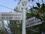 ...But I don't want to go via Quiet Lane"
- Long, E.T. (1972). "Medieval Wall Paintings in Oxfordshire Churches". Oxoniensia (Oxfordshire Architectural and Historical Society) XXXVII: 106–107.
- Sherwood, Jennifer; Pevsner, Nikolaus (1974). Oxfordshire. The Buildings of England. Harmondsworth: Penguin Books. pp. 533–534. ISBN 0 14 071045 0.
External links
Categories:- Villages in Oxfordshire
- Civil parishes in Oxfordshire


Wikimedia Foundation. 2010.