Municipal Borough of Wallingford
- Municipal Borough of Wallingford
-
The Municipal Borough of Wallingford was an administrative district based on the town of Wallingford, then in Berkshire, now Oxfordshire, in southern in England, established in 1834 and disbanded in 1974, when it became part of South Oxfordshire. The municipal borough, administered by Wallingford Borough Council, was based on the ancient borough of Walllingford, which itself centred on Wallingford’s burh. Wallingford was established as a borough by the time of the Domesday book. Municipal records begin with burghmote rolls in 1232 and gild records in 1227, and the first mayor is recorded for 1231. The borough was given parliamentary representation as a parliamentary borough in 1295, which continued until 1885. Mayor of Wallingford remains a title associated with Wallingford Town Council.
References
- ^ Whitaker's Almanack 1974, complete edition (106th ed.). London: J. Whitaker & Sons. 1973 [1868]. p. 665. ISBN 0 85021 067 4. "Registrar General's Estimate, June 1972"
External links
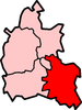
| v · South Oxfordshire |
|
|
|
|
| Towns |
|
 |
|
| Large Villages |
|
|
Other Civil
Parishes
(Component
Villages
and Hamlets) |
Adwell • Aston Rowant • Aston Tirrold • Aston Upthorpe • Beckley and Stowood ( Beckley, Stowood) • Berrick Salome ( Berrick Prior, Roke, Rokemarsh) • Binfield Heath • Bix and Assendon ( Bix, Bix Bottom, Lower Assendon, Middle Assendon) • Brightwell Baldwin • Britwell Salome • Checkendon • Clifton Hampden (Burcot) • Crowell • Cuddesdon and Denton ( Cuddesdon, Denton) • Culham • Cuxham with Easington ( Cuxham, Easington) • Dorchester • Drayton St. Leonard • East Hagbourne ( Coscote) • Elsfield • Eye and Dunsden ( Sonning Eye, Dunsden Green, Playhatch) • Forest Hill with Shotover (Forest Hill, Shotover) • Goring Heath (Whitchurch Hill, Cray's Pond) • Great Haseley (Latchford, Little Haseley, North Weston, Rycote) • Harpsden • Highmoor (Satwell) • Holton • Ipsden • Kidmore End ( Gallowstree Common) • Lewknor ( Postcombe, South Weston) • Little Milton • Little Wittenham • Long Wittenham • Mapledurham ( Trench Green, Chazey Heath) • Marsh Baldon ( Baldon Row) • Moulsford • Nettlebed • Newington ( Great Holcombe) • North Moreton • Nuffield • Nuneham Courtenay • Pishill with Stonor ( Pishill, Stonor, Maidensgrove, Russell's Water) • Pyrton (Clare, Standhill) • Rotherfield Greys • Rotherfield Peppard • Shirburn • South Moreton ( Fulscot) • South Stoke ( Littlestoke) • Stadhampton ( Chiselhampton, Brookhampton, Ascott) • Stanton St. John (Woodperry) • Stoke Row • Stoke Talmage • Swyncombe • Sydenham (Kingston Stert) • Tetsworth • Tiddington-with-Albury (Tiddington, Albury) • Toot Baldon • Towersey • Warborough ( Shillingford) • Waterstock • West Hagbourne • Whitchurch-on-Thames • Woodeaton • Waterperry with Thomley ( Waterperry, Thomley) • Wheatfield • Wilcote
|
|
Former Districts
and Boroughs |
|
|
Former
Constituencies |
|
|
|
|
|
Coordinates: 51°35′56″N 1°07′30″W / 51.599°N 1.125°W / 51.599; -1.125
Categories:
- Districts of England abolished by the Local Government Act 1972
- Municipal boroughs of England
Wikimedia Foundation.
2010.
Look at other dictionaries:
Wallingford — Wallingford, 1) alte Stadt (municipal borough) in Berkshire (England), an der Themse, inmitten eines dicht bevölkerten Bezirks, hat mehrere alte Kirchen, Lateinschule, Kornbörse, Produktenhandel und (1901) 2808 Einw. Von dem alten, 1652… … Meyers Großes Konversations-Lexikon
Municipal Corporations Act 1835 — The Municipal Corporations Act 1835 Parliament of the United Kingdom Long title An Act to provide for the Regulation of Municipal Corporations in England and Wales Statute book chapter … Wikipedia
Wallingford, Pennsylvania — Geobox Settlement name = Wallingford native name = other name = other name1 = category = image size = image caption = Wallingford train station flag size = symbol = symbol size = nickname = motto = country = United States state = Pennsylvania… … Wikipedia
Ancient borough — An early historical analysis of cities and boroughs by Robert Brady (1704) … Wikipedia
Oxfordshire (UK Parliament constituency) — Oxfordshire Former County constituency for the House of Commons County Oxfordshire 1290 (1290)–1885 … Wikipedia
Crowmarsh Gifford — Coordinates: 51°35′56″N 1°06′43″W / 51.599°N 1.112°W / 51.599; 1.112 … Wikipedia
Cholsey — Coordinates: 51°34′26″N 1°09′04″W / 51.574°N 1.151°W / 51.574; 1.151 … Wikipedia
Crowmarsh Rural District — Crowmarsh Geography Status Rural distric … Wikipedia
Abingdon (UK Parliament constituency) — UK former constituency infobox Name = Abingdon division of Berkshire Type = County Year = 1885 Abolition = 1983 members = oneUK former constituency infobox Name = Abingdon Type = Borough Year = 1558 Abolition = 1885 members = oneAbingdon was a… … Wikipedia
Didcot — Coordinates: 51°36′22″N 1°14′28″W / 51.606°N 1.241°W / 51.606; 1.241 … Wikipedia
