- Kinross, Western Australia
Infobox Australian Place | type = suburb
name = Kinross
city = Perth
state = wa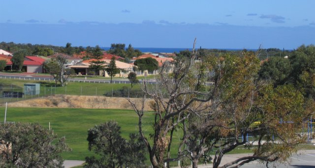
caption = View over Callander Park and Indian Ocean glimpse in the distance.
pop = 7232 (2006 Census)Census 2006 AUS|id=SSC51771|name=Kinross (State Suburb)|quick=on|accessdate=2007-06-27]
lga = City of Joondalup
postcode = 6028
dist1 = 32 | location1=Perth
est = 1993
stategov = Ocean Reef
fedgov = Moore
near-nw =
near-n = Tamala Park
near-ne =
near-w = Burns Beach
near-e = Neerabup
near-se = Joondalup
near-sw = Iluka
near-s = Currambinecoord|-31.722|115.74|type:city(7232)_region:AU-WA_scale:30000|format=dms|display=titleKinross is a small suburb in the
City of Joondalup located in the northern suburbs of Perth,Australia . Kinross was constructed around 1992-3 in various stages. It is bordered byNeerabup National Park , and is the City of Joondalup's most northerly suburb.Kinross mostly contains young families and overseas migrants, especially from the United Kingdom, Ireland and South Africa. Several parks are dotted through the suburb, most of which offer playground facilities.
The Scottish influence in Kinross is not limited to its name but extends throughout the suburb with road names, parks and others mainly derived from Scottish place names, for example Glencoe Loop, Edinburgh Avenue, Selkirk Drive, Falkirk Court, Ben Nevis Turn and many others.
Facilities
The schools are in the heart of the suburb located along Kinross Drive and Callander Avenue. Kinross Primary School was opened in 1995, and Kinross College, a "Middle School" serving years 6-10, was opened in 2002.
Kinross has its own football club (Westside Soccer Club) which plays its home matches at the McNaughton Park ground. There is a skate park and community centre next to McNaughton Park.
There are two suburban shopping centres, one located along Kinross Drive which includes a pharmacy, medical centre, convenience store, fast food takeaways, hair dressers, real estate agent and a DVD/video rental. A new shopping centre called Kinross Central on the corner of Connolly Drive and Selkirk Drive has been opened in recent years.
Demographics
According to the 2006 Census, Kinross had a population of 7,232. 0.3% of the total population are
Indigenous Australians (Aboriginals andTorres Strait Islander s). 46.5% of the population are aged between 25 and 54 years, while 20.4% of the population are between 5 and 14 years. The percentages of these age groups are higher than the respective national percentages of 42.2% and 13.5%. Also, 5.3% of the population are aged above 65, which is significantly less than the Australian population percentage of 13.3%.42.9% of the population were born overseas, which is significantly more than the Australian population percentage of 22.2%. A large number of people who were born overseas were from
England (21.0%). The next most common responses of their country of birth wereScotland ,South Africa ,New Zealand andIreland . The most popular language spoken at home other than English wasAfrikaans (1.1%). The next most popular spoken languages were Arabic, Persian, Mandarin and Cantonese.25.9% of the population in Kinross are
Anglican and 22.3% areCatholic . These are the most popular religions in the suburb. 24.3% of the people have no religion.Transport
Kinross is located northeast of
Marmion Avenue and Burns Beach Road, and theMitchell Freeway is being extended to Burns Beach Road with construction expected to be completed in early 2009. The southeastern corner of Kinross is also served by the Currambine railway station, whilst other sections are served by one of threeTransperth bus routes operated byPath Transit which run between Joondalup Station and Clarkson Station. The 472 service travels along Marmion Avenue and terminates at the northerly point of Kinross Drive. The 473 service travels the length of Kinross Drive and terminates at Duart Pass. The 474 service serves Selkirk/MacNaughton and continues across to Kinross Drive and terminates at Clarkson Train Station.References
Wikimedia Foundation. 2010.