- Draycott, Somerset
-
Coordinates: 51°15′23″N 2°45′03″W / 51.2563°N 2.7507°W
Draycott 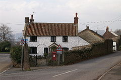
Draycott
 Draycott
Draycott shown within SomersetOS grid reference ST477510 District Mendip Shire county Somerset Region South West Country England Sovereign state United Kingdom Post town CHEDDAR Postcode district BS27 Dialling code 01934 Police Avon and Somerset Fire Devon and Somerset Ambulance South Western EU Parliament South West England UK Parliament Wells List of places: UK • England • Somerset Draycott is a small village in Somerset, England, neighbouring the village of Cheddar on the southern edge of the Mendip Hills Area of Outstanding Natural Beauty. It is within the parish of Rodney Stoke.
Contents
History
There is some evidence of occupation of the site in the Iron Age including an unfinished earthwork enclosure on the hill above Draycott.[1]
The village was listed in the Domesday Book of 1086 as Draicote, meaning 'The dray shelter' from the Old English dragan and cot.[2] Another derivation is from the Brythonic from Tre meaning settlement and Coet meanings woods.
Geography
Close to the village is the Draycott Sleights nature reserve which has been designated as a Site of Special Scientific Interest.
Halesland Airfield is situated just to the north of the village and is home to the Mendip Gliding Club. Draycott is still a major strawberry producer and the now-disused railway line that ran through the village was called the Strawberry Line. The pub located opposite the old railway station is called The Strawberry Special.
The A371 road runs north to south through the village's longest axis. Despite being classified as an A-road, it significantly narrows at certain points along the southern part of the village and has been the cause of congestion during times of increased traffic flow such as during the summer tourist season.
Church
The church of St Peter was built in 1861 by the architect C.E. Giles. It is a Grade II listed building.[3] The majority of the stonework is that known locally as 'Draycott Marble', a dolomitic conglomerate with a pronounced pinkish tinge, that was quarried quite close by at Draycott quarry.[4] Notable interior features are the stained glass east windows, the fine wrought-iron rood screen (1894), and the neo-Norman font by William Burges.[5]
References
- ^ "Mendip Hills An Archaeological Survey of the Area of Outstanding Natural Beauty". Somerset County Council Archeological Projects. http://www1.somerset.gov.uk/archives/hes/downloads/HES_MendipAONB.pdf. Retrieved 16 January 2011.
- ^ Robinson, Stephen (1992). Somerset Place Names. Wimborne, Dorset: The Dovecote Press Ltd. ISBN 1874336032.
- ^ "Church of St Peter". Images of England. http://www.imagesofengland.org.uk/details/default.aspx?id=268102. Retrieved 2006-07-17.
- ^ Atthill, Robin (1976). Mendip: A new study. Newton Abbot, Devon: David & Charles. ISBN 0715372971.
- ^ "Church of St Peter". http://rodneystokewithdraycott.org.uk/Draycott/Buildings/StPetersBuilding.htm. Retrieved 2006-07-17.
External links
Categories:- Mendip Hills
- Villages in Mendip


Wikimedia Foundation. 2010.