- Congresbury Yeo
-
"Yeo Valley" redirects here. For other uses, see Yeo Valley (disambiguation).For other rivers called Yeo, see River Yeo (disambiguation).
Congresbury Yeo River 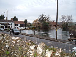
Country England County Somerset Cities Ubley, Congresbury, Wrington, Iwood Landmark Blagdon Lake Source Compton Martin Duck Pond - location Compton Martin, Somerset, England - coordinates 51°18′38″N 2°39′12″W / 51.31056°N 2.65333°W Mouth Severn Estuary - location Kingston Seymour, Somerset, England - elevation 0 ft (0 m) - coordinates 51°23′43″N 2°54′39″W / 51.39528°N 2.91083°W The River Yeo (often referred to as the Congresbury Yeo, after the village of Congresbury, through which it flows, to avoid confusion with other similarly named rivers) is a river which flows through North Somerset, England.
Contents
River course
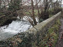
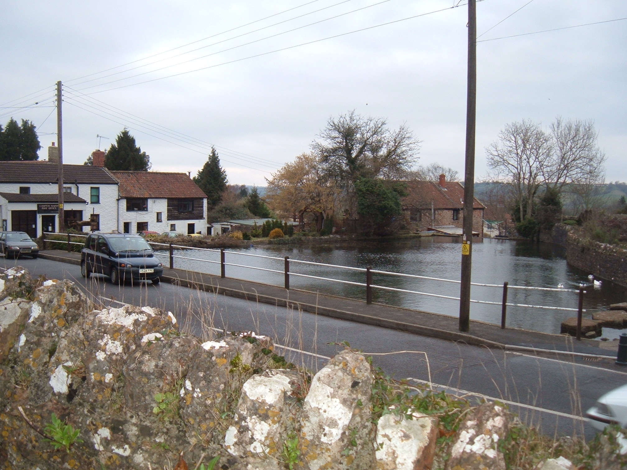
The river rises in the centre of Compton Martin village, in the district of Bath and North East Somerset, as a spring which feeds the village duckpond. From there it flows past the village of Ubley and enters Blagdon Lake (created in the 1890s by damming the river) just north of the village of Blagdon. From the lake the river flows south of Wrington and Iwood, where there were once a series of watermills along its banks. Its route then takes it around the northern outskirts of Congresbury, and across the North Somerset Levels roughly parallel to the A370 road, past the site of a Roman villa before crossing under the M5 motorway and emptying into the Severn Estuary in Woodspring Bay, downstream from Clevedon and west of the village of Kingston Seymour.
Close to the mouth on the Severn Estuary on land owned by Environment Agency and leased by the Avon Wildlife Trust are Blake's Pools which were dug between 1983 and 1987 to attract wildlife. It forms part of the Severn Estuary Site of Special Scientific Interest, Special Protection Area and Ramsar site.[1]
Flood prevention and conservation
The river falls within the area of the West Mendip Internal Drainage Board, which has a range of policies and guidance about flood prevention and conservation in the area.
See also
References
- ^ "Blake's Pools". Reserves. Avon Wildlife Trust. Archived from the original on 2008-05-16. http://web.archive.org/web/20080516123323/http://www.avonwildlifetrust.org.uk/level1/reserves/blakes_pools.htm. Retrieved 2008-06-01.
External links
Chew Valley Villages: Belluton · Bishop Sutton · Blagdon · Burnett · Cameley · Camerton · Chelwood · Chew Magna · Chew Stoke · Chewton Keynsham · Chewton Mendip · Clutton · Compton Dando · Compton Martin · East Harptree · High Littleton · Hinton Blewett · Hunstrete · Keynsham · Litton · Marksbury · Nempnett Thrubwell · Norton Malreward · Pensford · Publow · Regil · Stanton Drew · Stanton Prior · Stowey · Temple Cloud · Timsbury · Ubley · West Harptree · Winford · WoollardReservoirs: Rivers: SSSIs: Open Access Land Councils: Surrounding areas: Ceremonial county of Somerset Somerset Portal Unitary authorities Boroughs or districts Major settlements Axbridge • Bath • Bridgwater • Bruton • Burnham-on-Sea • Castle Cary • Chard • Clevedon • Crewkerne • Dulverton • Frome • Glastonbury • Highbridge • Ilminster • Keynsham • Langport • Midsomer Norton • Minehead • Nailsea • North Petherton • Portishead • Radstock • Shepton Mallet • Somerton • South Petherton • Taunton • Watchet • Wellington • Wells • Weston-super-Mare • Wincanton • Wiveliscombe • Yeovil
See also: List of civil parishes in SomersetRivers Alham • Aller • Avill • Avon • Axe (Bristol Channel) • Axe (Lyme Bay) • Badgworthy Water • Banwell • Barle • Brue • Cam Brook • Cary • Chew • East Lyn • Exe • Fivehead • Frome • Haddeo • Hoar Oak Water • Holford • Horner • Huntspill • Isle • Land Yeo • Mells • Midford Brook • Oare Water • Parret • Severn Estuary • Sheppey • Somer • Sowy • Tone • Washford • Wellow Brook • West Lyn • Whitelake • Yeo (Congresbury) • Yeo (South Somerset)Topics County Council • Culture of Somerset • Economy of Somerset • Geography of Somerset • Geology of Somerset • History of Somerset • Museums • Transport in Somerset
Geographic areas: Blackdown Hills • Brendon Hills • Chew Valley • Exmoor • Mendip Hills • Polden Hills • Quantock Hills • Somerset Levels • South West Coast Path • West Somerset Coast PathCategories:- Mendip Hills
- North Somerset
- Rivers of Somerset

Wikimedia Foundation. 2010.