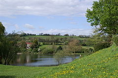
- Chew Magna Reservoir
-
Chew Magna Reservoir 
Location Somerset Coordinates 51°21′58″N 2°37′34″W / 51.366°N 2.626°WCoordinates: 51°21′58″N 2°37′34″W / 51.366°N 2.626°W Lake type reservoir Primary inflows Winford brook Primary outflows Winford brook Basin countries United Kingdom Surface area 5 acres (2.0 ha) Chew Magna Reservoir is a small reservoir on the western outskirts of the village of Chew Magna, Somerset, England. It lies just north of the B3130 Winford Road.
This 5 acres (2 ha) reservoir was created in the 1930s, damming Winford brook, to supply water for villages in the Chew Valley. It is owned and managed by Bristol Water.
Chew Magna reservoir provides fly fishing for stocked Brown Trout (Salmo trutta morpha fario) and Rainbow Trout (Oncorhynchus mykiss).[1] Rainbows can be fished all year. Parking is close to the lake and there are many stagings erected around the lake.
In 2011 the reservoir emptied following a long period without sustained rainfall. Staff from Bristol Water rescued the trout and transferred them to the nearby Chew Valley Lake.[2]
Reservoir
- ^ "Chew Magna Reservoir". Waterscape. http://www.waterscape.com/things-to-do/fishing/fisheries/16576/chew-magna-reservoir. Retrieved 6 September 2011.
- ^ "Chew Magna Reservoir empty". Bristol Water. http://www.bristolwater.co.uk/news/mainNews.asp?newsID=899. Retrieved 6 September 2011.
Bibliography
- Janes, Rowland (ed) (1987). The Natural History of the Chew Valley. ISBN 0-9545125-0-2.
External links
Bristol Reservoirs The reservoirs: Chew Valley Lake · Blagdon Lake · Cheddar Reservoir · Barrow Gurney Reservoirs · Litton Reservoirs · Chew Magna Reservoir
Related topics: Bristol Water
Chew Valley Villages: Belluton · Bishop Sutton · Blagdon · Burnett · Cameley · Camerton · Chelwood · Chew Magna · Chew Stoke · Chewton Keynsham · Chewton Mendip · Clutton · Compton Dando · Compton Martin · East Harptree · High Littleton · Hinton Blewett · Hunstrete · Keynsham · Litton · Marksbury · Nempnett Thrubwell · Norton Malreward · Pensford · Publow · Regil · Stanton Drew · Stanton Prior · Stowey · Temple Cloud · Timsbury · Ubley · West Harptree · Winford · WoollardReservoirs: Rivers: SSSIs: Open Access Land Councils: Surrounding areas: Categories:- Drinking water reservoirs in England
- Geography of Somerset
Wikimedia Foundation. 2010.
