- River Aller
Geobox River
name =River Aller
native_name =
other_name =
other_name1 =

image_size =
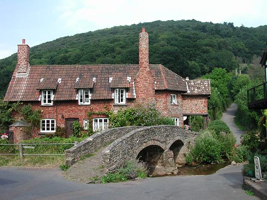
image_caption = Packhorse Bridge,Allerford
etymology =
country = England
country1 =
state = Somerset
state1 =
region = Exmoor
region1 =
district = West Somerset
district1 =
city = Allerford
city1 =
landmark =
landmark1 =
length_imperial =
watershed_imperial =
discharge_location =
discharge_imperial =
discharge_max_imperial =
discharge_min_imperial =
discharge1_location =
discharge1_imperial =
source_name =
source_location = Holnicote
source_district =West Somerset
source_region = Exmoor
source_state = Somerset
source_country = England
source_lat_d = 51
source_lat_m = 11
source_lat_s = 54
source_lat_NS = N
source_long_d = 3
source_long_m = 32
source_long_s = 52
source_long_EW = W
source_elevation_imperial =
source_length_imperial =
mouth_name =Porlock Bay ,Bristol Channel
mouth_location = nearHurlestone Point
mouth_district =
mouth_region =
mouth_state = Somerset
mouth_country = England
mouth_lat_d = 51
mouth_lat_m = 13
mouth_lat_s = 31
mouth_lat_NS = N
mouth_long_d = 3
mouth_long_m = 35
mouth_long_s = 10
mouth_long_EW = W
mouth_elevation = 0
tributary_left = River Horner
tributary_left1 =
tributary_right =
tributary_right1 =
free_name =
free_value =
map_size =
map_caption = The River Aller is a small river onExmoor inSomerset ,England .It rises as several small streams around
Tivington andHuntscott and flows through theHolnicote Estate pastHolnicote and throughAllerford , where it passes under a packhorse bridge of medieval origin. [cite web | title=Packhorse Bridge | work=Images of England | url=http://www.imagesofengland.org.uk/details/default.aspx?id=265486 | accessdate=2008-01-05] It then joins theRiver Horner flows intoPorlock Bay nearHurlestone point on theBristol Channel .References
Wikimedia Foundation. 2010.
