Hoar Oak Water

Hoar Oak Water

Geobox River
name = Hoar Oak Water
native_name =
other_name =
other_name1 =


image_size =
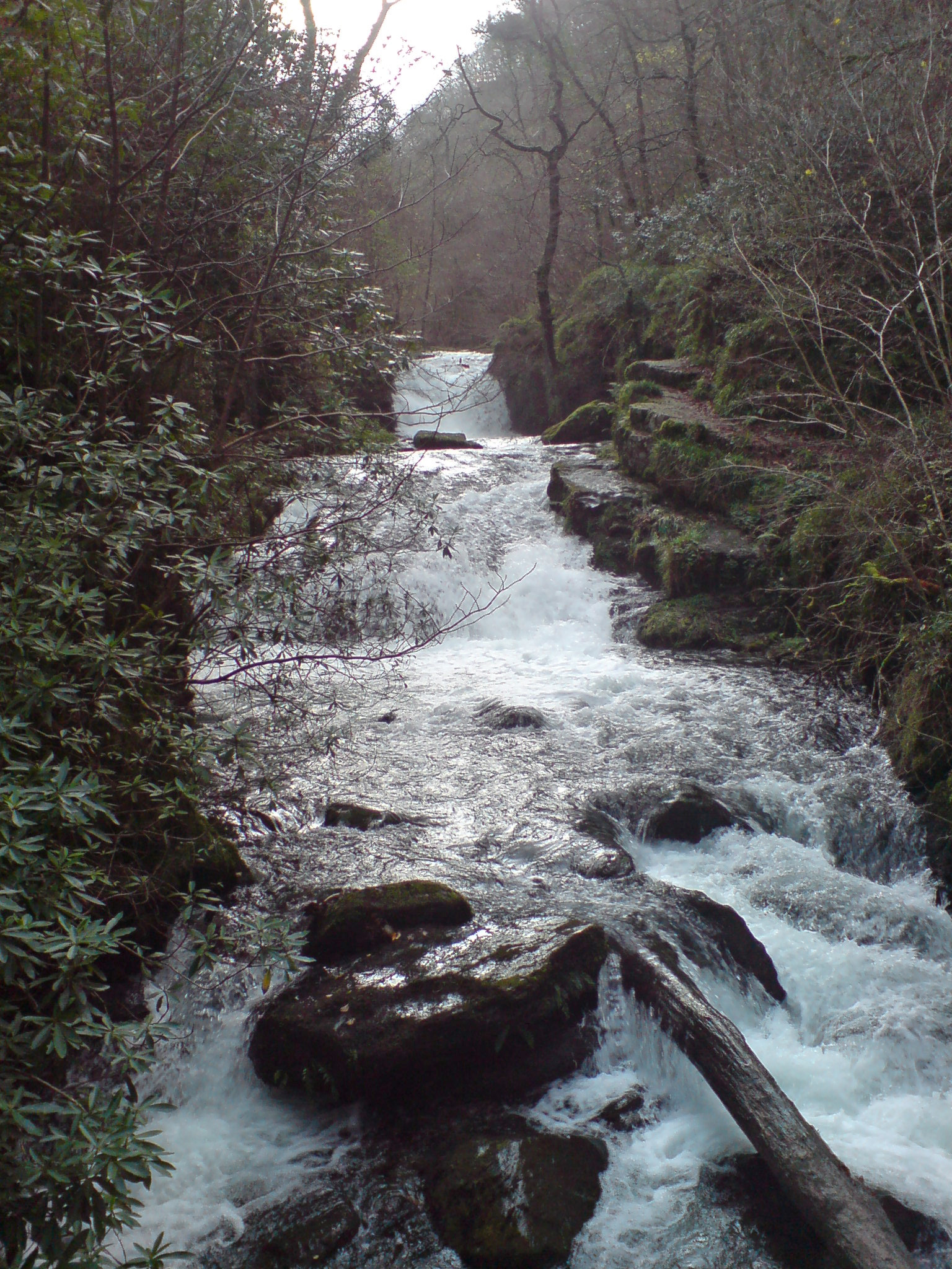
image_caption = The Hoar Oak waterfalls running into Watersmeet
etymology =
country = England
country1 =
state = Somerset
state1 = Devon
state_type = County
region = Exmoor
region1 =
district =
district1 =
city =
city1 =
landmark =
landmark1 =
length_imperial =
watershed_imperial =
discharge_location =
discharge_imperial =
discharge_max_imperial =
discharge_min_imperial =
discharge1_location =
discharge1_imperial =
source_name = Hoarok Hill
source_location =
source_district =
source_region =
source_state = Somerset
source_country = England
source_lat_d = 51
source_lat_m = 10
source_lat_s = 06
source_lat_NS = N
source_long_d = 3
source_long_m = 48
source_long_s = 11
source_long_EW = W
source_elevation_imperial = 475
source_length_imperial =
mouth_name = East Lyn River
mouth_location = Watersmeet
mouth_district =
mouth_region =
mouth_state = Devon
mouth_country = England
mouth_lat_d = 51
mouth_lat_m = 13
mouth_lat_s = 24
mouth_lat_NS = N
mouth_long_d = 3
mouth_long_m = 47
mouth_long_s = 59
mouth_long_EW = W
mouth_elevation_imperial =
tributary_left =
tributary_left1 =
tributary_right =
tributary_right1 =
free_name =
free_value =


map_size =
map_caption =

Hoar Oak Water is a moorland tributary of the East Lyn River in Exmoor, Somerset.

It rises at Hoaroak Hill in Somerset and flows to Watersmeet in Devon.


Wikimedia Foundation. 2010.

Игры ⚽ Нужно сделать НИР?

Look at other dictionaries:

  • Oare Water — Coordinates: 51°13′05″N 3°43′42″W / 51.21806°N 3.72833°W / 51.21806; 3.72833 …   Wikipedia

  • East Lyn River — Geobox River name = East Lyn River native name = other name = other name1 = image size = image caption = country = England region = Somerset city = city1 = region type = County length = watershed = discharge location = discharge average =… …   Wikipedia

  • Exmoor — Geobox|Protected Area name = Exmoor native name = other name = other name1 = category local = National Park of England category iucn = II image size = image caption = View of the Porlock Vale over toward Bossington Hill from Porlock Hill country …   Wikipedia

  • Nailsea — Coordinates: 51°26′N 2°46′W / 51.43°N 2.76°W / 51.43; 2.76 …   Wikipedia

  • Bath, Somerset — Coordinates: 51°23′N 2°22′W /  …   Wikipedia

  • Chew Valley — This article is about Chew Valley in Somerset. For Chew Valley in Saddleworth, see Chew Valley, Greater Manchester. Not to be confused with Cheu Valley …   Wikipedia

  • Somerset — This article is about the county of Somerset in England. For other uses, see Somerset (disambiguation). Somerset Motto of County Council: Sumorsǣte ealle ( All The People of Somerset ) …   Wikipedia

  • Culture of Somerset — Somerset is a county in the south west of England. It has a varied cultural tradition ranging from the Arthurian legends to The Wurzels, a band specialising in Scrumpy and Western music. The west front of Wells Cathedral …   Wikipedia

  • List of rivers of England — This is a list of rivers of England, organised geographically and taken anti clockwise, from Land s End. It includes the whole length of those rivers whose estuary lies wholly or partly in England and thus includes a number of tributaries which… …   Wikipedia

  • Mendip Hills — Coordinates: 51°18′N 2°44′W / 51.3°N 2.733°W / 51.3; 2.733 …   Wikipedia

Share the article and excerpts

Direct link
Do a right-click on the link above
and select “Copy Link”