- Compton Bishop
-
Coordinates: 51°17′42″N 2°52′08″W / 51.295°N 2.869°W
Compton Bishop 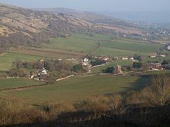
Compton Bishop seen from the Mendip Hills.
 Compton Bishop
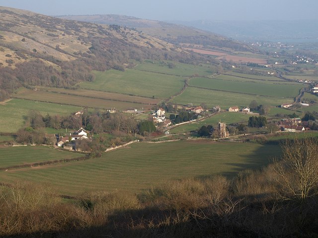
Compton Bishop shown within SomersetPopulation 609 [1] OS grid reference ST395555 District Sedgemoor Shire county Somerset Region South West Country England Sovereign state United Kingdom Post town AXBRIDGE Postcode district BS26 Dialling code 01934 Police Avon and Somerset Fire Devon and Somerset Ambulance South Western EU Parliament South West England UK Parliament Wells List of places: UK • England • Somerset Compton Bishop is a small village and civil parish, at the western end of the Mendip Hills in the English county of Somerset. It is located close to the historic town of Axbridge. Along with the village of Cross and the hamlets of Rackley and Webbington it forms the parish of Compton Bishop and Cross.
Contents
History
It was listed in the Domesday Book of 1086 as Comtone. It was the property of Giso, Bishop of Wells.[2] The parish was part of the Winterstoke Hundred.[3]
The parish includes the hamlet of Rackley which was a trading port on the River Axe in the Middle Ages following construction of a wharf in 1200. It now north of the river Axe as the course has been diverted, but on the Cheddar Yeo near the confluence. In 1324 Edward II confirmed it as a borough, however by the end of the 14th century the port was in decline.[4] In the 14th century a French ship sailed up the river and by 1388 Thomas Tanner from Wells used Rackley to export cloth and corn to Portugal, and received iron and salt in exchange. Later slate was imported through this route and it may have still be possible to trade through Rackley until the act of 1915 authorising the drainage of the Axe and installation of the flood gate at Bleadon.[5]
Also within the parish is the small village of Cross where Wavering Down house was, for the last 20 years of his life, the home of the British comedian Frankie Howerd.[6] The house is now a tourist attraction, and in the summer hosts concerts and opens regularly as a museum of Howerd's collection of memorabilia to raise fund for charities.[6]
The name Webbington is believed to mean 'The weaving enclosure' from the Old English webbian and tun.[7] Webbington is popular with hikers as it has many good footpaths leading up to Crook Peak and Shute Shelve, at the western edge of the Mendip Hills, and is part of the Wessex walk route leading from Weston-super-Mare to Wells. The Webbington Hotel [8] dominates the hamlet and is the only commercial building in the immediate area.
Governance
The parish council has responsibility for local issues, including setting an annual precept (local rate) to cover the council’s operating costs and producing annual accounts for public scrutiny. The parish council evaluates local planning applications and works with the local police, district council officers, and neighbourhood watch groups on matters of crime, security, and traffic. The parish council's role also includes initiating projects for the maintenance and repair of parish facilities, as well as consulting with the district council on the maintenance, repair, and improvement of highways, drainage, footpaths, public transport, and street cleaning. Conservation matters (including trees and listed buildings) and environmental issues are also the responsibility of the council.
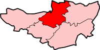
The village falls within the Non-metropolitan district of Sedgemoor, which was formed on April 1, 1974 under the Local Government Act 1972, having previously been part of Axbridge Rural District,[9] which is responsible for local planning and building control, local roads, council housing, environmental health, markets and fairs, refuse collection and recycling, cemeteries and crematoria, leisure services, parks, and tourism.
Somerset County Council is responsible for running the largest and most expensive local services such as education, social services, libraries, main roads, public transport, policing and fire services, trading standards, waste disposal and strategic planning.
It is also part of the Wells county constituency represented in the House of Commons of the Parliament of the United Kingdom. It elects one Member of Parliament (MP) by the first past the post system of election, and part of the South West England constituency of the European Parliament which elects seven MEPs using the d'Hondt method of party-list proportional representation.
Religious sites
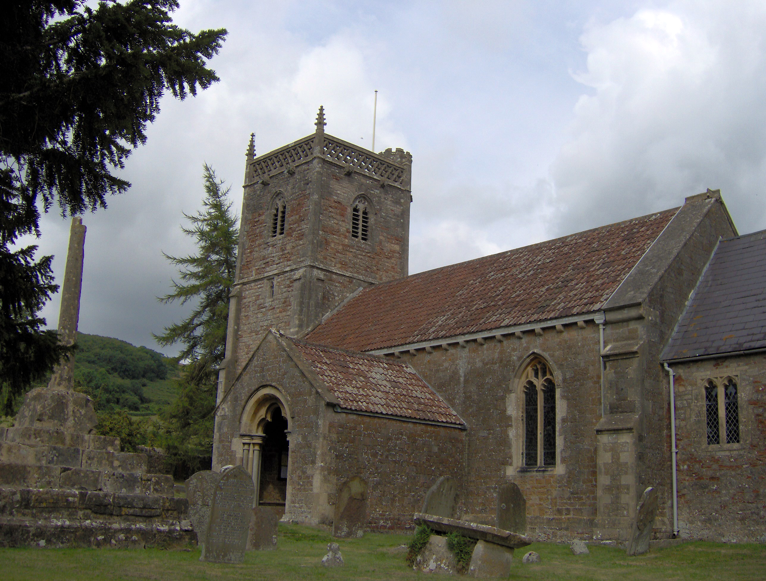
The Church of England parish church of St Andrew dates from the 13th century, being consecrated by Bishop Jocelin in 1236, with more recent restoration. It has a 15th-century pulpit with tracery panels, carved friezes and cresting. Above the pulpit is a large pedimented wall monument to John Prowse who died in 1688, as well as several of his children.[10] It is a Grade I listed building.[11]
Notable residents
References
- ^ "Parish Population Statistics for Sedgemoor". ONS Census 2001. Somerset County Council. http://www.webcitation.org/5lRyCSu4c. Retrieved 2009-12-17.
- ^ Robinson, Stephen (1992). Somerset Place Names. Wimborne, Dorset: The Dovecote Press Ltd. ISBN 1874336032.
- ^ "Somerset Hundreds". GENUKI. http://www.genuki.org.uk/big/eng/SOM/Miscellaneous/. Retrieved 9 September 2011.
- ^ "An archaeological assessment of Rackley". Somerset County Council. http://www.somerset.gov.uk/media/12861/EUS_RackleyText.pdf. Retrieved 26 November 2008.
- ^ Toulson, Shirley (1984). The Mendip Hills: A Threatened Landscape. London: Victor Gollancz. ISBN 057503453X.
- ^ a b Smith, Stephen (March 17 2007). "Titter ye not — it's Frankie's pad". BBC. http://news.bbc.co.uk/1/hi/programmes/newsnight/4813788.stm. Retrieved 2007-10-16.
- ^ Robinson, Stephen (1992). Somerset Place Names. Wimborne, Dorset: The Dovecote Press Ltd. ISBN 1874336032.
- ^ "Webbington Hotel". Latona Hotels. http://www.latonahotels.co.uk/webbington-home.html. Retrieved 2006-10-12.
- ^ A Vision of Britain Through Time : Axbridge Rural District
- ^ Rutter, John (1829). Delineations of the North Western Division of the County of Somerset and of The Mendip Caverns. p. 165. http://books.google.com/books?id=V6wHAAAAQAAJ&pg=PA165&vq=prowse&dq=john+prowse+compton+bishop.
- ^ "Church of St Andrew". Images of England. http://www.imagesofengland.org.uk/details/default.aspx?id=268803. Retrieved 2006-05-09.
External links
Towns, villages and hamlets in the Sedgemoor district of Somerset, England  Ashcott · Axbridge · Badgworth · Bawdrip · Berrow · Brean · Brent Knoll · Bridgwater · Broomfield · Burnham-on-Sea · Burtle · Cannington · Catcott · Chapel Allerton · Cheddar · Chedzoy · Chilton Polden · Chilton Trinity · Compton Bishop · Cossington · Durleigh · East Brent · Huntspill · Edington · Edithmead · Enmore · Fiddington · Goathurst · Greinton · Highbridge · Lympsham · Lyng · Mark · Middlezoy · Moorlinch · Nether Stowey · North Petherton · Othery · Otterhampton · Over Stowey · Pawlett · Puriton · Shapwick · Shipham · Spaxton · Stawell · Stockland Bristol · Thurloxton · Weare · Wedmore · Wembdon · Westonzoyland · WoolavingtonCategories:
- Mendip Hills
- Villages in Sedgemoor
- Civil parishes in Somerset

Wikimedia Foundation. 2010.