- River Huntspill
Geobox River
name = River Huntspill
native_name =
other_name =
other_name1 =

image_size =
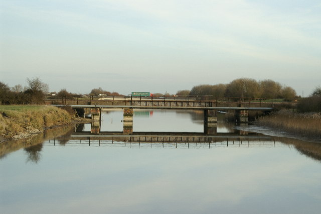
image_caption = The Huntspill river crossed by a railway bridge and theM5 motorway
etymology =
country = England
country1 =
state = Somerset
state_type = County
state1 =
region = Somerset Levels
region1 =
district = Sedgemoor
district1 =
city = Street
city1 =
landmark =
landmark1 =
length_imperial = 5
watershed_imperial =
discharge_location =
discharge_imperial =
discharge_max_imperial =
discharge_min_imperial =
discharge1_location =
discharge1_imperial =
source_name =
source_location =
source_district =
source_region =
source_state =
source_country =
source_lat_d =
source_lat_m =
source_lat_s =
source_lat_NS =
source_long_d =
source_long_m =
source_long_s =
source_long_EW =
source_elevation_imperial =
source_length_imperial =
mouth_name = River Parrett
mouth_location = Huntspill
mouth_district =
mouth_region =
mouth_state = Somerset
mouth_country = England
mouth_lat_d = 51
mouth_lat_m = 12
mouth_lat_s = 29
mouth_lat_NS = N
mouth_long_d = 3
mouth_long_m = 00
mouth_long_s = 52
mouth_long_EW = W
mouth_elevation_imperial = 0
tributary_left =
tributary_left1 =
tributary_right =
tributary_right1 =
free_name =
free_value =
map_size =
map_caption = The River Huntspill (or Huntspill River) is an artificial river, in theSomerset Levels , in theSedgemoor district ofSomerset ,England .The river was excavated as a five
mile long straight channel using adragline during the early years ofWorld War II . It was constructed as a priority war work.Cite book
last = Williams
first = Michael
origyear = 1970
title ="The Draining of the Somerset Levels"
publisher = Cambridge University Press
location = Cambridge
id= ISBN 0-521-07486-X
pages= pp. 238] Its main function was to provide an all year-round guaranteed supply of 4.5 million gallons per day of process water forROF Bridgwater , theRoyal Ordnance Factory nearPuriton . It was also intended to help drain parts of the lower Brue Valley. It was connected to the South Drain at Gold Corner. It implemented parts of a drainage plan for the Somerset Levels first drawn up in 1853 but not implemented until World War II.The Huntspill River has retention
sluice s at both ends. In winter flood water can be removed by gravity drainage; and in summer it can be topped up by pumping water from the moors.The Huntspill River is a National Nature Reserve, [cite web |url=http://www.english-nature.org.uk/special/nnr/nnr_details.asp?nnr_name=&C=0&Habitat=0&natural_area=&local_team=0&spotlight_reserve=0&X=&NNR_ID=216 |title=Huntspill River National Nature Reserve |accessdate=2007-06-09 |format= |work=
Natural England ] it discharges into theRiver Parrett just south of Highbridge. The Parrett flows intoBridgwater Bay , which also an important National Nature Reserve, [cite web | url= http://www.english-nature.org.uk/special/nnr/nnr_details.asp?nnr_name=&C=0&Habitat=0&natural_area=&local_team=0&spotlight_reserve=0&X=&NNR_ID=28 | work=Natural England | title= Bridgwater Bay National Nature Reserve | accessdate= 2007-11-22] on the edge of theBristol Channel .References
Wikimedia Foundation. 2010.
