- Downhead
-
Coordinates: 51°12′40″N 2°26′35″W / 51.2110°N 2.4430°W
Downhead 
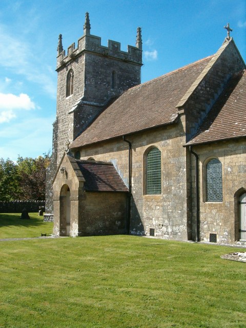
Parish church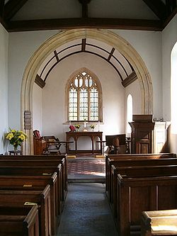
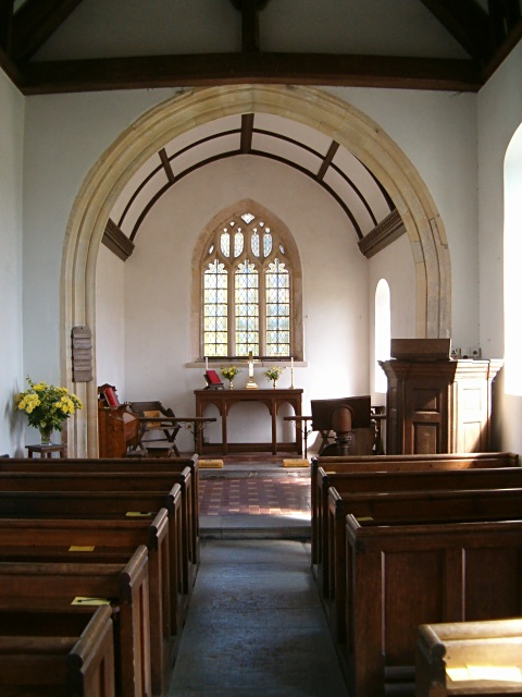
Interior of parish church
 Downhead
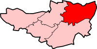
Downhead shown within SomersetPopulation 88 [1] OS grid reference ST691458 District Mendip Shire county Somerset Region South West Country England Sovereign state United Kingdom Post town SHEPTON MALLET Postcode district BA4 Dialling code 01749 Police Avon and Somerset Fire Devon and Somerset Ambulance South Western EU Parliament South West England UK Parliament Somerton and Frome List of places: UK • England • Somerset Downhead is a village and civil parish close to Leigh-on-Mendip and 5 miles (8 km) north east of Shepton Mallet, in the Mendip district of Somerset, England. The parish includes the medieval settlement of Tadhill.
Contents
History
The parish of Downhead was part of the Whitstone Hundred.[2]
The village was recorded as Dunehevede, meaning the top of the down, in 1196. The manor was given to Glastonbury Abbey by King Æthelwulf of Wessex, but by 1066 was held under the abbey by Erneis. By the early 18th century the estate was held by the Portmans of Orchard Portman.[3]
Downhead Basalt Quarry to the west of the village, opened before 1904 and ceased Basalt mining in 1925. It was serviced by a 2 ft (610 mm) narrow gauge railway.[4]
Governance
The parish council has responsibility for local issues, including setting an annual precept (local rate) to cover the council’s operating costs and producing annual accounts for public scrutiny. The parish council evaluates local planning applications and works with the local police, district council officers, and neighbourhood watch groups on matters of crime, security, and traffic. The parish council's role also includes initiating projects for the maintenance and repair of parish facilities, as well as consulting with the district council on the maintenance, repair, and improvement of highways, drainage, footpaths, public transport, and street cleaning. Conservation matters (including trees and listed buildings) and environmental issues are also the responsibility of the council.
The village falls within the Non-metropolitan district of Mendip, which was formed on April 1, 1974 under the Local Government Act 1972, having previously been part of Shepton Mallet Rural District,[5] which is responsible for local planning and building control, local roads, council housing, environmental health, markets and fairs, refuse collection and recycling, cemeteries and crematoria, leisure services, parks, and tourism.
Somerset County Council is responsible for running the largest and most expensive local services such as education, social services, libraries, main roads, public transport, policing and fire services, trading standards, waste disposal and strategic planning.
It is also part of the Somerton and Frome county constituency represented in the House of Commons of the Parliament of the United Kingdom. It elects one Member of Parliament (MP) by the first past the post system of election, and part of the South West England constituency of the European Parliament which elects seven MEPs using the d'Hondt method of party-list proportional representation.
Geography
It is close to the Asham Wood biological Site of Special Scientific Interest which is the largest and most diverse of the ancient semi-natural woods in the Mendip Hills. It has been the subject of controversy and attempts to protect the environment from increased quarrying activity in the area, particularly at Torr Works which is also known as Merehead Quarry. The wood occupies 2 deep valleys and the intervening plateau. Most of the underlying rocks are calcareous Carboniferous Limestone and Shales, but Devonian Portishead Beds outcrop along the northern valley. There are a range of unusual flora and fauna.[6]
Religious sites
All Saints church is a Grade II* listed building with a 14th-century tower and 18th-century nave and chancel.[7] The church tower contains three bells cast in 1782 by William Bilbie of Chew Stoke. In 2007 funding from the levy on nearby quarries was obtained to pay for repair and restoration work on the bells by Matthew Higby.[8]
References
- ^ "Parish Population Statistics". ONS Census 2001. Somerset County Council. http://www.webcitation.org/5lRyC5ccr. Retrieved 2009-12-14.
- ^ "Somerset Hundreds". GENUKI. http://www.genuki.org.uk/big/eng/SOM/Miscellaneous/. Retrieved 22 October 2011.
- ^ Bush, Robin (1994). Somerset: The Complete Guide. Dovecote Press. pp. 85. ISBN 1874336261.
- ^ Mitchell, Vic and Smith, Keith (2006). Dorset and Somerset Narrow Gauge. Middleton Press. ISBN 1904474764.
- ^ A Vision of Britain Through Time : Shepton Mallet Rural District
- ^ "Asham Woods". English Nature. http://www.english-nature.org.uk/citation/citation_photo/1003657.pdf. Retrieved 2006-07-17.
- ^ "Church of All Saints". Images of England. http://www.imagesofengland.org.uk/details/default.aspx?id=266702. Retrieved 2007-05-02.
- ^ "Let the Bells ring. May 2007". Mendip Times. http://www.mendiptimes.co.uk. Retrieved 2007-05-02.
External links
 Media related to Downhead at Wikimedia Commons
Towns, villages and hamlets in the Mendip district of Somerset, England  Ashwick · Baltonsborough · Batcombe · Beckington · Berkley · Binegar · Buckland Dinham · Chewton Mendip · Chilcompton · Coleford · Cranmore · Croscombe · Ditcheat · Doulting · Downhead · East Lydford · East Pennard · Emborough · Evercreech · Frome · Glastonbury · Godney · Great Elm · Hemington · Holcombe · Kilmersdon · Lamyat · Leigh-on-Mendip · Litton · Lullington · Lydford-on-Fosse · Meare · Mells · Milton Clevedon · North Wootton · Norton St Philip · Nunney · Pilton · Priddy · Pylle · Rode · Rodney Stoke · Rudge · Selwood · Sharpham · Shepton Mallet · St Cuthbert Out · Stoke St Michael · Ston Easton · Stratton-on-the-Fosse · Street · Tellisford · Trudoxhill · Upton Noble · Walton · Wanstrow · Wells · West Bradley · West Lydford · West Pennard · Westbury-sub-Mendip · Whatley · Witham Friary · Wookey · Wookey HoleCategories:
- Villages in Mendip
- Civil parishes in Somerset

Wikimedia Foundation. 2010.