- City of Preston, Lancashire
-
This article is about the local government district of Lancashire. For the settlement after which it is named, see Preston, Lancashire. For other uses, see City of Preston and Preston.
Coordinates: 53°45′32″N 2°41′56″W / 53.759°N 2.699°W
City of Preston Beacon Fell is the highest point in the district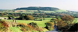

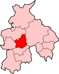
Coat of Arms of the City CouncilNickname(s): Proud Preston Shown within Lancashire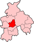 Shown within England
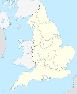
 City of Preston
Coordinates: 53°45′N 2°42′W / 53.75°N 2.7°W Country United Kingdom Constituent Country England Region North West England County Lancashire Founded ?? Guild Merchant charter 1179 City status 2002 Government – Type Non-metropolitan district – Local Authority Preston City Council – Leadership: Leader & Cabinet – Executive: Labour – Leader of the Council Cllr Peter Rankin (Lab) – MPs: Mark Hendrick (Lab),
Ben Wallace (Con),
Mark Menzies (Con)Area – City 54.9 sq mi (142.22 km2) Population (2010 est.) – City 135,100 (Ranked 148th) – Urban 365,000 (Central Lancashire) – Ethnicity 82.3% White British
11.6% S.Asian
2.6% White Other
1.1% White Irish
1.5% Mixed Race
1.1% Black British
1.0% E.Asian and OtherTime zone Greenwich Mean Time (UTC+0) Postcode PR1–PR4 Area code(s) 01772, 01995 ISO 3166-2 GB-LAN ONS code 30UK OS grid reference SD535295 NUTS Demonym Prestonian Website http://www.preston.gov.uk/ The City of Preston
 i/ˈprɛstən/ is a city and non-metropolitan district in Lancashire, England. It is located on the north bank of the River Ribble, and was granted city status in 2002, becoming England's 50th city in the 50th year of Queen Elizabeth II's reign.[1] The City of Preston district has a population of 131,900, and lies at the centre of the wider Preston sub-area, which has a population of 184,836, and the Central Lancashire sub-region, with a population of 335,000.[2]
The district, formerly known as the Borough of Preston, is named after the urban settlement of Preston which lies in the south of the district, and also contains eight rural civil parishes.
Contents
History
In 1974, the non-metropolitan district of Preston was formed from the County Borough of Preston, Fulwood Urban District, and a major part of Preston Rural District. The district was granted city status in 2002.
Governance
Preston City Council
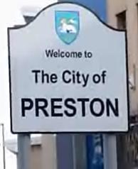
Further information: Preston local elections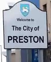 Entering the city centre from Fylde Road
The City of Preston is divided into 22 district council wards represented by 57 councillors. There are nine wards with two councillors and 13 wards with three councillors. The two seat wards cover c. 3600 electors and the three seat wards c. 5400 electors. Preston City councillors serve a four-year term. Preston City Council is elected "by thirds", 19 at a time. One councillor from each of the three-member wards is elected every year for three years. In each of those years six of the nine two-seat wards also elect a councillor. Every fourth year there are no Preston City Council elections, Lancashire County Council elections taking place instead.
After the 2007 local election the Labour Party was the largest Group with 24 members but the Conservatives with 20 seats in alliance with the Liberal Democrats with 10 seats took control of the Cabinet and all committees except the Scrutiny committee. This situation continued after the 2008 local election, at which the Conservatives, with 21 Councillors took a net seat from the Liberal Democrats who had 9 seats and Labour remained the largest party with 24 members, and the 2010 local election when Labour had 25 councillors, the Conservatives 22, the Liberal Democrats seven, while two Deepdale Independents and one Independent Socialist, made up the remaining three places.
At the most recent elections, Labour regained control with 29 councillors, the Conservatives 21, the Liberal Democrats have six, and one Deepdale Independent.
The local areas of Preston can be found at Districts of Preston
The current mayor is Councillor Roberta Cartwright.
Preston operates a Leader and Cabinet system. The current Leader is Councillor Peter Rankin.
Freedom of the City
Freedom of the City has been granted to:
- The Loyal Regiment (North Lancashire) 7 August 1952 (This was subsequently transferred to:)
- The Queen's Lancashire Regiment 9 September 1972
- The Duke of Lancaster's Regiment 1 July 2006
- Andrew Flintoff, England cricket captain, January 2006
Lancashire County Council
Further information: Lancashire local electionsThe City of Preston contains ten Lancashire County Council electoral divisions with one county councillor in each district.
Parliament
The City of Preston is currently divided between three Westminster constituencies, namely Preston, Wyre and Preston North, and Fylde.
Historically, Preston has been divided between such constituencies as Preston North, Preston South, and Fylde South although until 1885 it comprised one constituency called Preston but which included most of west Lancashire.
Minster Church
Like numerous other major English towns granted city status since 1889, Preston has no cathedral (see City status in the United Kingdom). Instead, following the granting of city status in the Queen's Golden Jubilee year in 2002, Preston's parish church was elevated by the Church of England to the status of Minster Church in June 2003.
Geography
Physical geography
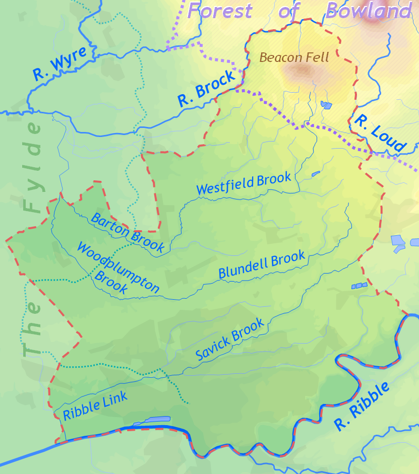
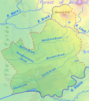 Topography of the City of Preston
The City of Preston district is a transitional region between coastal plain, river valley and moorland. The west of the district lies within the flat coastal plain of the Fylde. The southern border is the River Ribble which meanders through a flood plain in a wide, steep-sided valley. The northeast of the district lies within the Forest of Bowland Area of Outstanding Beauty.
The highest point is the summit of Beacon Fell at 266 m (873 ft) above sea level, an isolated fell two miles south of the main range of Bowland Fells just outside the district boundaries. The lowest point lies on the River Ribble in the southwest corner of the district. The Ribble here is tidal and therefore virtually at sea level. The course of the river west of Preston was artificially straightened in the 19th century, to ease passage of shipping to the docks.
The southern one-third of the district, most of which is covered by Preston and its suburbs, drains into Savick Brook running east-to-west and then turning south into the Ribble. The lowest section of the brook has been widened into the Ribble Link which connects the Lancaster Canal to the Ribble. The central and northern parts of the district drain into south- and west-flowing tributaries of the River Brock, itself a tributary of the Wyre whose estuary is at Fleetwood. The Brock forms part of the district boundary on the west and north sides of Beacon Fell. A small part of the district along the eastern boundary drains into the east-flowing River Loud, a tributary of the Hodder.
The lowland area in the north and east of the district, between Beacon Fell and the Fylde, is a dairy farming area, particularly noted for its cheesemaking dairies. Six of the ten Lancashire Cheese dairies listed on the British Cheese Board's website in 2011 are located in the City of Preston district (and the other four are only a few miles outside).[3] Beacon Fell has a Protected Designation of Origin cheese named after it.[4]
At 53°45′N 2°42′W / 53.75°N 2.7°W, Preston city centre is approximately 27 miles north west of Manchester, 26 miles north east of Liverpool, and 15 miles east of the coastal town Blackpool.
Like most of inland Lancashire, Preston receives a higher than UK average total of rainfall, and is slightly colder. On 10 August 1893 Preston entered the UK Weather Records, with the Highest 5-min total rainfall of 32 mm. As of November 2008 this remains a record.[5]
See also: Preston, Lancashire — ClimateAreas and estates
Further information: List of places in PrestonAs with many cities, Preston has developed from a number of former towns and villages.
Civic geography
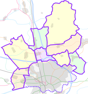 (unparished area)
PrestonCivil parishes in the City of Preston
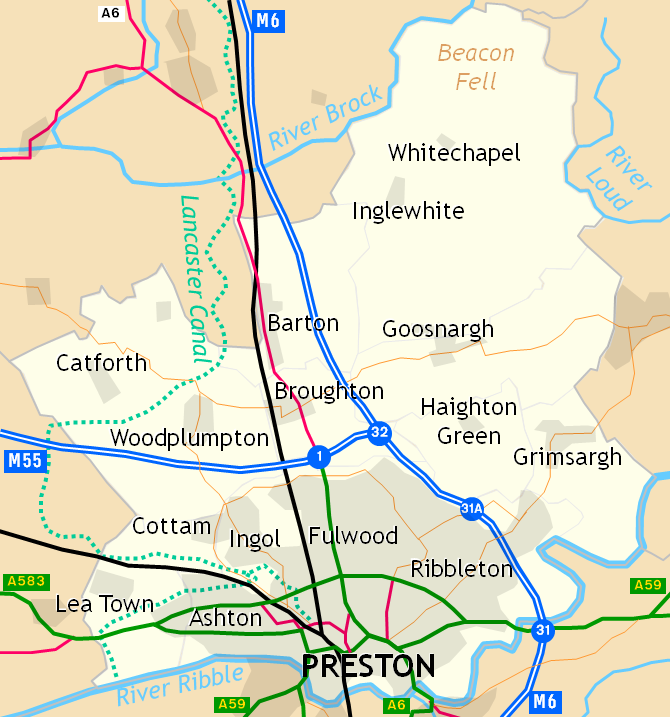
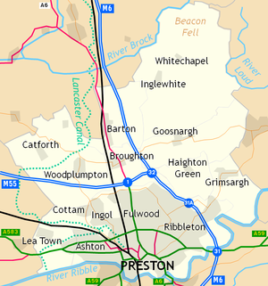 Places in the City of Preston
The southern part of the district is mostly urbanised but the northern part is quite rural. The current borders came into effect on 1 April 1974, when the Local Government Act 1972 merged the existing County Borough of Preston with Fulwood Urban District and part of Preston Rural District. Preston was designated as part of the Central Lancashire new town in 1970. The former Preston Rural District part of the district is divided into a number of civil parishes:
Demographics
Ethnicity
Preston is a diverse city, although the majority of the non-indigenous people are South Asians, in particular Indians. The ethnic makeup of Preston based on 2007 estimates is as follows (With national average in brackets): 81.9% White British (83.6%), 1.0% White Irish (1.1%), 1.6% Other White (3.5%). 1.6% Mixed Race (1.7%). 8.1% Indian (2.6%), 2.6% Pakistani (1.8%), 0.3% Bangladeshi (0.7%), 0.5% Other South Asian (0.7%). 0.6% Black Caribbean (1.2%), 0.4% Black African (1.4%), 0.1% Other Black (0.2%). 0.8% Chinese (0.8%) and 0.4% Other East Asian and Arab (0.7%).[6]
Child poverty
In 2008 a survey revealed that 50% of all children living in the city were living in families suffering from financial depression. An estimated 15,380 youngsters were part of the families on the breadline. The Campaign to End Child Poverty report defined children in poverty as children living in homes where occupants work less than 16 hours a week, or not at all, or where the full amount of tax credit is being claimed. The city was one of the most severely affected areas of the North West outside Liverpool and Manchester, with 21% of children in the city living in households which were completely workless and a further 29% in families struggling to get by with working tax credits. The two worst affected areas of the city were the Deepdale and St George's wards, where 75% and 77% of children respectively were said to be living in poverty.[7]
Religion
The City of Preston lies in the Roman Catholic Diocese of Lancaster and the Anglican Diocese of Blackburn.
The 2001 Census recorded 72% of the population as Christians, 10% as having no religion, and 8% as Muslims.[8] The Hindu and Sikh populations are smaller at 3% and 0.6% respectively, but in both cases this represents the highest percentage of any local authority area in the North West. 2% of the city's population were born in other EU countries.
References
- ^ "'Proud Preston' wins city status", BBC News, 14 March 2002. Retrieved 6 June 2006.
- ^ Census 2001: Preston, Office for National Statistics. Retrieved 6 June 2006.
- ^ Butler's, JJ Sandhams, Greenfields, Mrs Kirkham's, Shorrocks and Carron Lodge, The Lancashire Dairies, British Cheese Board, accessed 4 August 2011
- ^ EU Protected Food Names Scheme: Beacon Fell traditional Lancashire cheese, DEFRA, retrieved 4 August 2011
- ^ "Extreme Weather". Met Office. http://www.metoffice.gov.uk/climate/uk/extremes/index.html. Retrieved 2010-07-17.
- ^ Neighbourhood Statistics. "Neighbourhood Statistics". Neighbourhood Statistics. http://neighbourhood.statistics.gov.uk/dissemination/LeadTableView.do?a=3&b=277022&c=Preston&d=13&e=13&g=463253&i=1001x1003x1004&m=0&r=1&s=1202935807210&enc=1&dsFamilyId=1812. Retrieved 2010-07-17.
- ^ "New survey reveals children's deprivation - News". lep.co.uk. 16 October 2008. http://www.lep.co.uk/news/New-survey-reveals-children39s-deprivation.4601814.jp. Retrieved 2010-07-17.
- ^ Census 2001: Statistics.. Retrieved 6 June 2006.
External links
Ceremonial county of Lancashire Unitary authorities Boroughs or districts Major settlements - Accrington
- Adlington
- Bacup
- Barnoldswick
- Blackburn
- Blackpool
- Brierfield
- Burnley
- Burscough
- Carnforth
- Chorley
- Clayton-le-Moors
- Cleveleys
- Clitheroe
- Colne
- Darwen
- Earby
- Fleetwood
- Garstang
- Great Harwood
- Haslingden
- Kirkham
- Lancaster
- Leyland
- Longridge
- Lytham St Annes
- Morecambe
- Nelson
- Ormskirk
- Oswaldtwistle
- Padiham
- Penwortham
- Poulton-le-Fylde
- Preesall
- Preston
- Rawtenstall
- Rishton
- Skelmersdale
- Wesham
- Whitworth
See also: List of civil parishes in Lancashire
Rivers Canals Topics  Districts of North West England
Cheshire 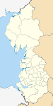
Cumbria Allerdale • Barrow-in-Furness • Carlisle • Copeland • Eden • South Lakeland
Greater Manchester Lancashire Blackburn with Darwen • Blackpool • Burnley • Chorley • Fylde • Hyndburn • Lancaster • Pendle • Preston • Ribble Valley • Rossendale • South Ribble • West Lancashire • Wyre
Merseyside Cities of the United Kingdom England Bath · Birmingham · Bradford · Brighton and Hove · Bristol · Cambridge · Canterbury · Carlisle · Chester · Chichester · Coventry · Derby · Durham · Ely · Exeter · Gloucester · Hereford · Kingston upon Hull · Lancaster · Leeds · Leicester · Lichfield · Lincoln · Liverpool · London · Manchester · Newcastle upon Tyne · Norwich · Nottingham · Oxford · Peterborough · Plymouth · Portsmouth · Preston · Ripon · St Albans · Salford · Salisbury · Sheffield · Southampton · Stoke-on-Trent · Sunderland · Truro · Wakefield · Wells · Westminster · Winchester · Wolverhampton · Worcester · York
Scotland Wales Northern Ireland Categories:- Local government in Preston
- Preston
- Cities in North West England
- Non-metropolitan districts of Lancashire
- Local government districts of North West England
- The Loyal Regiment (North Lancashire) 7 August 1952 (This was subsequently transferred to:)


Wikimedia Foundation. 2010.