- Districts of Preston
-
Preston is a city of Lancashire, England. The districts of Preston vary in size and shape, many of which reflect the districts developed from former villages and boroughs which now lie within the boundaries of the city of Preston. Districts of Preston have little administrative purpose: for local elections voters in each return either two, or three, councillors to Town Hall. For the purposes of national General elections, the parliamentary constituencies representing the city use the electoral districts as "building bricks"
Contents
Present day divisions
The City of Preston is divided into 22 wards, which are used in the creation of "Area Forums", local consultative bodies organised by city council; and also the composition of parliamentary constituencies.
Electors in each ward return two, or three, electors to Town Hall in elections, results of which can be found at Preston local elections.
Since 2010, the City of Preston has been covered by three parliamentary constituencies, Preston, Wyre and Preston North and Fylde. Those wards formerly within the Ribble Valley constituency, on the whole, now form the southern flank of the newly created constituency of Wyre and Preston North.
The wards are used to build electoral divisions for elections to Lancashire County Council.
Map County
Council
divisionWard Area
forumParishes Other places Parliamentary
constituency
(from 2010)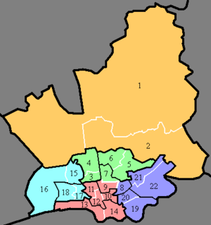
Preston
Rural1. Preston Rural North Rural Barton Newsham Wyre and
Preston NorthGoosnargh Beacon Fell, Inglewhite, Whitechapel Whittingham Goosnargh, Cumeragh Village Woodplumpton Catforth, Eaves, Higher Bartle, Nog Tow 2. Preston Rural East Broughton Fernyhalgh Grimsargh Elston Haighton Cow Hill, Haighton Green, Haighton Top Preston
North3. Cadley North
(Fulwood)unparished
area
(Preston)Nooklands 4. Greyfriars Preston
North East5. Garrison Fulwood Row, Ladyewell 6. Sharoe Green Sherwood Preston
Central North7. College 8. Deepdale East Holme Slack Preston 9. Moor Park Central Preston
Central South10. St George's Adelphi 11. Tulketh Lane Ends, Maudlands 12. University Adelphi, Maudlands Preston
City13. Riversway Broadgate, Christ Church 14. Town Centre Avenham, Frenchwood, Winckley Square Preston
West15. Ingol West Tanterton 16. Lea Lea Cottam, Lea Town Fylde Preston
North West17. Ashton unparished
area
(Preston)Preston 18. Larches Savick Preston
South East19. Fishwick East Farringdon Park 20. St Matthew's Preston
East21. Brookfield 22. Ribbleton Farringdon Park, Grange, Red Scar, Ribbleton Hall The wards of Preston Rural North, Preston Rural East and Lea are parished: they contain parish councils with their own structure and elected councillors. All the other wards lie in an unparished area and are governed directly by Preston City Council.
Comparison of areas called "Preston"
The name "Preston" is associated with a number of different areas that are related to the city:
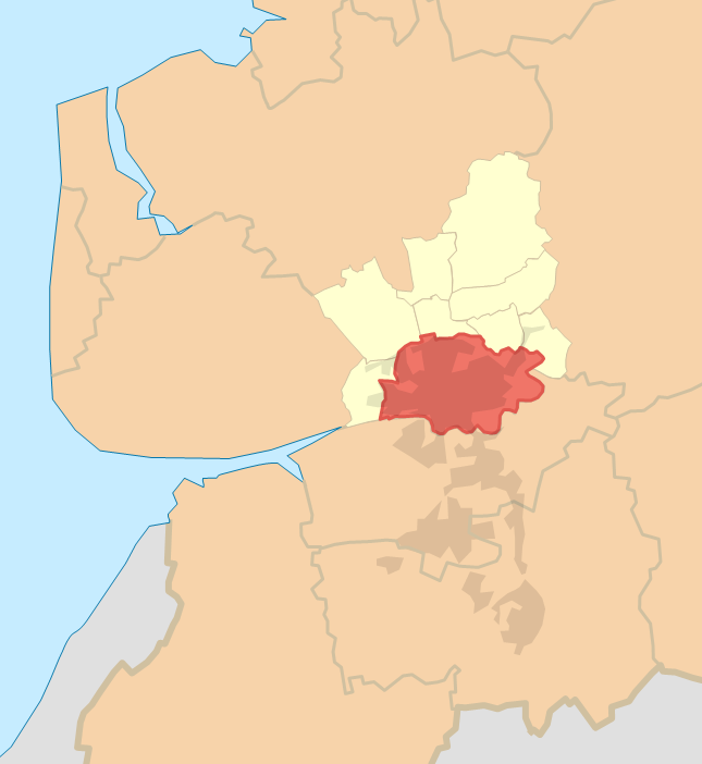
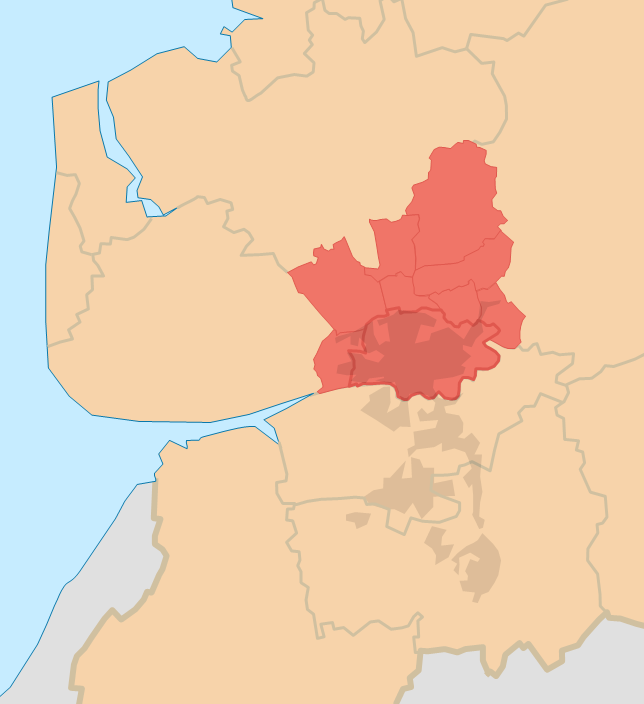
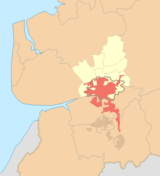
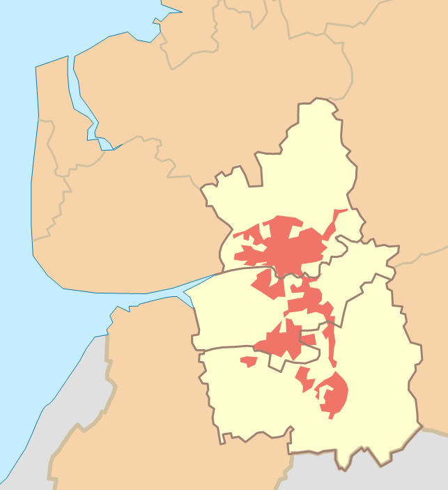
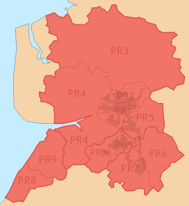
Name Preston City of Preston Preston (sub-division of Preston Urban Area) Preston Urban Area PRESTON PR postcode area
also known as Preston postcode areaMap 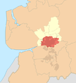
shown within the City of Preston
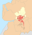
shown with the parishes of the City of Preston
shown within Central Lancashire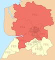
shown within the PR postcode area
Type unparished area local government district subdivision of an ONS urban area ONS urban area post town postcode area Population (2001) 112,019[1] 129,633[2] 184,836[3] 264,601[3] Extent Preston city centre,
Fulwood,
Ribbleton,
Ashton-on-Ribble,
IngolPreston (unparished area),
Barton,
Broughton,
Grimsargh,
Goosnargh,
Haighton,
Lea,
Whittingham,
Woodplumptonurban parts of Preston (unparished area),
Cottam,
Lea,
Grimsargh,
Penwortham,
Bamber Bridge,
Walton-le-Dale,
Clayton Brook,
Whittle-le-Woods,
Walton Summit,
Farrington,
Lostock Hall,
Tardy Gateurban parts of Preston,
Leyland,
Chorley,
Euxton,
Wymott Prison
including contiguous urban suburbspostcode districts PR1–PR5 PRESTON,
CHORLEY,
SOUTHPORT,
LEYLANDpost towns
References
- ^ City of Preston: 129,633. "Neighbourhood Statistics: Preston (Local Authority)", Office for National Statistics. Retrieved 13 November 2011.
The population for the unparished area of Preston is calculated by subtracting the populations of the three rural Middle Layer Super Output Areas, Preston 001 (5,472), Preston 002 (6,347) and Preston 010 (5,795).
"Preston 001 (Middle Layer Super Output Area)", Office for National Statistics. Retrieved 13 November 2011.
"Preston 002 (Middle Layer Super Output Area)", Office for National Statistics. Retrieved 13 November 2011.
"Preston 010 (Middle Layer Super Output Area)", Office for National Statistics. Retrieved 13 November 2011. - ^ "Neighbourhood Statistics: Preston (Local Authority)", Office for National Statistics. Retrieved 13 November 2011.
- ^ a b (2004) “Census 2001: Key Statistics for urban areas in the North“, ‘‘Office for National Statistics‘‘, ISBN 0 11 621744 8 , Table KS01, p.24. Retrieved 13 November 2011.
External links
Categories:- Local government in Preston
- Wards of Preston
- Council elections in Preston
- ^ City of Preston: 129,633. "Neighbourhood Statistics: Preston (Local Authority)", Office for National Statistics. Retrieved 13 November 2011.


Wikimedia Foundation. 2010.