- Whittingham, Lancashire
-
Coordinates: 53°49′01″N 2°39′29″W / 53.817°N 2.658°W
Whittingham 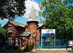
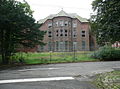
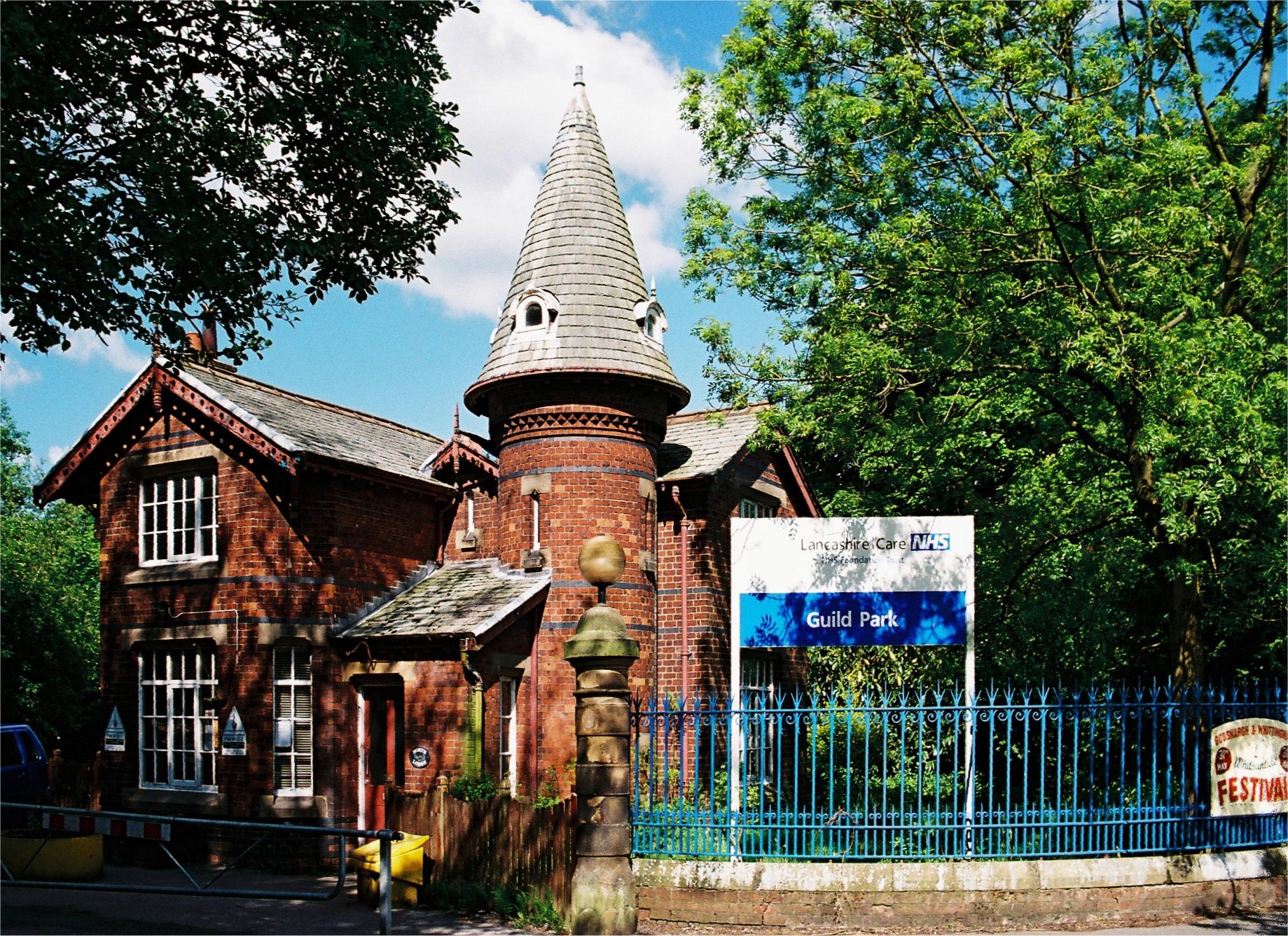
North Lodge, the entrance to Guild Park, the grounds of the former Whittingham Hospital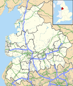
 Whittingham
Whittingham shown within LancashirePopulation 2,189 (2001) OS grid reference SD505345 Parish Whittingham District Preston Shire county Lancashire Region North West Country England Sovereign state United Kingdom Post town PRESTON Postcode district PR3 Dialling code 01772 Police Lancashire Fire Lancashire Ambulance North West EU Parliament North West England UK Parliament Wyre and Preston North List of places: UK • England • Lancashire 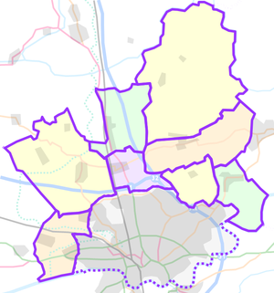 Whittingham(unparished area)
PrestonCivil parishes in the City of Preston
Whittingham is a civil parish in the City of Preston, Lancashire, England. The parish measures 4 miles (6 km) east-to-west, from the outskirts of Longridge to the outskirts of Broughton, but only 1 mile (1½ km) north-to-south. Its population was 2,189 in 2001.[1] The village of Goosnargh is at its centre.
The parish once contained the largest mental hospital in England, North West England’s nuclear bunker, and, according to legend, a giant cow.
Contents
Goosnargh and Whittingham
Main article: GoosnarghThe only village of any substantial size in the parish is Goosnargh. Goosnargh is unusual because only one side of one road in the village lies within the parish boundaries of Goosnargh; almost all of the village lies within Whittingham parish.
This may explain why the village is sometimes referred to as “Goosnargh and Whittingham”, as if there were two villages. Some road signs on entering the village display “Whittingham and Goosnargh”. The website of the local “Goosnargh & Whittingham Whitsuntide Festival” refers to “the twin villages of Goosnargh and Whittingham”.[2] An article in a local newspaper also refers to “the villages of Whittingham and Goosnargh”.[3]
However, no modern maps show a village marked “Whittingham” and the website of Whittingham Parish Council[4] refers only to the village of Goosnargh.
Whittingham Hospital
Whittingham Hospital, whose grounds adjoin the village of Goosnargh, grew to be the largest mental hospital in the country, and pioneered the use of electroencephalograms (EEGs). During its time it had its own church, farms, railway, telephone exchange, post office, reservoirs, gas works, brewery, orchestra, brass band, ballroom and butchers.[5]
In 1866, the three Lancashire lunatic asylums at Prestwich, Rainhill and Lancaster were deemed to be full.[6] The building of Whittingham Asylum began in 1869, originally to accommodate 1000 patients.[7] It was built from brick made from clay dug on site from a pit which later became a fish pond.[8]
The hospital officially opened on 1 April 1873. The large site included an Anglican church, a Catholic chapel, a recreation hall (also used as a ballroom) and several farms.[9]
The Whittingham Hospital Railway was a two-mile (3 km) private branch to Grimsargh, built in 1887, to provide coal and other goods. It also provided free transport for staff and passengers.[10] It eventually closed in on 30 June 1957.[11]
In the early years there was a brewery on the site.[12] At the end of the first World War, a part of the hospital (later known as “St Margaret’s Division”) was used as a military hospital.[13] It was again used for this purpose during the second World War.[14]
By 1923, the hospital was known as “Whittingham Mental Hospital”.[13] By 1939, the number of patients was 3533, with a staff of 548, making it the largest mental hospital in the country.[14]
By 1948, it had incorporated Ribchester Hospital, and became known as “Whittingham Hospital”.
The Mental Health Act of 1960 deemed large institutions like Whittingham to be out of favour. Allegations of cruelty to patients led to a public inquiry.[15]
During the 1970s and 1980s, new drugs and therapies were introduced. Long-stay patients were returned to the community or dispersed to smaller units around Preston. The hospital eventually closed in 1995. [15]
The site subsequently became known as “Guild Park”. In 1999, Guild Lodge was opened on the edge of Guild Park, supplying secure mental services, followed the next year by rehabilitation cottages close by.[16]
It is planned to build 650 new homes on the site and to preserve some of the hospital buildings as apartments. However, the plan will not proceed until a date for the construction of the Broughton bypass is known.[17][18] but in the mean time some of the smaller outer buildings are currently be ripped down.
-
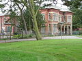
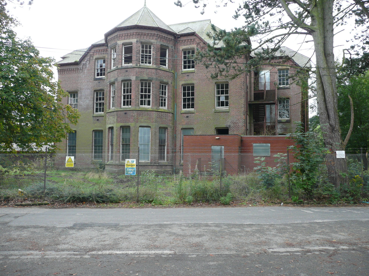
The remains of the main building entrance (St Luke's) in 2008
-

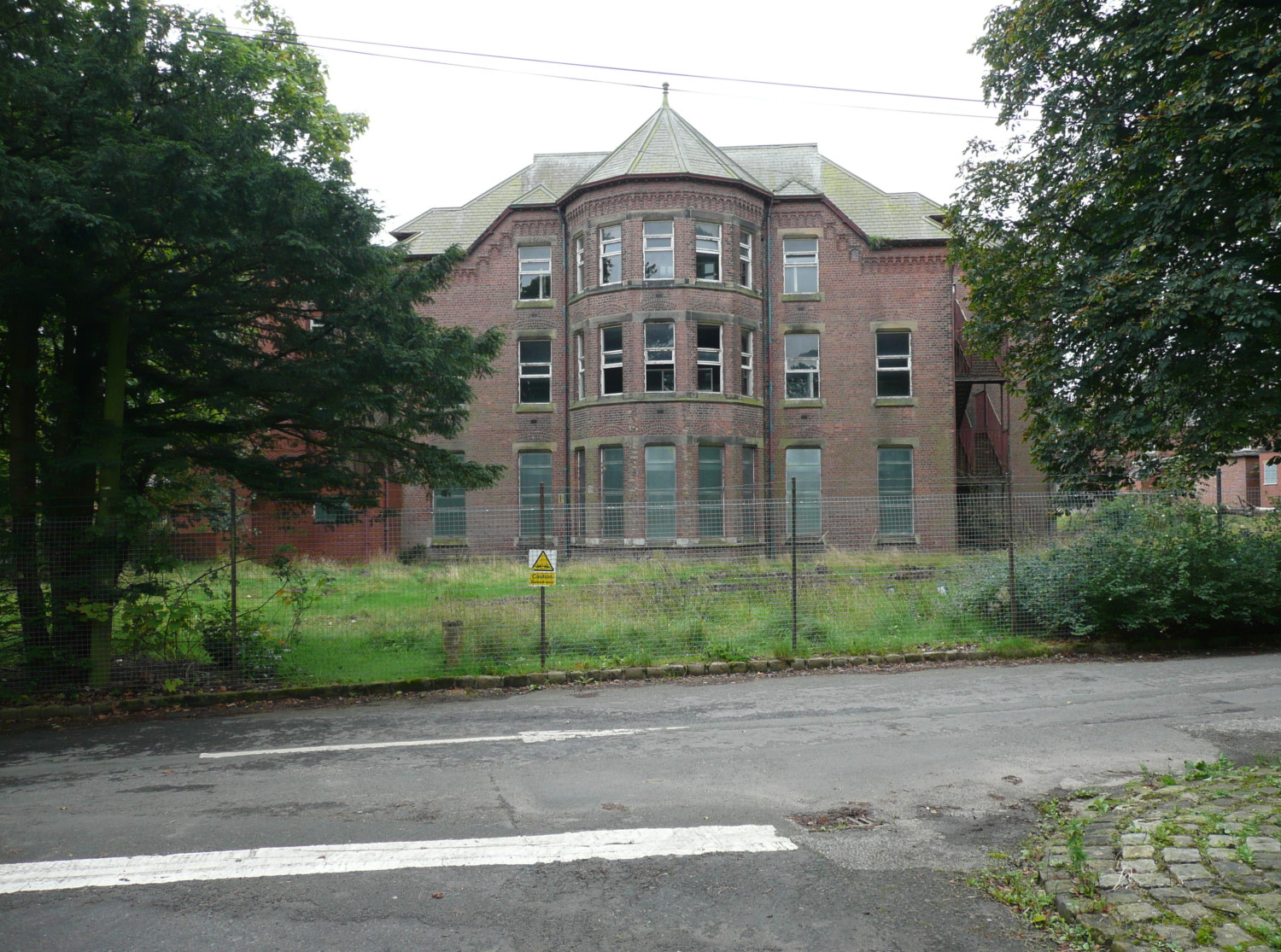
2008 remains
-
2008 remains
Cumeragh Village
Cumeragh Village is a hamlet that consists of houses around a square. It lies just outside the village of Goosnargh and directly opposite the main entrance to the grounds of the former Whittingham Hospital. The houses were originally built to house hospital workers.[19]
Notable places
Just outside the town of Longridge, within the parish of Whittingham, lies Halfpenny Lane (locally /ˈheɪpni/ "hape-ny"), so named because of a toll charged to cattle drovers for an overnight stay.[20] Dun Cow Rib Farm was built on the lane by Adam Hoghton in 1616,[20][21] and contains embedded in its wall a large rib. According to legend, the rib came from a giant "dun cow" which roamed the area at the time of the Plague, and whose milk saved the local inhabitants, and was buried at nearby Cow Hill, near Grimsargh.[22][23] An alternative legend claims that the cow gave milk freely to all comers, but died of shock when an old witch asked it to fill a riddle (sieve) instead of a pail.[21] In reality, the rib is probably from a whale or Bronze Age aurochs.[22]
Chingle Hall was built by the Singleton family and first appears by name in 1354. Whittingham Hall, half a mile to the east, was owned by the Whittingham family.
Between 1962 and 1991, straddling the boundary of Whittingham and Goosnargh parishes in Langley Lane, were the headquarters of the Western Region of the United Kingdom Warning and Monitoring Organisation. They were in a vast underground bunker that would have been the Northwest of England’s control centre in the event of a nuclear attack on Britain. After the collapse of the Soviet Union, the site was sold off and the above-surface buildings are now used as a veterinary centre.[24][25]
Whittingham House is one of the oldest houses in the parish.[citation needed] It used to own 300 acres (1.2 km2) of land, which was subsequently divided up. In the twentieth century the house was about to be converted into flats, but one of the wings was burnt down, leading to the withdrawal of the plans.
References
- ^ Neighbourhood Statistics: Whittingham (CP) Parish, accessed 12 November 2007
- ^ Goosnargh & Whittingham Whitsuntide Festival: 2008 Festival, accessed 5 November 2007
- ^ “Sports association up off the blocks”, Longridge News, 3 May 2007, accessed online 6 November 2007
- ^ Lancashire Parish Portal: Whittingham Parish Council, accessed 5 November 2007
- ^ Pattinson, p.108
- ^ Pattinson, p.109
- ^ Pattinson, p.111
- ^ Pattinson, p.112
- ^ Pattinson, p.114
- ^ Pattinson, p.119
- ^ Pattinson, p.139
- ^ Pattinson, p.123
- ^ a b Pattinson, p.128
- ^ a b Pattinson, p.132
- ^ a b “Asylum” Whittingham Hospital accessed 5 November 2007
- ^ Lancashire Care—Secure Services, accessed 5 November 2007
- ^ English Partnerships: Whittingham, Preston
- ^ “Whittingham housing plans submitted”, Longridge News, 12 September 2007, accessed online 6 November 2007
- ^ 1 April 2002, "Residents see red over fight to save green land", Lancashire Evening Post, Preston, accessed 17 May 2011
- ^ a b Till, p.21
- ^ a b ‘Townships: Whittingham’, A History of the County of Lancaster: Volume 7 (1912), pp.207–13, accessed 15 June 2007
- ^ a b Rothwell, p.102
- ^ Dewhurst, p.22
- ^ Hunt, p.151
- ^ In 2007 the bunker site was purchased by National Monitoring, it was extensivley modernised but a lot of the original features have been retained. The bunker actually remains what it always was a monitoring station however it is now used as a burglar alram monitoring and receiving centre. Subterranea Britannica: Royal Observer Corps: Preston, accessed 6 November 2007
Bibliography
- Dewhurst, A (1985) Times Past in Goosnargh, Countryside Publications, Chorley, ISBN 0 86157 183 5
- Hunt, D. (2003) The Wharncliffe Companion to Preston — An A to Z of Local History, Wharncliffe Books, Barnsley, ISBN 1-903425-79-4.
- Pattinson, M. (Ed.) (1999) Longridge — The Way we Were, Hudson History of Settle, ISBN 0-9533643-4-8
- Rothwell, C (1995) Around Garstang, Alan Sutton Publishing, Stroud, ISBN 0-7509-0870-X
- Till, J.M. (1993) A History of Longridge and its People, Carnegie Publishing, Preston, ISBN 0-947789-92-1 (paperback) (also available in hardback: ISBN 0-947789-86-7)
External links
Ceremonial county of Lancashire Unitary authorities Boroughs or districts Major settlements - Accrington
- Adlington
- Bacup
- Barnoldswick
- Blackburn
- Blackpool
- Brierfield
- Burnley
- Burscough
- Carnforth
- Chorley
- Clayton-le-Moors
- Cleveleys
- Clitheroe
- Colne
- Darwen
- Earby
- Fleetwood
- Garstang
- Great Harwood
- Haslingden
- Kirkham
- Lancaster
- Leyland
- Longridge
- Lytham St Annes
- Morecambe
- Nelson
- Ormskirk
- Oswaldtwistle
- Padiham
- Penwortham
- Poulton-le-Fylde
- Preesall
- Preston
- Rawtenstall
- Rishton
- Skelmersdale
- Wesham
- Whitworth
See also: List of civil parishes in Lancashire
Rivers Canals Topics Categories:- Civil parishes in Lancashire
- Geography of Preston
-


Wikimedia Foundation. 2010.