A civil parish is a subnational entity, forming the lowest unit of local government in England . There are 219 civil parishes in the ceremonial county of Lancashire , most of the county being unparished; Blackpool is completely unparished; Pendle and Ribble Valley are entirely parished. At the 2001 census, there were 587,074 people living in the 219 parishes, accounting for 41.5 per cent of the county's population.
History
Parishes arose from Church of England divisions, and were originally purely ecclesiastical divisions. Over time they acquired civil administration powers.[ 1]
The Highways Act 1555 made parishes responsible for the upkeep of roads. Every adult inhabitant of the parish was obliged to work four days a year on the roads, providing their own tools, carts and horses; the work was overseen by an unpaid local appointee, the Surveyor of Highways .[ 2]
The poor were looked after by the monasteries , until their dissolution . In 1572, magistrates were given power to 'survey the poor' and impose taxes for their relief. This system was made more formal by the Poor Law Act 1601 , which made parishes responsible for administering the Poor Law ; overseers were appointed to charge a rate to support the poor of the parish.[ 3] Poor Law powers were transferred to Poor Law Unions.[ 4] Public Health Act 1872 grouped parishes into Rural Sanitary Districts, based on the Poor Law Unions; these subsequently formed the basis for Rural Districts .[ 5]
Parishes were run by vestries , meeting annually to appoint officials, and were generally identical to ecclesiastical parishes,[ 6] townships in large parishes administered the Poor Law themselves; under the Divided Parishes and Poor Law Amendment Act 1882 , all extra-parochial areas and townships that levied a separate rate became independent civil parishes.[ 7]
Civil parishes in their modern sense date from the Local Government Act 1894 , which abolished vestries ; established elected parish councils in all rural parishes with more than 300 electors; grouped rural parishes into Rural Districts; and aligned parish boundaries with county and borough boundaries.[ 7] Urban District , Municipal Borough or County Borough in which they were situated; many large towns contained a number of parishes, and these were usually merged into one. Parish councils were not formed in urban areas, and the only function of the parish was to elect guardians to Poor Law Unions; with the abolition of the Poor Law system in 1930 the parishes had only a nominal existence.[ 8]
The Local Government Act 1972 retained civil parishes in rural areas, and many former Urban Districts and Municipal Boroughs that were being abolished, were replaced by new successor parishes; urban areas that were considered too large to be single parishes became unparished areas .[ 9]
The current position
Recent governments have encouraged the formation of town and parish councils in unparished areas, and the Local Government and Rating Act 1997 gave local residents the right to demand the creation of a new civil parish.[ 10]
A parish council can become a town council unilaterally, simply by resolution;[ 9] city status , but only if that is granted by the Crown.[ 9] mayor .[ 9] Local Government and Public Involvement in Health Act 2007 introduced alternative names: a parish council can now choose to be called a community; village; or neighbourhood council.[ 11]
Civil parishes with town status
List of civil parishes and unparished areas
Image
Name
Status
Population
District
Former local authority
Refs
Blackburn Unparished area
97,058
Blackburn with Darwen Blackburn [ 12] [ 13]
Darwen Town
27,495
Blackburn with Darwen Darwen [ 14] [ 15] [ 16]
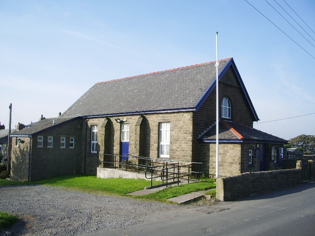
Eccleshill Civil parish
276
Blackburn with Darwen Blackburn [ 17] [ 18]
Hoddlesden
Unparished area
1,292
Blackburn with Darwen Darwen [ 14] [ 19]
Livesey Civil parish
6,337
Blackburn with Darwen Blackburn [ 17] [ 18]
North Turton Civil parish
3,736
Blackburn with Darwen Turton [ 20] [ 18]
Pleasington Civil parish
467
Blackburn with Darwen Blackburn [ 17] [ 18]
Tockholes Civil parish
454
Blackburn with Darwen Blackburn [ 17] [ 18]
Yate and Pickup Bank Civil parish
355
Blackburn with Darwen Blackburn [ 17] [ 18]
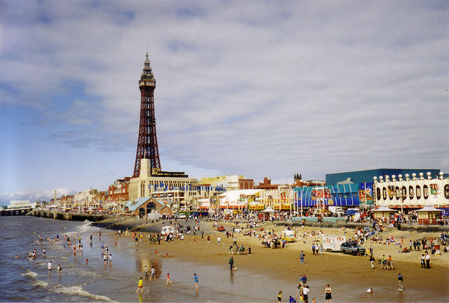
Blackpool Unparished area
142,283
Blackpool Blackpool [ 21] [ 22]
Briercliffe
Civil parish
3,187
Burnley Burnley [ 23] [ 24]
Burnley Unparished area
64,925
Burnley Burnley [ 25] [ 26]
Cliviger Civil parish
2,350
Burnley Burnley [ 23] [ 24]
Dunnockshaw Civil parish
212
Burnley Burnley [ 23] [ 24]
Habergham Eaves
Civil parish
1,581
Burnley Burnley [ 23] [ 24]
Hapton Civil parish
3,769
Burnley Burnley [ 23] [ 24]
Ightenhill Civil parish
1,512
Burnley Burnley [ 23] [ 24]
Padiham Town
8,998
Burnley Padiham [ 27] [ 24]
Worsthorne with Hurstwood Civil parish
2,986
Burnley Burnley [ 23] [ 24]
Adlington Town
5,270
Chorley Adlington [ 28] [ 29]
Anderton Civil parish
1,206
Chorley Anglezarke Civil parish
23
Chorley Astley Village Civil parish
3,329
Chorley Chorley [ 31] [ 29]
Bretherton Civil parish
655
Chorley Brindle Civil parish
999
Chorley Charnock Richard Civil parish
1,885
Chorley Chorley Unparished area
31,556
Chorley Chorley [ 31] [ 32]
Clayton le Woods Civil parish
14,528
Chorley Coppull Civil parish
7,637
Chorley Croston Civil parish
2,679
Chorley Cuerden Civil parish
77
Chorley Eccleston Civil parish
4,353
Chorley Euxton Civil parish
8,318
Chorley Heapey Civil parish
955
Chorley Heath Charnock Civil parish
2,065
Chorley Heskin Civil parish
883
Chorley Hoghton Civil parish
867
Chorley Mawdesley Civil parish
1,787
Chorley Rivington Civil parish
144
Chorley Ulnes Walton Civil parish
2,048
Chorley Wheelton Civil parish
1,001
Chorley Whittle le Woods Civil parish
4,553
Chorley Withnell Civil parish
3,631
Chorley Withnell [ 33] [ 29]
Bryning with Warton Civil parish
3,572
Fylde
Elswick Civil parish
1,057
Fylde
Freckleton Civil parish
6,045
Fylde
Greenhalgh with Thistleton Civil parish
462
Fylde
Kirkham Town
7,127
Fylde
Kirkham [ 36] [ 35]
Little Eccleston with Larbreck
Civil parish
374
Fylde
Lytham
Unparished area
15,584
Fylde
Lytham St Annes [ 37] [ 38]
Medlar with Wesham Town
3,245
Fylde
Newton with Clifton Civil parish
2,680
Fylde
Ribby with Wrea
Civil parish
1,489
Fylde
Singleton Civil parish
877
Fylde
St Anne's on the Sea Town
25,743
Fylde
Lytham St Annes [ 37] [ 39]
Staining Civil parish
2,312
Fylde
Treales, Roseacre and Wharles
Civil parish
447
Fylde
Weeton with Preese Civil parish
1,096
Fylde
Westby with Plumptons Civil parish
1,107
Fylde
Accrington Unparished area
34,128
Hyndburn Accrington [ 40] [ 41]
Altham Civil parish
897
Hyndburn Burnley [ 23] [ 42]
Church Unparished area
3,988
Hyndburn Church [ 43] [ 44]
Clayton le Moors Unparished area
8,289
Hyndburn Clayton le Moors [ 45] [ 46]
Great Harwood Unparished area
11,217
Hyndburn Great Harwood [ 47] [ 48]
Oswaldtwistle Unparished area
15,627
Hyndburn Oswaldtwistle [ 49] [ 50]
Rishton Unparished area
7,350
Hyndburn Rishton [ 51] [ 52]
Arkholme with Cawood Civil parish
334
Lancaster Bolton le Sands Civil parish
4,098
Lancaster Borwick Civil parish
210
Lancaster Burrow with Burrow Civil parish
191
Lancaster Cantsfield Civil parish
76
Lancaster Carnforth Town
5,350
Lancaster Carnforth [ 56] [ 54]
Caton with Littledale
Civil parish
2,720
Lancaster Claughton Civil parish
132
Lancaster Cockerham Civil parish
558
Lancaster Ellel
Civil parish
2,521
Lancaster Gressingham
Civil parish
153
Lancaster Halton with Aughton Civil parish
2,360
Lancaster Heaton with Oxcliffe
Civil parish
2,225
Lancaster Heysham Unparished area
11,016
Lancaster Morecambe and Heysham [ 57] [ 58]
Hornby with Farleton
Civil parish
729
Lancaster Ireby Civil parish
78
Lancaster Lancaster Unparished area
50,867
Lancaster Lancaster [ 59] [ 60]
Leck
Civil parish
189
Lancaster Melling with Wrayton Civil parish
290
Lancaster Middleton Civil parish
521
Lancaster Morecambe Town
35,916
Lancaster Morecambe and Heysham [ 57] [ 61] [ 62]
Nether Kellet Civil parish
646
Lancaster Over Kellet Civil parish
778
Lancaster Over Wyresdale Civil parish
348
Lancaster Overton Civil parish
1,015
Lancaster Priest Hutton
Civil parish
177
Lancaster Quernmore Civil parish
532
Lancaster Roeburndale
Civil parish
76
Lancaster Scotforth Civil parish
239
Lancaster Silverdale Civil parish
1,545
Lancaster Slyne with Hest
Civil parish
3,163
Lancaster Tatham Civil parish
393
Lancaster Thurnham Civil parish
595
Lancaster Tunstall Civil parish
105
Lancaster Warton Civil parish
2,315
Lancaster Wennington Civil parish
102
Lancaster Whittington Civil parish
359
Lancaster Wray with Botton
Civil parish
521
Lancaster Yealand Conyers Civil parish
176
Lancaster Yealand Redmayne Civil parish
295
Lancaster Barley with Wheatley Booth Civil parish
271
Pendle Burnley [ 23] [ 63]
Barnoldswick Town
10,859
Pendle Barnoldswick [ 64] [ 63]
Barrowford Civil parish
6,039
Pendle Barrowford [ 65] [ 63]
Blacko Civil parish
595
Pendle Burnley [ 23] [ 63]
Bracewell and Brogden Civil parish
238
Pendle Skipton [ 66] [ 63]
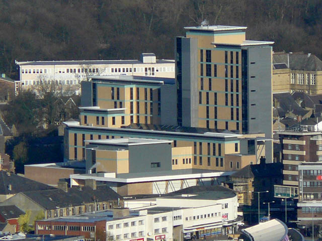
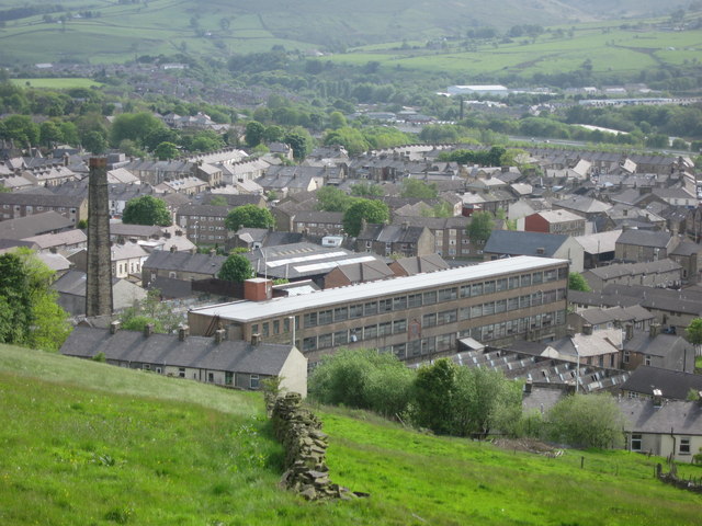
Brierfield
Town
8,199
Pendle Brierfield [ 67] [ 63]
Colne Town
18,117
Pendle Colne [ 68] [ 69] [ 70]
Earby Civil parish
4,348
Pendle Earby [ 71] [ 63]
Foulridge Civil parish
1,506
Pendle Burnley [ 23] [ 63]
Goldshaw Booth Civil parish
265
Pendle Burnley [ 23] [ 63]
Higham with West Close Booth Civil parish
808
Pendle Burnley [ 23] [ 63]
Kelbrook and Sough Civil parish
1,026
Pendle Earby [ 71] [ 63]
Laneshaw Bridge Civil parish
759
Pendle Colne [ 68] [ 63]
Nelson Town
29,108
Pendle Nelson [ 72] [ 73] [ 70]
Old Laund Booth Civil parish
1,586
Pendle Burnley [ 23] [ 63]
Reedley Hallows
Civil parish
1,994
Pendle Burnley [ 23] [ 63]
Roughlee Booth
Civil parish
328
Pendle Burnley [ 23] [ 63]
Salterforth Civil parish
625
Pendle Skipton [ 66] [ 63]
Trawden Forest Civil parish
2,580
Pendle Trawden [ 74] [ 63]
Barton Civil parish
1,096
Preston Preston [ 75] [ 76]
Broughton Civil parish
1,735
Preston Preston [ 75] [ 76]
Fulwood Unparished area
33,171
Preston Fulwood [ 77] [ 78]
Goosnargh Civil parish
1,204
Preston Preston [ 75] [ 76]
Grimsargh Civil parish
2,164
Preston Preston [ 75] [ 76]
Haighton Civil parish
197
Preston Preston [ 75] [ 76]
Lea Civil parish
5,962
Preston Preston [ 75] [ 76]
Preston
Unparished area
79,864
Preston Preston [ 79] [ 80]
Whittingham Civil parish
2,189
Preston Preston [ 75] [ 76]
Woodplumpton Civil parish
2,051
Preston Preston [ 75] [ 76]
Aighton, Bailey and Chaigley Civil parish
1,249
Ribble Valley Balderstone
Civil parish
379
Ribble Valley Blackburn [ 17] [ 82]
Bashall Eaves Civil parish
162
Ribble Valley Bowland [ 83] [ 82]
Billington and Langho Civil parish
4,555
Ribble Valley Blackburn [ 17] [ 82]
Bolton by Bowland
Civil parish
498
Ribble Valley Bowland [ 83] [ 82]
Bowland Forest High Civil parish
163
Ribble Valley Bowland [ 83] [ 82]
Bowland Forest Low Civil parish
168
Ribble Valley Bowland [ 83] [ 82]
Bowland with Leagram
Civil parish
128
Ribble Valley Chatburn Civil parish
1,104
Ribble Valley Chipping Civil parish
1,046
Ribble Valley Clayton le Dale
Civil parish
1,142
Ribble Valley Blackburn [ 17] [ 82]
Clitheroe Town
14,697
Ribble Valley Clitheroe [ 84] [ 82]
Dinckley Civil parish
83
Ribble Valley Blackburn [ 17] [ 82]
Downham Civil parish
156
Ribble Valley Dutton Civil parish
212
Ribble Valley Preston [ 75] [ 82]
Easington
Civil parish
52
Ribble Valley Bowland [ 83] [ 82]
Gisburn Civil parish
506
Ribble Valley Bowland [ 83] [ 82]
Gisburn Forest
Civil parish
137
Ribble Valley Bowland [ 83] [ 82]
Great Mitton
Civil parish
205
Ribble Valley Bowland [ 83] [ 82]
Grindleton
Civil parish
723
Ribble Valley Bowland [ 83] [ 82]
Horton
Civil parish
76
Ribble Valley Bowland [ 83] [ 82]
Hothersall
Civil parish
136
Ribble Valley Preston [ 75] [ 82]
Little Mitton
Civil parish
42
Ribble Valley Longridge Town
7,546
Ribble Valley Longridge [ 85] [ 82]
Mearley
Civil parish
25
Ribble Valley Mellor Civil parish
2,126
Ribble Valley Blackburn [ 17] [ 82]
Middop Civil parish
43
Ribble Valley Bowland [ 83] [ 82]
Newsholme Civil parish
50
Ribble Valley Bowland [ 83] [ 82]
Newton
Civil parish
237
Ribble Valley Bowland [ 83] [ 82]
Osbaldeston Civil parish
165
Ribble Valley Blackburn [ 17] [ 82]
Paythorne
Civil parish
95
Ribble Valley Bowland [ 83] [ 82]
Pendleton Civil parish
203
Ribble Valley Ramsgreave Civil parish
770
Ribble Valley Blackburn [ 17] [ 82]
Read Civil parish
1,383
Ribble Valley Burnley [ 23] [ 82]
Ribchester Civil parish
1,535
Ribble Valley Preston [ 75] [ 82]
Rimington Civil parish
382
Ribble Valley Bowland [ 83] [ 82]
Sabden Civil parish
1,371
Ribble Valley Burnley [ 23] [ 82]
Salesbury Civil parish
391
Ribble Valley Blackburn [ 17] [ 82]
Sawley Civil parish
305
Ribble Valley Bowland [ 83] [ 82]
Simonstone Civil parish
1,152
Ribble Valley Burnley [ 23] [ 82]
Slaidburn Civil parish
288
Ribble Valley Bowland [ 83] [ 82]
Thornley with Wheatley
Civil parish
327
Ribble Valley Twiston
Civil parish
64
Ribble Valley Waddington Civil parish
878
Ribble Valley Bowland [ 83] [ 82]
West Bradford Civil parish
730
Ribble Valley Bowland [ 83] [ 82]
Whalley Civil parish
2,645
Ribble Valley Wilpshire Civil parish
2,569
Ribble Valley Blackburn [ 17] [ 82]
Wiswell Civil parish
985
Ribble Valley Worston Civil parish
76
Ribble Valley Bacup Unparished area
14,191
Rossendale Bacup [ 86] [ 87]
Edenfield Unparished area
3,544
Rossendale Ramsbottom [ 88] [ 89]
Haslingden Unparished area
16,849
Rossendale Haslingden [ 90] [ 91]
Rawtenstall Unparished area
23,805
Rossendale Rawtenstall [ 92] [ 93]
Whitworth Town
7,263
Rossendale Whitworth [ 94] [ 95]
Cuerdale Civil parish
36
South Ribble Preston [ 75] [ 96]
Farington Civil parish
6,088
South Ribble Preston [ 75] [ 96]
Hutton Civil parish
2,073
South Ribble Preston [ 75] [ 96]
Leyland Unparished area
30,165
South Ribble Leyland [ 97] [ 98]
Little Hoole
Civil parish
1,815
South Ribble Preston [ 75] [ 96]
Longton Civil parish
7,732
South Ribble Preston [ 75] [ 96]
Much Hoole Civil parish
1,851
South Ribble Preston [ 75] [ 96]
Penwortham Town
23,436
South Ribble Preston [ 75] [ 96]
Samlesbury Civil parish
1,011
South Ribble Preston [ 75] [ 96]
Walton le Dale
Unparished area
29,660
South Ribble Walton le Dale [ 99] [ 100]
Aughton Civil parish
8,342
West Lancashire West Lancashire [ 101] [ 102]
Bickerstaffe Civil parish
1,196
West Lancashire West Lancashire [ 101] [ 102]
Bispham
Civil parish
207
West Lancashire West Lancashire [ 101] [ 102]
Burscough Civil parish
8,968
West Lancashire Ormskirk [ 103] [ 102]
Dalton Civil parish
348
West Lancashire Wigan [ 104] [ 102]
Downholland Civil parish
966
West Lancashire West Lancashire [ 101] [ 102]
Great Altcar Civil parish
243
West Lancashire West Lancashire [ 101] [ 102]
Halsall Civil parish
1,873
West Lancashire West Lancashire [ 101] [ 102]
Hesketh with Becconsall
Civil parish
3,873
West Lancashire West Lancashire [ 101] [ 102]
Hilldale
Civil parish
633
West Lancashire Wigan [ 104] [ 102]
Lathom Civil parish
890
West Lancashire Ormskirk [ 103] [ 102]
Lathom South
Civil parish
762
West Lancashire Ormskirk [ 103] [ 105] [ 106]
Newburgh Civil parish
1,080
West Lancashire Ormskirk [ 103] [ 102]
North Meols Civil parish
3,792
West Lancashire West Lancashire [ 101] [ 102]
Ormskirk Unparished area
17,234
West Lancashire Ormskirk [ 103] [ 107]
Parbold Civil parish
2,702
West Lancashire Wigan [ 104] [ 102]
Rufford Civil parish
2,048
West Lancashire West Lancashire [ 101] [ 102]
Scarisbrick Civil parish
3,204
West Lancashire West Lancashire [ 101] [ 102]
Simonswood Civil parish
130
West Lancashire West Lancashire [ 101] [ 102] [ 108]
Skelmersdale Unparished area
34,550
West Lancashire Skelmersdale and Holland [ 109] [ 110]
Tarleton Civil parish
5,350
West Lancashire West Lancashire [ 101] [ 102]
Up Holland
Civil parish
7,180
West Lancashire Skelmersdale and Holland [ 109] [ 102]
Wrightington
Civil parish
2,807
West Lancashire Wigan [ 104] [ 102]
Barnacre with Bonds
Civil parish
1,751
Wyre Bleasdale Civil parish
147
Wyre Cabus Civil parish
1,572
Wyre Catterall Civil parish
1,981
Wyre Claughton Civil parish
562
Wyre Fleetwood Town
26,841
Wyre Fleetwood [ 113] [ 114] [ 115]
Forton
Civil parish
1,253
Wyre Garstang Town
4,074
Wyre Great Eccleston Civil parish
1,473
Wyre Hambleton Civil parish
2,678
Wyre Inskip with Sowerby
Civil parish
878
Wyre Kirkland Civil parish
343
Wyre Myerscough and Bilsborrow Civil parish
1,521
Wyre Nateby Civil parish
475
Wyre Nether Wyresdale Civil parish
613
Wyre Out Rawcliffe Civil parish
567
Wyre Pilling Civil parish
1,739
Wyre Poulton le Fylde
Unparished area
18,264
Wyre Poulton le Fylde [ 117] [ 118]
Preesall Town
5,314
Wyre Preesall [ 119] [ 112]
Stalmine with Staynall
Civil parish
1,476
Wyre Thornton–Cleveleys
Unparished Area
31,157
Wyre Thornton–Cleveleys [ 120] [ 121]
Upper Rawcliffe with Tarnacre
Civil parish
604
Wyre Winmarleigh Civil parish
335
Wyre edit] See also
References
^ Discovering Parish Boundaries . Shire Publications. Princes Risborough, 96 pages ISBN 978-0-7478-0470-3 ^ RAC Foundation : What Went Wrong? British Highway Development Before Motorways Retrieved 22 August 2009^ The Victorian Web : The Poor Law : Introduction Retrieved 22 August 2009^ Staffordshire University : Poor Law Unions and Registration Districts Retrieved 22 August 2009^ A Vision of Britain Through Time : Status Details for Rural Sanitary District Retrieved 22 August 2009^ The Reformation and the Towns in England , 1998, Oxford University Press, 395 pages, ISBN 978-0-19-820718-4 ^ a b Modern British Surnames : Selected Events in the History of Civil Registration and Boundary Changes 1801-1996 Retrieved 22 August 2009
^ The Local Government Act 1894 and the Subsequent Statutes Affecting Parish Councils , 1907, Butterworth and Co, London, 626 pages^ a b c d Office of Public Sector Information : Local Government Act 1972 Retrieved 22 August 2009
^ Office of Public Sector Information : Local Government and Rating Act 1997 Retrieved 22 August 2009^ Office of Public Sector Information : Local Government and Public Involvement in Health Act 2007 Retrieved 22 August 2009^ A Vision of Britain Through Time : Blackburn County Borough Retrieved 4 February 2010^ Office for National Statistics : Census 2001 : Table KS01 : Usual Resident Population Audley; Bastwell; Beardwood with Lammack; Corporation Park; Ewood; Fernhurst; Higher Croft; Little Harwood; Meadowhead; Mill Hill; Queen's Park; Roe Lee; Shadsworth and Whitebirk; Shear Brow; and Wensley Fold wards. Retrieved 4 February 2010^ a b A Vision of Britain Through Time : Darwen Municipal Borough Retrieved 4 February 2010
^ Office for National Statistics : Census 2001 : Table KS01 : Usual Resident Population Earcroft; Marsh House; Sudell; Sunnyhurst; and Whitehall wards. Retrieved 4 February 2010^ Darwen Town Council : First Meeting of Darwen Town Council : 17 June 2009 : Appendix 1 : A Copy of the Blackburn with Darwen Borough Council (Reorganisation of Community Governance) Order 2009 Retrieved 3 February 2010^ a b c d e f g h i j k l m n A Vision of Britain Through Time : Blackburn Rural District Retrieved 4 February 2010
^ a b c d e f Office for National Statistics : Census 2001 : Parish Headcounts : Blackburn with Darwen Retrieved 4 February 2010
^ Office for National Statistics : Census 2001 : Table KS01 : Usual Resident Population East Rural (part) ward. Retrieved 4 February 2010^ A Vision of Britain Through Time : Turton Urban District Retrieved 4 February 2010^ A Vision of Britain Through Time : Blackpool County Borough Retrieved 4 February 2010^ Office for National Statistics : Census 2001 : Table KS01 : Usual Resident Population Anchorsholme; Bispham; Bloomfield; Brunswick; Claremont; Clifton; Greenlands; Hawes Side; Highfield; Ingthorpe; Layton; Marton; Norbreck; Park; Squires Gate; Stanley; Talbot; Tyldesley; Victoria; Warbreck; and Waterloo wards. Retrieved 4 February 2010^ a b c d e f g h i j k l m n o p q r s A Vision of Britain Through Time : Burnley Rural District Retrieved 4 February 2010
^ a b c d e f g h Office for National Statistics : Census 2001 : Parish Headcounts : Burnley Retrieved 4 February 2010
^ A Vision of Britain Through Time : Burnley County Borough Retrieved 4 February 2010^ Office for National Statistics : Census 2001 : Table KS01 : Usual Resident Population Bank Hall; Briercliffe (part); Brunshaw; Coal Clough with Deerplay (part); Daneshouse with Stoneyholme; Gannow; Lanehead; Queensgate; Rosegrove with Lowerhouse (part); Rosehill with Burnley Wood; Trinity; and Whittlefield with Ightenhill (part) wards. Retrieved 4 February 2010^ A Vision of Britain Through Time : Padiham Urban District Retrieved 4 February 2010^ A Vision of Britain Through Time : Adlington Urban District Retrieved 5 February 2010^ a b c d e f g h i j k l m n o p q r s t u v w Office for National Statistics : Census 2001 : Parish Headcounts : Chorley Retrieved 5 February 2010
^ a b c d e f g h i j k l m n o p q r s t A Vision of Britain Through Time : Chorley Rural District Retrieved 5 February 2010
^ a b A Vision of Britain Through Time : Chorley Municipal Borough Retrieved 5 February 2010
^ Office for National Statistics : Census 2001 : Table KS01 : Usual Resident Population Chorley East; Chorley North East; Chorley North West; Chorley South East; and Chorley South West wards. Retrieved 4 February 2010^ A Vision of Britain Through Time : Withnell Urban District Retrieved 7 February 2010^ a b c d e f g h i j k l m A Vision of Britain Through Time : Fylde Rural District Retrieved 8 February 2010
^ a b c d e f g h i j k l m n Office for National Statistics : Census 2001 : Parish Headcounts : Fylde Retrieved 8 February 2010
^ A Vision of Britain Through Time : Kirkham Urban District Retrieved 8 February 2010^ a b A Vision of Britain Through Time : Lytham St Annes Municipal Borough Retrieved 8 February 2010
^ Office for National Statistics : Census 2001 : Table KS01 : Usual Resident Population Ansdell; Clifton; Fairhaven (part); Park (part); and St John's wards. Retrieved 4 February 2010^ Office for National Statistics : Census 2001 : Table KS01 : Usual Resident Population Ashton; Central; Fairhaven (part); Heyhouses; Kilnhouse; Park (part) and St Leonards wards. Retrieved 4 February 2010^ A Vision of Britain Through Time : Accrington Municipal Borough Retrieved 9 February 2010^ Office for National Statistics : Census 2001 : Table KS01 : Usual Resident Population Barnfield; Baxenden; Central; Church (part); Huncoat; Immanuel (part); Milnshaw; Peel; and Spring Hill wards. Retrieved 4 February 2010^ Office for National Statistics : Census 2001 : Parish Headcounts : Hyndburn Retrieved 9 February 2010^ A Vision of Britain Through Time : Church Urban District Retrieved 9 February 2010^ Office for National Statistics : Census 2001 : Table KS01 : Usual Resident Population Altham (part); and Church (part) wards. Retrieved 4 February 2010^ A Vision of Britain Through Time : Clayton le Moors Urban District Retrieved 9 February 2010^ Office for National Statistics : Census 2001 : Table KS01 : Usual Resident Population Altham (part); and Clayton le Moors wards. Retrieved 4 February 2010^ A Vision of Britain Through Time : Great Harwood Urban District Retrieved 9 February 2010^ Office for National Statistics : Census 2001 : Table KS01 : Usual Resident Population Netherton; and Overton wards. Retrieved 4 February 2010^ A Vision of Britain Through Time : Oswaldtwistle Urban District Retrieved 9 February 2010^ Office for National Statistics : Census 2001 : Table KS01 : Usual Resident Population Immanuel (part); St Andrew's; and St Oswald's wards. Retrieved 4 February 2010^ A Vision of Britain Through Time : Rishton Urban District Retrieved 9 February 2010^ Office for National Statistics : Census 2001 : Table KS01 : Usual Resident Population Rishton ward. Retrieved 4 February 2010^ a b c d e f g h i j k l m n o p q r s t u A Vision of Britain Through Time : Lunesdale Rural District Retrieved 11 February 2010
^ a b c d e f g h i j k l m n o p q r s t u v w x y z aa ab ac ad ae af ag ah ai aj ak Office for National Statistics : Census 2001 : Parish Headcounts : Lancaster Retrieved 11 February 2010
^ a b c d e f g h i j k l m n o A Vision of Britain Through Time : Lancaster Rural District Retrieved 11 February 2010
^ A Vision of Britain Through Time : Carnforth Urban District Retrieved 11 February 2010^ a b A Vision of Britain Through Time : Morecambe and Heysham Municipal Borough Retrieved 10 February 2010
^ Office for National Statistics : Census 2001 : Table KS01 : Usual Resident Population Heysham Central; Heysham South; and Overton (part) wards. Retrieved 4 February 2010^ A Vision of Britain Through Time : Lancaster Municipal Borough Retrieved 10 February 2010^ Office for National Statistics : Census 2001 : Table KS01 : Usual Resident Population Bulk; Castle; Duke's; John O'Gaunt; Scotforth East; Scotforth West; Skerton East; Skerton West (part); and University (part) wards. Retrieved 4 February 2010^ Office for National Statistics : Census 2001 : Table KS01 : Usual Resident Population Bare; Harbour; Heysham North; Poulton; Torrisholme (part); and Westgate (part) wards. Retrieved 4 February 2010^ Lancaster City Council : Find Out More About Morecambe Parish Council Retrieved 27 October 2009^ a b c d e f g h i j k l m n o p q Office for National Statistics : Census 2001 : Parish Headcounts : Pendle Retrieved 23 May 2010
^ A Vision of Britain Through Time : Barnoldswick Urban District Retrieved 23 May 2010^ A Vision of Britain Through Time : Barrowford Urban District Retrieved 23 May 2010^ a b A Vision of Britain Through Time : Skipton Rural District Retrieved 23 May 2010
^ A Vision of Britain Through Time : Brierfield Urban District Retrieved 23 May 2010^ a b A Vision of Britain Through Time : Colne Municipal Borough Retrieved 23 May 2010
^ Office for National Statistics : Census 2001 : Table KS01 : Usual Resident Population Boulsworth (part);; Foulridge (part); Horsfield; Vivary Bridge; and Waterside wards. Retrieved 23 May 2010^ a b The Pendle (Parishes) Order 2008 Retrieved 23 May 2010
^ a b A Vision of Britain Through Time : Earby Urban District Retrieved 23 May 2010
^ A Vision of Britain Through Time : Nelson Municipal Borough Retrieved 24 May 2010^ Office for National Statistics : Census 2001 : Table KS01 : Usual Resident Population Bradley; Brierfield (part); Clover Hill; Marsden; Southfield; Walverden and Whitefield wards. Retrieved 24 May 2010^ A Vision of Britain Through Time : Trawden Urban District Retrieved 25 May 2010^ a b c d e f g h i j k l m n o p q r s A Vision of Britain Through Time : Preston Rural District Retrieved 24 May 2010
^ a b c d e f g h Office for National Statistics : Census 2001 : Parish Headcounts : Preston Retrieved 26 July 2010
^ A Vision of Britain Through Time : Fulwood Urban District Retrieved 24 May 2010^ Office for National Statistics : Census 2001 : Table KS01 : Usual Resident Population Brookfield (part); Cadley, College, Garrison; Greyfriars; and Sharoe Green wards. Retrieved 24 May 2010^ A Vision of Britain Through Time : Preston County Borough Retrieved 24 May 2010^ Office for National Statistics : Census 2001 : Table KS01 : Usual Resident Population Ashton; Brookfield (part); Deepdale; Fishwick; Ingol; Larches; Moor Park; Ribbleton; Riversway; St George's; St Matthew's; Town Centre; Tulketh; and University wards. Retrieved 24 May 2010^ a b c d e f g h i j k l m A Vision of Britain Through Time : Clitheroe Rural District Retrieved 31 July 2010
^ a b c d e f g h i j k l m n o p q r s t u v w x y z aa ab ac ad ae af ag ah ai aj ak al am an ao ap aq ar as at au av aw Office for National Statistics : Census 2001 : Parish Headcounts : Ribble Valley Retrieved 31 July 2010
^ a b c d e f g h i j k l m n o p q r s A Vision of Britain Through Time : Bowland Rural District Retrieved 12 October 2010
^ A Vision of Britain Through Time : Clitheroe Municipal Borough Retrieved 12 October 2010^ A Vision of Britain Through Time : Longridge Urban District Retrieved 13 October 2010^ A Vision of Britain Through Time : Bacup Municipal Borough Retrieved 4 February 2010^ Office for National Statistics : Census 2001 : Table KS01 : Usual Resident Population Greensclough; Irwell; and Stacksteads wards. Retrieved 24 May 2010^ A Vision of Britain Through Time : Ramsbottom Urban District Retrieved 4 February 2010^ Office for National Statistics : Census 2001 : Table KS01 : Usual Resident Population Eden ward. Retrieved 24 May 2010^ A Vision of Britain Through Time : Haslingden Municipal Borough Retrieved 4 February 2010^ Office for National Statistics : Census 2001 : Table KS01 : Usual Resident Population Greenfield; Helmshore; and Worsley wards. Retrieved 24 May 2010^ A Vision of Britain Through Time : Rawtenstall Municipal Borough Retrieved 4 February 2010^ Office for National Statistics : Census 2001 : Table KS01 : Usual Resident Population Cribden; Goodshaw; Hareholme; Longholme; and Whitewell wards. Retrieved 24 May 2010^ A Vision of Britain Through Time : Whitworth Urban District Retrieved 14 October 2010^ Office for National Statistics : Census 2001 : Parish Headcounts : Rossendale Retrieved 4 February 2010^ a b c d e f g h Office for National Statistics : Census 2001 : Parish Headcounts : South Ribble Retrieved 24 May 2010
^ A Vision of Britain Through Time : Leyland Urban District Retrieved 4 February 2010^ Office for National Statistics : Census 2001 : Table KS01 : Usual Resident Population Earnshaw Bridge; Farington East (part); Golden Hill; Leyland Central; Leyland St Ambrose; Leyland St Mary's; Lowerhouse; Moss Side; and Seven Stars wards. Retrieved 24 May 2010^ A Vision of Britain Through Time : Walton le Dale Urban District Retrieved 24 May 2010^ Office for National Statistics : Census 2001 : Table KS01 : Usual Resident Population Bamber Bridge East; Bamber Bridge North; Bamber Bridge West; Coupe Green and Gregson Lane; Lostock Hall; Samlesbury and Walton (part); Tardy Gate; and Walton le Dale wards. Retrieved 24 May 2010^ a b c d e f g h i j k l A Vision of Britain Through Time : West Lancashire Rural District Retrieved 24 May 2010
^ a b c d e f g h i j k l m n o p q r s t Office for National Statistics : Census 2001 : Parish Headcounts : West Lancashire Retrieved 24 May 2010
^ a b c d e A Vision of Britain Through Time : Ormskirk Urban District Retrieved 24 May 2010
^ a b c d A Vision of Britain Through Time : Wigan Rural District Retrieved 24 May 2010
^ Office for National Statistics : Census 2001 : Table KS01 : Usual Resident Population Bickerstaffe (part); and Newburgh (part) wards. Retrieved 24 May 2010^ The West Lancashire (Parish Electoral Arrangements and Electoral Changes) Order 2007 Retrieved 24 May 2010^ Office for National Statistics : Census 2001 : Table KS01 : Usual Resident Population Derby; Knowsley; and Scott wards. Retrieved 24 May 2010^ The Cheshire, Lancashire and Merseyside (County and Metropolitan Borough Boundaries) Order 1993 Retrieved 18 October 2010^ a b A Vision of Britain Through Time : Skelmersdale and Holland Urban District Retrieved 24 May 2010
^ Office for National Statistics : Census 2001 : Table KS01 : Usual Resident Population Ashurst; Birch Green; Digmoor; Moorside; Skelmersdale North; Skelmersdale South; and Tanhouse wards. Retrieved 24 May 2010^ a b c d e f g h i j k l m n o p q r s A Vision of Britain Through Time : Garstang Rural District Retrieved 24 May 2010
^ a b c d e f g h i j k l m n o p q r s t Office for National Statistics : Census 2001 : Parish Headcounts : Wyre Retrieved 24 May 2010
^ A Vision of Britain Through Time : Fleetwood Municipal Borough Retrieved 24 May 2010^ Office for National Statistics : Census 2001 : Table KS01 : Usual Resident Population Mount; Park; Pharos; Rossall; and Warren wards. Retrieved 24 May 2010^ The Wyre Borough Council (Reorganisation of Community Governance) Order 2009 Retrieved 19 May 2010^ The Wyre (Parishes) Order 2003 Retrieved 22 October 2010^ A Vision of Britain Through Time : Poulton le Fylde Urban District Retrieved 24 May 2010^ Office for National Statistics : Census 2001 : Table KS01 : Usual Resident Population Breck; Carleton; Hardhorn; High Cross; and Tithebarn wards. Retrieved 24 May 2010^ A Vision of Britain Through Time : Preesall Urban District Retrieved 24 May 2010^ A Vision of Britain Through Time : Thornton–Cleveleys Urban District Retrieved 24 May 2010^ Office for National Statistics : Census 2001 : Table KS01 : Usual Resident Population Bourne; Cleveleys Park; Jubilee; Norcross; Staina; and Victoria wards. Retrieved 24 May 2010
External links
Wikimedia Foundation .
2010 .
Look at other dictionaries:
List of civil parishes in Lancashire Wikipedia
Civil parishes in England Wikipedia
Civil parishes in Merseyside Wikipedia
Civil parishes in Cambridgeshire Wikipedia
Civil parishes in Cumbria Wikipedia
Civil parishes in Bedfordshire Wikipedia
Civil parishes in Cheshire Wikipedia
Civil parishes in Cornwall Wikipedia
Civil parishes in South Yorkshire Wikipedia
Civil parishes in West Yorkshire Wikipedia
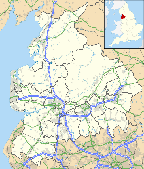
 A map of Lancashire, showing the Boroughs : (1) West Lancashire; (2) Chorley; (3) South Ribble; (4) Fylde; (5) Preston; (6) Wyre; (7) Lancaster; (8) Ribble Valley; (9) Pendle; (10) Burnley; (11) Rossendale; (12) Hyndburn; (13) Blackpool; and (14) Blackburn with Darwen.
 BrierfieldCivil parishes with town status