- Nether Kellet
-
Coordinates: 54°06′25″N 2°45′32″W / 54.107°N 2.759°W
Nether Kellet 
Village Green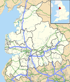
 Nether Kellet
Nether Kellet shown within LancashirePopulation 646 (2001) OS grid reference SD504681 Parish Nether Kellet District Lancaster Shire county Lancashire Region North West Country England Sovereign state United Kingdom Post town CARNFORTH Postcode district LA6 Dialling code 01524 Police Lancashire Fire Lancashire Ambulance North West EU Parliament North West England UK Parliament Morecambe and Lunesdale List of places: UK • England • Lancashire Nether Kellet is a village and civil parish in the City of Lancaster in Lancashire, England, a few miles south of Carnforth. It had a population of 646 recorded in the 2001 census.[1] The parish includes the small hamlet of Addington, to the east.
Contents
Community
Nether Kellet is one of the Thankful Villages - only 52 of which are known. These villages and parishes sent men to fight in the Great War, 1914-1918, and all of them came back alive. Nether Kellet sent 21. Their near neighbour, Arkholme, 5 miles (8.0 km) to the east, sent by far the most, 59 men, all of whom returned. It is remarkable to think that two small villages, geographically so close to one another, escaped unscathed from such a conflagration. Furthermore, Nether Kellet was doubly thankful,[2] as 16 villagers served in World War II, 1939-1945, without loss of life.
Geography
The village is located south of Over Kellet, north of Halton, west of Aughton and east of Bolton-le-Sands.
References
- ^ Office for National Statistics : Census 2001 : Parish Headcounts : Lancaster Retrieved 12 February 2010
- ^ Jon Kelly (11 November 2011). "Thankful villages: The places where everyone came back from the wars". BBC News. http://www.bbc.co.uk/news/magazine-15671943. Retrieved 11 November 2011.
External links
 Media related to Nether Kellet at Wikimedia Commons
Ceremonial county of Lancashire North West England Portal Unitary authorities Boroughs or districts Major settlements Accrington • Adlington • Bacup • Barnoldswick • Blackburn • Blackpool • Brierfield • Burnley • Burscough • Carnforth • Chorley • Clayton-le-Moors • Cleveleys • Clitheroe • Colne • Darwen • Earby • Fleetwood • Garstang • Great Harwood • Haslingden • Kirkham • Lancaster • Leyland • Longridge • Lytham St Annes • Morecambe • Nelson • Ormskirk • Oswaldtwistle • Padiham • Penwortham • Poulton-le-Fylde • Preesall • Preston • Rawtenstall • Rishton • Skelmersdale • Wesham • Whitworth
See also: List of civil parishes in LancashireRivers Canals Topics Categories:- Lancashire geography stubs
- Villages in Lancashire
- Civil parishes in Lancashire
- Geography of Lancaster
- Thankful Villages


Wikimedia Foundation. 2010.