- Chorley (borough)
-
Coordinates: 53°39′11″N 2°37′55″W / 53.653°N 2.632°W
Borough of Chorley — Borough — Shown within Lancashire
Sovereign state United Kingdom Constituent country England Region North West England Ceremonial county Lancashire Founded 1 April 1974 Admin. HQ Chorley Government - Type Chorley Borough Council - Leadership: Leader & Cabinet - Executive: Conservative / Liberal Democrat - MPs: Lindsay Hoyle (L) Area - Total 78.3 sq mi (202.8 km2) Area rank 165th Population (2010 est.) - Total 105,400 - Rank Ranked 214th - Density 1,346.1/sq mi (519.7/km2) Time zone Greenwich Mean Time (UTC+0) - Summer (DST) British Summer Time (UTC+1) Postcode areas PR6–PR7, BL6 Area code(s) 01257 ISO 3166-2 – ONS code 30UE OS grid reference SD5817 NUTS 3 – Ethnicity 96.5% White
1.6% S.Asian[1]Website chorley.gov.uk Chorley is a local government district with borough status in Lancashire, England. It is named after its largest settlement, the town of Chorley.
Contents
Creation
The present Borough of Chorley was formed on 1 April 1974 by the merger of the then existing municipal borough of Chorley with the urban districts of Adlington and Withnell, and Chorley Rural District.
Parishes
With exception of the town of Chorley, which remains an unparished area, the borough has twenty-three civil parishes: Adlington, Anderton, Anglezarke, Astley Village, Bretherton, Brindle, Charnock Richard, Clayton-le-Woods, Coppull, Croston, Cuerden, Eccleston, Euxton, Heapey, Heath Charnock, Heskin, Hoghton, Mawdesley, Rivington, Ulnes Walton, Wheelton, Whittle-le-Woods, and Withnell.
Wards
Chorley Council is made up of forty-seven councillors, representing the following twenty electoral wards:[2][3]
- Adlington & Anderton
- Astley & Buckshaw
- Brindle and Hoghton
- Chisnall (Charnock Richard)
- Chorley East
- Chorley North East
- Chorley North West
- Chorley South East
- Chorley South West
- Clayton-le-Woods & Whittle-le-Woods
- Clayton-le-Woods North
- Clayton-le-Woods West & Cuerden
- Coppull
- Eccleston & Mawdesley
- Euxton North
- Euxton South
- Heath Charnock & Rivington
- Lostock (Bretherton, Croston, & Ulnes Walton)
- Pennine (Heapey & Anglezarke)
- Wheelton & Withnell
Parliamentary constituency
The Chorley Parliament constituency is a constituency in the House of Commons, and until recently it was coterminous with the borough. Through boundary changes, Croston, Eccleston, Bretherton and Mawdesley were transferred to the South Ribble constituency. The current Member of Parliament for Chorley is Lindsay Hoyle, who was first elected to the seat in 1997.
See also
References
- ^ "Neighbourhood Statistics - Chorley (Local Authority)". Office for National Statistics. http://www.neighbourhood.statistics.gov.uk/dissemination/LeadTableView.do?a=3&b=277017&c=chorley&d=13&e=13&g=461789&i=1001x1003x1004&m=0&r=1&s=1206542205140&enc=1&dsFamilyId=1812. Retrieved 2008-09-06.
- ^ Your Councillors by Ward. Chorley Council. Retrieved 27 June 2010.
- ^ Chorley Lower-Layer Super Output Areas. Lancashire County Council. Retrieved 27 June 2010.
Ceremonial county of Lancashire North West England Portal Unitary authorities Boroughs or districts Major settlements Accrington • Adlington • Bacup • Barnoldswick • Blackburn • Blackpool • Brierfield • Burnley • Burscough • Carnforth • Chorley • Clayton-le-Moors • Cleveleys • Clitheroe • Colne • Darwen • Earby • Fleetwood • Garstang • Great Harwood • Haslingden • Kirkham • Lancaster • Leyland • Longridge • Lytham St Annes • Morecambe • Nelson • Ormskirk • Oswaldtwistle • Padiham • Penwortham • Poulton-le-Fylde • Preesall • Preston • Rawtenstall • Rishton • Skelmersdale • Wesham • Whitworth
See also: List of civil parishes in LancashireRivers Canals Topics  Districts of North West England
Cheshire 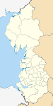
Cumbria Allerdale • Barrow-in-Furness • Carlisle • Copeland • Eden • South Lakeland
Greater Manchester Lancashire Blackburn with Darwen • Blackpool • Burnley • Chorley • Fylde • Hyndburn • Lancaster • Pendle • Preston • Ribble Valley • Rossendale • South Ribble • West Lancashire • Wyre
Merseyside Categories:- Chorley
- Local government in Chorley
- Non-metropolitan districts of Lancashire
- Local government districts of North West England

Wikimedia Foundation. 2010.