- Ormskirk
-
Coordinates: 53°33′59″N 2°53′13″W / 53.5665°N 2.8869°W
Ormskirk 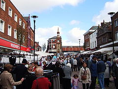
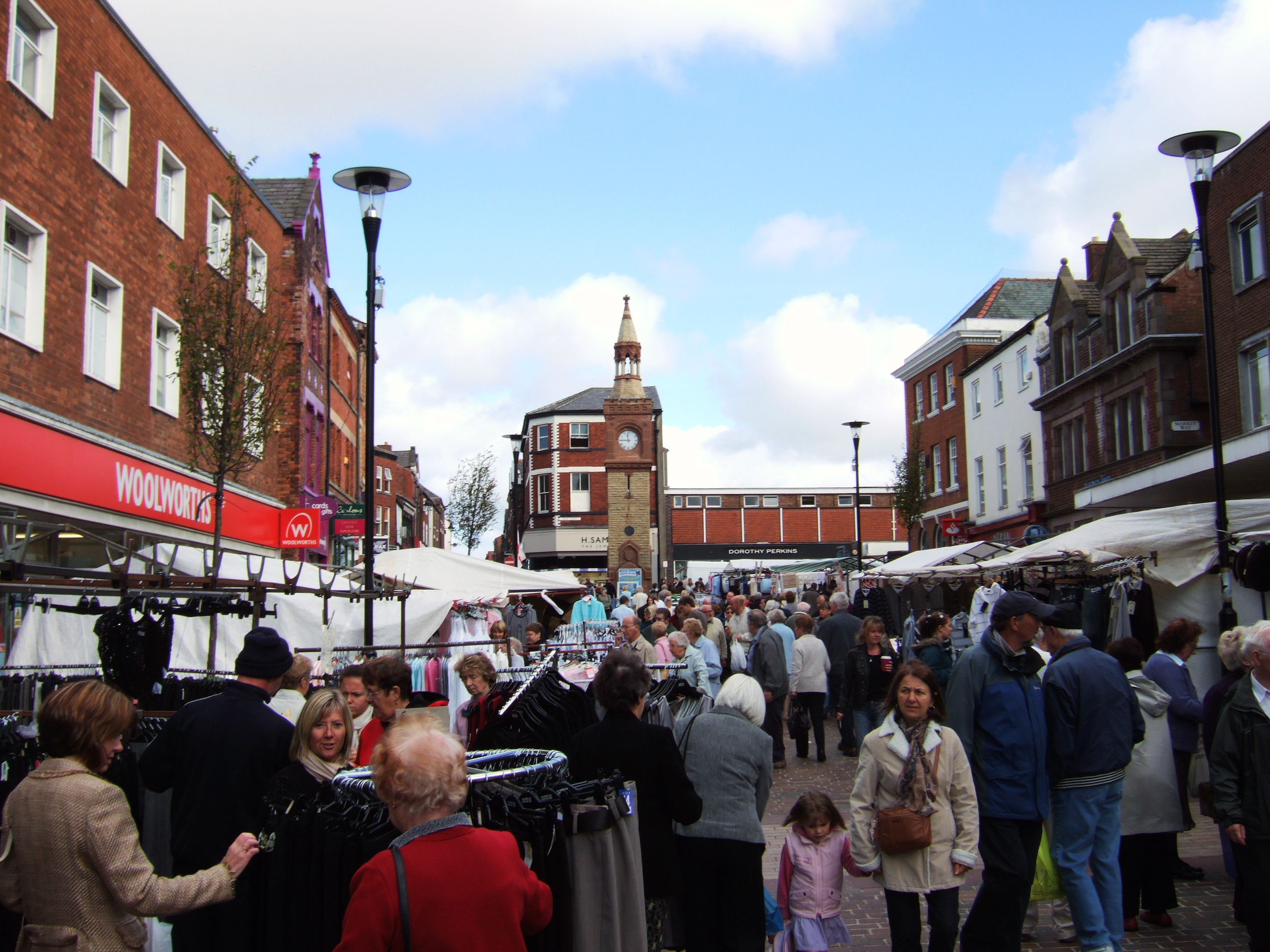
Market day in Ormskirk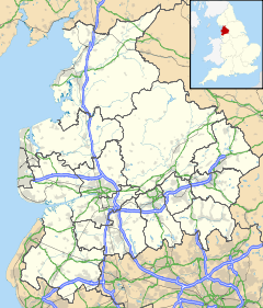
 Ormskirk
Ormskirk shown within LancashirePopulation 23,392 OS grid reference SD415085 District West Lancashire Shire county Lancashire Region North West Country England Sovereign state United Kingdom Post town ORMSKIRK Postcode district L39 Dialling code 01695 Police Lancashire Fire Lancashire Ambulance North West EU Parliament North West England UK Parliament West Lancashire List of places: UK • England • Lancashire Ormskirk is a market town in West Lancashire, England. It is situated 13 miles (21 km) north of Liverpool city centre, 11 miles (18 km) northwest of St Helens, 9 miles (14 km) southeast of Southport and 15 miles (24 km) southwest of Preston.
Contents
Geography and administration
Ormskirk lies on sloping ground on the side of a ridge, whose highest point is 68 metres (223 ft) above sea-level, at the centre of the West Lancashire Plain,[1] and has been described as a "planned borough", laid out in the 13th century.[2]
Ormskirk is an unparished area, surrounded by the parishes of Bickerstaffe, Aughton, Scarisbrick, Burscough and Lathom, and the unparished town of Skelmersdale.[3]
The town is located in the district of West Lancashire and is the site of the headquarters of West Lancashire Borough Council. Ormskirk is also a 'post town' in the Liverpool postcode area.
Since Ormskirk does not have a parish council, a voluntary association, Ormskirk Community Partnership, was created in 2009, with the support of the West Lancashire Borough Council, to act as a voice for Ormskirk. [4]
Ormskirk is home to Edge Hill University.[5]
History
The name ‘Ormskirk’ is Old Norse in origin and is derived from Ormres kirkja, from a personal name, Ormr (which means "serpent" or dragon), and the Old Norse word for church.[2] Ormr may have been a Viking who settled here, became a Christian and founded the church but there are no other records or archeological evidence to support this and Ormr's identity is unknown.
There is no reference to Ormskirk in the Domesday Book of 1086 but it has been suggested that it may have been part of Lathom at that time. In about 1189, the lord of Lathom granted the church of Ormskirk to Burscough Priory, which does suggest that Ormskirk had been subordinate to Lathom before that date.[2]
An open market is held twice-weekly, on Thursdays and Saturdays, in the pedestrianised centre of Ormskirk. The location was originally the junction of the main roads to Preston, Liverpool and Wigan, and was marked by a market cross until it was replaced by the current clock tower in the nineteenth century. The market was established by a Royal Charter that was granted by Edward I of England in 1286 to the monks of Burscough Priory. Thursday has been market day in Ormskirk since at least 1292. The King also granted a borough charter to Ormskirk at about the same time, but this seems to have become extinct by the end of the fifteenth century.[2]
The Ormskirk Poor Law Union was established in 1837, covering 21 parishes and townships from Tarleton to Simonswood, and from Birkdale to Skelmersdale. Ormskirk Union Workhouse was built in 1853 on Wigan Road and later became Ormskirk District General Hospital.[6]
With its weekly markets, the town became a focal point for local farmers and their agricultural workers, cottagers, cow-keepers etc. to trade their goods and obtain necessities from the markets and from the retail establishments which were established along with public houses and inns. An engineering industry, based on making and mending agricultural machinery also developed.
Parish Church of St Peter and St Paul
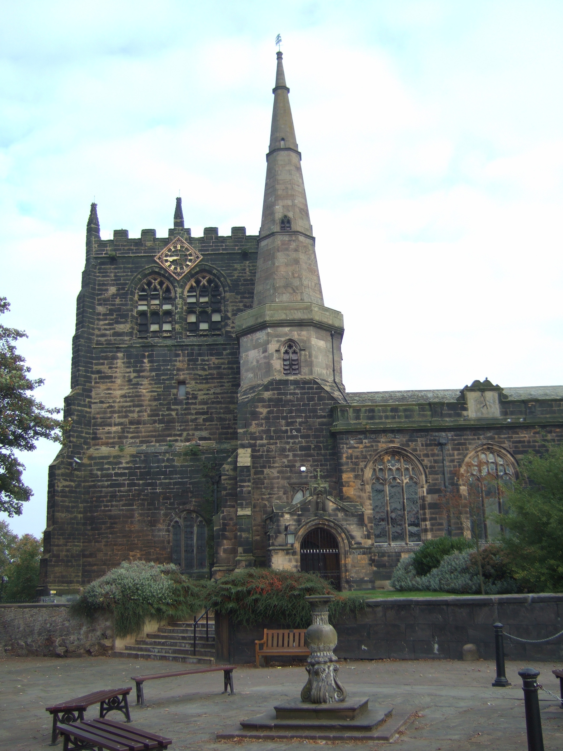
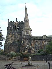 The distinctive tower and spire of Ormskirk Parish Church
The Parish Church of St Peter and St Paul is believed to be on the site of the original kirk, on a sandstone outcrop, and is the oldest building in the town. Its exact age is unknown; the building does contain some fragments of Norman architecture.
The parish church has many connections with the Earls of Derby and the Stanley family. Many family members are buried in the church's Derby Chapel, including Thomas Stanley, the first Earl, who caused Richard III to lose his crown by changing sides at the Battle of Bosworth in 1485, and the Royalist James Stanley, the seventh Earl, who was beheaded at Bolton in 1651 after the Civil War. His body is buried in one coffin and his head in a separate casket.
This is one of only three parish churches in England to have a tower and a spire, and is unique in that it has both at the same end of the building. (The other two are St Mary's Church, Purton and St Andrew's Church, Wanborough, both near Swindon, in Wiltshire). Legend has it that Orme had two sisters, one who wanted a tower and one who wanted a spire, and Orme built both to please both. Regrettably, the truth is not so romantic. The 'steeple' dates from the early fifteenth century, but the original blew down in 1731 and was rebuilt between 1790 and 1832. The large west tower was added to the church around 1548 to house the bells of nearby Burscough Priory following the dissolution of the monasteries. One of these bells can still be seen in the church.
Transport
The A59 is the main road, with Preston to the north and Liverpool to the south. The A570, from Southport, crosses the town from west to east and provides a link to the national motorway network at junction 3 of the M58, about three miles from the town centre.
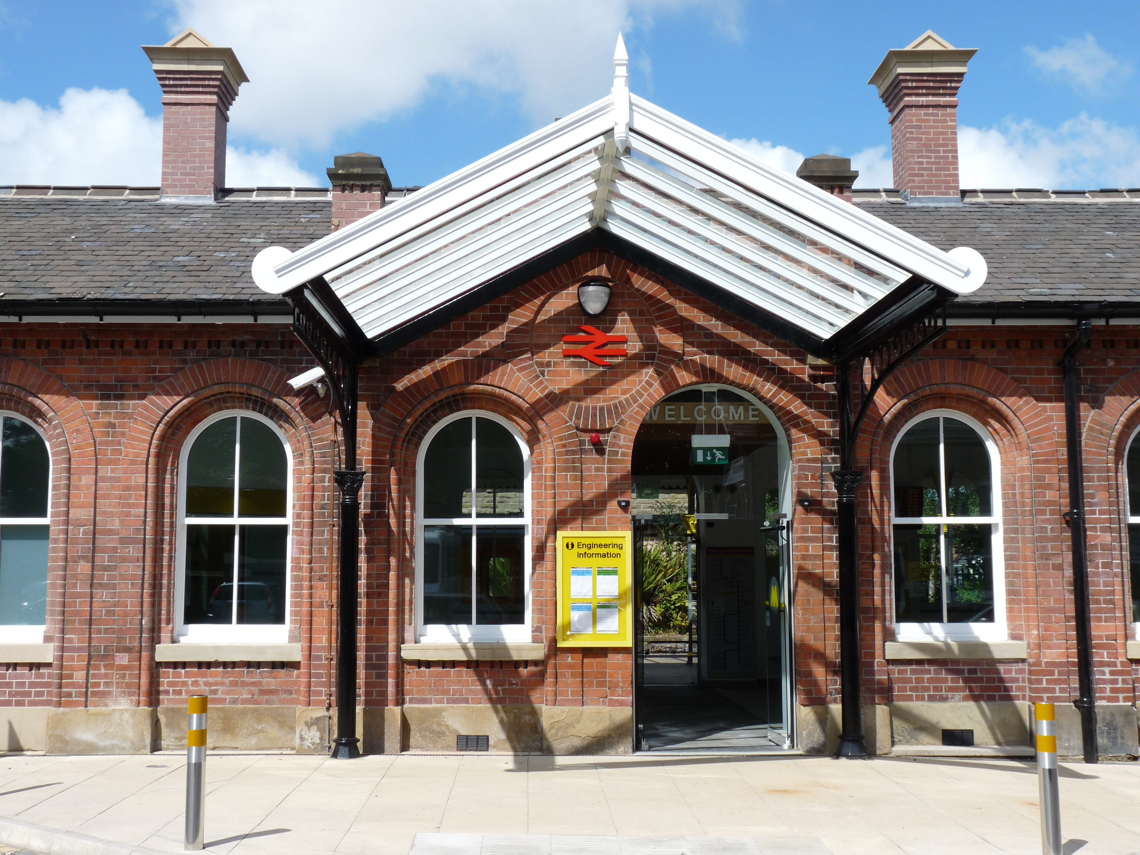
The town's railway station, which was refurbished at a cost of £1 million in 2009, is a northern terminus of Merseyrail, and the line continues, with a change from electric to diesel multiple units, through to Preston. This line was promoted by the Liverpool, Ormskirk and Preston Railway in August 1846, but was completed by the East Lancashire Railway. The route and Ormskirk station opened on 2 April 1849, the undertaking being merged into the Lancashire and Yorkshire Railway on 13 May 1859.
The Lancashire and Yorkshire Railway built the Skelmersdale Branch line to Skelmersdale and Rainford Junction, which opened on 1 March 1858. Passenger services ended on 5 November 1956, goods to Rainford Junction finished on 16 November 1961 and to Skelmersdale on 4 November 1963.
Local economy
Ormskirk is now mainly a retail centre, which also has a number of bars and restaurants.
There is a Tesco on Church Street and a Morrisons on Park Road, formerly home to the local gasworks and local Rover/Austin Morris car dealership (Balmforths). A new Marks & Spencer food store has also been opened. There is a small retail park with a McDonalds, an Argos catalogue store, and an Aldi supermarket, in a shopping development known as Two Saints in honour of the aforementioned Church. Ormskirk also has an indoor market situated on Moorgate.
An out of town business park includes stores such as Jewson and Halfords.
The Alpine bar (formerly The Arriba) stands at the west end of the indoor market on the site of an earlier bar called the Brahms and Liszt, itself converted from Ormskirk's last cinema, The Pavilion.
The only significant manufacturing business remaining in Ormskirk, in 2007, was Atkinson & Kirby, who made hardwood floors, employing 80 people.[7] Other businesses in the town are mainly professional and financial services, such as solicitors, estate agents, architects and accountants.
Education
Ormskirk School (ages 11–18) is on Wigan Road in the east of the town, situated on a site formerly home to the demolished Cross Hall High School. Ormskirk School is the result of a merger between Ormskirk Grammar School and Cross Hall High School. St Bede's Catholic High School (ages 11–16) is on St Anne's Road next to the A59 and Prescot Road, and opposite St Anne's church. Edge Hill University is on the A570 St Helens Road heading east. West Lancashire College, a further education college, has a site in the town centre on Hants Lane. There is also an independent school- Scarisbrick Hall School formerly Kingswood College. Ormskirk is also home to a public library.
Notable people
Members of Parliament for Ormskirk
- James Bell
- Ronald Cross
- Douglas Glover
- Robert Kilroy-Silk
- Stephen King-Hall
- James Salter
- Harold Soref
- Arthur Stanley
- Harold Wilson
Other connections
- Billy Ayre (lived and died), football player and manager
- Joseph Brandreth (born), physician
- Jon Culshaw (born), impressionist
- Duncan Ferguson (lives), footballer
- James Hopwood Jeans (born), physicist, astronomer and mathematician
- Stuart Maconie (student), TV presenter
- Nicholas Monsarrat (lived), novelist, author of The Cruel Sea
- Tony Morley (born), England and Aston Villa footballer, European Cup winner in 1982
- Jimmy O'Neill (lived), Irish international footballer[8]
- Les Pattinson (born), former member of Echo & the Bunnymen
- Jonathan Pryce (student), actor
- Robbie Slater (born), Australian footballer
- John Souch (born), seventeenth-century painter
- Stephen Warnock (born), England and Aston Villa footballer
Gallery
-
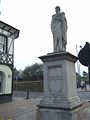
The Beaconsfield monument on Moor Street
-

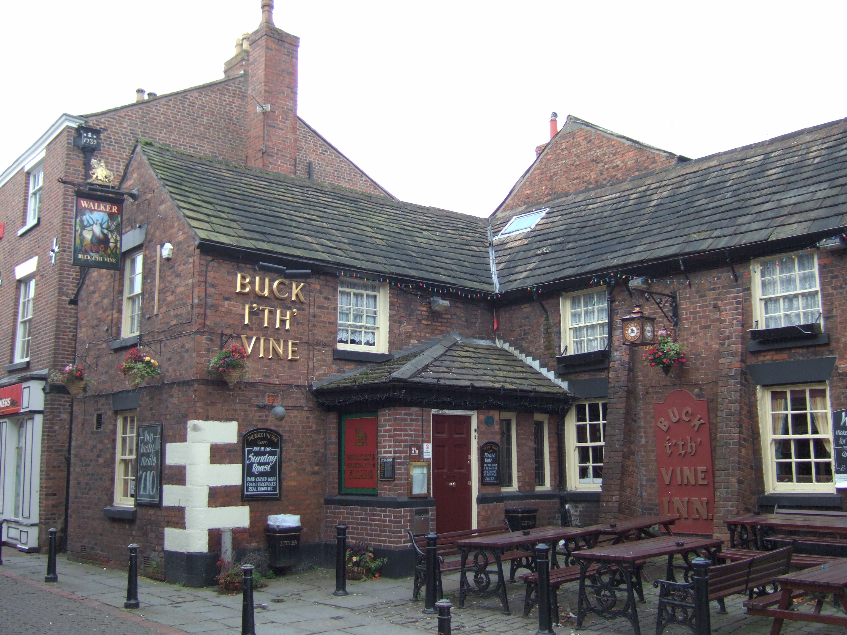
The Buck i'th' Vine Inn on Burscough Street
-
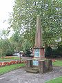
Memorial to Sergeant-Major Nunnerly in Victoria Gardens
-
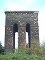
The old water tower on Tower Hill
See also
- Edge Hill University
- Ormskirk Urban District
- Ormskirk (UK Parliament constituency)
- Tower Hill Water Tower
- West Lancashire (UK Parliament constituency)
Notes
- ^ Townships: Ormskirk, British History Online
- ^ a b c d Lancashire.gov.uk, Ormskirk historic town assessment, Lancashire County Council, 2006
- ^ Mariolancashire.gov.uk, Map of Lancashire parishes
- ^ Westlandsdc.gov.uk Ormskirk Community Partnership
- ^ Edgehill.ac.uk, Edge Hill's 'how to find us' page
- ^ Workhouses.org.uk, Ormskirk Workhouses
- ^ Akirby.co.uk, Atkinson & Kirby home page
- ^ "Tributes as ex-Everton goalie dies, aged 76", Ormskirk Advertiser, Issue 13,698, 20 December 2007, p. 12
References
- Duggan, Mona (1998) Ormskirk, the Making of a Modern Town. Stroud: Sutton ISBN 0-7509-1868-3
External links
Ceremonial county of Lancashire Unitary authorities Boroughs or districts Major settlements Accrington • Adlington • Bacup • Barnoldswick • Blackburn • Blackpool • Brierfield • Burnley • Burscough • Carnforth • Chorley • Clayton-le-Moors • Cleveleys • Clitheroe • Colne • Darwen • Earby • Fleetwood • Garstang • Great Harwood • Haslingden • Kirkham • Lancaster • Leyland • Longridge • Lytham St Annes • Morecambe • Nelson • Ormskirk • Oswaldtwistle • Padiham • Penwortham • Poulton-le-Fylde • Preesall • Preston • Rawtenstall • Rishton • Skelmersdale • Wesham • Whitworth
See also: List of civil parishes in LancashireRivers Canals Topics Categories:- Ormskirk
- Market towns in Lancashire
- Geography of West Lancashire
- Towns in Lancashire


Wikimedia Foundation. 2010.