- Cuerden
-
Coordinates: 53°42′22″N 2°39′38″W / 53.706104°N 2.66045°W
Cuerden 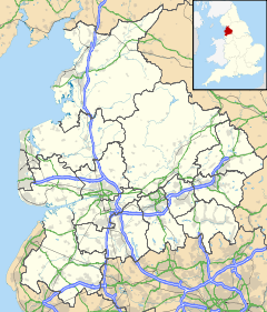
 Cuerden
Cuerden shown within LancashirePopulation 77 (2001) OS grid reference SD565235 Parish Cuerden District Chorley Shire county Lancashire Region North West Country England Sovereign state United Kingdom Post town CHORLEY Postcode district PR6 Dialling code 01772 Police Lancashire Fire Lancashire Ambulance North West EU Parliament North West England UK Parliament Chorley List of places: UK • England • Lancashire Cuerden is a village and civil parish of the Borough of Chorley, in Lancashire, England. It is situated between Bamber Bridge and Leyland, and has a population of 77.[1]
Contents
History
The name derives from the Welsh cerdin, the plural of cerdinen, "rowan".
The manor was given to Vivian Molyneux by Roger de Poitou and devolved to the Banastres, Charnocks, Langtons, and Fleetwoods.[2] The manor house, Cuerden Hall, is a country house begun in the 1717 on the site of a 17th century house, and extended between 1816-19 by Lewis Wyatt.
During the Industrial Revolution two cotton mills were built by the river by William Clayton and William Eccles and employed more than 700 persons in 1848.[2]
St Saviour's Church was built in 1836–37 to a design by the architect Edmund Sharpe.
Governance
Cuerden was a township in the ancient ecclesiastical parish of Leyland and the Leyland hundred.[2] It became part of the Chorley Poor Law Union, formed in 1837, which took responsibility for the administration and funding of the Poor Law and built a workhouse in that area.[3]
Geography
Cuerden coved 800 acres about 4½ miles south east of Preston on the River Lostock on the road between Preston and Wigan.[2][4] Cuerden Valley Park, south of the M1 and M65 junction, covers 650 acres, half of which is used for agriculture. The park has a lake and was once the estate of Cuerden Hall.
See also
References
- ^ Office for National Statistics : Census 2001 : Parish Headcounts : Chorley Retrieved 6 February 2010
- ^ a b c d Lewis, Samuel (1848), "Cuerden", A Topographical Dictionary of England (British History Online): pp. 746–751, http://www.british-history.ac.uk/report.aspx?compid=50910, retrieved 2011-04-30
- ^ Workhouse, Workhouses.org, http://www.workhouses.org.uk/index.html?Chorley/Chorley.shtml, retrieved 2011-04-30
- ^ Cuerden Township Boundaries, GenUKI, http://www.genuki.org.uk/big/eng/LAN/Cuerden/ParishMap.shtml, retrieved 2011-05-01
External links
- Cuerden chorley.gov.uk.
Categories:- Lancashire geography stubs
- Geography of Chorley
- Villages in Lancashire
- Civil parishes in Lancashire

Wikimedia Foundation. 2010.