- Metropolitan Borough of St Helens
-
Coordinates: 53°27′14″N 2°44′46″W / 53.454°N 2.746°W
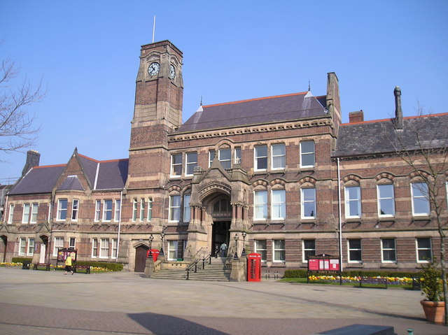
Metropolitan Borough of St Helens — Metropolitan borough — St Helens Town Hall, the seat of the Borough Council
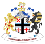
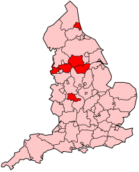
Coat Of Arms of the Borough CouncilMotto: Prosperitas In Excelsis St Helens shown within England
Sovereign state United Kingdom Constituent country England Region North West England Ceremonial county Merseyside Admin HQ St Helens (Town Hall) Founded 1 April 1974 Borough status Government – Type Metropolitan borough – Governing body St Helens Metropolitan Borough Council – Leadership: Leader & Cabinet – Executive: Labour – Leader of the Council Cllr Marie Rimmer (Lab) – MPs: David Watts (Lab),
Shaun Woodward (Lab)Population (2010 est.) – Total 177,400 (Ranked 95th) – Ethnicity 98.8% White Time zone Greenwich Mean Time (UTC+0) Postcodes WA & WN Area code(s) 01744 Website http://www.sthelens.gov.uk/ The Metropolitan Borough of St Helens is a metropolitan borough of Merseyside, in North West England. It is named after its largest town St Helens, and covers an area which includes the settlements of Newton-le-Willows, Earlestown, Haydock, Rainhill, Eccleston, Clock Face, Billinge and Rainford.
Ward profiles are maintained by the Metropolitan Borough Council.[1]
Contents
History
The Metropolitan Borough was formed on 1 April 1974 as a merger of the former County Borough of St Helens, along with the urban districts of Haydock, Newton-le-Willows and Rainford, and parts of Billinge-and-Winstanley and Ashton-in-Makerfield urban districts, along with part of Whiston Rural District, all from the administrative county of Lancashire.
Between 1974 and 1986 the borough council shared functions with Merseyside County Council. The functions of this body were in part devolved to the boroughs and in part transferred to ad hoc agencies.
Governance
On 17 May 2006, following local elections held on 4 May, the political control of the Council changed from the Labour Party to a coalition formed by the Liberal Democrats and the Conservative Party. Labour had been in power since 1 April 1974 following the first elections to the shadow council in 1973.
After local elections in 2008 St Helens was a hung council with no party having overall control, as a result The Liberal Democrats and the Conservative coalition continued their governance of the council. Labour were the largest party represented followed by the Liberal Democrats and then the Conservatives.
Year Labour Liberal Democrats Conservatives 2008 23 19 6 After local elections in 2010 the Labour Party retook overall control of St Helens council with a majority of 8 after increasing its tally by 5 at the expense of the Liberal Democrats and the Conservatives. This brought to an end the Lib/Con coalition which had governed the council since 2006. Labour continue to be the largest party represented followed by the Liberal Democrats and then the Conservatives.
Year Labour Liberal Democrats Conservatives 2010 28 15 5 Following the United Kingdom local elections, 2011, in which one third of the seats in St Helens Council were up for election, Labour increased their majority by 7, as a result of the collapse of the Liberal Democrat vote, with them losing all but one of the seats they were defending while the Conservatives also lost one seat to Labour.
Year Labour Liberal Democrats Conservatives 2011 35 9 4 Parliamentary constituencies
Geography

The borough borders the borough of Knowsley, within Merseyside, in the south-west, the Lancashire district of West Lancashire in the north, the Greater Manchester Borough of Wigan in the north-east, and to the south the boroughs of Warrington and Halton in Cheshire.
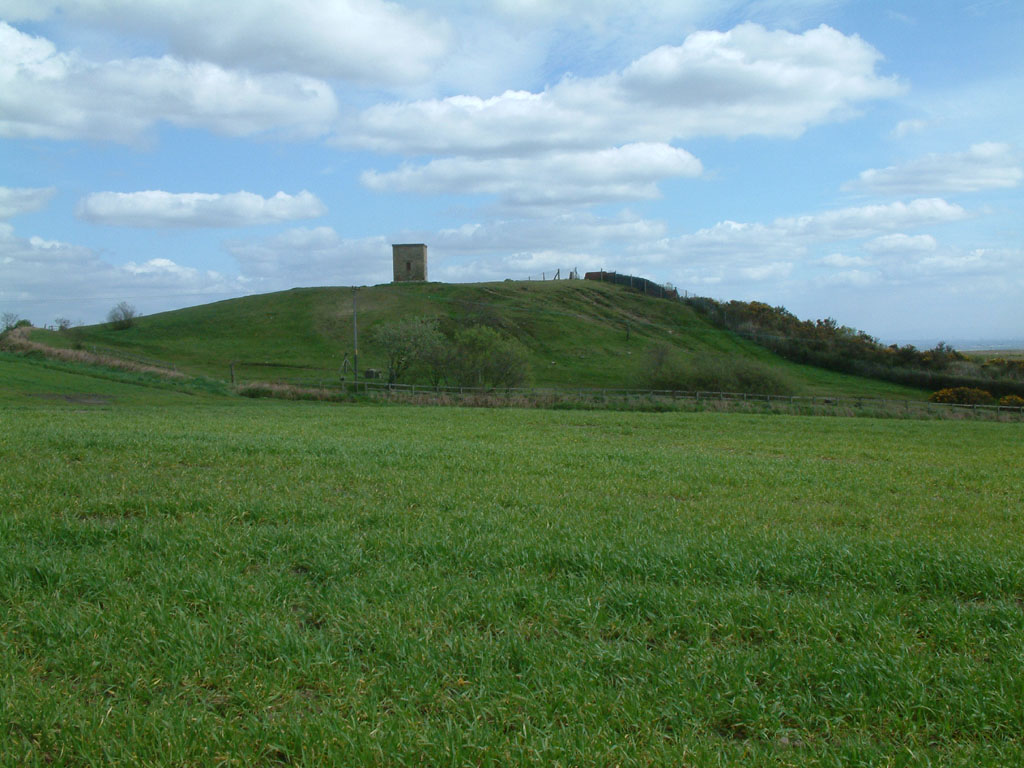
The St Helens Borough covers roughly 30 km² over an area of soft rolling hills used primarily for agricultural purposes, mainly arable. The highest point in the Metropolitan Borough of St Helens, and the whole of Merseyside is Billinge Hill, 4.5 miles (7.2 km) north from the town centre. The town is landlocked with a stream running through, Mill Brook/Windle Brook running through Eccleston and connecting with the (disused) St. Helens Branch/Section of the Sankey Canal in the town centre. St Helens is around 160 feet (50 m) above sea level.
From the top of Billinge Hill the cities of Manchester and Liverpool are visible on a clear day as well as the towns of Wigan, Bolton and Warrington.
Carr Mill Dam is Merseyside's largest body of inland water, offering picturesque lakeside trails and walks as well as national competitive powerboating and angling events.
The Burgies are two tailings on the site of the old Rushy Park coal mine. They were created by the dumping of toxic chemical waste from the manufacture of glass, they have since been covered with tall grass and woodland.
Demography
St Helens Population using 2001 Data, 2008 Wards 2001 UK Census Population Households Billinge and Seneley Green 12,717 4985 Blackbrook 9,128 3,604 Bold 9,040 3,586 Earlestown 10,274 4,420 Eccleston 10,528 4,218 Haydock 11,962 4,817 Moss Bank 10,276 4,337 Newton 11,144 4,506 Parr 12,082 3,541 Rainford 8344 3,484 Rainhill 11,913 4,762 Sutton 12,622 5,075 Thatto Heath 9,393 3,852 Town Centre 10,795 4,958 West Park 11,558 4,947 Windle 8,621 3,607 Total 176,843 72,697 Education
Main article: Education services in St Helens, MerseysideCoat of arms
Coat of Arms of St Helens Council 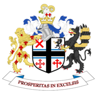
Details Armiger College of Heralds Adopted 1974 Crest A rams head with fleur-de-lys mounted on a helmet, representing Lord Newton Escutcheon Quarterly: 1 red saltire representing Ashton and Seneley Green, 2 Black griffin representing Rainhill, 3 Pilkingtons Cross representing Windle], 4 Red crosslet representing Billinge summounted by the Black Cross of Haydock & Eccleston and the Blue Bars of Parr. Supporters A golden lion and a black griffin Motto Latin: Prosperitas In Excelsis English: "Flourishing Well" Use On all council documents References
- ^ "2007 Ward profiles". St Helens Council. http://sthelens.gov.uk/atoz/tags.htm?tag=Ward%20Profiles.
External links
- St. Helens Metropolitan Borough Council
- Earlestown Historical Website
- Newton-le-Willows Historical Website
Ceremonial county of Merseyside Metropolitan districts - City of Liverpool
- Metropolitan Borough of Knowsley
- Metropolitan Borough of Sefton
- Metropolitan Borough of St Helens
- Metropolitan Borough of Wirral
Major settlements Rivers Topics  Districts of North West England
Cheshire 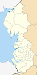
Cumbria Allerdale • Barrow-in-Furness • Carlisle • Copeland • Eden • South Lakeland
Greater Manchester Lancashire Blackburn with Darwen • Blackpool • Burnley • Chorley • Fylde • Hyndburn • Lancaster • Pendle • Preston • Ribble Valley • Rossendale • South Ribble • West Lancashire • Wyre
Merseyside Metropolitan counties and metropolitan districts Greater Manchester 
Merseyside South Yorkshire Tyne and Wear West Midlands West Yorkshire Categories:- St Helens, Merseyside
- Metropolitan boroughs
- Local government in St Helens, Merseyside
- Liverpool City Region
- Local government districts of North West England


Wikimedia Foundation. 2010.