- Nether Wyresdale
-
Coordinates: 53°57′02″N 2°43′37″W / 53.9505°N 2.7269°W
Nether Wyresdale 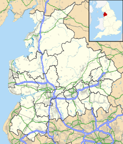
 Nether Wyresdale
Nether Wyresdale shown within LancashirePopulation 613 (2001 Census) Parish Nether Wyresdale District Wyre Shire county Lancashire Region North West Country England Sovereign state United Kingdom Post town LANCASTER Postcode district LA2 Dialling code 01524 Police Lancashire Fire Lancashire Ambulance North West EU Parliament North West England UK Parliament Lancaster and Fleetwood List of places: UK • England • Lancashire Nether Wyresdale is a civil parish in Lancashire, England. In the 2001 United Kingdom census, it had a population of 613.[1]
Contents
History
Along with Over Wyresdale, Nether Wyresdale probably formed part of the manor of Wyresdale in the 12th century.[2] Historically, the village formed part of Garstang Rural District and the ecclesiastical parish of Garstang.[3][4]
Governance
Nether Wyresdale is in the non-metropolitan district of Wyre, in the parliamentary constituency of Lancaster and Fleetwood and is represented at parliament by Conservative MP Eric Ollerenshaw. It is part of the European Parliament constituency of North West England.
Geography
Nether Wyresdale is approximately 8 miles (13 km) south of Lancaster and approximately 16 miles (26 km) north of Preston. It is situated between the River Wyre and Grizedale Brook.[5] It includes the village of Scorton, the hamlet of Street, and part of the village of Dolphinholme.
Church
The parish church of St Peter (located in Scorton) was built 1878–79 to a design by Lancaster architects Paley and Austin. It is a Grade II listed building.[6]
References
- ^ "Area: Nether Wyresdale CP", Neighbourhood Statistics (Office for National Statistics), http://www.neighbourhood.statistics.gov.uk/dissemination/LeadTableView.do?a=7&b=795863&c=LA2+9DH&d=16&e=15&g=464985&i=1001x1003x1004&m=0&r=0&s=1286053905601&enc=1&dsFamilyId=779, retrieved 2 October 2010
- ^ Fishwick (1878), p. 46
- ^ Farrer & Brownbill (1912), pp. 291–300
- ^ "Relationships / Unit History of Nether Wyresdale", A Vision of Britain through Time (Great Britain Historical GIS) (University of Portsmouth), 2009, http://www.visionofbritain.org.uk/relationships.jsp?u_id=10385910, retrieved 2 October 2010
- ^ Farrer & Brownbill (1912), pp. 300–305
- ^ "Church Of St Peter", Heritage Gateway (English Heritage), http://www.heritagegateway.org.uk/Gateway/Results_Single.aspx?uid=185561&resourceID=5, retrieved 2 October 2010
- Sources
- Farrer, William; Brownbill, J., eds. (1912), "The Parish of Garstang", A History of the County of Lancaster: Volume 7 (Constable), OCLC 59626695, http://www.british-history.ac.uk/report.aspx?compid=53240
- Farrer, William; Brownbill, J., eds. (1912), "Townships: Nether Wyresdale", A History of the County of Lancaster: Volume 7 (Constable), OCLC 59626695, http://www.british-history.ac.uk/report.aspx?compid=53241
- Fishwick, Henry (1878), The History of the Parish of Garstang in the County of Lancaster, Manchester: Chetham Society, OCLC 5824231
Categories:- Civil parishes in Lancashire
- Geography of Wyre

Wikimedia Foundation. 2010.